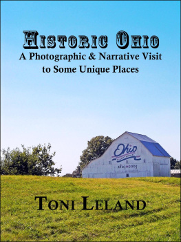
HISTORIC OHIO
A Photographic and Narrative Visit to Some Unique Places
Toni Leland
This 103-page collection of articles by freelance writer Toni Leland visits some of the fascinating historical places in Ohio. While the articles only touch on a small portion of Ohio's historic wealth, the ones chosen are true gems.
Ride with the author as she travels the National Road from the historic Wheeling Suspension Bridge at Bridgeport to the last important town before the Indiana border, New Paris. When you've caught your breath, visit some of the amazing Ohio opera houses that have been lovingly restored and are in use today.
Like archaeology? Interested in Native American history? The Earthworks of Licking County are fascinating and beautiful. Then, for something a little more off the beaten track, the author shares photographs and vignettes of some of the more interesting historical cemeteries in the state. From the comfort of your home, view the gorgeous photographs of these places and, perhaps, plan your own outing for the future. Except where indicated, all photographs were taken by the author.
Copyright 2013 All Rights Reserved
This ebook is licensed for your personal enjoyment only. This ebook may not be resold or given away to other people. If you would like to share this book with another person, please purchase an additional copy for each recipient. If you are reading this book and did not purchase it, or it was not purchased for your use only, then please purchase your own copy. Thank you for respecting the hard work of this author.
~ ~ ~ ~ ~ ~ ~ ~ ~ ~ ~
TABLE OF CONTENTS
Bridgeport St. Clairsville Morristown Fairview Middlebourne Old Washington Cambridge New Concord Zanesville Columbus Lafayette Springfield New Paris Brownsville
Nelsonville Hayesville Cedarville Pemberville McConnelsville Gallipolis
Akron Chillicothe Cincinnati Columbus Cleveland Jackson Sunbury
Includes bibliographies and contact information for locations covered.
Mile by Mile on the National Road in Ohio
A note from the author: When I set out to write this piece on the National Road, I never dreamed I would become so enamored of the history and nostalgia that paves every mile. My photographic journey took three days, the first of which was in the company of my good friend and well-known Ohio historian, Dr. Lorle Porter, who has the knack for bringing ordinary history to life. I can honestly say that I enjoyed the process of researching this article more than anything I've ever done, before or since. The original printed piece featured three of the dozens of photographs I took; it now gives me great pleasure to share some of those never-before-published images here. I hope you'll enjoy the journey.
On some e-readers, tapping the photographs will enlarge them; turning some readers horizontally enlarges the images even more. Where space was of concern, I transcribed the historic markers that are difficult to read in the photographs.

In the Beginning
T he Father of Our Country was also the man who recognized the potential of opening the gates to the West. In George Washingtons time, the West was that unknown and impenetrable area past the Appalachian Mountains. Washington spent his younger years as a surveyor in the Black Forest of West Virginia and Ohio. He saw the potential and, when Ebenezer Zane finished the Trace from Wheeling to the interior of the Ohio Country, Washington knew the time had come.
Though Thomas Jefferson signed the National Road into reality in 1806 as the first large public works project in American history, not a spade of soil was turned until 1811. The sum of $60,000 was allocated for the first phase and work at Cumberland, Maryland opened the beginning of the road to build a nation.
The plan was to build a road from Cumberland to Vandalia, Illinoisa distance of 600 miles. The road reached Wheeling, West Virginia in 1818 and pioneers began to search for better ways to get goods to the interior of the Ohio Country. Noted Ohio historian Dr. Lorle Porter says, ...it cost more to transport supplies thirty miles inland than it did to ship them to London.

T he National Road in Ohio spans 227.9 miles from Bridgeport on the Ohio River across the center of the state, ending at New Paris at the Indiana border.
The Panic of 1819 brought construction to a standstill, but the Road had already made an impact: In 1822, more than 5,000 wagons unloaded in Wheeling, and every tenth one continued across the ferry and onto the jolting Trace. ( A People Set Apart , Lorle Porter, Ph.D.)
Eventually, Congress released $150,000 for construction from Wheeling to Zanesville, but the money was depleted before the Road reached the Belmont/Guernsey County line. (The final cost for the entire project would come to $8,000 per mile!)
Theres a Road in Them Thar Hills!
T he biggest challenge for builders of the National Road was the topography. Terrain determined the distance between pike townstowns that came to be because of the Road. Those in the higher elevations were closer together due to the need to change out draft animals. As the Road progressed, engineers traveled ahead of the construction, building stone bridges across creeks and streams. The S bridge is a significant feature of the eastern Ohio portion of the Road. Dr. Porter states that the need to build a bridge [where] the arch would go straight across the stream accounted for the S style.

T he oldest S-bridge in Ohio was built in Blaine in 1828. It is the longest of the S-bridges, and the only remaining 3-arch stone structure in the state. In 2003, the bridge was selected as the Ohio Bicentennial Bridge


Bridgeport was the first town in Ohio to open the National Road.
M uch of the original old National Road is covered by U.S. 40, but many portions are still navigable. We begin our Ohio National Road journey at Bridgeport on the Ohio River, where construction began in 1825.

B ridgeport was settled in the late 1700s by Ebenezer Zane, who built Zanes Trace through the wilderness.
The road starts to climb almost immediately as we leave the town. About 3 miles inland, we come to an important stop on this trip: the Blaine S-Bridge, built in 1828. It is the oldest, longest, and only remaining 3-arch stone bridge in Ohio, and it is the official Ohio Bicentennial Bridge. To reach it on the old National Road, plan on rough travel through tiny coal towns. An easier access is via Interstate 70 at the National Road/County Rd 214 exit. The bridge is directly beneath the Arches of Memory Bridge (U.S. 40).

T he oldest S-bridge in Ohio was built in Blaine in 1828. The Arches of Memory bridge above it was built for U.S. Route 40.
Next page
