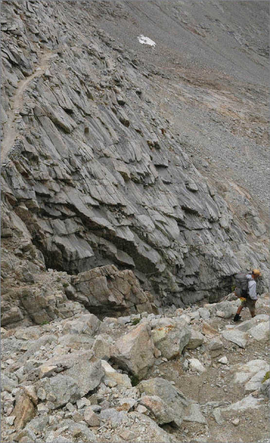
Descending the switchbacks on the south side of Forester Pass
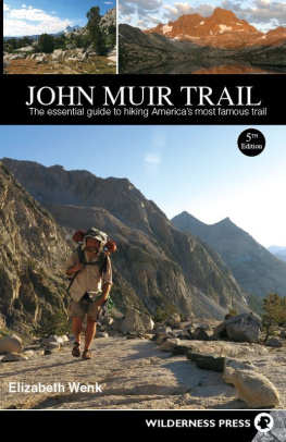
John Muir Trail: The essential guide to hiking Americas most famous trail
5th Edition
Copyright 1978, 1984, 1998, 2007, 2014 by Wilderness Press
Front and back cover photos copyright 2014 by Elizabeth Wenk
Unless otherwise noted, all interior photos by Elizabeth Wenk
Maps: Elizabeth Wenk
Cover design: Scott McGrew
Editor: Amber Kaye Henderson
ISBN: 978-0-89997-736-2; eISBN: 978-0-89997-737-9
Manufactured in the United States of America
Published by: Wilderness Press
c/o Keen Communications
PO Box 43673
Birmingham, AL 35243
800-443-7227; FAX 205-326-1012
wildernesspress.com
Visit our website for a complete listing of our books and for ordering information.
Distributed by Publishers Group West
Front cover, clockwise from top left: Donohue Pass Trail, Garnet Lake, and the Golden Staircase; Back cover, top to bottom: North side of Island Pass and Silver Pass Creek
All rights reserved. No part of this book may be reproduced in any form, or by any means electronic, mechanical, recording, or otherwise, without written permission from the publisher, except for brief quotations used in reviews.
SAFETY NOTICE: Although Wilderness Press and the author have made every attempt to ensure that the information in this book is accurate at press time, they are not responsible for any loss, damage, injury, or inconvenience that may occur to anyone while using this book. You are responsible for your own safety and health while in the wilderness. The fact that a trail is described in this book does not mean that it will be safe for you. Be aware that trail conditions can change from day to day. Always check local conditions and know your own limitations.
CONTENTS
LIST OF MAPS
ACKNOWLEDGMENTS
W hile only short stretches of Californias John Muir Trail (JMT) have been rerouted in the seven years since the fourth edition of this book was published in 2007, a trail guide nevertheless requires updating, both to accurately represent the continually changing landscape and to reflect modern thinking and trends. For me that required not just rehiking the JMT, but also extensive consultation with others; their knowledge and perspectives have made this book much richer.
I am especially appreciative of the interactions I have had with National Park Service staff, including Naomi Chakrin, George Durkee, Greg Fauth, David Gordon, Chris Miles, Martijn Ouborg, Rob Pilewski, Alison Steiner, Jen VanDragt, and Ken Watson. As the JMT continues to grow in popularity, hikers increasingly impact the stripe of wilderness through which the trail passes, and it is important to me to consult with the local rangers (broadly speaking) to minimize the impact. They spent time reviewing key information provided in the book and discussing their experiences with me. I thank them enormously for this input.
I would also like to thank the many hikers whom I met on the trail this summer for their conversation and insights. Hiking a long trail is about more than covering the miles and seeing the scenery: it is also about the other people who are sharing the same experience, each through their own lens. I thoroughly enjoyed listening to others experiences and did my best to weave their suggestions into this next edition.
Many scientists fact-checked sections of the book. Robert Derlett, professor of medicine at the University of California, Davis researches High Sierra water quality and read through my text on water quality and treatment; Greg Stock, the Yosemite National Park geologist, read through the geologic information included in the book; Roland Knapp, a researcher at the Sierra Nevada Aquatic Research Lab, reviewed the information about the mountain yellow-legged frogs; and John Wehausen, a researcher at the White Mountain Research Station, read through my text on large mammals. In addition to the time they spent reading my manuscript, I am grateful for the time they, and others, have spent learning ever more about the Sierra, for in-depth knowledge of the ecosystems natural history enriches the hike for all of us.
One of the most time-consuming additions to this edition are my own topo maps, for which I intended to use GPS tracks I had collected for both the John Muir Trail and all of the major access trails over the past few years. Here technology thwarted my best efforts, as my primary GPS corrupted and deleted some of my data on several days this past summer. I therefore need to acknowledge other hikers who generously provided their own GPS tracks for trails where I lost my data or which I could not visit in the past few summers. Many thanks to David Harris, Seth Heringer, Joerg Lohse, Dave Lubertozzi, and Matt Maxon.
And most important I need to thank my family and friends with whom I hiked and who made this hike possible. As a mother of two young daughters, Eleanor and Sophia, disappearing into the mountains for a month required the support and help of many others, especially my mother, Julia, and husband, Douglas. But I also applaud Eleanor and Sophia as well as their cousins Jane and Liam, whose small legs trudged slowly from Tuolumne Meadows to Agnew Meadows. And two friends, Tara Cameron and Steve Jones, provided wonderful companionship along the middle 100-mile stretch of the JMT.
Elizabeth Wenk
Sydney, Australia, March 2014
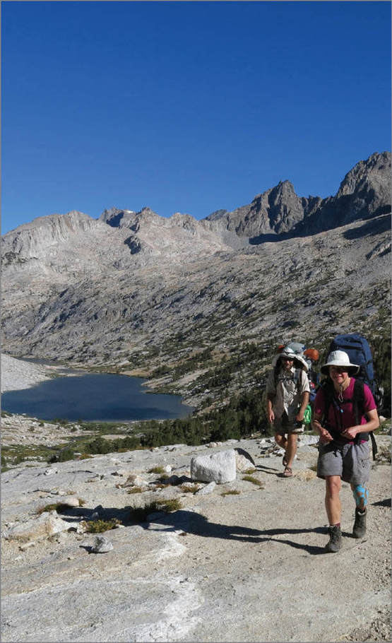
Climbing from the Palisade Lakes toward Mather Pass
INTRODUCTION
T he John Muir Trail (or, more simply, the JMT) passes through what many backpackers agree is the finest mountain scenery in the United States. Some hikers may give first prize to some other place, but none will deny the great attractiveness of Californias High Sierra. This is a land of 13,000-and 14,000-foot peaks, of soaring granite cliffs, of lakes by the thousands, and of canyons 5,000 feet deep. It is a land where trails touch only a tiny portion of the total area, so that by leaving the path, you can find utter solitude. It is a land uncrossed by road for 140 miles as the crow flies, from Sherman Pass in the south to Tioga Pass in the north. And perhaps best of all, it is a land blessed with the mildest, sunniest climate of any major mountain range in the world. Though rain does fall in the summeras does much snow in the winterit seldom lasts more than an hour or two, and the sun is out and shining most of the hours of the day. You are, of course, not the only person to have heard of these attractions and will encounter people daily, but the trail really is a thin line through a vast land; with little effort you can always camp on your own if you leave the trail.
This book describes the JMT from its northern terminus at Happy Isles to its southern terminus atop Mt. Whitney, and then to Whitney Portal, the nearest trailhead, for a total of 220 miles of magnificent Sierra scenery. For those who prefer to walk south to north, a description written in reverse is available in a separate electronic version of the book. The book is aimed at all hikers: hikers completing the entire JMT in a single trip, as well as those walking a shorter section of the trail; hikers completing the route in 10 days and those taking a month. As a result, the guide does not include suggested daily itineraries, as each person or group has a different pace, different desires for layover days, lazy afternoons around camp, or detours to nearby peaks or lake basins. Instead, this guide is aimed to provide you with background knowledge and let you design your own trip, in advance or as you walk. The book provides information on distances, lateral trails, established camping locations, notable stream crossings, long climbs, especially splendid lakes, detours up worthy peaks, and a bit of natural history to encourage you to gaze at your surroundings. From there, you design the itinerary that best suits you.
Next page
