IMAGES
of America
NORTHERN CALIFORNIAS
LOST COAST
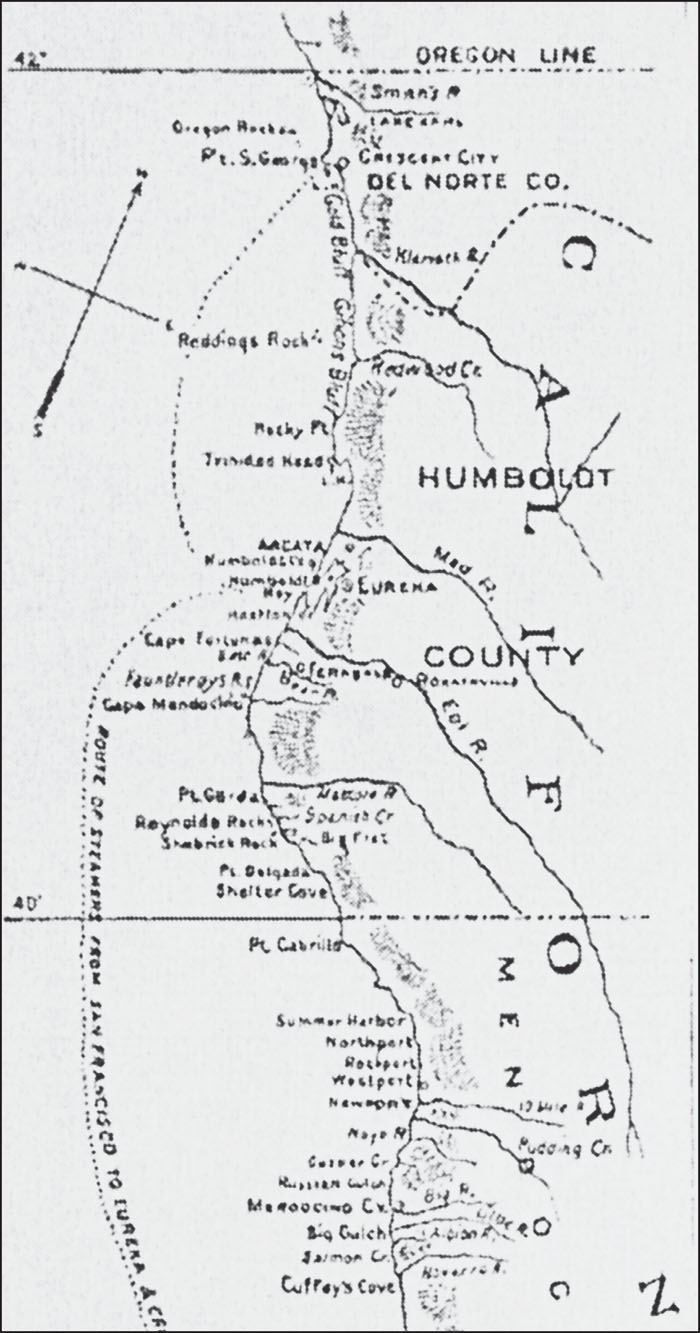
This book covers the Lost Coast from Ferndale south to Westport. This 1881 map, from The History of Humboldt County published by Wallace W. Elliot & Company, shows the coast from San Francisco to Eureka. It illustrates the small inlets where ships would stop, as well as the Eel and Mattole Rivers. (Authors collection.)
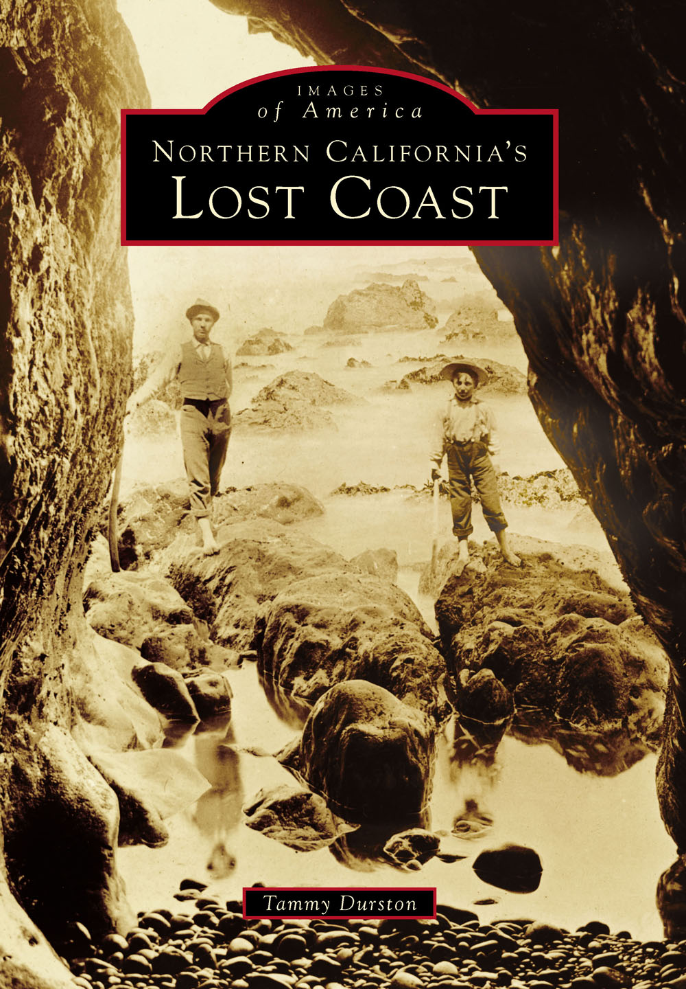
ON THE COVER: Taken March 1, 1898, at Cape Mendocino, this image offers a glimpse of the Lost Coast. Cape Mendocino, the westernmost point in California, has been a landmark for sailors since the 1500s. Numerous sea caves exist along the coast in both Mendocino and Humboldt Counties. (Kelley House Museum.)
IMAGES
of America
NORTHERN CALIFORNIAS
LOST COAST
Tammy Durston

Copyright 2017 by Tammy Durston
ISBN 978-1-4671-2544-4
Ebook ISBN 9781439659878
Published by Arcadia Publishing
Charleston, South Carolina
Library of Congress Control Number: 2016954034
For all general information, please contact Arcadia Publishing:
Telephone 843-853-2070
Fax 843-853-0044
E-mail
For customer service and orders:
Toll-Free 1-888-313-2665
Visit us on the Internet at www.arcadiapublishing.com
This book is dedicated to my grandparents Edmund Durston and Leila Zimmerman Durston, who were teachers at Fortuna High School from 1919 to 1921; David; and my kids Max, Alex, and Chloe.
CONTENTS
ACKNOWLEDGMENTS
I was very fortunate to have some wonderful assistance with this project. First, I would like to thank Caitrin Cunningham, my title manager at Arcadia Publishing, for her patience and guidance. In regards to the book materials, I would like to thank Laura Cooskey at the Mattole Valley Historical Society for her generosity and knowledge of the area. This project could not have been completed without her help and guidance. Greg Rumney, who collects old photographs, was also extremely helpful with sharing images and helped me with his knowledge of the area. Anne Cooper and Ray Duff of the Kelley House Museum in Mendocino were great with helping me identify and copy photographs. Thanks go to them and their wonderful organization. The staff and volunteers at the Humboldt County Historical Society opened their doors to me, and I appreciate that very much. Humboldt State University also provided very valuable assistance by sharing photographs. I would also like to thank Rachel Sowards of the Bureau of Land Management (BLM) in Whitethorn for her help with information about Punta Gorda. The Bancroft Library at the University of California at Berkeley provided some valuable photographs for me too. The area is very fortunate to have such wonderful local historical organizations that preserve and document the regions history.
INTRODUCTION
What is the Lost Coast? Although most locals do not use this term, the Lost Coast refers to a region of the Northern California coastline that has remained relatively untouched. The Lost Coast encompasses a portion of two counties: the northern coast of Mendocino and the southern coastline of Humboldt. This area is the wildest and least traveled part of Californias entire shoreline. It is known for steep mountains rising quickly above the sea, empty beaches, grassy meadows, and dense forests. Once populated by Native Americans, the Lost Coast is now predominantly park and conservation wilderness land.
When the highways were first built, Highway 1, which traditionally hugs the California coastline, had to be moved inland due to the difficulties highway engineers had trying to design the road along the coast. Even today, there are few access points to the ocean by car. Small towns in the area, such as Petrolia, Honeydew and Shelter Cove, remain isolated today.
The first inhabitants were Native Americans. It is estimated there were more than 15,000 living in southern Humboldt and northern Mendocino Counties. The Soo-lah-te-luk (Wiyots) lived from Humboldt Bay south down to below the mouth of the Eel River. Near the Bear River to the coastline, the Nek-an-ni (Bear Rivers) lived. To the immediate south were the Be-tol or Pe-tol (Mattoles). Further south were the Sinkyones and the Coast Yukis. Bountiful plant life, with redwoods, tan oaks, and Douglas fir, coupled with food from the ocean and rivers created an atmosphere ideal for sustaining life. Native Americans grouped themselves by language, not by the concept of a tribe. Within each group, there were also villages. Early white settlers came up with names for these groups that sometimes sounded like the names of the languages; sometimes, they did not.
Harsh weather on the seas kept many early explorers away from the area. There were more than 50 shipwrecks on the Humboldt and Mendocino coastline from 1850 to 1900. Early European explorers quickly learned that the ocean on the Northern California coast was deadly. Fierce storms combined with reefs offshore caused shipwreck after shipwreck. Landings were also problematic due to the rocky shores. Eventually, Spanish explorers turned around after reaching this part of the California coast. Although the Russians built an outpost to the south at Fort Ross in the early 1800s and there were settlements in Humboldt Bay, the Lost Coast remained unexplored until around 1850.
Early land explorations were also hindered by the mountains, and expeditions avoided the area. The Gold Rush changed everything though. As more and more explorers and would-be gold miners flocked to California, explorations were not limited to the areas near goldfields. Most early accounts document that at first, Native Americans greeted the new explorers in a friendly manner, wanting to trade. However, this changed as settlement grew. White settlers began to homestead on Native American land. The Native Americans way of life was dismantled, and they no longer could roam for food. Skirmishes ensued. Not only were the Indians displaced, they were denied resources for survival. The conflict grew into a war and most tribes were wiped out. By 1862, almost all Native Americans that were left were rounded up and placed on reservations.
Many of the new settlers came to California for gold, but quickly discovered the timber. The timber industry remained dominant until the supply was depleted. Cattle, sheep ranching, and dairies were well suited to the land. After the timber industry wound down, the area became depopulated, which contributed to the term Lost Coast. Then, during the 1970s, most of the coastline was converted to parkland. In 1970, the King Range National Conservation Area was formed. Consisting of more than 68,000 acres, the King Range spans 35 miles of the coastline. From Shelter Cove south to Usal is Sinkyone Wilderness State Park. The Lost Coast Trail was developed during the 1970s. It begins at the Mattole trailhead in Humboldt County and ends at Usal Beach in Mendocino County. Thousands of hikers make this trek each year.
This book chronicles from the small town of Westport in Mendocino County north to Ferndale in Humboldt County. The focus is the history of the area and some of the settlements and towns that no longer exist. The book is divided into three chapters: a brief history with a focus on indigenous people, the Northern section of the Lost Coast from Ferndale south to Shelter Cove, and the Southern section from Shelter Cove south to Westport. The author has purposely taken an expansive view in order to showcase the history of this important area through glimpses of historical photographs. The book is an incomplete history due to necessary restrictions but hopefully it will encourage you to explore the history of the area.
Next page

