Pagebreaks of the print version

BRITAIN
AND THE
OCEAN ROAD
Front cover:
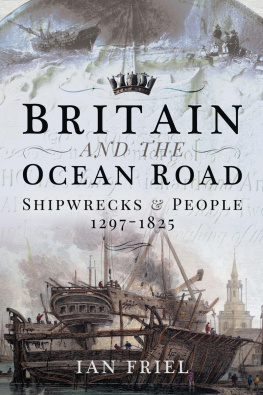
Lower : Floating Dock at Rotherhithe, drawn by Franois Louis Thomas Francia, engraved by J C Allen and published in 1829 by W B Cooke for his Views of the Thames . Research by the National Maritime Museum suggests the possibility that the original drawing dates back to 1793 and that the vessel cradled in the dock was a slave-ship, the Sandown .
Middle : The naval crown, a symbol of British sea power that dates back to at least the late eighteenth century.
Upper : An unknown wreck on the Kent coast, c.1842 (see ).
Back cover:
Left : HMS Duke of Wellington firing a royal salute when it was the flagship at Portsmouth, c.18841886. Launched in 1852, the ship was one of the last First Rates to be built, and was obsolete within a decade.
Right (bottom to top) :
A carved ship from the 1517 Greenway Chapel, St Peters church Tiverton (see ).
The Boreas and Neptune poem from the tombstone of Thomas Barrow, Bosham, 1759 (see ).
An anchor from the SS Hoche , wrecked at Blegberry, north Devon, in 1882 (see ).
BRITAIN
AND THE
OCEAN ROAD
SHIPWRECKS AND PEOPLE, 12971825
IAN FRIEL
First published in Great Britain in 2020 by
PEN AND SWORD HISTORY
An imprint of
Pen & Sword Books Ltd
Yorkshire Philadelphia
Copyright Ian Friel, 2020
ISBN 978 1 52673 836 3
eISBN 978 1 52673 837 0
Mobi ISBN 978 1 52673 838 7
The right of Ian Friel to be identified as Author of this work has been asserted by him in accordance with the Copyright, Designs and Patents Act 1988.
A CIP catalogue record for this book is available from the British Library.
All rights reserved. No part of this book may be reproduced or transmitted in any form or by any means, electronic or mechanical including photocopying, recording or by any information storage and retrieval system, without permission from the Publisher in writing.
SJmagic DESIGN SERVICES, India.
Pen & Sword Books Limited incorporates the imprints of Atlas, Archaeology, Aviation, Discovery, Family History, Fiction, History, Maritime, Military, Military Classics, Politics, Select, Transport, True Crime, Air World, Frontline Publishing, Leo Cooper, Remember When, Seaforth Publishing, The Praetorian Press, Wharncliffe Local History, Wharncliffe Transport, Wharncliffe True Crime and White Owl.
For a complete list of Pen & Sword titles please contact
PEN & SWORD BOOKS LIMITED
47 Church Street, Barnsley, South Yorkshire, S70 2AS, England
E-mail:
Website: www.pen-and-sword.co.uk
Or
PEN AND SWORD BOOKS
1950 Lawrence Rd, Havertown, PA 19083, USA
E-mail:
Website: www.penandswordbooks.com
Acknowledgements
I would like to thank the following people and institutions for their help: the staff of The National Archives, Kew; the staff of West Sussex Libraries, together with the Libraries excellent reserve book collection; the staff of Merseyside Maritime Museum Archive and Library; the staff of the Library of the Institute of Historical Research, London; Gordon Blacklock and his colleagues at Norfolk Record Office; Dr Michael Duffy for his kind permission to base my Trafalgar map on his own closely researched map of the battle; Terry Carlysle for some helpful references; Sian Phillips and Rob Lloyd of Bridgeman Art Library Ltd for their help with images; Kay Smith for kindly sharing her highly significant recent work on the early history of guns and gunpowder.
As will be clear from the text, I have been able to benefit from the work of a large number of other scholars, past and present, and I give my thanks to them. Any errors are my own.
Special thanks are due to my agent, Donald Winchester of Watson Little, Ltd, who had faith in this project when I first mooted it to him, and has supported it ever since, to my Editor at Pen & Sword, Claire Hopkins, who also saw the potential of these books, and to Alan Murphy for his thorough editorial work.
My daughter, Helen Friel, turned my scribbled draft images into the beautiful maps and diagrams in this book. My son, David Friel, gave me vital IT support when my laptop started grinding to a halt, and helped me to source some online images. My wife, Lynne Friel, read the text and gave helpful comments that enabled me to improve the way it reads. More generally, I want to thank Lynne, Helen and David for their love, support and forbearance while I have been writing Britain and the Ocean Road .
Image and quotation credits
I would like to thank Bridgeman Art Library Ltd, the Royal Geographical Society, a Private Collection, the National Museum of the Royal Navy, Hull City Museums and the De Agostini Picture Library for permission to reproduce some of the images in the text.
In the case of some of the older photographs, it has not been possible to locate copyright holders, if any still exist, despite my best efforts. If a copyrighted image has been inadvertently used without permission, I ask the copyright holders pardon and will make due acknowledgment in any future editions of this book.
Unless otherwise specified, all other images, including maps and line drawings (apart from historic woodcuts), are the authors copyright.
Quotations from material in The National Archives (TNA) at Kew are Crown copyright, and gratefully acknowledged here. TNA is a resource of international importance, as the sources used in this book show. The British Library also kindly allowed me to quote from some of its sources. Much of the newspaper material quoted in this work has come via the British Newspaper Archive ( www.britishnewspaperarchive.co.uk ), a hugely useful source for historical research. Estimates of the modern value of old money have been calculated using the excellent www.measuringworth.com website.
All quotations from the sources have been rendered in modern spellings, for the sake of clarity, unless otherwise indicated.
A note on tonnage measurement
Tonnage measurement is an issue that can drive you round the bend when discussing ships, past and present. Historically, at least seven or eight different types of ship capacity or size measures have existed in the English-speaking world since the Middle Ages. Each measure could be applied to the same hull and produce a mathematically accurate figure, but each result would be different. In order to reduce confusion to manageable levels I have tried to explain the meanings of the different tonnage calculation methods as they arise in the text.
Introduction
I saw my first shipwreck, aged nine, on a grey Saturday evening one summer. We were on holiday near Hartland Point in north Devon, staying in a cottage close to the shore, and had gone out to explore the rocky beach. Rocky conjurs up images of pebbles. This was far from it. The Devon coast here consists of great cliffs fronted by a shoreline full of tumbled boulders, some as big as cars. We picked our way carefully across the rocks, climbing where we had to, and hopping from stone to stone where we could. Then we found something unexpected.
Lying among the stones were large lumps of rusty metal, including two big pistons laid side by side. Even as a child from an inland village, I knew what they were: parts of a wrecked ship (see ) . It was an exciting find, one that still lives in my memory, though as a nine year-old I had no thought of whatever tragic story might lie behind those corroded fragments.

