IMAGES
of America
GEYSER BASINS
OF YELLOWSTONE
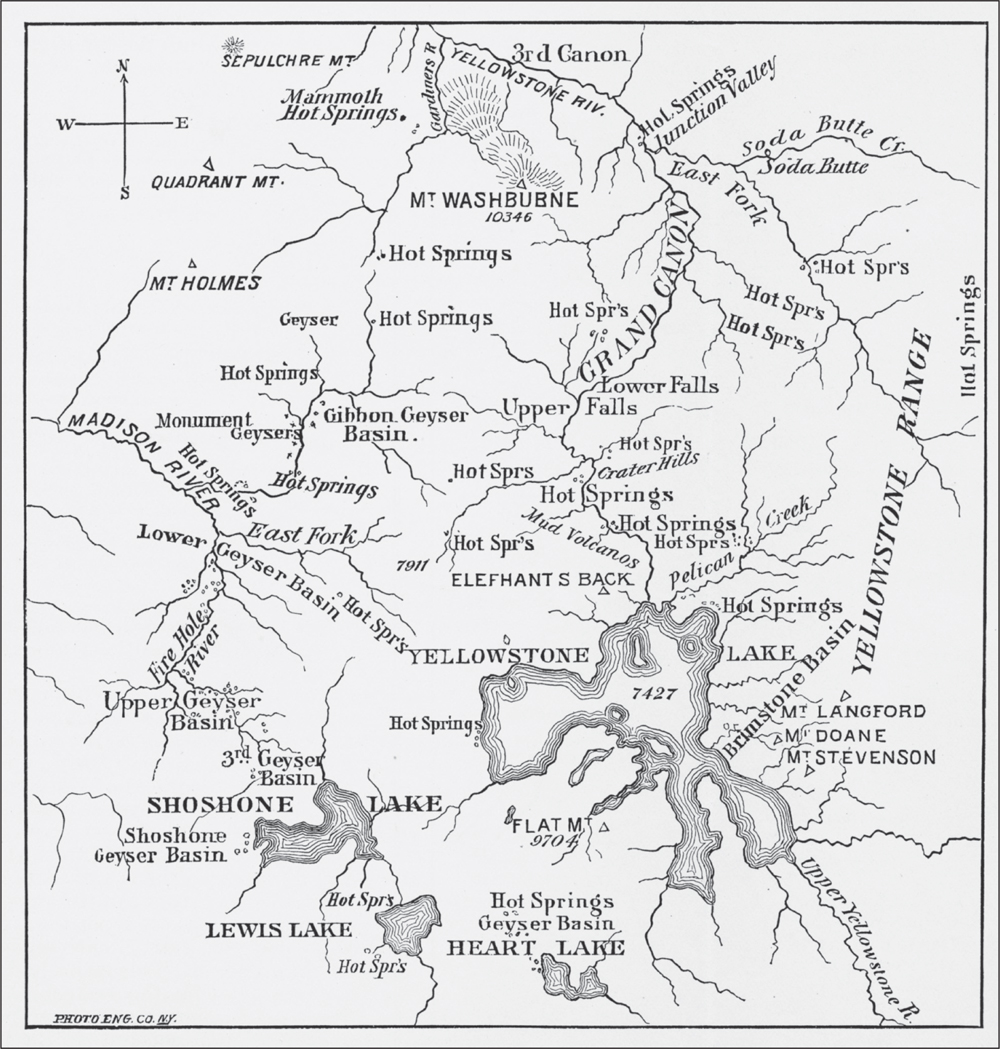
This map from the 1878 US Geological and Geographical Survey of the Territories of Wyoming and Idaho (USGGS) presents the distribution of geysers and hot springs in Yellowstone National Park. The 1871, 1872, and 1878 USGGSs investigated and published detailed reports of nearly all the springs and basins shown on this map. Since some of the geysers, hot springs, and basins are reachable only by long hiking trails and are without the safety of marked trails and boardwalks, this book presents only those basins reachable by the Grand Loop Road around the park. Since the earliest expeditions in 1869 and 1870 described the Mud Volcano area first, this book begins with that basin.
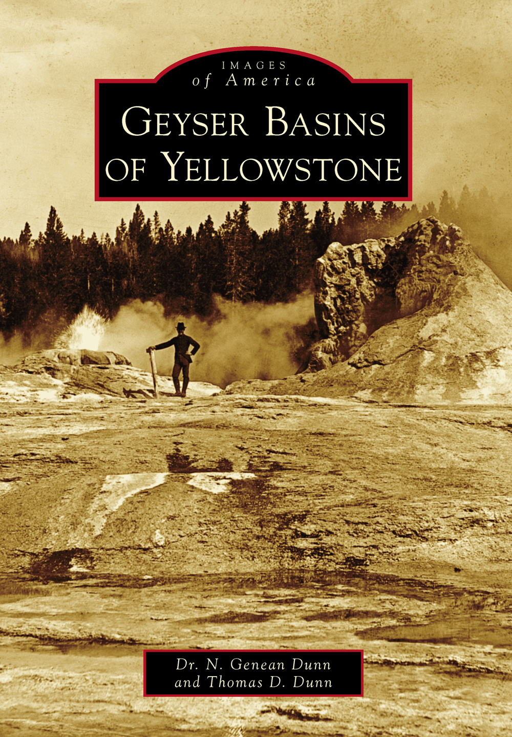
ON THE COVER: Around 1890, J.P. Iddings photographed an unidentified man posing in front of Giant Geyser in the Upper Geyser Basin with Bijou Geyser erupting to his right. (USGS, ijp00204.)
IMAGES
of America
GEYSER BASINS
OF YELLOWSTONE
Dr. N. Genean Dunn and Thomas D. Dunn

Copyright 2014 by Dr. N. Genean Dunn and Thomas D. Dunn.
ISBN 978-1-4671-3102-4
Ebook ISBN 9781439645949
Published by Arcadia Publishing
Charleston, South Carolina
Library of Congress Control Number: Applied For
For all general information, please contact Arcadia Publishing:
Telephone 843-853-2070
Fax 843-853-0044
E-mail
For customer service and orders:
Toll-Free 1-888-313-2665
Visit us on the Internet at www.arcadiapublishing.com
This book is dedicated to the early explorers and visitors to Yellowstones geyser basins who provided vivid descriptions, drawings, and photographs. We also dedicate this book to the geyser gazer community that taught us about geysers and shared many amazing moments over the last 33 years.
CONTENTS
ACKNOWLEDGMENTS
Images of Yellowstone National Park appear courtesy of the National Park Service, Yellowstone National Park Museum Collection (YNPMC) and the Yellowstone National Park Digital Slide File (YNPDSF); the Carnegie Institute, publisher of Hot Springs of the Yellowstone National Park by E.T. Allen and Arthur L. Day (AandD); the Beinecke Rare Book and Manuscript Library at Yale University (BYALE); the U.S. Geological Survey Photographic Library (USGS); the Library of Congress Prints & Photographs Division (LOC); and the Yellowstone Gateway Museum. Images from the private collections of T. Scott Bryan, Udo Freund, Avon Leeking, Graham Meech, David Monteith, Pat Snyder, and Ralph Taylor are also included. All other images not credited above are in the authors private collection. All images are dated, and the photographer is listed if known. Historical names no longer in use are placed in quotes. The authors thank Lee Whittlesey, Yellowstone National Park historian, and David Alberstein for suggesting improvements to this book.
INTRODUCTION
The earliest history of the geyser basins is written not in books, but in the rocks. The Yellowstone plateau was the site of some of largest volcanic eruptions in North America. Eruptions occurred about 2.1 million years ago, 1.3 million years ago, and 640,000 years ago. The last eruption ejected 1,000 cubic kilometers of material and formed the Yellowstone Caldera. The heat for these eruptions began in a hot spot in the earths mantle and is the source of heat for the geyser basins today.
Well before the famous Washburn Expedition of 1870 left from Helena, Montana, Native Americans visited the Yellowstone plateau and probably lived in the area of the park as early as 11,000 years ago. Of course, there is no written record of these early inhabitants, but they left evidence of their presence, such as arrowhead-like points and chips of obsidian, at more than 1,900 sites. When white men first entered the Rocky Mountain area, they found that many Great Plains tribes traveled through this mountainous area. They saw evidence that the Kiowa, Crow, Blackfoot, Shoshone, Bannock, Nez Perce, and many other tribes visited geysers, conducted ceremonies, hunted, gathered plants and minerals, and engaged in trade in the area.
From the late 1700s through the early 1800s, a few hardy explorers ventured into the vast Yellowstone region. Lewis and Clark traveled within 150 miles of the parks northern boundary. However, they did not explore the rumors of volcanic phenomena up the tributaries of the Missouri River such as the Yellow Stone. John Colter left the Lewis and Clark Expedition in 1806 and traveled throughout the region, but it is not clear if he saw the geyser basins of the park. A trapper named Osborne Russell left a written description of geyser and hot spring features from his trips in the late 1830s. After the fur trappers, the prospectors came in search of gold. One of these men was Walter W. DeLacy, who described some of the hot springs and geysers in the Yellowstone region.
However, not until 1869 did explorers set out for Yellowstone with the specific purpose of exploring its wonders. Charles W. Cook, David E. Folsom, and William Peterson entered the Yellowstone region during that year. They saw Tower Fall, Grand Canyon of the Yellowstone, Mud Volcano area, Lower Geyser Basin, and Midway Geyser Basin before leaving the area of the park. Word of their travels and the wonders they saw spread through Montana and led to the next and much larger expedition, known as the Washburn-Langford-Doane Expedition of 1870. This expedition named many important features of the park, including Mount Washburn, Old Faithful, Castle, Giant, and Beehive Geysers.
The next year, another group of explorers entered Yellowstone. This trip in 1871 was the first expedition led by Dr. Ferdinand Vandiveer Hayden, who was in charge of the United States Geological and Geographical Survey of the Territories. He and his party explored, mapped, and described the wonders they saw. Two members of the party, artist Thomas Moran and photographer William Henry Jackson, had to pay their own ways to be part of the expedition. Some of Jacksons historic photographs and Morans paintings are included and described in this book. The idea of a national park evolved from these first expeditions. The US House of Representatives debated the Act to Set Apart a Certain Tract of Land Near the Head-waters of the Yellowstone River as a Public Park on December 18, 1871. After it passed the House, the US Senate approved the act on January 22, 1872, and Pres. Ulysses S. Grant signed it into law on March 1, 1872. In the pages that follow, information about the major Yellowstone geyser basins includes quotes from early explorers, employees, and visitors to the park. Photographs are presented that show some of the features explorers first saw, named, and made famous.
Following the government surveys in 1871, 1872, and 1878, visitors began to arrive. As the number of visitors interested in seeing the thermal features increased, the need for better transportation, roads, and hotels around the park became apparent. A road and hotel system evolved to support this visitor business. This book provides historical photographs that depict the thermal features in the major geyser basins, the series of hotels, and the means of travel through Yellowstone. In the early days, visitors were able to explore the basins with few restrictions. Walking around or over geysers was common. Standing near them and waiting for an eruption was an experience many wanted. As time went by, the need to better protect the thermal features, and the visitors, became clear.
Next page

