About the Author

Jeff Ryan grew up in Maine, where a lifelong appreciation for the outdoors is practically assured.
His first hike of consequence was a summer camp counselor led 16-mile day-hike when Jeff was 11 years oldan event that left permanent impressions (magnificent views are worth the effort, several miles of road walking on pavement, not so much).
Jeff spent countless hours as a youth exploring the Maine woods on foot and snowshoes (his preferred winter footwear). College, however,
proved to be the accelerant that fueled adventures farther afield. Wisconsin served as base camp for trips to Denver, the Smokey Mountains and Pictured Rocks National Seashore. Most important, the friendships made there led to his first long distance hike in 19836+ months on the Pacific Crest Trail.
Upon his return to Maine from the PCT, Jeff kept right on hiking. He and a hiking partner climbed Maines highest 50 mountains in one year. He began section hiking the Appalachian Trail in 1985. He also hiked an impressive list of shorter trails including Vermonts Long Trail, Massachusettss Midstate Trail, Mattacomet-Monadnock Trail and Taconic Crest Trail.
In 1990, he traversed Maine south to north by bicycle, foot and canoea 500 plus mile trip he and a friend completed in 24 days.
Lately, Jeff has focused on completing his quest to climb New Englands Hundred Highest mountains and planning another long distance adventure.
In between trips, Jeff is a dedicated writer and voracious reader. When hes not in a tent, he sleeps in a real bed in the Portland, Maine area.

DownEastBooks
Published by Down East Books
An imprint of Globe Pequot
Trade division of The Rowman & Littlefield Publishing Group, Inc.
4501 Forbes Boulevard, Suite 200, Lanham, Maryland 20706
www.rowman.com
Unit A, Whitacre Mews, 26-34 Stannary Street, London SE11 4AB, United Kingdom
Distributed by NATIONAL BOOK NETWORK
Designed by Hillary Steinau, Camden Design
Maps by Rachel Carter and Puelle Design.
Copyright 2016 by Jeffrey H. Ryan
All rights reserved. No part of this book may be reproduced in any form or by any electronic or mechanical means, including information storage and retrieval systems, without written permission from the publisher, except by a reviewer who may quote passages in a review.
British Library Cataloguing in Publication Information Available
Library of Congress Cataloging-in-Publication Data Available
ISBN 978-1-60893-578-9 (paperback : alk. paper)
ISBN 978-1-60893-579-6 (electronic)
 The paper used in this publication meets the minimum requirements of American National Standard for Information SciencesPermanence of Paper for Printed Library Materials, ANSI/NISO Z39.48-1992.
Printed in the United States of America

A message to readers who are thinking about hiking the AT
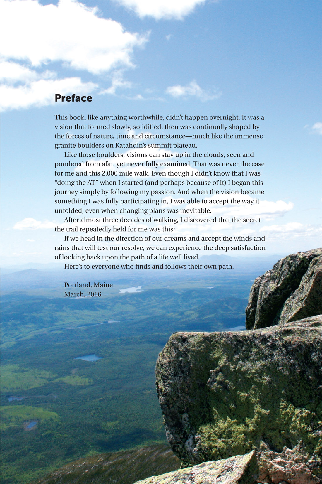
This book isnt a trail guide. The profile maps created for this book are meant to portray general elevation loss and gain and to indicate the places we camped. They are not designed for, nor should be used for navigation. If you are planning a hike on the AT, I recommend purchasing and carrying a trail map and guide (preferably one published by the Appalachian Trail Conservancy).
The guidebooks to each trail section (generally one guide per state) contain detailed trail descriptions, profile maps and topographic maps. These three pieces of information are not only critical to navigating the trail, finding water sources, etc., they can also provide a much needed perspective on how to get to help should you encounter a medical emergency (either yours or that of another hiker).
Carrying a guide book and maps is more than common sense. The proceeds from the guides also support the efforts of the chapter clubs that work tirelessly to maintain the AT and surrounding trails for everyones enjoyment. Please consider supporting their work by making an additional donation or becoming a volunteer or member.
About the Appalachian Trail
The idea to create the Appalachian Trail (AT) is widely credited to Benton MacKaye, a regional planner who envisioned a network of work, study and farming camps stretching from Mt. Washington in New Hampshire to Mt. Mitchell in North Carolina.
The vision for the trail was first publicized in October of 1921. By 1925, the first Appalachian Trail Conference was convened to get the project off the ground. Like most large scale projects, the creation of the Appalachian Trail happened in fits and starts. While the trail was completed as a continuous footpath in 1937, it wasnt until 1968 that it was designated as a national scenic trail and afforded federal protection (along with The Pacific Crest Trail).
The Appalachian Trail Conservancy provides a detailed history of the trail on their website.
The Appalachian Trail is a mountain trail. It is mentally and physically demanding. While it has been portrayed as a walk in the woods, there are precious few sections that allow one to stroll. The fact that many underestimate the terrain and what it takes to complete a through-hike is illustrated by a single statistic: 75% of people who begin the hike dont finish.
AT Mileage by State
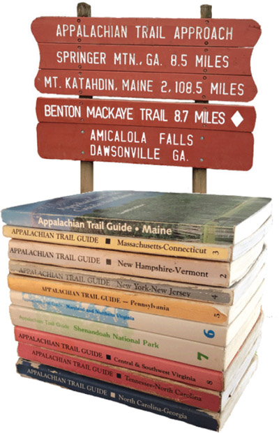
Maine: 281.4 miles
New Hampshire: 160.9 miles
Vermont: 149.8 miles
Massachusetts: 90.2 miles
Connecticut: 51.6 miles
New York: 88.4 miles
New Jersey: 72.2 miles
Pennsylvania: 229.6 miles
Maryland: 40.9 miles
West Virginia: 4 miles
Virginia: 550.3 miles
Tennessee: 287.9 miles
North Carolina: 95.5 miles
Georgia: 76.4 miles
Footnote
*Based on 2006-2011 data compiled by the Appalachian Trail Conservancy
APPALACHIAN TRAIL STATS
DISTANCE: 2,181 miles
NUMBER OF STATES:
HIGHEST ELEVATION: 6643
(Clingmans Dome, TN)
LOWEST ELEVATION: 124
(Bear Mountain State Park, NY)
PERCENTAGE OF HIKERS COMPLETING THE TRAIL THAT ARE SECTION HIKERS
(THOSE DOING THE TRAIL IN PIECES) 20%
NUMBER OF SECTION HIKERS COMPLETING THE TRAIL PER YEAR ON AVERAGE*:
116.5
NUMBER OF THRU HIKERS STARTING THE TRAIL THAT FINISH IN ANY GIVEN YEAR:
ABOUT 25%*
CHAPTER 1
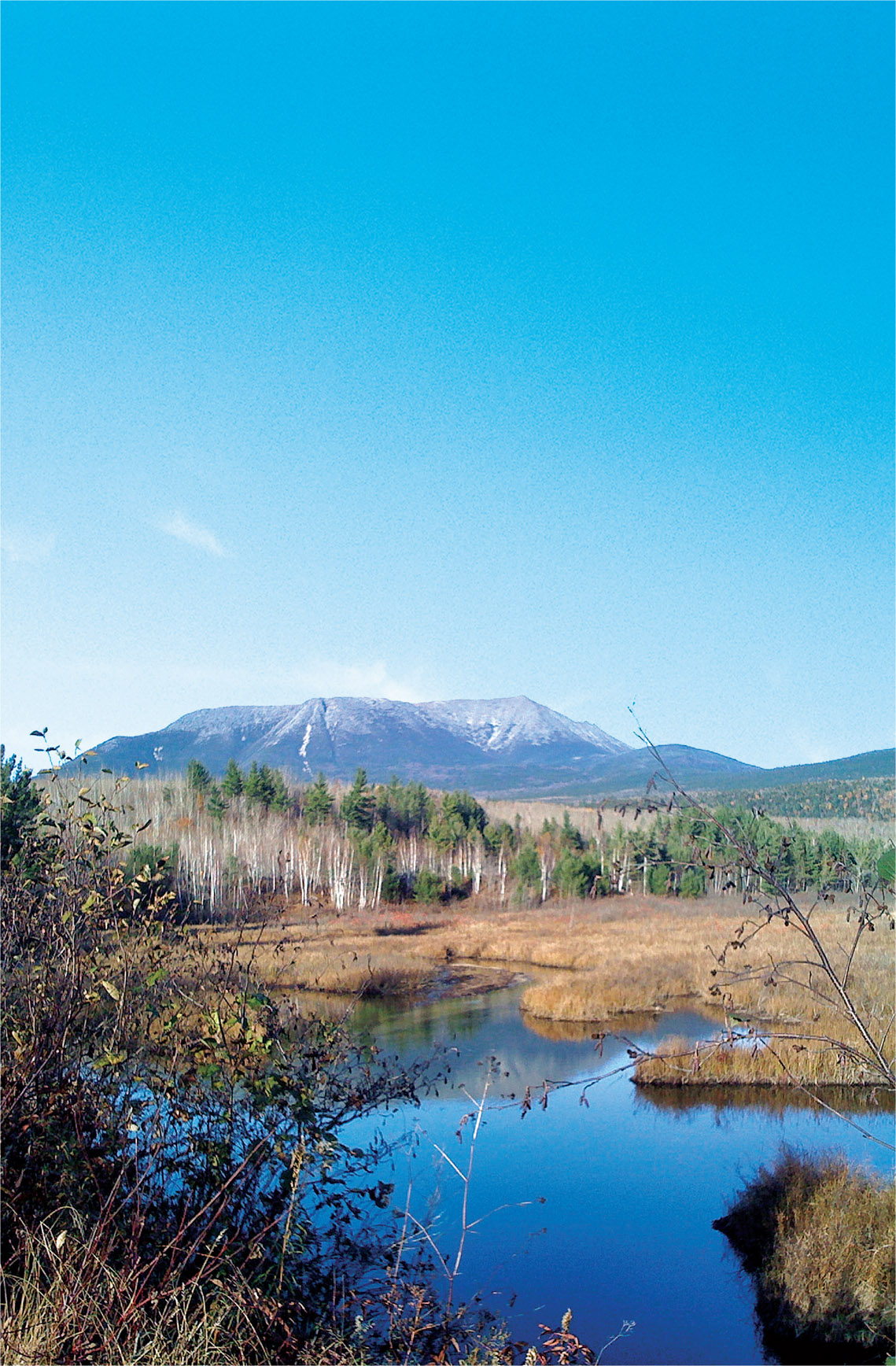
Katahdin
What began as a day hike to the summit of Maines fabled mountain became a 28-year adventure to places and events I could not have imagined.










 The paper used in this publication meets the minimum requirements of American National Standard for Information SciencesPermanence of Paper for Printed Library Materials, ANSI/NISO Z39.48-1992.


