ACKNOWLEDGMENTS
They say no one person can make a pencil. I have learned the same is true of writing a book. I have many to thank, starting with John Garvey for his knowledge and contact information. Thank you to Mark Purdy for a great foreword. I could not have collected enough materials without Rick Swig, the ultimate collector of all things Giants. Also at the top of my list is Heather Hollingworth, who edited my text, and Jane Bolles Grimm, who shared pictures and stories of her father.
In the baseball subject matter, I am grateful to Jaime and Kim Rupert, Lon Lewis, Charlie Hallstrom, Hank Greenwald, Sherry Davis, Andrew Holloway, Kerry Yo Nakagawa, Mitsuhiro Murooka, and Russ Moshier. Thank you to Pat Gallagher for his knowledge of the stadium and the Giants marketing efforts and to Giants president Larry Baer for sharing his experiences. Thank you to Dave Cross for his great photograph of October 17, 1989.
I could not have done this book without the assistance of Jim Mercurio, vice president of Stadium Operations for the 49ers. I am also grateful to president Jed York and his staff in Santa Clara who allowed me access to their photograph archives. Also thanks to Dan Henderson and Bob Mallamo at the 49ers. I am grateful to Bill Fox and Dennis Desprois for allowing me to use their photographs. My thanks to Mo Fowell and Jim Wyatt for their help.
Thank you to Michael Olmstead and Erin Olmstead at e2k Events for allowing me access to their files. Thank you, also, to stadium manager Mike Gay for his photographs and knowledge.
Thank you to the following for the concert and other materials: Joel Selvin, Ken Friedman, Len Hruszowy, Shayla Moore at Gordon Biersch, Tony Ferrari, Dennis Mattish, Gary Horstkorta, Nora Hannah at Until There is a Cure, Jeff Hoganson, and Barry Hood.
Thank you, also, to Max Schultz, Heather David, Christina Moretta, Jeff Thomas at the San Francisco History Room, and Joe Ferreira.
Thank you to my editor John Poultney, and thank you to Apple, as I processed hundreds of photographs without a computer crash.
Find more books like this at
www.imagesofamerica.com
Search for your hometown history, your old
stomping grounds, and even your favorite sports team.
CANDLESTICK POINT
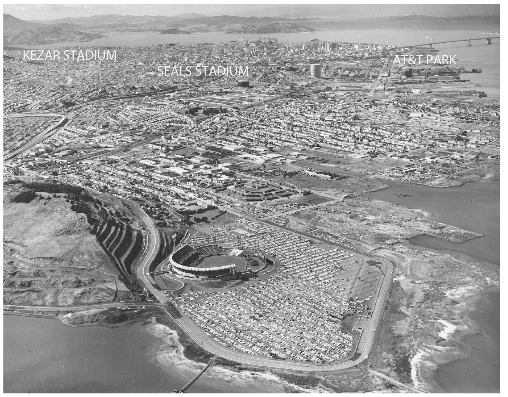
Candlestick Park is located at Candlestick Point in the southwest corner of San Francisco. It is on the edge of the Bayview-Hunters Point neighborhood. Kezar Stadium was in Golden Gate Park adjacent to the Haight-Ashbury. Opened in 1925, it was the home field for the popular college teams of Santa Clara University, St. Marys College, and the University of San Francisco. The 49ers played there from 1946 to 1970, and the Raiders played five games there in 1960. Seals Stadium was at Sixteenth and Bryant Streets in the Mission District. Built in 1931, it was home to the Seals and the San Francisco Missions of the Pacific Coast League. The Giants played there in 1958 and 1959 while Candlestick Park was being built. Opened in 2000, AT&T Park is located at Third and King Streets in China Basin. The stadium, built and operated by the Giants, is considered one of the finest in Major League Baseball. This general location was among those considered before Candlestick Point but was rejected as it was too close to port operations and industrial plants. (Courtesy Jane Bolles Grimm.)
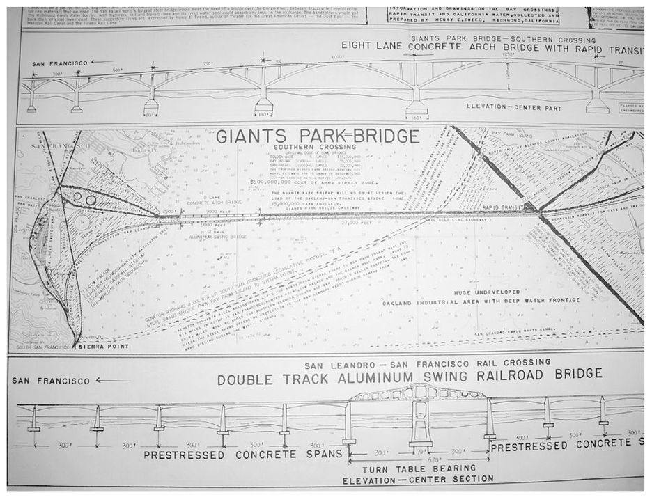
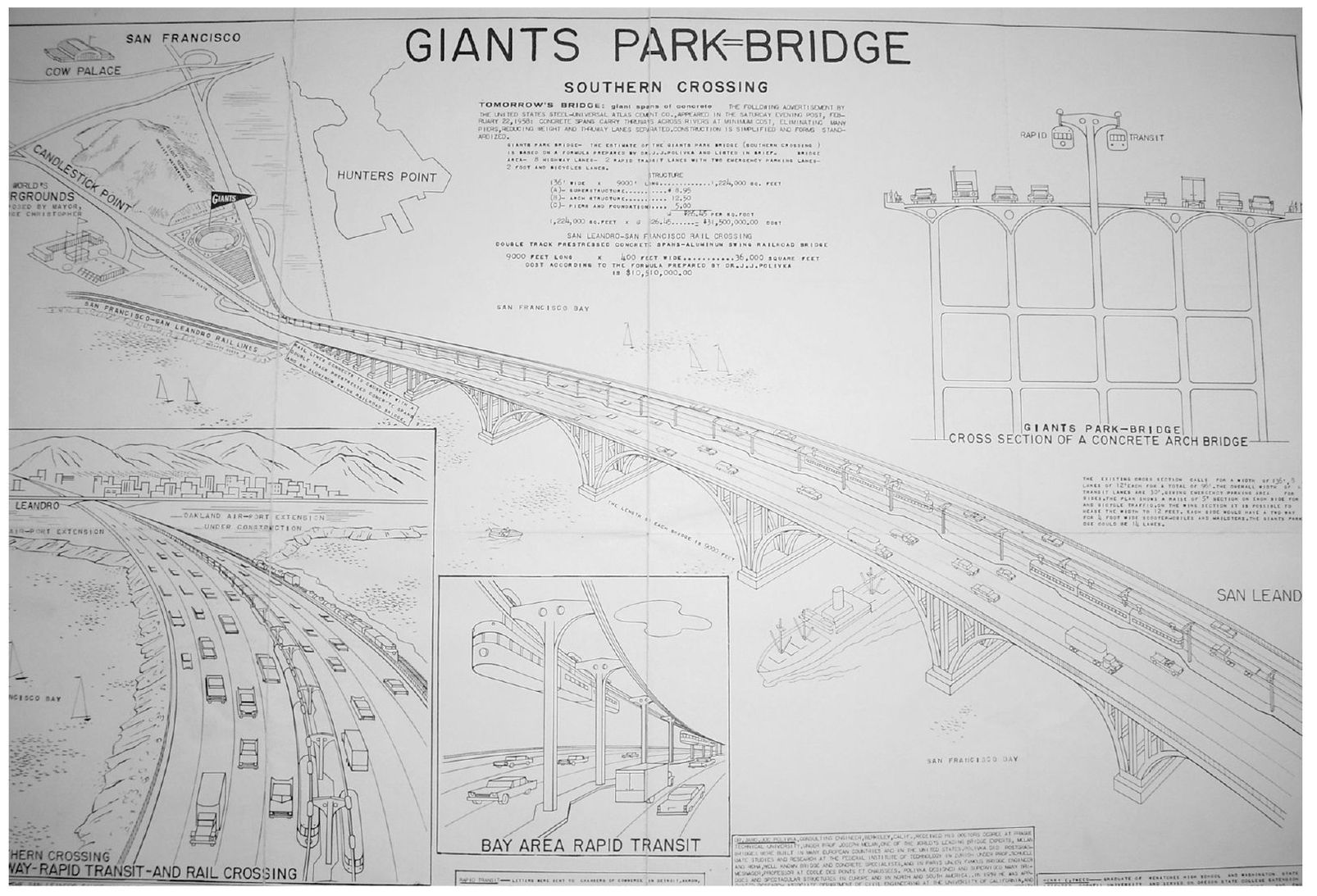
Drawings showed the need for transportation and infrastructure. A crossing to link the southern part of the city to the East Bay had been discussed since 1948, and the California Department of Highways had a plan for a crossing at Army Street (now Cesar Chavez Street). But in 1959, Resolution 4559, which opposed many planned freeway routes, was passed. (Courtesy San Francisco History Center, San Francisco Public Library.)
Government officials and newspaper writers proposed elaborate plans for development around Candlestick Park. Among those ideas was to host a Worlds Fair on more filled-in bay lands south of the stadium. San Francisco had previously hosted a successful Worlds Fair in 1939 and 1940 on Treasure Island, but plans for one near Candlestick Park never materialized. (Courtesy San Francisco History Center, San Francisco Public Library.)
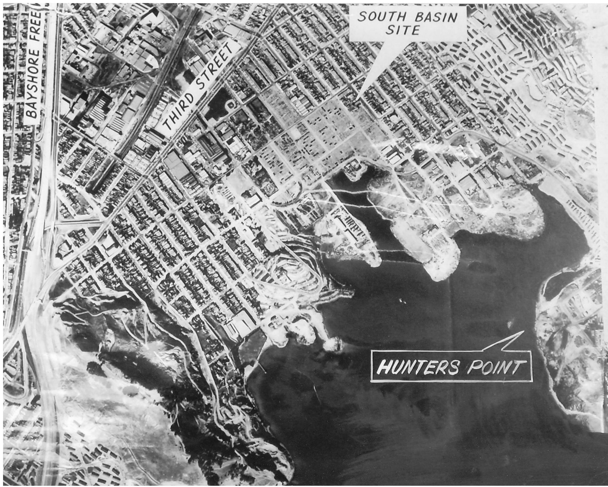
A second site for the stadium was considered in an area between Candlestick Point (lower left corner) and Hunters Point Naval Shipyard. During the grand jury investigation in 1958 nobody could testify as to who actually picked Candlestick Point as the site for the stadium. It is, however, believed to have been Mayor George Christopher. California Geographic Names lists Candlestick Point as being named for a pinnacle of rock noted in a U.S. National Geodetic Survey in 1869, SE from and under Visitacion Knob, about 130 feet above the high water mark and directly over 8-foot sharp pinnacle of rock near high water mark. Jose Canizares, a pilot in the De Anza Expedition in 1781, also noted the rock. Located near the east side of the stadium, the rock formation appeared on survey charts through 1920 but then disappeared. Others attribute the name to a long-billed curlew bird named the candlestick bird that was indigenous to the area, but whose population declined in the area in the early 20th century. (Courtesy San Francisco History Center, San Francisco Public Library.)
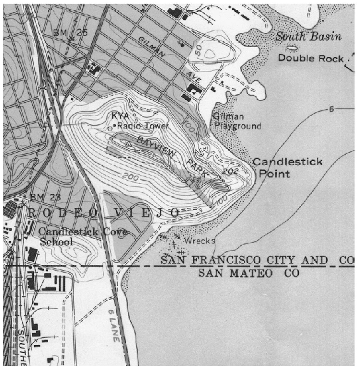
Candlestick Point remained untouched in 1956. The KYA radio tower on the north side of Visitacion Knob was on land owned by the Hearst Corporation. The south side land was part of 3,000 acres owned by Charles Crocker (one of the Big Four of the Central Pacific Railroad) that he donated to the city in 1915 as a park to prevent a planned quarantine facility. (Courtesy authors collection.)
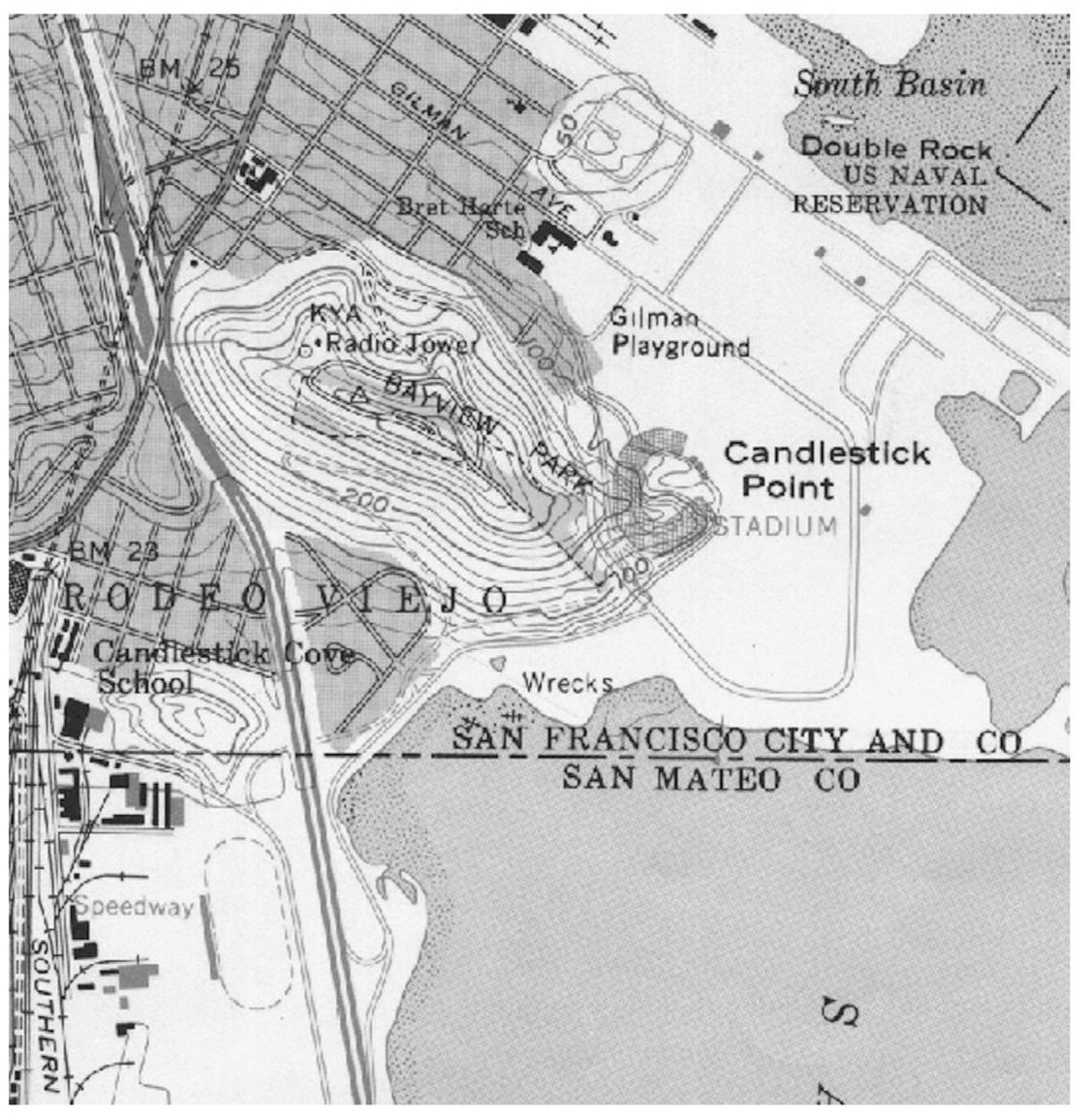
Candlestick Point was cut down in order to build the stadium and Jamestown Avenue. The rocks and dirt were used to fill in the tidelands for the parking lots and what would become Candlestick Point State Park. Charles Harney did not have to pay for the fill material, which was part of the controversy surrounding the sale of the land for the stadium. The map is from 1968. (Courtesy authors collection.)

