Dear Everybody
Dear Everybody
A WOMANS JOURNEY FROM PARK AVENUE
TO A LABRADOR TRAPLINE
ANNE BUDGELL

Library and Archives Canada Cataloguing in Publication
Budgell, Anne, 1950-
Dear everybody [electronic resource] : a woman's journey
from Park Avenue to a Labrador trapline / Anne Budgell.
Includes bibliographical references.
Electronic monograph in PDF format. Issued also in print format.
ISBN 978-1-927099-18-6
1. Budgell, Anne, 1950-. 2. Trappers--Newfoundland and
Labrador--Labrador--Biography. 3. Socialites--New York (State)--
New York--Biography. 4. Labrador (N.L.)--Biography. I. Title.
FC2193.3.B83A3 2013 971.8'205092 C2013-900346-0
Published by Boulder Publications
Portugal Cove-St. Philips, Newfoundland and Labrador
www.boulderpublications.ca
2013 Anne Budgell
Copy editor: Iona Bulgin
Design and layout: John Andrews
eBook development: WildElement.ca
Excerpts from this publication may be reproduced under licence from Access Copyright, or with the express written permission of Boulder Publications Ltd., or as permitted by law. All rights are otherwise reserved and no part of this publication may be reproduced, stored in a retrieval system, or transmitted in any form or by any means, electronic, mechanic, photocopying, scanning, recording, or otherwise, except as specifically authorized.
We acknowledge the financial support of the Government of Newfoundland and Labrador through the Department of Tourism, Culture and Recreation.
We acknowledge the financial support for our publishing program by the Government of Canada and the Department of Canadian Heritage through the Canada Book Fund.
For Ruby and George
Contents
NOTES ON THE TEXT,
PHOTOGRAPHS, AND MAPS
I n Barbara Mundy Grovess papers, there are 75 letters written by her between 1935 and 1948. She saved two diaries from long cruises to Europe with family members in 1926 and 1929, a brief diary of her trip from Boston to St. Anthony in 1935, a tiny diary written in North West River, 1944-1946, and her trapline diary of more than 300 pages, 1947-1949. Typographical errors such as misspellings, redundant quotation marks, and transposed letters have been silently corrected in the excerpts from these papers.
All photographs in this book, except those of Barbara, were taken by her. She brought a camera to Labrador and took photos in North West River, on Grand (Churchill) River, and on the trapline. Barbara took photos on the river as she walked along the boulder-covered shore, nervously watching the men pole and track the heavy canoes against the current. She sent her film to be processed in New York and the prints came back with negatives in sleeves. It was possible to date and locate most of the photos in this book by comparing them with photos in an album donated by her family to the Heritage Museum in North West River. Barbaras collection also included colour slides made from pictures shot during her two winters on the trapline, which she captioned.
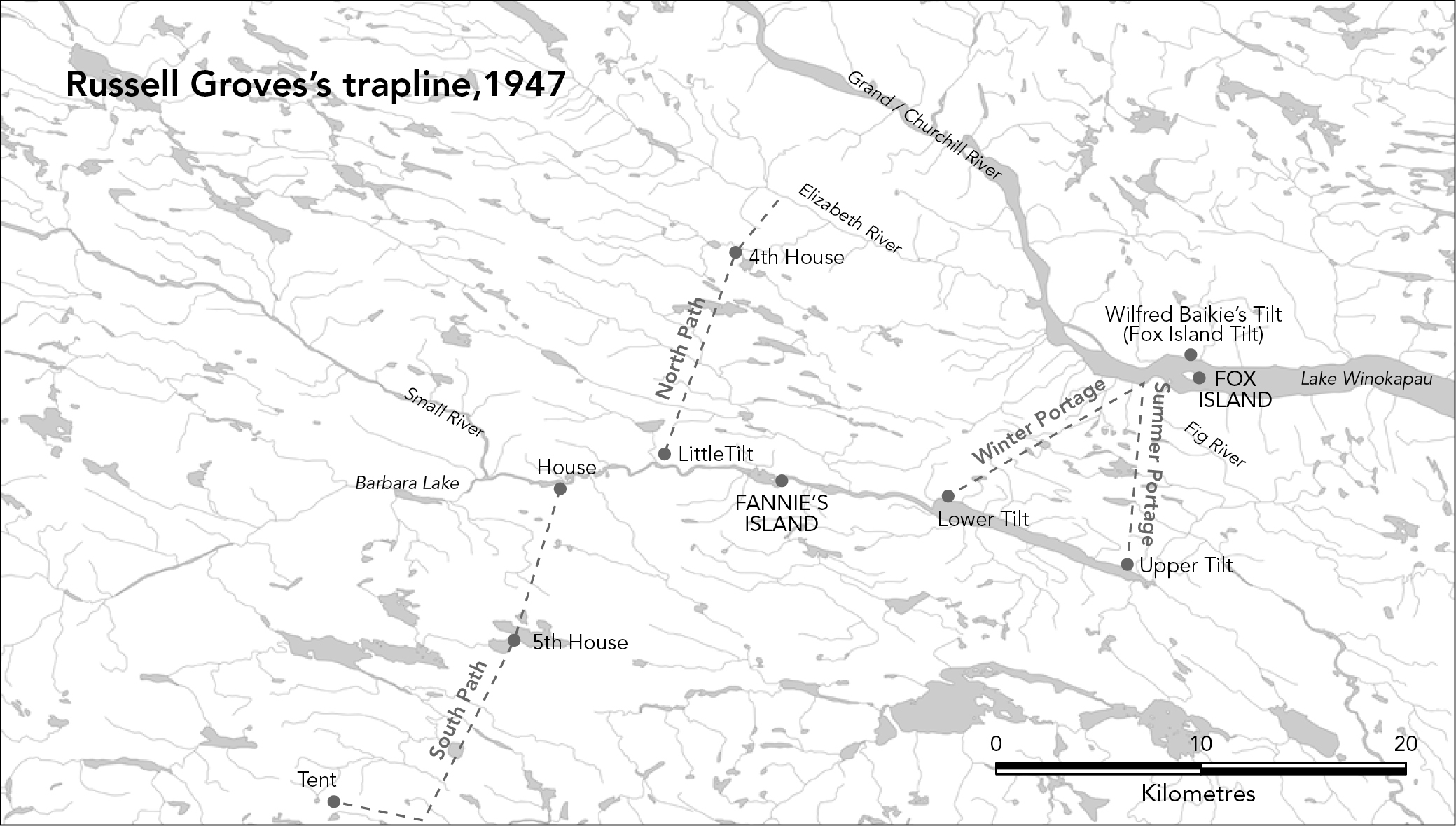
Amongst the papers of Barbara Mundy Groves, a hand-drawn map made by Russell Groves, probably in the late 1940s, shows the location of his trapping paths. The western end of Winokapau, Wilfred Baikies tilt on the north shore, and Fox Island are all clearly marked, as are Grand River, Elizabeth River, and Fig River. Two other features are named: Fannys Island in Fig River and a lake Russell named Barbara Lake. If names are known for any of the hundreds of lakes, brooks, islands, streams, and rivers, they do not appear on his map or present- day official maps. (Many places were named by Innu people, but those names have not made it to official maps. Fig River is Kakupiu-shipu; in English, Porcupine Lake River.)
Russells map shows enough features to make it possible to transpose his drawing to a topographical map, but it is an informed guess at best. Fig River on the official government map of today is not exactly where he had his trapline. Russells Fig River is unnamed on modern maps and widens into a lake that connects to the official Fig River. He conflated the parts that were merely portages to be passed over and expanded the areas where he had traps or tilts (cabins). Lines for his portages and trapping paths could be extrapolated because he drew the rivers and lakes he paddled or walked over, illustrating significant islands, small rivers, brooks, and points of land.
Russell drew dots around the perimeter of the Fig River system and larger lakes. These are places where he put traps. He wrote BH to indicate beaver houses. He located each of his tilts and the main House. Notes in Barbaras handwriting add some details. It took one day to walk from the House to Lower Tilt, North Path took two days, South Path four days. The Winter Portage walk from Winokapau to the Lower Tilt took one day. The words cat, fox, marten, mink, and otter were written where those animals were likely to be found.
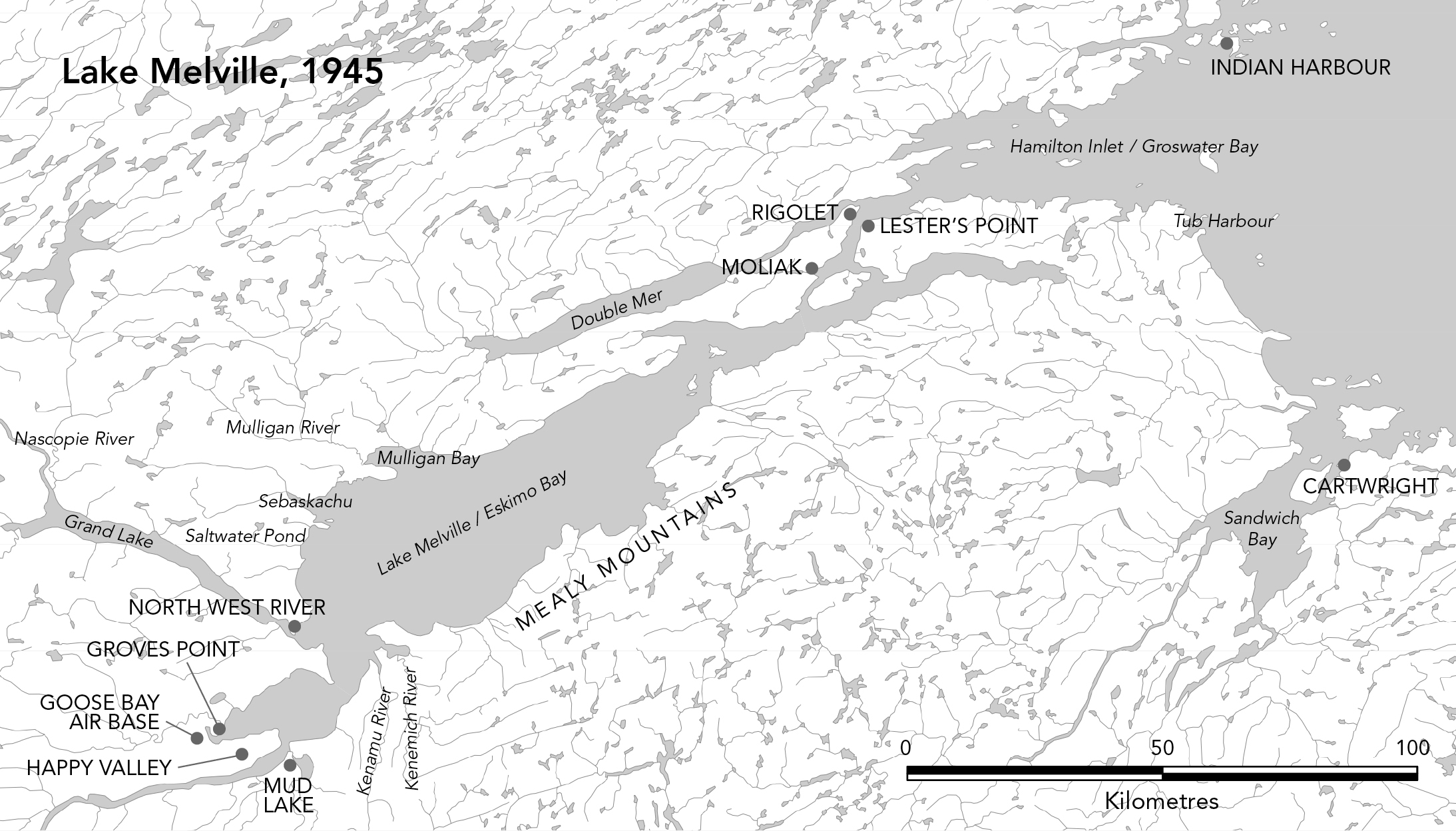
Place names for the Lake Melville map presented a different challenge. Is it Molioch, Mulliauk, Moliak, or one of the four other spellings found in old documents? Eldred Allen, the Geographic Identification Specialist with the Nunatsiavut Government, Department of Lands and Natural Resources, tried to help. He asked Inuit elders in Rigolet, who told him they werent sure. Everyone preferred Moliak and that is the spelling used in this book and on some current maps. River and place names were taken from official maps but numerous other spellings exist for Sebaskachu, Kenemich, Kenamu, Nascopie, and Winokapau. They are all derived from Innu names. The excellent website www.innuplaces.ca identifies hundreds of places in Labrador and translates names. There are some mysteries, like Mulligan, known to the Innu as Maunakan. Nobody knows if the name originated with English or Innu speakers.
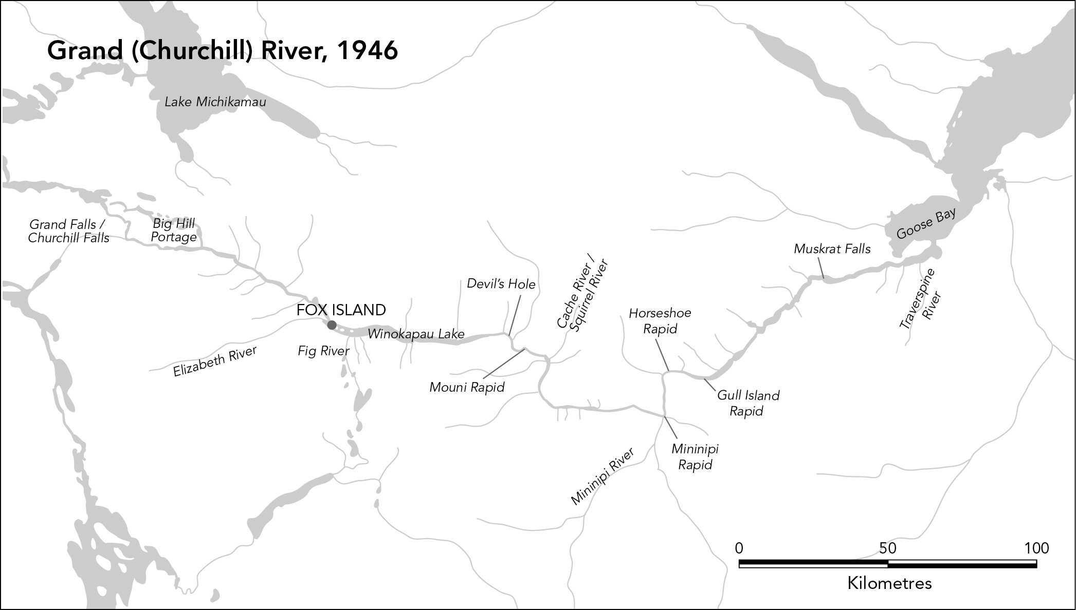
The map of the Grand (Churchill) River shows what it looked like in 1946, when Barbara and Russell did their first trip upriver together, with Nora Groves and John Blake. The river has changed since 1971, the amount of water flow moderated by the development of the Upper Churchill hydroelectric project. The flooded area of western Labrador, Smallwood Reservoir, is a prominent feature on modern maps. The river will change again with the development of the Lower Churchill Project. When the new dam is built at Muskrat Falls in Phase One, a massive reservoir of 107 square kilometres will flood the river valley for 60 kilometres between the falls and Gull Island. Phase Two calls for a dam 99 metres high to be constructed at Gull Island, creating an even larger reservoir of 200 square kilometres in area, filling the valley for a distance of 225 kilometres.* The river rapids, both feared and respected by the trappers, will be gone forever.
Anne Budgell
* Lower Churchill Hydroelectric Generation Project , November 30, 2006, a document prepared by Newfoundland and Labrador Hydro as required by federal and provincial environmental assessment regulations.
