Christopher Thomas - Building a Smarter Community: GIS for State and Local Government
Here you can read online Christopher Thomas - Building a Smarter Community: GIS for State and Local Government full text of the book (entire story) in english for free. Download pdf and epub, get meaning, cover and reviews about this ebook. year: 2021, publisher: Esri Press, genre: Politics. Description of the work, (preface) as well as reviews are available. Best literature library LitArk.com created for fans of good reading and offers a wide selection of genres:
Romance novel
Science fiction
Adventure
Detective
Science
History
Home and family
Prose
Art
Politics
Computer
Non-fiction
Religion
Business
Children
Humor
Choose a favorite category and find really read worthwhile books. Enjoy immersion in the world of imagination, feel the emotions of the characters or learn something new for yourself, make an fascinating discovery.

- Book:Building a Smarter Community: GIS for State and Local Government
- Author:
- Publisher:Esri Press
- Genre:
- Year:2021
- Rating:5 / 5
- Favourites:Add to favourites
- Your mark:
Building a Smarter Community: GIS for State and Local Government: summary, description and annotation
We offer to read an annotation, description, summary or preface (depends on what the author of the book "Building a Smarter Community: GIS for State and Local Government" wrote himself). If you haven't found the necessary information about the book — write in the comments, we will try to find it.
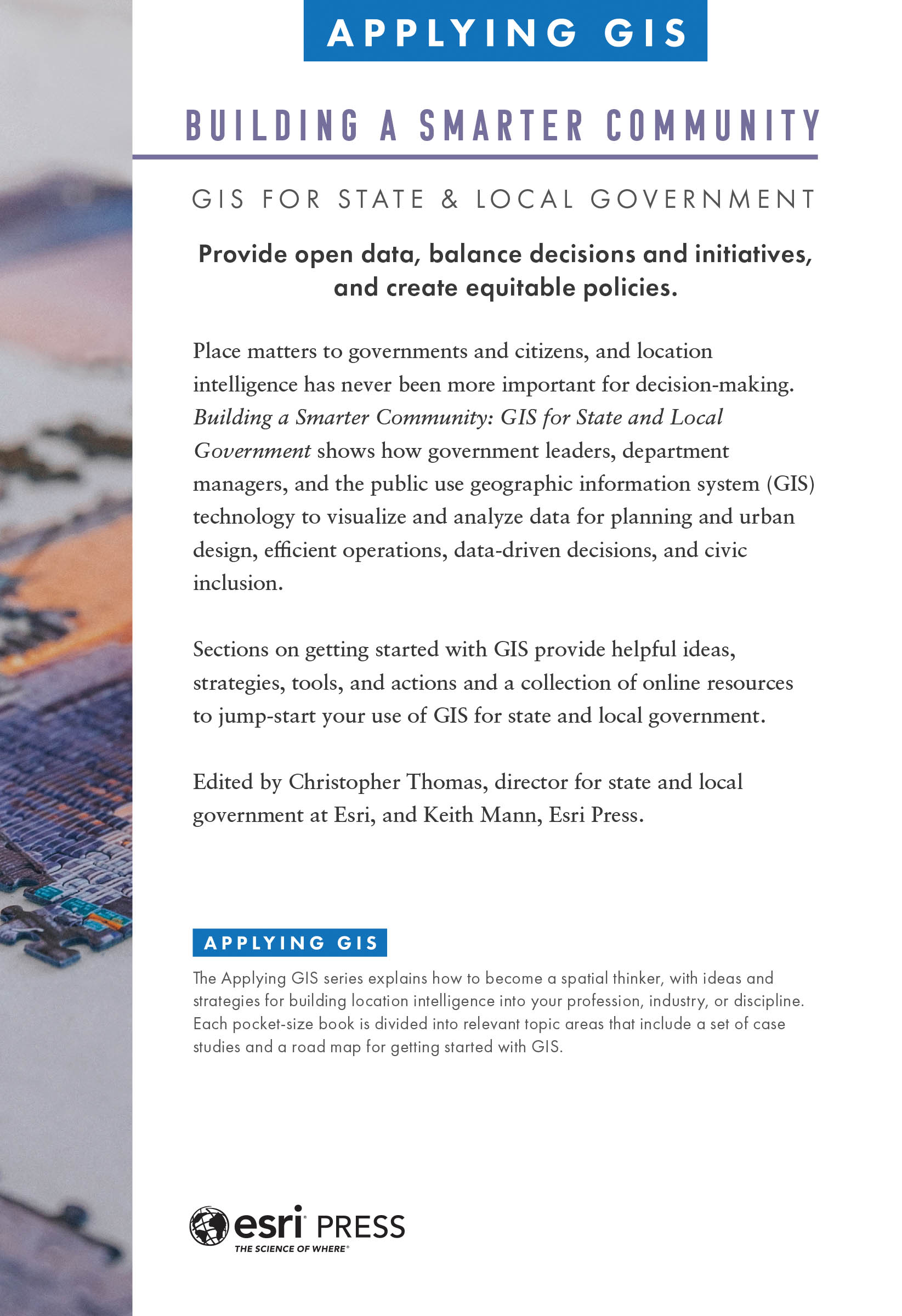
Provide open data, balance decisions and initiatives, and create equitable policies.
Smart communities dont wait for someone to deem them smart; they take action. State and local governments worldwide have taken that first step using geographic information system (GIS) technology. Applying GIS to planning and urban design, public works operations, and racial equity and social justice has helped meet citizens needs and improve government operations. And with advancements in smart technology, location intelligence for state and local governments is not just for GIS specialists.
More informed, data-driven decisions lead to improved outcomes that can be shared and replicated in other communities, helping citizens and government collaborate for the common good. Building a Smarter Community: GIS for State and Local Government shows how government leaders in cities, counties, and states have applied GIS for improved planning, operations, and civic inclusion.
In this collection of case studies and guidance to get started, learn how GIS:
Web apps, GIS hubs and dashboards, and other GIS solutions help state and local governments develop a deeper understanding of the communities they serve within a real-world context. Sections on getting started with GIS provide helpful ideas, strategies, tools, and actions and a collection of online resources to jump-start your use of GIS for state and local government.
Discover how GIS and location intelligence support state and local government decisions and citizen participation in Building a Smarter Community.
Christopher Thomas: author's other books
Who wrote Building a Smarter Community: GIS for State and Local Government? Find out the surname, the name of the author of the book and a list of all author's works by series.


Building a Smarter Community: GIS for State and Local Government — read online for free the complete book (whole text) full work
Below is the text of the book, divided by pages. System saving the place of the last page read, allows you to conveniently read the book "Building a Smarter Community: GIS for State and Local Government" online for free, without having to search again every time where you left off. Put a bookmark, and you can go to the page where you finished reading at any time.
Font size:
Interval:
Bookmark:
Transcription:
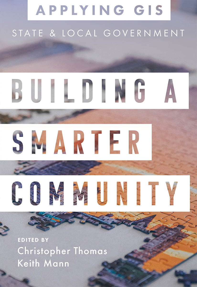
Building A Smarter Community: GIS for State & Local Government (Applying GIS series)
Provide open data, balance decisions and initiatives, and create equitable policies.
Place matters to governments and citizens, and location intelligence has never been more important for decision-making. Building a Smarter Community: GIS for State and Local Government shows how government leaders, department managers, and the public use geographic information system (GIS) technology to visualize and analyze data for planning and urban design, efficient operations, data-driven decisions, and civic inclusion.
Sections on getting started with GIS provide helpful ideas, strategies, tools, and actions and a collection of online resources to jump-start your use of GIS for state and local government.
Edited by Christopher Thomas, director for state and local government at Esri, and Keith Mann, Esri Press.
Applying GIS
The Applying GIS series explains how to become a spatial thinker, with ideas and strategies for building location intelligence into your profession, industry, or discipline. Each pocket-size book is divided into relevant topic areas that include a set of case studies and a road map for getting started with GIS.
 Esri Press, 380 New York Street, Redlands, California 92373-8100
Copyright 2021 Esri
All rights reserved.e-ISBN: 9781589486850The Library of Congress has cataloged the print edition as follows: 2021936215The information contained in this document is the exclusive property of Esri unless otherwise noted. This work is protected under United States copyright law and the copyright laws of the given countries of origin and applicable international laws, treaties, and/or conventions. No part of this work may be reproduced or transmitted in any form or by any means, electronic or mechanical, including photocopying or recording, or by any information storage or retrieval system, except as expressly permitted in writing by Esri. All requests should be sent to Attention: Contracts and Legal Services Manager, Esri, 380 New York Street, Redlands, California 92373-8100, USA.The information contained in this document is subject to change without notice.US Government Restricted/Limited Rights: Any software, documentation, and/or data delivered hereunder is subject to the terms of the License Agreement. The commercial license rights in the License Agreement strictly govern Licensees use, reproduction, or disclosure of the software, data, and documentation. In no event shall the US Government acquire greater than RESTRICTED/LIMITED RIGHTS. At a minimum, use, duplication, or disclosure by the US Government is subject to restrictions as set forth in FAR 52.227-14 Alternates I, II, and III (DEC 2007); FAR 52.227-19(b) (DEC 2007) and/or FAR 12.211/12.212 (Commercial Technical Data/Computer Software); and DFARS 252.227-7015 (DEC 2011) (Technical DataCommercial Items) and/or DFARS 227.7202 (Commercial Computer Software and Commercial Computer Software Documentation), as applicable. Contractor/Manufacturer is Esri, 380 New York Street, Redlands, CA 92373-8100, USA.@esri.com, 3D Analyst, ACORN, Address Coder, ADF, AML, ArcAtlas, ArcCAD, ArcCatalog, ArcCOGO, ArcData, ArcDoc, ArcEdit, ArcEditor, ArcEurope, ArcExplorer, ArcExpress, ArcGIS, arcgis.com, ArcGlobe, ArcGrid, ArcIMS, ARC/INFO, ArcInfo, ArcInfo Librarian, ArcLessons, ArcLocation, ArcLogistics, ArcMap, ArcNetwork, ArcNews, ArcObjects, ArcOpen, ArcPad, ArcPlot, ArcPress, ArcPy, ArcReader, ArcScan, ArcScene, ArcSchool, ArcScripts, ArcSDE, ArcSdl, ArcSketch, ArcStorm, ArcSurvey, ArcTIN, ArcToolbox, ArcTools, ArcUSA, ArcUser, ArcView, ArcVoyager, ArcWatch, ArcWeb, ArcWorld, ArcXML, Atlas GIS, AtlasWare, Avenue, BAO, Business Analyst, Business Analyst Online, BusinessMAP, CommunityInfo, Database Integrator, DBI Kit, EDN, Esri, Esri CityEngine, esri.com, EsriTeam GIS, EsriThe GIS Company, EsriThe GIS People, EsriThe GIS Software Leader, FormEdit, GeoCollector, Geographic Design System, Geography Matters, Geography Network, geographynetwork.com, Geoloqi, Geotrigger, GIS by Esri, gis.com, GISData Server, GIS Day, gisday.com, GIS for Everyone, JTX, MapIt, Maplex, MapObjects, MapStudio, ModelBuilder, MOLE, MPSAtlas, PLTS, Rent-a-Tech, SDE, See What Others Cant, SML, SourcebookAmerica, SpatiaLABS, Spatial Database Engine, StreetMap, Tapestry, the ARC/INFO logo, the ArcGIS Explorer logo, the ArcGIS logo, the ArcPad logo, the Esri globe logo, the Esri Press logo, The Geographic Advantage, The Geographic Approach, the GIS Day logo, the MapIt logo, The Worlds Leading Desktop GIS, Water Writes, and Your Personal Geographic Information System are trademarks, service marks, or registered marks of Esri in the United States, the European Community, or certain other jurisdictions. Other companies and products or services mentioned herein may be trademarks, service marks, or registered marks of their respective mark owners.For purchasing and distribution options (both domestic and international), please visit esripress.esri.com.On the cover: Photograph by Bianca Ackermann.177626
Obeying the law, serving on a jury, and paying taxes are fundamental aspects of civic responsibility and community stability. However, the greater goal of making a community a better place to live requires citizens and governments to work together to affect change and address larger economic, environmental, and social issues. State and local governments form the front lines of improving the lives of residents by responding to community needs and requests, increasing access to social services, and introducing initiatives and programs that improve the infrastructure, safety, and health of communities within their jurisdictions.
In this book, the word community includes all the ways that people are combined within governmental jurisdictions, from small neighborhoods to regional areas (such as counties), to large jurisdictions (such as states and provinces). These communities are inherently entangled with each other through location. For example, a neighborhood exists within a city, which in turn is part of a county that is contained within a state. Governancethe processes that ensure accountability, openness, equity and inclusiveness, and participationflows between communities.
With smart communities, the word smart refers to the use of technology, accurate and timely data, and scientific methods to solve problems. A smart community uses innovative approaches, including location intelligence, to collect and share information and drive good decision-making.
Smart communities dont wait for someone to deem them smart; they take action. One of the most effective actions is to apply geographic information system (GIS) technology to planning and urban design, operations (such as public works), and social issues (such as racial equity and social justice). With GIS, state and local governments make more informed, data-driven decisions that lead to improved outcomes. These outcomes can be shared and replicated in other communities, helping citizens and governments work better together for the common good.
This book is organized in four parts.
With GIS, city and regional planners and urban designers can create realistic alternatives for comparing different planning and design scenarios, including 2D and 3D visualizations that are more relatable to government officials, businesses, and residents. Planners can combine data about diversity, high density and mixed land uses, open space preservation, housing affordability, and economic viability into their analysis, maps, and presentations to the public.
Font size:
Interval:
Bookmark:
Similar books «Building a Smarter Community: GIS for State and Local Government»
Look at similar books to Building a Smarter Community: GIS for State and Local Government. We have selected literature similar in name and meaning in the hope of providing readers with more options to find new, interesting, not yet read works.
Discussion, reviews of the book Building a Smarter Community: GIS for State and Local Government and just readers' own opinions. Leave your comments, write what you think about the work, its meaning or the main characters. Specify what exactly you liked and what you didn't like, and why you think so.