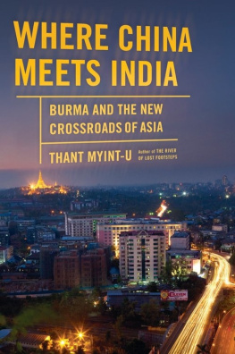
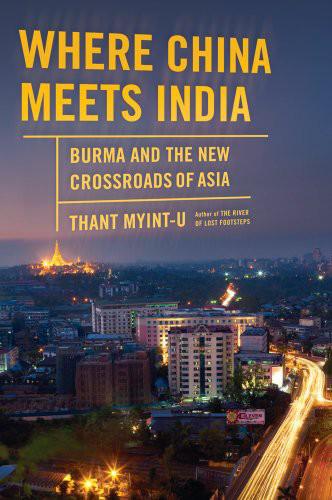
Thant Myint-U - Where China Meets India: Burma and the New Crossroads of Asia
Here you can read online Thant Myint-U - Where China Meets India: Burma and the New Crossroads of Asia full text of the book (entire story) in english for free. Download pdf and epub, get meaning, cover and reviews about this ebook. year: 2011, publisher: Farrar, Straus and Giroux, genre: Politics. Description of the work, (preface) as well as reviews are available. Best literature library LitArk.com created for fans of good reading and offers a wide selection of genres:
Romance novel
Science fiction
Adventure
Detective
Science
History
Home and family
Prose
Art
Politics
Computer
Non-fiction
Religion
Business
Children
Humor
Choose a favorite category and find really read worthwhile books. Enjoy immersion in the world of imagination, feel the emotions of the characters or learn something new for yourself, make an fascinating discovery.

- Book:Where China Meets India: Burma and the New Crossroads of Asia
- Author:
- Publisher:Farrar, Straus and Giroux
- Genre:
- Year:2011
- Rating:5 / 5
- Favourites:Add to favourites
- Your mark:
Where China Meets India: Burma and the New Crossroads of Asia: summary, description and annotation
We offer to read an annotation, description, summary or preface (depends on what the author of the book "Where China Meets India: Burma and the New Crossroads of Asia" wrote himself). If you haven't found the necessary information about the book — write in the comments, we will try to find it.
Thant Myint-U: author's other books
Who wrote Where China Meets India: Burma and the New Crossroads of Asia? Find out the surname, the name of the author of the book and a list of all author's works by series.


Where China Meets India: Burma and the New Crossroads of Asia — read online for free the complete book (whole text) full work
Below is the text of the book, divided by pages. System saving the place of the last page read, allows you to conveniently read the book "Where China Meets India: Burma and the New Crossroads of Asia" online for free, without having to search again every time where you left off. Put a bookmark, and you can go to the page where you finished reading at any time.
Font size:
Interval:
Bookmark:
To Sofia
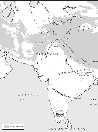
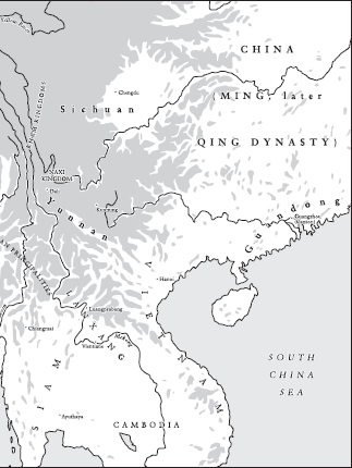
China, Burma, and India in the first century BC
Burma and its neighbours in the ninth century AD
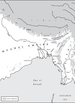
Burma and its neighbours in the seventeenth century
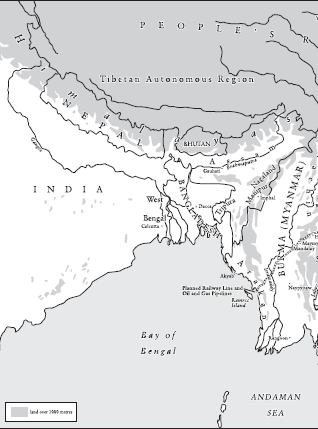
Burma and its neighbours in 2011
In 122 BC , a special mission was dispatched by the emperor of China, a mission to find a rumoured southwest passage, one that was said to lead from his Middle Kingdom to the only recently discovered land of India and from India to the unfamiliar countries beyond.
A few years before, the explorer Zhang Qian had arrived back at the imperial court after a long and arduous journey along an already known northern route, reaching the limits of the known world. He had spent years in captivity at the hands of Chinas mortal enemies, the Xiongnu barbarians, before venturing across vast deserts and wastelands, to strange and outlandish places. He described the Fergana valley and the oasis towns along what would one day be known as the Silk Road, as well as his travels onwards to Bactria, in what is today Afghanistan, and which was then part of a flourishing Greek and Buddhist civilization. And he told of mysterious realms even further afield, like Persia and Mesopotamia, as well as Shendu or India, a region hot and damp where the inhabitants ride elephants when they go into battle. These were kingdoms with their own cities and systems of writing and merchants who sailed the ocean.
And Zhang the explorer told them something even more astonishing: in the markets of Bactria, he had noticed merchandise cloth and bamboo sticks that had been made in the Chinese province of Shu. Shu is modern Sichuan, and in the extreme southwest of what was ancient China. Had other Chinese come this way before him? No, he was told, the products from Shu had come via India. It was a revelation and could only mean one thing: that there existed a southwesterly route, from China to the Indian world.
The existing northern way was treacherous and skirted the territory of the Xiongnu, fierce nomads who spoke a language akin to modern Turkish and Mongolian. Not long before, these nomads had defeated their rivals, called the Yuezhi, slaughtered the Yuezhi king and made his skull into a cup. A southwest passage would be a way around this menace. And direct contact with India could mean a grand alliance between China and India against the barbarians in between.
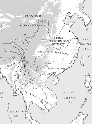
The expedition would not be a great success, however. The imperial envoys started off in Shu or Sichuan, and then travelled south over many months, up great cliffs and through narrow forest trails, braving tigers and giant snakes. Emperor Wus Han dynasty ruled what is today eastern China and even held sway over much of modern Vietnam and Korea. The Pacific coastline was well known. But now they were deep in the interior, surrounded by alien tribes and uncertain how far India would be.
After first crossing the kingdom of Yelang, on the very margins of Chinese civilization, the envoys pushed further south, finally reaching the kingdom of Dian, in what is today the province of Yunnan, near Burma, and until then unknown to the imperial court. The king of Dian treated the envoys well but told them that their way onwards was blocked by another people, called the Kunming. They were forbidden to proceed. Quite possibly, the wily king of Dian wanted to protect his own commercial monopoly and the already thriving regional trade in everything from cowry shells to rhinoceros horns. He did, however, provide his visitors with additional information and told them that some thousand li further to the west there was yet another kingdom, called Dianyue, whose people rode elephants and where merchants from Shu sometimes went secretly to trade.
The emperors original desire had been to open direct relations with India, and to outflank the Xiongnu by finding another route to the west. In this, he would fail. But in making contact with the kingdom of Dian, he began a millennia-long process that would finally bring China, by the end of the twentieth century, to the very borders of Burma, and bring the ancient dream of a direct passage to India within reach.
Geography sometimes changes. This can happen for natural reasons, such as when ocean levels fell during the last ice age, and connected Asia and America by land across what is now the Bering Sea. Or when rain patterns changed thousands of years ago, turning the once green and wet north of Africa into the virtually impassable Sahara Desert, and in this way separating much of that continent from the European world.
In modern times, man has also changed geography. In the nineteenth century, the Suez Canal joined the Mediterranean and the Indian Ocean, dramatically reducing the length of a journey from Europe to India and facilitating Western domination of Asia and Africa. And around the same time the first transcontinental railways were laid across North America, entrenching English-speaking control of the Pacific coast; other railways, across Siberia, would consolidate tsarist authority in the Far East.
When geography changes, old patterns of contact may disappear and new ones take hold, turning strangers into neighbours, and transforming backwaters into zones of strategic significance. Entire peoples face decline or vanish; others rise in importance.
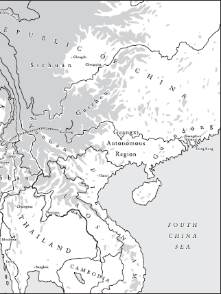
Several years ago I began noticing the news reports of schemes that promised nothing less than a new map of Asia. There were plans from China to join the interior of that vast country to the shores of the Indian Ocean. New highways would slice through the highlands of Burma and link the Chinese hinterland directly both to India and to the warm waters of the Bay of Bengal. A great port would be constructed along the bay, where oil tankers would off-load African and Middle Eastern oil, to be transported along a new thousand-mile-long pipeline. There has even been talk of dredging the upper reaches of Burmas Irrawaddy River to allow giant cargo ships access to Chinas most remote inland regions.
There were reports from India, too, and Indian ambitions appeared no less modest. With their Look East policy, successive Indian governments since the 1990s have sought to revive and strengthen age-old ties to the Far East, across the sea and overland across Burma, creating new connections over mountains and jungle. Just north of where China is building its pipeline, along the Burmese coast, India has planned to build another seaport, with a special road and waterway to link this port to its hitherto isolated northeastern states. There is even a proposal to reopen the Stilwell Road, built by the Allies at epic cost during the war against Japan and then abandoned, a road that would link the easternmost reaches of India with Chinas Yunnan province.
Font size:
Interval:
Bookmark:
Similar books «Where China Meets India: Burma and the New Crossroads of Asia»
Look at similar books to Where China Meets India: Burma and the New Crossroads of Asia. We have selected literature similar in name and meaning in the hope of providing readers with more options to find new, interesting, not yet read works.
Discussion, reviews of the book Where China Meets India: Burma and the New Crossroads of Asia and just readers' own opinions. Leave your comments, write what you think about the work, its meaning or the main characters. Specify what exactly you liked and what you didn't like, and why you think so.