
Published in the United States of America
by Cherry Lake Publishing
Ann Arbor, Michigan
www.cherrylakepublishing.com
Content Adviser: James Wolfinger, PhD, Associate Professor, History and Teacher Education, DePaul University, Chicago, Illinois
Book design: The Design Lab
Photo credits: Cover and page 3, iStockphoto.com/gchutka, iStockphoto.com/killahfunkadelic, iStockphoto.com/gelyngfjell, and Yuri Tuchkov/Shutterstock, Inc.; page 4, Tom Denham/Dreamstime.com; page 5, Matt Antonino/Dreamstime.com; page 6, Michael Pettigrew/Dreamstime.com; page 8, Rob Byron/Shutterstock, Inc.; page 9, Stevebrigman/Dreamstime.com; page 10, Ron Chapple Studios/Dreamstime.com; page 11, Lunamarina/Dreamstime.com; page 12, Jeff Kinsey/Dreamstime.com; page 13, Chrisseman/Dreamstime.com; page 14, Designpicssub/Dreamstime.com; page 15, Greg Amptman/Dreamstime.com; pages 16, 17, 18, and 23, North Wind Picture Archives/Alamy; page 21,thatsmymop/Shutterstock, Inc.; page 22, C. Kurt Holter/Shutterstock, Inc.; page 24, Martin Thomas Photography/Alamy; page 26, Lbarn/Dreamstime.com; page 27, Joseph Sohm-Visions of America/Media Bakery; page 28, Fotoluminate/Dreamstime.com; page 29, Olivier Le Queinec/Dreamstime.com; page 30, Joe Gough/Shutterstock, Inc.; page 32,Steve Heap/Shutterstock, Inc.; page 33, Steve Kingsman/Dreamstime.com; page 34, Philip Lange/Shutterstock, Inc.; page 35, Kenneth D Durden/Dreamstime.Com; page 36, Juan Moyano/Dreamstime.com; page 37, Reika/Shutterstock, Inc.; page 38, 3445128471/Shutterstock, Inc.;40, Mark Stout Photography/Shutterstock, Inc.; page 41, Cafebeanz Company/Dreamstime.com; page 42, Jose Gil/Dreamstime.com; page 43Mike Flippo/Shutterstock, Inc.
Copyright 2012 by Cherry Lake Publishing
All rights reserved. No part of this book may be reproduced or utilized in any form or by any means without written permission from the publisher.
Library of Congress Cataloging-in-Publication Data
Marsico, Katie, 1980
Its cool to learn about the United States: Southeast/by Katie Marsico.
p. cm.(Social studies explorer)
Includes bibliographical references and index.
ISBN-13: 978-1-61080-181-2 (lib. bdg.)
ISBN-13: 978-1-61080-303-8 (pbk.)
1. Southern StatesJuvenile literature. I. Title. II. Title: Southeast. III. Series.
F209.3.M37 2011
975dc22 2011006971
Cherry Lake Publishing would like to acknowledge the work of The Partnership for 21st Century Skills. Please visit www.21stcenturyskills.org for more information.
Printed in the United States of America
Corporate Graphics Inc.
July 2011
CLFA09
TABLE OF CONTENTS
CHAPTER ONE
WELCOME TO THE SOUTHEAST
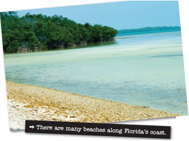
Would you like to hike through Arkansass Ozark Mountains? Maybe you would prefer to hunt for sea-shells along a Florida beach. Perhaps U.S. history is your thing, and you would rather visit a famous battle site in Virginia. Just be sure you have enough time left over to enjoy a little country music in Tennessee and a steaming bowl of gumbo in Louisiana!
The Southeast is made up of 12 states: Alabama, Arkansas, Florida, Georgia, Kentucky, Louisiana, Mississippi, North Carolina, South Carolina, Tennessee, Virginia, and West Virginia. In 2009, about 78,320,977 people lived in this region.

THE LAY OF THE LAND
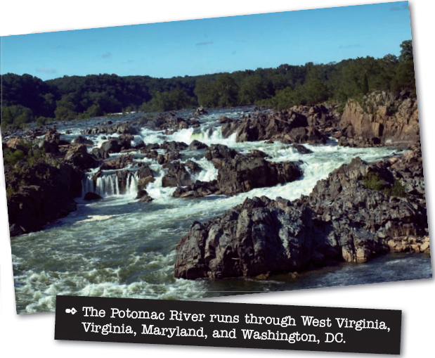
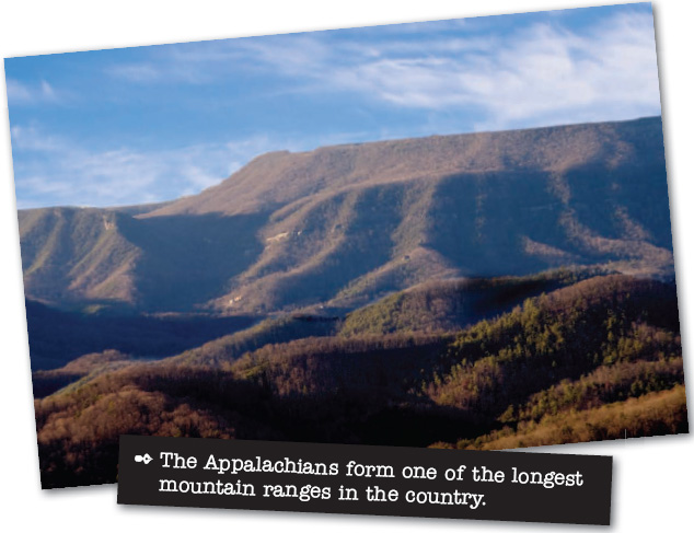
The geography of the Southeast is as diverse as the people who live there. Kentucky is filled with short, steep hills and flat highlands called plateaus. The Mississippi River flows along its western border. The Appalachian Mountains tower over eastern Kentucky, as well as West Virginia and Virginia. Thick forests and deep caves fill the landscape in this portion of the Southeast. In Virginia, the James, Potomac, Rappahannock, and York Rivers flow into Chesapeake Bay, which empties into the Atlantic Ocean.
ACTIVITY
STATE CAPITALS
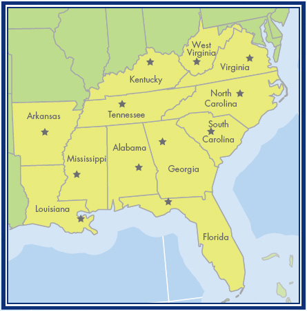
Make a copy of this map of the United States. The southeastern states are yellow. Each star represents the location of a state capital. Look at the list to the right of the map and write the names of the capitals next to the stars in the correct states.
Montgomery
Little Rock
Tallahassee
Atlanta
Frankfort
Baton Rouge
Jackson
Raleigh
Columbia
Nashville
Richmond
Charleston
Answers: Alabama, Montgomery; Arkansas, Little Rock; Florida, Tallahassee; Georgia, Atlanta; Kentucky, Frankfort; Louisiana, Baton Rouge; Mississippi, Jackson; North Carolina, Raleigh; South Carolina, Columbia; Tennessee, Nashville; Virginia, Richmond; West Virginia, Charleston

Farther south, low-lying coastal plains stretch across eastern North Carolina and South Carolina. An area known as the Piedmont makes up the middle sections of these states. It is shaped by several plateaus and foothills. The Appalachian Mountains spread across the western portion of the Carolinas. They rise over much of eastern Tennessee, too. Forests cover many of that states mountain ridges and sloping hillsides.
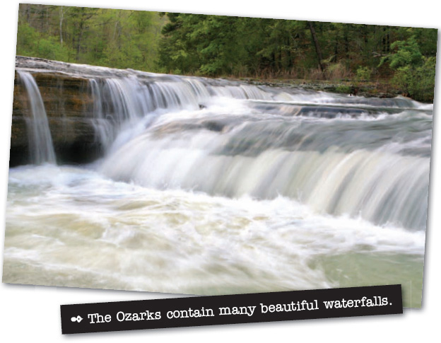
The Mississippi River forms Tennessees western border, helping to create fertile soil that is good for farming. This river flows across other parts of the Southeast as well, including eastern Arkansas. The Ozark and Ouachita Mountains cut through the northwestern and west central portions of that state. Like Tennessee, Arkansas is filled with thick woods and fertile plains and valleys. It is also famous for its many caves, gorges, and springs.
Louisiana, directly south of Arkansas, has several well-known geographic features. One of these is the Mississippi River delta. A delta is a low triangular area that is made from soil and rock that builds up when a river divides or empties into a larger body of water. The Mississippi River delta sits where the Mississippi River flows into the Gulf of Mexico. It contains Louisianas richest farmlands. Marshes, swamps, and


