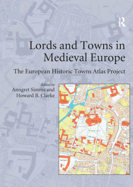
LORDS AND TOWNS IN MEDIEVAL EUROPE
This volume is based on possibly the biggest single Europe-wide project in urban history. In 1955 the International Commission for the History of Towns established the European historic towns atlas project in accordance with a common scheme in order to encourage comparative urban studies. Although advances in urban archaeology since the 1960s have highlighted the problematic relationship between the oldest extant town plan and the actual origins of a town, the large-scale cadastral maps as they have been made available by the European historic towns atlas project are still necessary if we want to understand the evolution of the physical form of our towns. By 2014 the project consisted of over 500 individual publications from over 18 different countries across Europe. Each atlas comprises at least a core-map at the scale of 1:2500, analytical maps and an explanatory text. The time has come to use this enormous database that has been compiled over the last 40 years. This volume, itself based on a conference related to this topic that was held in the Royal Irish Academy in Dublin in 2006, takes up this challenge.
The focus of the volume is on the question of how seigneurial power influenced the creation of towns in medieval Europe and of how this process in turn influenced urban form. Part I of the volume addresses two major issues: the history of the use of town plans in urban research and the methodological challenges of comparative urban history. Parts II and III constitute the core of the book focusing on the dynamic relationship between lordship and town planning in the core area of medieval Europe and on the periphery. In Part IV the symbolic meaning of town plans for medieval people is discussed. Part V consists of critical contributions by an archaeologist, an art historian and a historical geographer.
By presenting case studies by leading researchers from different European countries, this volume combines findings that were hitherto not available in English. A comparison of the English and German bibliographies, attached to this volume, reveals some interesting insights as to how the focus of research shifted over time. The book also shows how work on urban topography integrates the approaches of the historian, archaeologist and historical geographer. The narrative of medieval urbanization becomes enriched and the volume is a genuine contribution to European studies.
Anngret Simms is Professor Emeritus of Historical Geography at University College, Dublin and a member of the Royal Irish Academy.
Howard B. Clarke is Professor Emeritus of Medieval Socio-Economic History at University College, Dublin and a member of the Royal Irish Academy.
Lords and Towns in
Medieval Europe
The European Historic Towns
Atlas Project
Edited by Anngret Simms
and Howard B. Clarke
First published 2015 by Ashgate Publishing
Published 2016 by Taylor & Francis
2 Park Square, Milton Park, Abingdon, Oxon OX14 4RN
711 Third Avenue, New York, NY 10017, USA
Routledge is an imprint of the Taylor & Francis Group, an informa business
Copyright 2015 Anngret Simms and Howard B. Clarke
Anngret Simms and Howard B. Clarke have asserted their right under the Copyright, Designs and Patents Act, 1988, to be identified as the editors of this work.
All rights reserved. No part of this book may be reprinted or reproduced or utilised in any form or by any electronic, mechanical, or other means, now known or hereafter invented, including photocopying and recording, or in any information storage or retrieval system, without permission in writing from the publishers.
Notice:
Product or corporate names may be trademarks or registered trademarks, and are used only for identification and explanation without intent to infringe.
British Library Cataloguing in Publication Data
A catalogue record for this book is available from the British Library.
The Library of Congress has cataloged the printed edition as follows:
Lords and towns in medieval Europe: the European historic towns atlas project /
edited by Anngret Simms and Howard B. Clarke.
pages cm
Includes bibliographical references and index.
ISBN 978-0-7546-6354-6 (hardback) 1. Cities and towns, MedievalEurope. 2.
NobilityEuropeHistoryTo 1500. 3. Power (Social sciences)EuropeHistoryTo
1500. 4. City planningEuropeHistoryTo 1500. 5. UrbanizationEuropeHistoryTo
1500. 6. Social historyMedieval, 5001500. 7. Cities and towns,
MedievalEuropeHistoriography. 8. AtlasesHistoryTo 1500. 9. EuropeHistorical
geography. I. Simms, Anngret. II. Clarke, Howard B.
HT131.L67 2015
307.76094dc23
2015009326
ISBN 9780754663546 (hbk)
Contents
Anngret Simms and Howard B. Clarke
Anngret Simms
Dietrich Denecke
Francesca Bocchi
Sandrine Lavaud
Daniel Stracke and Thomas Tippach
Peter Johanek
Josef emlika
Ferdinand Opll
Martina Stercken
Terry R. Slater
Roman Czaja
Katalin Szende and Andrs Vgh
Paul Niedermaier
Mirela Slukan Alti
Howard B. Clarke
Marjatta Hietala
Bram Vannieuwenhuyze and Reinout Rutte
Keith D. Lilley
Derek Keene
Matthias Untermann
Jrgen Paul
Mark Hennessy
Francesca Bocchi is Professor Emeritus of Medieval History and the History of Towns at the University of Bologna. She was the founder of the Centro Gina Fasoli per la storia delle citt at the same university, of which she is the academic director. A vice-president of the International Commission for the History of Towns, she is the co-director of the Atlante storico delle citt italiane. In 19969 she published with others the atlas of Bologna in four volumes.
Howard B. Clarke is Professor Emeritus of Medieval Socio-Economic History at University College Dublin. Since 1991 he has been a joint editor of the Irish Historic Towns Atlas and is the author of Dublin, Part I, to 1610 (2002). He is the co-editor with Anngret Simms of The Comparative History of Urban Origins in Non-Roman Europe (1985); the editor of Irish Cities (1995); the co-author with Jacinta Prunty of Reading the Maps: a Guide to the Irish Historic Towns Atlas (2011) and co-editor with Sarah Gearty of Maps and Texts: Exploring the Irish Historic Towns Atlas (2013). He is a member of the Royal Irish Academy and of the International Commission for the History of Towns.
Roman Czaja is Professor of Medieval History at the Nicolaus Copernicus University in Toru. His PhD thesis on the socio-topography of Elblag/Elbing became the basis of a book dealing with Prussian towns and the Teutonic Order. His research interests are concentrated on the history of medieval towns, the Hanseatic League, the Teutonic Order and historical cartography. He is an editor of the Atlas historyczny miast polskich/Historischer Atlas polnischer Stdte and a member of the International Commission for the History of Towns.
Dietrich Denecke is Professor Emeritus of Historical Geography at the University of Gttingen. He has published widely on methodological approaches in urban historical geography. Jointly with Gareth Shaw he edited


