Copyright 2015 by John R. Dunlavey
A GLX LLC product
All rights reserved
Published in the United States of America
First Edition
Library of Congress Control Number: 2015901155
ISBN-13:978-09860955-0-4
ISBN-10: 0986095508
Cover Design by Anita Jovanovic
Photographs by John R. Dunlavey, except as noted
Maps by John Dunlavey, except:
Maps 19, 20, 21, 22, 23, 24, 25, 26 by Laura Allen, Migito Design
All maps edited by John R. Dunlavey
Unless otherwise indicated, all photographs and illustrations are the property of the author and GLX LLC.
No part of this book may be reproduced in any form or by any electronic or mechanical means, including information storage and retrieval devices, without the written permission of the publisher.
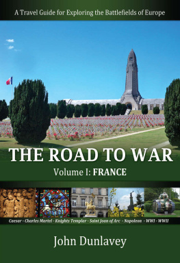
Front cover photos: LOssuaire de Douaumont in Verdun (center). Photo bar, left to right: Roman soldiers, courtesy of Lyons Muses Gallo-Romans; Stained glass window, Clermont-Ferrand Cathedral; St. Joan of Arc, Paris; Kellerman Statue, Valmy; Char B 1, Stonne.
Back cover photos, left to right: Tiger I, Vimoutiers; Vimy Ridge Memorial; American Cemetery, Somme; roadway in Alsace.
For
Louise OLeary Wilson
19452014
War is an ugly thing, but not the ugliest of things. The decayed and degraded state of moral and patriotic feeling which thinks that nothing is worth war is much worse.
John Stuart Mill
TABLE OF CONTENTS
,
,
LIST OF MAPS
.
LIST OF PHOTOS
,
I. INTRODUCTION
W hy did I write this book? In part, I had a somewhat self-serving purpose. Alcuin, Charlemagnes biographer, wrote, The way to live forever is to pass on knowledgeand we all want to live forever, right?
The real reason I researched and visited these fields and memorials was to honor soldiers, like my dad, who fought for a greater purpose far away from home. This book is a humble effort to remember their sacrifice and to keep the history and their honor alive. I hope this book inspires tourists, students, teachers and historians to honor these soldiers courage and to learn from history that we must keep the peace while also having the courage to defeat evil when necessary.
The inspiration to write this book first came to me during a trip I took to Europe with my dad in 2007. We saw the locations of Operation Market Garden and the Battle of the Bulge, as well as Normandy and the Hrtgen Forest. I have always loved history, especially military history, and always enjoyed taking trips with family and friendseven when were hungry, tired and lost! During the 2007 trip, I was fascinated by a personal tour we received from a wild Dutchman named Ron Von Rijt. Some friends of ours had put us in touch with Ron for a two-day tour of the Battle of the Hrtgen Forest and the northern section of the Battle of the Bulge. I was amazed by the terrain and the small memorials and humbled by the courage and sacrifice that manifested there. I was captivated by the fact that the Dutchman had dedicated a large portion of his life to honoring American and German soldiers. In fact, he had signed up to take care of three American graves in one of the American cemeteries in Holland, and had also built a memorial in downtown Schmidt, Germany.
While touring the Hrtgen Forest, no matter how well Ron explained the battle, I had a difficult time understanding our location relative to the overall battle movements. The experience made me reflect upon how great it would be to have a written guide that would help me better understand the Battle of Hrtgen Forest. After the trip, I started a short write-up. Then I began thinking about all the other major battles in Europe. The list kept growing! I was fortunate to have a job in Germany and was able to travel easily from there. I organized my trips so that I could see historic sites, but the highlights werent just battlefields. I also enjoyed meeting great people, eating great food, seeing beautiful landscapes and letting myself be surprised.
Please also look for these books:
VOLUME II Belgium, Netherlands and Luxembourg
VOLUME III Germany
VOLUME IV Austria and Hungary
VOLUME V Czech Republic, Slovakia and Poland
VOLUME VI Ireland and United Kingdom
VOLUME VII Mediterranean (Italy, Greece, Spain, Turkey)
II. HOW TO USE THIS BOOK AND TIPS FOR TRAVEL
T his book is arranged chronologically, starting with the Roman Battle of Alesia in 52 BC and concluding with the World War II Battle of Alsace. For each battle, I provide a description of related events and locations to visit, including GPS coordinates. These Places to See also appear on the corresponding maps. Use these to map out your trip and create your own itinerary based on your location. (Youll discover that many sites are quite close to each other.)
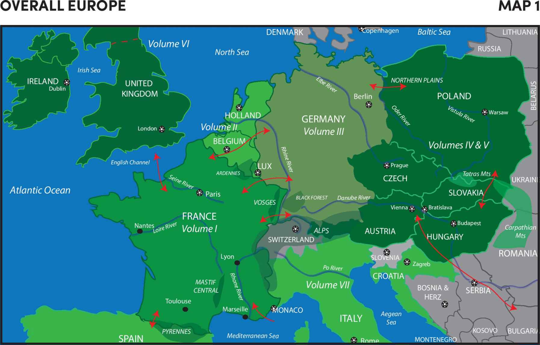
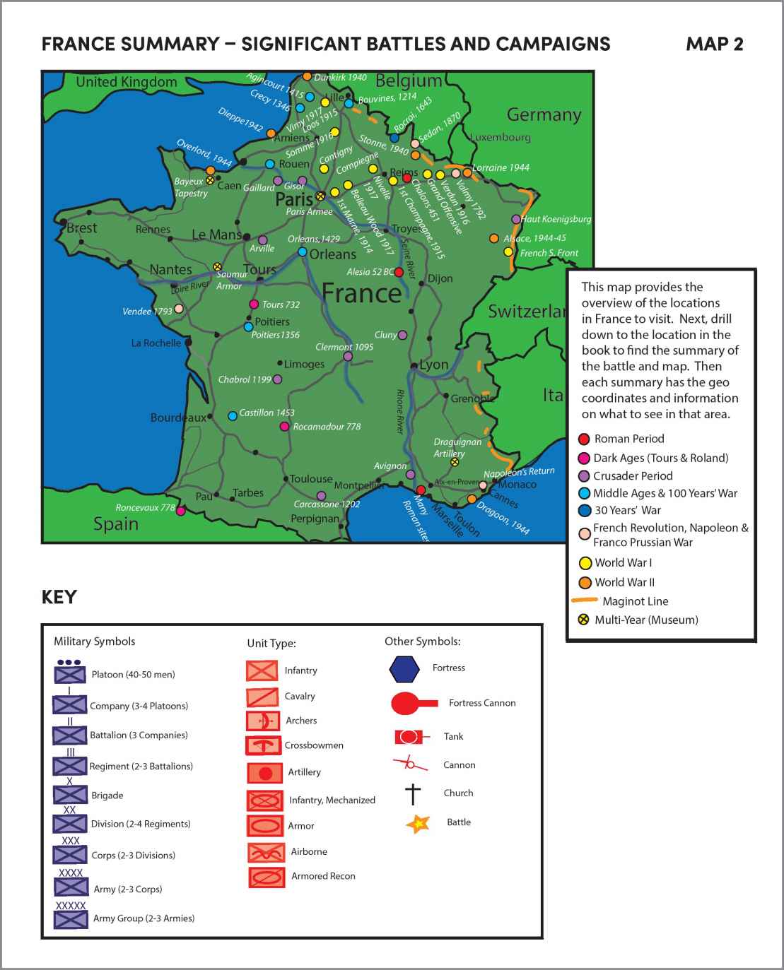
OVERALL EUROPE: The purpose of this map is to briefly highlight the significant terrain and the corresponding traditional invasion routes (shown with red arrows). My series of books are organized by country and within the countries are summaries and maps for each battle. For example, the next is the Summary of France. It highlights the major battles and places to visit. Then within France are summaries of battles with a supporting map and geo coordinates of places to see related to the battle or topic.
TRAVEL TIPS
TRANSPORTATION:
ADDRESS VS. GPS COORDINATES: This book does not use addresses because, based on personal experience, Ive found that addresses do not match up well. (Plus, many of the places I included might not have addresses!) For this reason, I use GPS coordinates only. The GPS coordinates and maps are based on WGS84 datum. I provide two types of coordinates:
GPS COORDINATE FORMAT
| Latitude | Longitude |
| N 50 06.814 | E 8 40.742 |
DECIMAL AND DEGREES FORMAT
| Latitude | Longitude |
| 50.113568 | 8.679037 |
Both are for the same location. The majority of rental car and personal GPS systems use one of these two formats.
As an added benefit, the GPS coordinates show how close many of these places are to typical tourist locations. For example, you may be in Paris at the Louvre and find that an American cemetery is just 20 minutes away, or a memorial to the last Templar Commander is only steps from Notre Dame Cathedral.
COMPASS AND MAP: Although you have a GPS, I suggest that you buy a European road map and take a compass with you. Many roads are under construction and navigation can be stressful, so a hard-copy map is very helpful. Also, having a compass when you are on the battlefield will help you pinpoint your direction.
ARRIVAL CITY: I lived in Frankfurt for three years and learned that, because of the volume of airlines arriving daily, good prices are usually available from the USA to Frankfurt. Using Frankfurt as a hub is also a good idea because youll easily be able to drive, take the train or connect to other flights. Kayak.com is a great tool to find the best prices. (And, FYI, Lufthansa has the best service!)
Next page
