THE GEOGRAPHY OF CHINA
SACRED AND HISTORIC PLACES
UNDERSTANDING CHINA
THE GEOGRAPHY OF CHINA
SACRED AND HISTORIC PLACES
EDITED BY KENNETH PLETCHER, SENIOR EDITOR, GEOGRAPHY AND HISTORY

Published in 2011 by Britannica Educational Publishing
(a trademark of Encyclopdia Britannica, Inc.)
in association with Rosen Educational Services, LLC
29 East 21st Street, New York, NY 10010.
Copyright 2011 Encyclopdia Britannica, Inc. Britannica, Encyclopdia Britannica, and the Thistle logo are registered trademarks of Encyclopdia Britannica, Inc. All rights reserved.
Rosen Educational Services materials copyright 2011 Rosen Educational Services, LLC. All rights reserved.
Distributed exclusively by Rosen Educational Services.
For a listing of additional Britannica Educational Publishing titles, call toll free (800) 237-9932.
First Edition
Britannica Educational Publishing
Michael I. Levy: Executive Editor
J.E. Luebering: Senior Manager
Marilyn L. Barton: Senior Coordinator, Production Control
Steven Bosco: Director, Editorial Technologies
Lisa S. Braucher: Senior Producer and Data Editor
Yvette Charboneau: Senior Copy Editor
Kathy Nakamura: Manager, Media Acquisition
Kenneth Pletcher: Senior Editor, Geography and History
Rosen Educational Services
Alexandra Hanson-Harding: Editor
Nelson S: Art Director
Cindy Reiman: Photography Manager
Matthew Cauli: Designer, Cover Design
Introduction by Carolyn Jackson
Library of Congress Cataloging-in-Publication Data
The geography of China: sacred and historic places / edited by Kenneth Pletcher.1st ed.
p. cm.(Understanding China)
In association with Britannica Educational Publishing, Rosen Educational Services.
Includes bibliographical references and index.
ISBN 978-1-61530-182-9 (eBook)
1. ChinaGeography. 2. Historic sitesChina. 3. Sacred spaceChina. 4. ChinaHistory,
Local. I. Pletcher, Kenneth.
DS706.7.G46 2011
915.1dc22
2010002170
Cover: The main tourist street in Yangshuo with the famous karsts (steep hills) of Guangxi province in the background. Ed Freeman/Photodisc/Getty Images; : Fisherman with cormorant on bamboo raft on the Li River in Guilin, Guangxi province, China. Dennis Cox/Time & Life Pictures/Getty Images; back cover: Summer Palace in Beijing. www.istockphoto.com/Nikada.
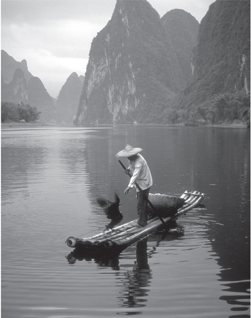
: Fisherman with cormorant on bamboo raft on the Li River in Guilin, Guangxi Province, China. Dennis Cox/Time & Life Pictures/Getty Images.
INTRODUCTION
T he Three Gorges Dam, the worlds largest when completed in 2006, is built across the Yangtze River in the heart of China. The project has been heavily criticizedto build the dam, more than 1.2 million people were moved from nearly 500 cities, towns, and villages, and 1,200 historical and archaeological sites were flooded. But proponents say it will help control deadly floods, create a deepwater reservoir, and allow for easier navigation for oceangoing freighters. Its 26 turbines will also create a massive amount of hydroelectric energy that will bring electricity to millions of people. Throughout its long history, the needs of Chinas people have spurred it to undertake giant projects that shape their land. That is a necessity, because although it is only slightly larger in area than the United States, China has today roughly 1 billion more people. In fact, about one in five people in the world is Chinese.
In this book, readers will learn how the contours, fertility, and weather patterns of Chinas land have shaped its people. They will also learn how Chinas populationthe largest in the worldhas put special pressure on the land. Peoples needs for water, food, fuel, and space have caused them to change and mold the landscape over time. Readers will also get an overview of China, from its landscapes to its cityscapes. This book explores many of the places that give China its character, from the Great Wall to vast mountain ranges to great cities and ancient provinces.
Eons before humans arrived, the Indian subcontinent was separate from the Asian mainland. Some 50 million years ago, India began crashing into Asia. The pressure created when the subcontinent was forced under the Asian landmass created the Himalayas, a vast mountain chain that has continued to slowly grow taller. The pressure also pushed up a wide region of land to the north of the mountains, so that today China is like a table tilting from west to east. This western part, the Plateau of Tibet (or Qiangtang), is known as the roof of the world. The worlds highest peak, Mount Everest, is in the Himalayas on Chinas border with Nepal. Just north of the Tibetan Plateau is the Turfan Depression, Chinas lowest spot, 508 feet (155 metres) below sea level. Also in western China, north of Tibet, lie the Kunlun Mountains. But the country generally slopes eastward until it reaches the Pacific Ocean. Chinas more than 50,000 rivers flow, with a few exceptions, from west to east.
The Huang He, or Yellow River, is the most northern of Chinas three main rivers. It rises on the Plateau of Tibet and drains into the Bo Hai (Gulf of Chihli), part of the Yellow Sea. The mighty river, which gets its name because it is so filled with silt that it appears to be yellow-brown in colour, enriches the land with the soil it deposits, making it fertile for farming. It also has been called Chinas Sorrow because the shifting river often overflows its banks and floods the North China Plain. The Huang He has changed course many times. In the past 4,000 years for instance, the river has entered the Yellow Sea at points that vary as much as 500 miles (800 km).
The Yangtze is the longest of Chinas rivers, flowing from the Plateau of Tibet to the East China Sea north of Shanghai. It divides northern and southern China. The longest river in Asia, it is the third longest river in the world3,915 miles (6,300 km). It is also has the greatest depth of any river in the worldin some spots it is as much as 500 to 600 feet (150 to 180 m) deep. Over history, the Yangtze has been responsible for many devastating floods along its fertile, highly populated banks.
The Xi is the most southern of Chinas great river systems; it flows from the Yunnan-Guizhou Plateau past picturesque mountains and into the Pearl River Delta, where it meets with two other rivers and flows into the South China Sea at Guangzhou. The Xi, whose flow is second only to the Yangtze, is 80 feet (25 m) higher in summer than winter because it is swelled by monsoon rains. Important cities line its banks as well.
Rainfall and temperatures in China vary greatly, and so do its soils. In general, the northern, wheat-growing, part of the country is cool and dry, and its soils tend to be alkaline. One important kind of soil in northern China is loess, which is very fertile but erodes away easily. In China, much of this loose, silty material is borne away by the Huang He. Some of the earliest evidence of human civilization in China has been found in the Loess Plateau.
In the south, the hot, humid weather is suitable for growing rice. Despite the acidity of the soil, skilled farmers have learned how to cultivate the land intensively enough to grow two or even three crops per year.
Urban grown accelerated in the mid-1980s as China entered the global economy. Today, some two in five Chinese live in cities. More than 70 cities have more than a million people, and several dozen top a half-million.
Next page
