This volume is dedicated to Richard Bradley
Published in the United Kingdom in 2016 by
OXBOW BOOKS
10 Hythe Bridge Street, Oxford OX1 2EW
and in the United States by
OXBOW BOOKS
1950 Lawrence Road, Havertown, PA 19083
Oxbow Books and the individual authors 2016
Paperback Edition: ISBN 978-1-78570-119-1
Digital Edition: ISBN 978-1-78570-120-7
Kindle Edition: ISBN 978-1-78570-121-4
PDF Edition: ISBN 978-1-78570-122-1
A CIP record for this book is available from the British Library
Library of Congress Cataloging-in-Publication Data
Names: Nimura, Courtney, author.
Title: Prehistoric rock art in Scandinavia : agency and environmental change / Courtney Nimura.
Description: Philadelphia : Oxbow Books, 2015. | Series: Swedish rock art series ; volume 4 | Includes bibliographical references.
Identifiers: LCCN 2015039319| ISBN 9781785701191 (pbk.) | ISBN 9781785701207 (epub) | ISBN 9781785701214 (mobi) | ISBN 9781785701221 (pdf)
Subjects: LCSH: Petroglyphs--Scandinavia. | Rock paintings--Scandinavia. | Art, Prehistoric--Scandinavia. | Antiquities, Prehistoric--Scandinavia. | Scandinavia--Antiquities.
Classification: LCC GN825 .N56 2015 | DDC 709.01/13--dc23 LC record available at http://lccn.loc.gov/2015039319
All rights reserved. No part of this book may be reproduced or transmitted in any form or by any means, electronic or mechanical including photocopying, recording or by any information storage and retrieval system, without permission from the publisher in writing.
Printed in the United Kingdom by Gomer Press
For a complete list of Oxbow titles, please contact:
UNITED KINGDOM
Oxbow Books
Telephone (01865) 241249, Fax (01865) 794449
Email:
www.oxbowbooks.com
UNITED STATES OF AMERICA
Oxbow Books
Telephone (800) 791-9354, Fax (610) 853-9146
Email:
www.casemateacademic.com/oxbow
Oxbow Books is part of the Casemate Group
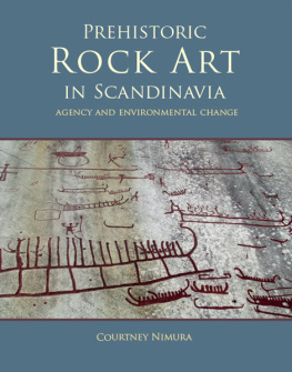
Front cover image: A rock art scene on the Vitlyckehllen in Bohusln
CONTENTS
ACKNOWLEDGEMENTS
The research included in this volume is based on the authors PhD study, which was completed at the Department of Archaeology, University of Reading and generously funded by the same. My thanks are extended to members of that department especially Dr Rob Hosfield, Professor Martin Bell and Professor Bob Chapman. The publication of this book was generously funded by the Department of Historical Studies, University of Gothenburg.
As part of the authors research a database was created of archaeological data from Denmark, Norway and Sweden. This would not have been possible without the help of individuals at the cultural heritage agencies in Scandinavia: Evi Berg at Riksantikvaren (Norwegian Directorate for Cultural Heritage), Maria Carlsson at Riksantikvariembetet (Swedish National Heritage Board), and Claus Dam at Kulturstyrelsen (Danish Agency for Culture).
A special thanks to Dr Johan Ling (University of Gothenburg), whose generosity with his data of Uppland and Bohusln and the reproduction of certain illustrations supported this research, and whose conversation and advice were invaluable. Over the past few years there have been other colleagues and friends in the field who have been extremely obliging with their constructive criticisms, advice and words of encouragement: Dr Peter Skoglund (University of Gothenburg), Dr Fredrik Fahlander (University of Stockholm), Dr Joe Flatman (Historic England), Eliott Wragg and Nathalie Cohen (MOLA), Dr Diane ODonoghue (Tufts University) and Dr Mike Allen (Allen Environmental Archaeology). I especially thank Dr Mark Sapwell, Dr Mara Vejby, Dr Julie Gardiner (Oxbow Books) and Professor Chris Gosden (University of Oxford).
Elizabeth Morrow edited this volume more than once: her patience and guidance was, and continues to be, indispensable. Many thanks to Julieta Molina Lalanne and Craig Williams, who were a great help with the creation of the figures. I thank Flemming Kaul and Camilla Sund for allowing me to reproduce their figures in this book. Where my foreign language skills lacked, I received translation help from various friends including Carina and George Fernee and Jesper Hansen (UCL). Dr Jacob Sonne, Dr Frederik Zahle and Beth Selchau not only helped with translation, but also provided a home for me during my many research trips to Scandinavia.
A number of friends and family helped me throughout the process of writing this book, most of all Audrey and Meggy. Many thanks are extended to: Andy, Chio and Frankie, Clare, Diana, Francesca, Frederik, Jacob, Jojo and Kev, Juli, Katie, Libby, Marion, Matty, Mel, Mez, Mike, Miki, Oli, Paul, Roan, Savanna, Serena and John, Shelley and Jeff, Thomas, and Yasmin.
INTRODUCTION
At the start of the postglacial period, in a Scandinavia that was still largely covered by the great Fennoscandian glacier, a tradition began that would last for thousands of years. This tradition would evolve and grow in manifold ways whilst simultaneously maintaining a core lexicon of recognisable imagery and familiar scenes. This tradition was making rock art.
Archaeologists, both Scandinavian and not, have found themselves captivated by these enigmatic images on stone. These images represent the largest body of visual imagery from Northern European prehistory stretching from northern Germany to the Arctic reaches of northern Norway. The Scandinavian tradition includes Denmark, Norway and Sweden, though similar rock art is also found in Finland, Russia and the eastern Baltic countries. The quantity and chronological extent of this rock art is aptly represented by the wealth of published material on the subject. However the majority of these rock art studies have focused on relatively small geographical areas, not the expansive geographical extent of Northern European rock art. Regional studies have been immensely important in articulating theories regarding their areas of study, but these theories are often inapplicable in other regions. And though general theory may be applied to smaller geographical areas, it is difficult to use smaller-scale studies to generate general theory. This was one of the key motivations for this research. Present-day geopolitical boundaries segment prehistoric Scandinavia and present challenges (different academic traditions, languages and national databases) for multi-national comparison. One of the main aims of this research was to create a database that would allow for a Scandinavian-wide investigation of prehistoric rock art from the Stone Age to the Early Iron Age. What this book contains is a presentation of these data derived from this new database in a series of distribution maps, tables and scattergrams. Though a general theory is proposed, it is intended to supplement existing interpretations of Scandinavian prehistoric rock art.
Certain imagery from the lexicon of rock art symbols was also immortalised in other media. The most prominent of these images was the ship, which is depicted on small portable art objects and appears in the form of large monuments. This icon of travel, trade, fishing and exploration is the most scrutinised motif in Scandinavian prehistoric art studies because of its pervasiveness geographically, temporally and materially. Because the ship is such a widespread symbol through time and space it is the ideal motif upon which to focus this Scandinavian-wide study.
In recent years advances in the study of palaeolandscapes have spurred new investigations into the prehistoric environments in which these rock art sites were created, and these studies have paved the way for new interpretations. These newer rock art studies challenge the paradigms that previously structured our hypotheses of Scandinavian prehistoric rock art and this has opened the floodgates for a wide variety of proposals regarding the meaning, style, purpose and consumption of this enigmatic material. Reconstructing past landscapes has prompted an exciting insight: that the ship images in prehistory were often located close to water whether coasts, lakes, rivers or other wet landscapes. Smaller-scale studies incorporating palaeolandscape data reveal that ships were often created on rocks in proximity to water: a clear decision on the part of prehistoric rock art makers. Yet many of these sites do not appear close to water today. This is due to a phenomenon resulting from the last Ice Age. The weight of the Fennoscandian glacier that blanketed Scandinavia forced the land to sink below its equilibrium. When the glacier melted, sea levels rose and coastlines encroached causing massive flooding of land in the Mesolithic. After this initial inundation the land began to return to its equilibrium, in an action called glacio-isostatic rebound. So after inundation came the retreating of coastlines as the land rose. This shoreline displacement was most dramatic in the Bronze Age. With new data on prehistoric landscapes coupled with a Scandinavian-wide database we can attempt to answer some basic questions, the first being: where did ship motifs appear in relation to water? The ship is not the only motif in Scandinavian rock art that is repeated across time and space. Other imagery such as footprints and animals, humans and geometrical shapes were also favoured. Do these other motifs show a similar or different relationship to water than the ships?
Next page


