Amber Dobrzensky - Moon Nicaragua
Here you can read online Amber Dobrzensky - Moon Nicaragua full text of the book (entire story) in english for free. Download pdf and epub, get meaning, cover and reviews about this ebook. year: 2013, publisher: Avalon Travel Publishing, genre: Art. Description of the work, (preface) as well as reviews are available. Best literature library LitArk.com created for fans of good reading and offers a wide selection of genres:
Romance novel
Science fiction
Adventure
Detective
Science
History
Home and family
Prose
Art
Politics
Computer
Non-fiction
Religion
Business
Children
Humor
Choose a favorite category and find really read worthwhile books. Enjoy immersion in the world of imagination, feel the emotions of the characters or learn something new for yourself, make an fascinating discovery.
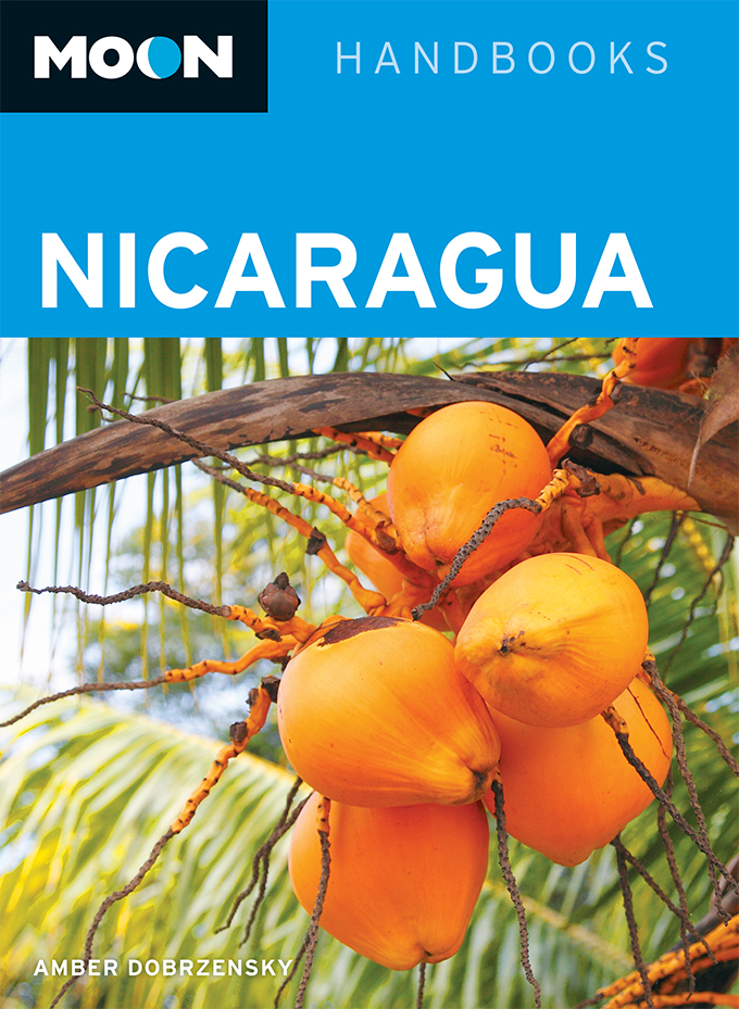
- Book:Moon Nicaragua
- Author:
- Publisher:Avalon Travel Publishing
- Genre:
- Year:2013
- Rating:4 / 5
- Favourites:Add to favourites
- Your mark:
Moon Nicaragua: summary, description and annotation
We offer to read an annotation, description, summary or preface (depends on what the author of the book "Moon Nicaragua" wrote himself). If you haven't found the necessary information about the book — write in the comments, we will try to find it.
Amber Dobrzensky: author's other books
Who wrote Moon Nicaragua? Find out the surname, the name of the author of the book and a list of all author's works by series.


Moon Nicaragua — read online for free the complete book (whole text) full work
Below is the text of the book, divided by pages. System saving the place of the last page read, allows you to conveniently read the book "Moon Nicaragua" online for free, without having to search again every time where you left off. Put a bookmark, and you can go to the page where you finished reading at any time.
Font size:
Interval:
Bookmark:
The largest and lowest Central American country, Nicaragua is a nation of geographical superlatives. Located at the elbow where the Central American isthmus bends and then plummets southward to Panam, Nicaragua is almost dead center between North and South America. Part of a biological corridor that for millions of years has allowed plant and animal species from two continents to mingle, it boasts an extraordinary blend of flora and fauna.
In the 16th century, Nicaraguas geographical beauty enchanted the conquistadores, who reported, The Nicaraguan plains are some of the most beautiful and pleasant lands that can be found in the Indies because they are very fertile with mahicales and vegetables, fesoles of diverse types, fruits of many kinds and much cacao.
Nicaragua is roughly triangular in shape and dominated by two large lakes in the southwest. Its 530-kilometer-long northern border with Honduras is the longest transect across the Central American isthmus. To the south, the southern shore of the Ro San Juan defines the better part of the NicaraguanCosta Rican border. Wholly within Nicaragua, the San Juan has been a continual source of conflict to this day with Costa Rica, whose attempts to navigate and patrol the river have been met aggressively by the Nicaraguan government. To the east and west lie the Caribbean Sea and the Pacific Ocean, respectively. With 127,849 square kilometers of land area, Nicaragua is approximately the size of Greece or the state of New York. But Nicaragua has lost some 50,000 square kilometers to her neighbors over the past several centuries: the eastern third of what is now Honduras, as well as the nowCosta Rican territories of Nicoya and Guanacaste, plus the Caribbean island of San Andrs.

Administratively, the nation is divided into 15 units called departamentos, and two vast autonomous regions on the Atlantic coast known as the North and South Atlantic Autonomous Regions (RAAN and RAAS). The departments, in turn, consist of 145 municipalities. The two autonomous regions elect their own officials on a separate electoral calendar. Nicaraguas three largest cities are Managua, Len, and Granada, followed by Estel, Masaya, and the remaining department capitals.
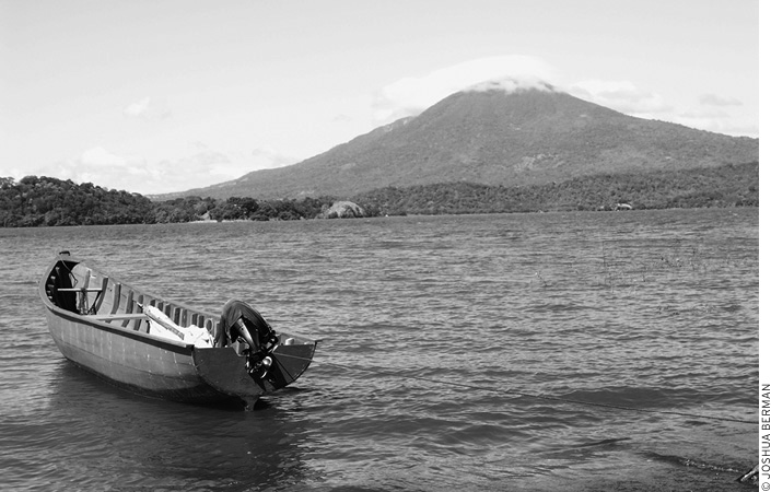
Nicaraguas favorite nickname, The Land of Lakes and Volcanoes, evokes its primary geographical features: two great lakes and a chain of impressive and active volcanoes. Nicaraguas water and volcanic resources have had an enormous effect on its human history, from the day the first Nahuatl people concluded their migration south and settled on the forested shores of Lake Cocibolca (Lake Nicaragua) to the first Spanish settlements along the lakes to the many as yet unrealized plans to build a trans-isthmus canal.
The isthmus now known as Central America took shape 60 million years ago (MYA); Nicaraguas northern third is geologically the most ancient. In the area of Telpaneca and Quilal, rocks dated at 200 million years old are thought to have once been part of a small Jurassic-Cretaceous continent that included the modern-day Yucatn Peninsula in Mexico and the Antilles Islands. To the south, what are now Costa Ricas Talamanca Mountains formed an archipelago of isolated volcanoes. During the Tertiary period (651.7 MYA), intense volcanic activity and erosion produced large amounts of sediment and volcanic flows that accumulated underwater.
Nicaragua is known as the land of lakes and volcanoes.
At least two periods of intense volcanic activity, one in the Eocenic-Oligocenic epoch (5525 MYA) formed the lesser features of Nicaraguas central highlands, and a second in the Miocene (2513 MYA) produced the larger mountains in Matagalpa and Jinotega. Eleven million years later, shifting tectonic plates in the Pacific and Caribbean lifted the seabed, forming the Pacific region.
When the Cocos plate slid under the Caribbean plate, the main volcanic mountain range running northwestsoutheast across the Pacific plains blistered to the surface. Ocean water from the Atlantic rushed in along a broad sunken valley of the Pacific plate now known as the Nicaraguan Depression and pooled, forming the lakes. Some geologists believe the Atlantic and Pacific actually connected at this point in time and were later cut off by volcanic sedimentation. Erosion began pulling material from the landmass outward to the sea, building up Nicaraguas Pacific region and gradually forming the Atlantic coast.
Plate tectonics theory, in spite of being widely accepted since the 1960s, is most frequently criticized for its failure to adequately explain the geology and geography of several regions of the world, including Central America. It is highly probable that our concept of the geological events that formed Central America will change as geologic science progresses. Regardless of the mechanism, however, convergence of the plates ensures crustal instability, which manifests itself in frequent volcanic and earthquake activity in all of Central America, and especially in Nicaragua.
Nicaragua has about 40 volcanoes, a half dozen of which are usually active at any time, whether venting light clouds of gas or actually erupting. Running parallel to the Pacific shore, Nicaraguas volcanoes are a part of the Ring of Fire that encompasses most of the western coast of the Americas, the Aleutian Islands of Alaska, Japan, and Indonesia. The Maribio (Nahuatl for the giant men) and Dirian volcano ranges stretch nearly 300 kilometers from the Concepcin and Maderas in the middle of Lake Nicaragua to Cosigina, which juts into the Gulf of Fonseca.
The first volcanic event in recorded history was a major eruption of Volcn Masaya in the early 1500s. The lava formed the present-day lagoon at the base of the mountain. Another great lava flow occurred in 1772, leaving a black, barren path still visible today where the Carretera Masaya highway crosses it. In 1609, Spanish settlers abandoned the city of Len when Momotombo erupted. And in January of 1835, Volcn Cosigina violently blew its top, hurling ash as far away as Jamaica and Mexico, covering the area for 250 kilometers around the volcano in ash and burning pumice and forcing the entire peninsula into three days of darkness. All this volcanic activity is responsible for the exceptional fertility of Nicaraguas soils, most notably the agricultural plains around Chinandega and Len.
Volcn Masaya is the most easily accessed of Nicaraguas volcanoes and boasts a paved road leading right to the lip of the crater. Volcn Masaya is actually formed of three craters, the largest of which, Santiago, is the only crater in the Americas that contains a visible pool of incandescent liquid lava in its center. The visibility of this lava fluctuates on a 30-year cycle and was best seen 19651979.
Climbing a few Nicaraguan giants is a great way to experience Central America. San Cristbal is the highest peak, at 1,745 meters. A smaller peak adjacent to San Cristbal, Volcn Casitas still bears the immense scar of the landslide that buried thousands in an avalanche of rock and mud during Hurricane Mitchand trembled briefly again in January of 2002. Isla de Ometepes twin cones are popular for hiking and easily accessible. No matter where you hike, always hire a guide, as several foreigners have gotten lost and perished while peak bagging.
Momotombo, San Cristbal, and Telca are the most active peaks and are prone to emit plumes of poisonous gases, smoke, and occasionally lava. La Isla de Ometepes Volcn Concepcin (1,610 meters) last blew its top in 2005 and 2007. The other half of Ometepe (Nahuatl for two peaks) is Volcn Maderas (1,394 meters) which sleeps, its crater drowned in a deep lagoon that feeds a thriving jungle.
Font size:
Interval:
Bookmark:
Similar books «Moon Nicaragua»
Look at similar books to Moon Nicaragua. We have selected literature similar in name and meaning in the hope of providing readers with more options to find new, interesting, not yet read works.
Discussion, reviews of the book Moon Nicaragua and just readers' own opinions. Leave your comments, write what you think about the work, its meaning or the main characters. Specify what exactly you liked and what you didn't like, and why you think so.