Norwegian
Cruising Guide
th Edition
Vol.
Swedish
Border To
Bergen
By Phyllis Nickel, John Harries &
Hans Jakob Valderhaug with Eli Husum
Norwegian Cruising Guide
Volume
Swedish Border to Bergen
8th EditionUpdated March 2021
By Phyllis Nickel, John Harries &
Hans Jakob Valderhaug with Eli Husum
ISBN: 978-0-9958939-6-2 (eBook) 978-1-9990043-1-6 (Softcover)
What Happened To Sweden?
We have removed the West Coast of Sweden chapter from this volume because:
It was a legacy from the 1986 1st Edition of the Norwegian Cruising Guide when there were no English-language guides to the Swedish coast. That is no longer the case.
Our information was getting out-of-date with no plans to sail in Sweden anytime soon.
Having a chapter on Sweden in a guide to Norway doesnt make sense.
However, if you were using this chapter in the 8th Edition of the Guide and still need it, we can send you a PDF copy for free.
Email us at info@norwegiancruisingguide.com
Register your Guide to get update notices
norwegiancruisingguide.com/register
Published by Attainable Adventure Cruising Ltd. P.O. Box 1086, Lunenburg, Nova Scotia, B0J 2C0 Canada
Copyright 2006-2021 Attainable Adventure Cruising Ltd, all rights are reserved.
This work is registered with the UK Copyright Service, the US Library of Congress and the Canadian Intellectual Property Office.
No part of this publication may be reproduced in any form or by any means, graphic, electronic or mechanical, without the prior written permission of the publishers.
While we have made every reasonable effort to ensure the accuracy of the informa- tion in this Guide, errors can and do occur.
Neither Attainable Adventure Cruising Ltd, the authors, or our contributors take any responsibility for any accident, injury or dam- age to you, your crew, your boat or any third party.
It is your responsibility to consult the appropriate government publications and charts while navigat- ing your vessel in the waters covered by this Guide.
Decisions to cruise the waters covered by this Guide, where you go, and how you equip your boat, are yours and yours alone.
The information in this Guide is based on what has worked for the authors and contributors in the past, but that does not mean it will work for you, or even that it is correct.
We have provided sketch maps to give a general indication of the layout of an area. They are not for navi- gation. We have not scanned the areas covered by these maps for rocks or obstruc- tions. We are assuming that you have the appropriate charts and will consult them.
Contents
Norwegian Cruising Guide
Help
First off, thanks for buying our Guide. We know you are impatient to jump right in, but first please take a moment for the following :
This is an interactive book with a lot of cool features that will help you find the information you need quickly. That said, we support many differ- ent devices and some of these have quirks (thats a polite word for bugs).
To learn more about this books features, and how to work around de- vice quirks, click (computer) or press (tablet or phone) on the question mark below. You will be taken to a Help page on our website that includes a short video tour. Now would be a great time to do this.
Click or touch the question mark to take the tour.
Get Your Free Waypoint File
We are cruisers, too, so we know what a big pain in the neck relating your real-world destination to a Guide that contains nearly 1000 detailed har- bour and anchorage descriptions is, so we fixed that by creating a way- point file that you can load into your plotter, your computer, or Google Earth. And, best of all, its free. You can get the waypoint file at any time by visiting our website.
But wait, we make it even easier, read on:
Register Your Guide
We work hard to keep the keep the Norwegian Cruising Guide up to date, but thats not useful if you never hear about a new edition. So please take a moment to register your Guide. And dont worry:
We wont send you spam.
We wont give your email address to anyone else.
We wont ask you to fill in one of those irritating and useless surveys.
This is purely about making sure you know about new editions and, once you are no longer interested, you can unsubscribe with one click.
Once you have registered, we will automatically take you to the way- point file download page.
Click or touch the R to register your guide.
Important note:
If this link does not work, please visit www.norwegiancruisingguide.com/ebook-help/
Contact Us
We have been working for over years to make the Norwegian Cruising Guide the very best guide available for any area. But we also know that there is always room for improvement. So if you have any suggestions to make the Guide (or the way we deliver it) better, please email us at:
info@norwegiancruisingguide.com
?
R
Harbours and Anchorages Overall Map
Norwegian Cruising Guide
Portr to Lindesnes
Lindesnes to Stavanger
Stavanger to Haugesund
Haugesund to Bergen
The Swedish Border
to Portr
Norwegian Cruising Guide
Chapter Map Symbol Key
Page Symbol Key
Norwegian Cruising Guide
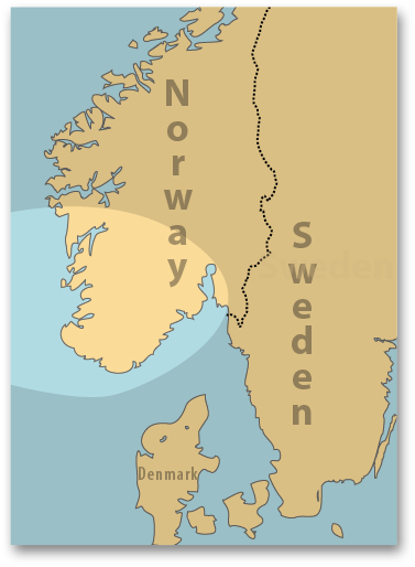
The passage from the Swedish border and along the east side of Oslofjord en is straightforward.
When sailing south from Oslo towards Stavern, your main decision is whether to take the open water route or sail inland up Tnsbergfjord en. If you choose the inland route, you will have a further decision to make between entering Tnsbergfjorden between Tjme and Nttery or fur- ther north, east of Tnsberg itself. There is little difference in terms of dis- tance between the inshore and offshore routes but the inshore routes are of much greater scenic interest.
West of Stavern there is a nm open water passage after which you can head up Langesundsbukta and into the sheltered eastern part of the popular Krager Archipelago.
Summer weather in this area is dominated by the sea breeze that regu- larly reaches to m/s (20 to knots) in the afternoon. Veering south-
Charts
Overview at 1:350,000: Chart Inner Oslofjorden: Charts and Detailed coverage at 1:50,000: Charts to


