Federal Aviation Administration - The Flight Navigator Handbook
Here you can read online Federal Aviation Administration - The Flight Navigator Handbook full text of the book (entire story) in english for free. Download pdf and epub, get meaning, cover and reviews about this ebook. year: 2013, publisher: Skyhorse, genre: Children. Description of the work, (preface) as well as reviews are available. Best literature library LitArk.com created for fans of good reading and offers a wide selection of genres:
Romance novel
Science fiction
Adventure
Detective
Science
History
Home and family
Prose
Art
Politics
Computer
Non-fiction
Religion
Business
Children
Humor
Choose a favorite category and find really read worthwhile books. Enjoy immersion in the world of imagination, feel the emotions of the characters or learn something new for yourself, make an fascinating discovery.

- Book:The Flight Navigator Handbook
- Author:
- Publisher:Skyhorse
- Genre:
- Year:2013
- Rating:3 / 5
- Favourites:Add to favourites
- Your mark:
The Flight Navigator Handbook: summary, description and annotation
We offer to read an annotation, description, summary or preface (depends on what the author of the book "The Flight Navigator Handbook" wrote himself). If you haven't found the necessary information about the book — write in the comments, we will try to find it.
The Flight Navigator Handbook provides information on all phases of air navigation and is a source of reference for everyone in the field, from navigators to navigator students.
This handbook explains how to measure, chart the earth, and use flight instruments to solve basic navigation problems. It also contains data pertaining to flight publications, preflight planning, in-flight procedures, and low altitude navigation.
Specific topics covered throughout the pages of this informational and helpful guide include:
Federal Aviation Administration: author's other books
Who wrote The Flight Navigator Handbook? Find out the surname, the name of the author of the book and a list of all author's works by series.


The Flight Navigator Handbook — read online for free the complete book (whole text) full work
Below is the text of the book, divided by pages. System saving the place of the last page read, allows you to conveniently read the book "The Flight Navigator Handbook" online for free, without having to search again every time where you left off. Put a bookmark, and you can go to the page where you finished reading at any time.
Font size:
Interval:
Bookmark:
Flight Navigator Handbook
U.S. Department of Transportation
FEDERAL AVIATION ADMINISTRATION
Flight Standards Service

Additional material copyright 2013 by Skyhorse Publishing, Inc.
No claim is made to material contained in this work that is derived from government documents. Nevertheless, Skyhorse Publishing claims copyright in all additional content, including, but not limited to, compilation copyright and the copyright in and to any additional material, elements, design, images, or layout of whatever kind included herein.
All inquiries should be addressed to Skyhorse Publishing, 307 West 36th Street, 11th Floor, New York, NY 10018.
Skyhorse Publishing books may be purchased in bulk at special discounts for sales promotion, corporate gifts, fund-raising, or educational purposes. Special editions can also be created to specifications. For details, contact the Special Sales Department, Skyhorse Publishing, 307 West 36th Street, 11th Floor, New York, NY 10018 or info@skyhorsepublishing.com.
Skyhorse and Skyhorse Publishing are registered trademarks of Skyhorse Publishing, Inc., a Delaware corporation.
Visit our website at www.skyhorsepublishing.com .
10 9 8 7 6 5 4 3 2 1
Library of Congress Cataloging-in-Publication Data is available on file.
ISBN: 978-1-62873-472-0
Printed in China
The Flight Navigator Handbook provides information on all phases of air navigation. It is a source of reference for navigators and navigator students. This handbook explains how to measure, chart the earth, and use flight instruments to solve basic navigation problems. It also contains data pertaining to flight publications, preflight planning, in-flight procedures, and low altitude navigation. A listing of references and supporting information used in this publication is at Appendix A; mathematical formulas to use as an aid in preflight and in-flight computations are at Appendix B; chart and navigation symbols are at Appendix C.; and a Celestial Computation Sheet is at Appendix D.
Any time there is a conflict between the information in this handbook and specific information issued by an aircraft manufacturer, the manufacturers data takes precedence over information in this handbook. Occasionally, the word must or similar language is used where the desired action is deemed critical. The use of such language is not intended to add to, interpret, or relieve a duty imposed by Title 14 of the Code of Federal Regulations (14 CFR).
It is essential for persons using this handbook to become familiar with and apply the pertinent parts of 14 CFR. The current Flight Standards Service (FSS) airman training and testing material and learning statements for all airman certificates and ratings can be obtained from www.faa.gov .
This handbook is available for download, in PDF format, from www.faa.gov .
This handbook is published by the United States Department of Transportation, Federal Aviation Administration, Airman Testing Standards Branch, AFS-630, P.O. Box 25082, Oklahoma City, OK 73125.
Comments regarding this publication should be sent, in email form, to the following address:
AFS630comments@faa.gov
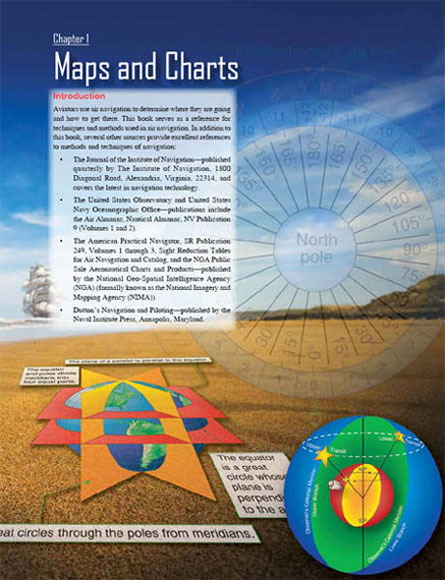
Chapter 1
Maps and Charts
Chapter 2
Flight Planning
Chapter 3
Basic Instruments
Chapter 4
Dead Reckoning
Chapter 5
Radio Aid Fixing
Chapter 6
Map Reading
Chapter 7
Radar Navigation
Chapter 8
Celestial Concepts
Chapter 9
Computing Altitude and True Azimuth
Chapter 10
Celestial Precomputation
Chapter 11
Plotting and Interpreting the Celestial Line of Position
Chapter 12
Special Celestial Techniques
Chapter 13
Sextants and Errors of Observation
Chapter 14
Grid Navigation
Chapter 15
Pressure Pattern Navigation
Chapter 16
Navigation Systems
Appendix A
References and Supporting Information
Appendix B
Mathematical Formulas
Appendix C
Chart and Navigation Symbols
Appendix D
Celestial Computation Sheet
Basic to the study of navigation is an understanding of certain terms that could be called the dimensions of navigation. The navigator uses these dimensions of position, direction, distance, altitude, and time as basic references. A clear understanding of these dimensions as they relate to navigation is necessary to provide the navigator with a means of expressing and accomplishing the practical aspects of air navigation. These terms are defined as follows:
Positiona point defined by stated or implied coordinates. Though frequently qualified by such adjectives as estimated, dead reckoning (DR), no wind, and so forth, the word position always refers to some place that can be identified. It is obvious that a navigator must know the aircrafts current position before being able to direct the aircraft to another position or in another direction.
Directionthe position of one point in space relative to another without reference to the distance between them. Direction is not in itself an angle, but it is often measured in terms of its angular distance from a referenced direction.
Distancethe spatial separation between two points, measured by the length of a line joining them. On a plane surface, this is a simple problem. However, consider distance on a sphere, where the separation between points may be expressed as a variety of curves. It is essential that the navigator decide exactly how the distance is to be measured. The length of the line can be expressed in various units (e.g., nautical miles (NM) or yards).
Altitudethe height of an aircraft above a reference plane. Altitude can be measured as absolute or pressure. Absolute altitude is measured by a radar altimeter, and pressure altitude is measured from various datum planes. Compare with elevation, which is the height of a point or feature on the earth above a reference plane.
Timedefined in many ways, but definitions used in navigation consist mainly of:
1. Hour of the day.
2. Elapsed interval.
Methods of expressionthe methods of expressing position, direction, distance, altitude, and time are covered fully in appropriate chapters. These terms, and others similar to them, represent definite quantities or conditions that may be measured in several different ways. For example, the position of an aircraft may be expressed in coordinates, such as a certain latitude and longitude. The position may also be expressed as 10 miles south of a certain city. The study of navigation demands the navigator learn how to measure quantities, such as those just defined and how to apply the units by which they are expressed.
For most navigational purposes, the earth is assumed to be a perfect sphere, although in reality it is not. Inspection of the earths crust reveals there is a height variation of approximately 12 miles from the top of the tallest mountain to the bottom of the deepest point in the ocean. A more significant deviation from round is caused by a combination of the earths rotation and its structural flexibility. When taking the ellipsoidal shape of the planet into account, mountains seem rather insignificant. The peaks of the Andes are much farther from the center of the earth than Mount Everest.
Measured at the equator, the earth is approximately 6,378,137 meters in diameter, while the polar diameter is approximately 6,356,752.3142 meters. The difference in these diameters is 21,384.6858 meters, and this difference may be used to express the ellipticity of the earth. The ratio between this difference and the equatorial diameter is:
Next pageFont size:
Interval:
Bookmark:
Similar books «The Flight Navigator Handbook»
Look at similar books to The Flight Navigator Handbook. We have selected literature similar in name and meaning in the hope of providing readers with more options to find new, interesting, not yet read works.
Discussion, reviews of the book The Flight Navigator Handbook and just readers' own opinions. Leave your comments, write what you think about the work, its meaning or the main characters. Specify what exactly you liked and what you didn't like, and why you think so.