Human/Cultural Geography
DANTES/DSST* Study Guide
All rights reserved. This Study Guide, Book and Flashcards are protected under the US Copyright Law. No part of this book or study guide or flashcards may be reproduced, distributed or stored in a retrieval system, or transmitted in any form or by any means, electronic, mechanical, photocopying, recording, or otherwise, without the prior written permission of the publisher Breely Crush Publishing, LLC.

2017 Breely Crush Publishing, LLC
*DSST is a registered trademark of The Thomson Corporation and its affiliated companies, and does not endorse this book.
971010515143
Copyright 20032017, Breely Crush Publishing, LLC.
All rights reserved.
This Study Guide, Book and Flashcards are protected under the US Copyright Law. No part of this publication may be reproduced, distributed or stored in a retrieval system, or transmitted in any form or by any means, electronic, mechanical, photocopying, recording, or otherwise, without the prior written permission of the publisher Breely Crush Publishing, LLC.
Published by Breely Crush Publishing
10808 River Front Parkway
South Jordan, UT 84095
www.breelycrushpublishing.com
ISBN: 978-1-61433-360-9
Printed and bound in the United States of America.
*DSST is a registered trademark of The Thomson Corporation and its affiliated companies, and does not endorse this book.
 Table of Contents
 Introduction to Geography
On the broadest level, geography is the study of land or landscapes and how people interact with them. In the literal sense, the term geography originates from the Greek geo which refers to the earth, and graphy referred to writings or drawings. The encompasses a wide variety of topics from cultural aspects of how a populations location will affect their beliefs and practices, all the way to political factors such as borders, economic systems, and others. In addition to culture and politics, geography additionally considers factors such as nature, space, and population. Geographers do this in terms of specific locations such as cities or states, and they do it in global contexts. What it all comes down to is that geography attempts to explain human actions as they are caused by, relate to, and affect one thing location.
In geography, the world can be represented in a number of different ways. The two most common methods used to represent the world are using a globe and using a flat map. Each of these methods is associated with different positive and negative aspects. Globes are useful because they are the most accurate representations of the actual surface of the earth. Because the earth is a sphere, the globe can show the relationships between different landmasses, oceans, and features most accurately.
However, globes can be disadvantageous because they are small-scale and therefore not always the most useful representations. Also, because they are round it is impossible to get a whole-earth view at once, so studying large distances can be difficult.
 Maps
Maps
In contrast, flat maps are very easy to use in judging distances, and are far more portable than globes are. However, it is important to keep in mind when examining a flat map that there will be distortions in the representation of different factors because of the conversion from three dimensions to two.
Distance plays an important part in this study. People identify and create regions, and,
regions encourage peoples activities. When regions are developed through agriculture
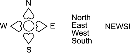
or industry, lands or industry situated far away from human habitations demand less rent. Locations are known by longitude and latitude, a distance that can isolate locations. Locations can be in different directions; map reading is an integral part of learning geography. Direction is normally shown:

When contour lines on a map take the shape of a V this can indicate two different things. If the point of the lines is directed downhill in terms of elevation, this indicates a ridge. On the other hand, if the point of the V is directed uphill this is an indication of a valley. Usually these coincide with nearby bodies of what that drain down through an area, causing a depression in the elevation over time.
Important to understanding the relative distance shown on a map or globe is the map key. This information is usually included at the bottom of the map and provides the means of calculating the distance between cities or counties.
Other information that is important to know is the chart found below:

Inch to Ratio
Foot 1:12
Yard 1:36
Mile 1:63,360
Meter 1: 39
Kilometer 1:39,370
 Latitude and Longitude
The most prominent and common lines to be found on maps are lines of latitude and longitude. Therefore, understanding these two types of lines is extremely important in geography. First, lines of latitude are the horizontal running lines that circle the earth. The most well-known line of latitude is the equator, which runs about the center of the earth at its widest point.
Latitude lines are used to describe absolute location north or south of the equator. Often, these lines are referred to as parallels. Because the earth is a giant sphere, latitude (and longitude) is measured in terms of degrees. Moving from the equator, latitude can be anywhere from zero to ninety degrees north (for the northern hemisphere), or zero to ninety degrees south (for the southern hemisphere. With the equator representing zero degrees. On the globe, each degree represents an approximately 69 mile distance.
Secondly, lines of longitude are the vertical running lines that circle the earth. Lines of longitude are often referred to as meridian lines.
 Prime Meridian
The central or zero degree meridian line is referred to as the Prime Meridian.
Throughout history there has been much debate about where the Prime Meridian should lie; however, today it is accepted that the Prime Meridian runs through Greenwich, the site of the British Royal Observatory.
In contrast to lines of latitude which range from zero to ninety degrees, lines of longitude run from zero to one hundred and eighty degrees east or west (moving outward from Greenwhich) and meet at the international date line in the middle of the Pacific Ocean (on the opposite side of the world as the Prime Meridian).


![Topik Guide - TOPIK--The Self-Study Guide [For All Levels]](/uploads/posts/book/387869/thumbs/topik-guide-topik-the-self-study-guide-for-all.jpg)


![Test Prep Books - AFOQT Study Guide 2019-2020: AFOQT Study Guide 2019 & 2020 and Practice Test Questions for the Air Force Officer Qualifying Test [NEW Edition]](/uploads/posts/book/149312/thumbs/test-prep-books-afoqt-study-guide-2019-2020.jpg)


