• Complain

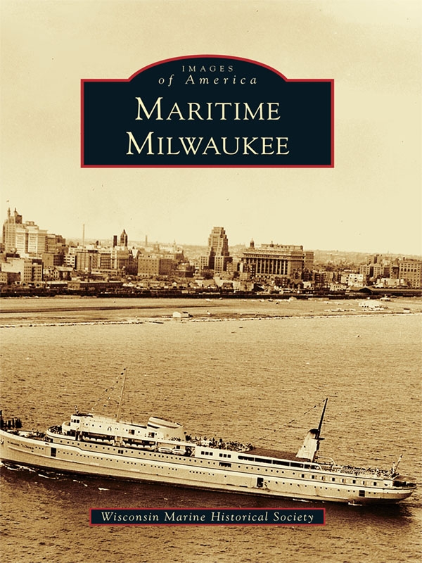
Wisconsin Marine Historical Society - Maritime Milwaukee

Here you can read online Wisconsin Marine Historical Society - Maritime Milwaukee full text of the book (entire story) in english for free. Download pdf and epub, get meaning, cover and reviews about this ebook. year: 2011, publisher: Arcadia Publishing, genre: Children. Description of the work, (preface) as well as reviews are available. Best literature library LitArk.com created for fans of good reading and offers a wide selection of genres:

Romance novel Science fiction Adventure Detective Science History Home and family Prose Art Politics Computer Non-fiction Religion Business Children Humor

Choose a favorite category and find really read worthwhile books. Enjoy immersion in the world of imagination, feel the emotions of the characters or learn something new for yourself, make an fascinating discovery.

Wisconsin Marine Historical Society Maritime Milwaukee

Maritime Milwaukee: summary, description and annotation

We offer to read an annotation, description, summary or preface (depends on what the author of the book "Maritime Milwaukee" wrote himself). If you haven't found the necessary information about the book — write in the comments, we will try to find it.

In 1778, the first sailing vessel with cargo holds, the Archange, a schooner built for prominent British trader John Askin, found quiet waters in Milwaukee Bay. These quiet waters and the Milwaukee, Menomonee, and Kinnickinnic Rivers made Milwaukee a favorable destination for early settlers. Maritime Milwaukee explores the growth of the citys port and three riverfronts through a variety of photographs spanning the 1800s to the present thanks to the archival preservation of collections by the Port of Milwaukee, the Milwaukee Public Library, and the Wisconsin Marine Historical Society.

Wisconsin Marine Historical Society: author's other books


Who wrote Maritime Milwaukee? Find out the surname, the name of the author of the book and a list of all author's works by series.

Maritime Milwaukee — read online for free the complete book (whole text) full work

Below is the text of the book, divided by pages. System saving the place of the last page read, allows you to conveniently read the book "Maritime Milwaukee" online for free, without having to search again every time where you left off. Put a bookmark, and you can go to the page where you finished reading at any time.

Light

Font size:

Reset

Interval:

Bookmark:

Make
Table of Contents ACKNOWLEDGMENTS This book could never have been created - photo 1
Table of Contents

ACKNOWLEDGMENTS

This book could never have been created without access to the extensive vessel files, subject files, and photographs maintained by the Wisconsin Marine Historical Society and the Milwaukee Public Library, and I wish to express my thanks for their generous assistance. I would also like to thank Suzette Lopez, Virginia Schwartz, and Carolyn Colwell for their invaluable assistance in helping me locate and select the material used. I am indebted to the Milwaukee Public Library for the use of its scanner, copier, and its facilities in general. In addition, I thank Eric Reinelt, director of the Port of Milwaukee, for the collection of photographs that were donated to the library and the marine society, supplementing their already extensive supply. Many of them were clearly unavailable elsewhere. The photographs in the final chapter are my own, but like those in the rest of the book, they can be found in the Wisconsin Marine Historical Society/Milwaukee Public Library collection. Unless otherwise noted, all images are courtesy of the Wisconsin Marine Historical Society and the Milwaukee Public Library.

Although not a source for any of the photographs used here, John Gurdas 1999 book, The Making of Milwaukee , published by the Milwaukee County Historical Society, is the source of much of my knowledge of Milwaukees history. It is the best on the subject that I have found. I recommend the book to those interested in seeking additional information about the history of Milwaukee and its waterways.

I would especially like to thank Jane Plowman and Rose Fortier for scanning all of the photographs and Suzette Lopez, Wisconsin Marine Historical Society executive director; Jack Godden, Wisconsin Marine Historical Society curator; and Jane Plowman for checking my text. Finally, I thank my fellow Wisconsin Marine Historical Society Tuesday volunteers at the library who took up the slack when I didnt have time to do my usual activities because I was working on the book.


Charles A. Sterba, editor

Find more books like this at wwwimagesofamericacom Search for your - photo 2

Find more books like this at
www.imagesofamerica.com


Search for your hometown history, your old
stomping grounds, and even your favorite sports team.

One
THE BEGINNINGS, PORT, FISHERMEN

Milwaukees first settlers were Native Americans, chiefly the Potawatomi, Ottawa, Ojibway, and Menominee; the Potawatomi was the dominant group. The rivers followed pretty much the same course as today, but their original outlet was at about the present Lincoln Avenue Viaduct. The rivers together with Lake Michigan constituted the Native American highways, and these continued to serve as the routes for the first commerce in the area. A schooner found shelter in the river mouth as early as 1778, but European settlement did not begin until after 1818, when Solomon Juneau established the first trading post in the area.

Jones Island was always a peninsula, but it was connected to the mainland at its north end, rather than at the south as it is today. Early on, piers were built at the natural harbor mouth, but the whole thing proved unsatisfactory. Most of the land surrounding the rivers, including Jones Island, was swamp. The Native Americans together with the earliest European settlers lived on the bluffs to the north and on higher ground to the west. They only visited Jones Island to fish, hunt, and to harvest the wild rice.

The harbor at the south end of Jones Island was inconvenient, and the earliest commercial pier in the lake was North Pier. It was built in 1842 at Huron Street, about where Discovery World is located today. A better solution, moving the river mouth closer to the settlement, was accomplished with the straight cut channel, which was completed in 1858 after four years of digging. Unfortunately few photographs exist from this early period. The straight cut opened the city to large ships and was really the start of the Port of Milwaukee. It remains, after 150 years, as todays harbor entrance.

The straight cut transformed Jones Island into a real island, which it remained until the original channel silted in. One of the earliest industries on the island was a shipyard that was begun by Capt. James Monroe Jones, the source of the islands name. Until ruined by the 1857 financial panic and the big storm of 1858, he built at least two dozen vessels on the island.

In the 1870s, fishermen from Kaszuby, part of Polands Baltic coast, and Northern Germany settled on the island as squatters. They apparently never secured title to the land, continuing on with their pioneer style of life into the 1930s, when they were expelled, ostensibly for their own good but probably to allow industrial expansion of the port. Due in part to Dr. Ruth Kriehns book, The Fisher Folk of Jones Island , today they remain popular in Milwaukee folk history.

Here is a map of Milwaukee settlement in 1835 The mouth of the Milwaukee River - photo 3

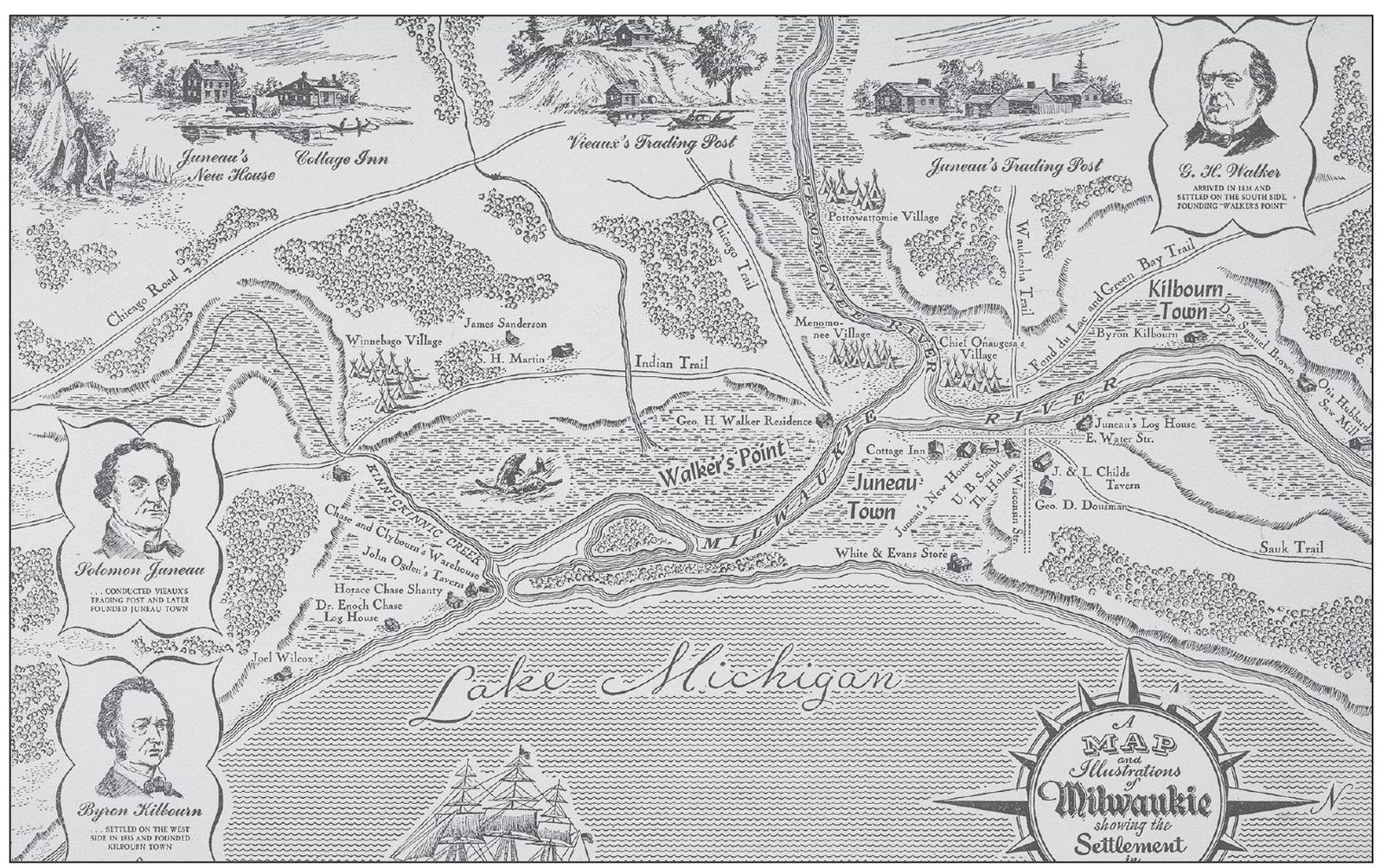
Here is a map of Milwaukee settlement in 1835. The mouth of the Milwaukee River is far to the south of its current location. There are no harbor piers and no straight cut and likewise no Jones Island. The small island in the river mouth was uninhabited. Pictured are the founders of the three communities that coalesced to form the city of Milwaukee, G. H. Walker (above left), Byron Kilbourn (below left), and Soloman Juneau (right). (Date of photograph: unidentified; photographer: Brown and Rehbaum.)

This map dates to around 1848 The port was served by two small piers and a - photo 4

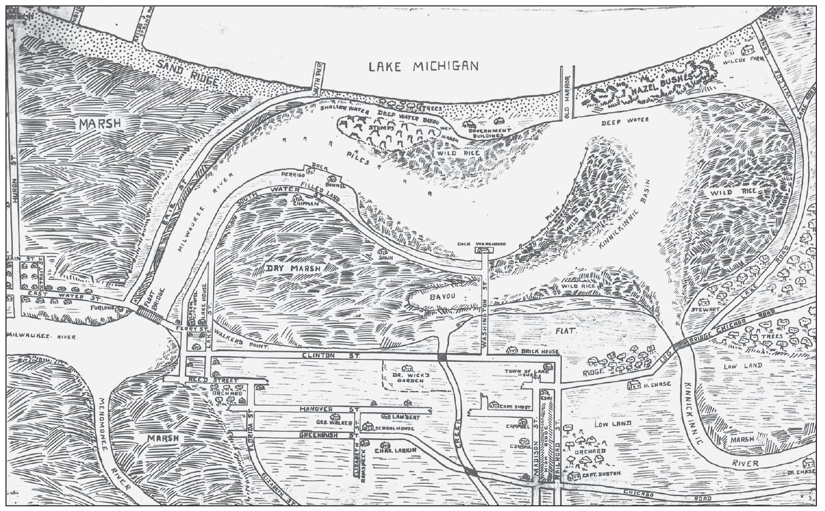
This map dates to around 1848. The port was served by two small piers and a dredged opening to the south at the original river mouth; it was improved, but not by much. Jones Island was still mostly given over to wild rice. (Date of photograph: unidentified; photographer: D. W. Chipman.)

A lithograph shows the Port of Milwaukee around 1870 with piers adjoining the - photo 5

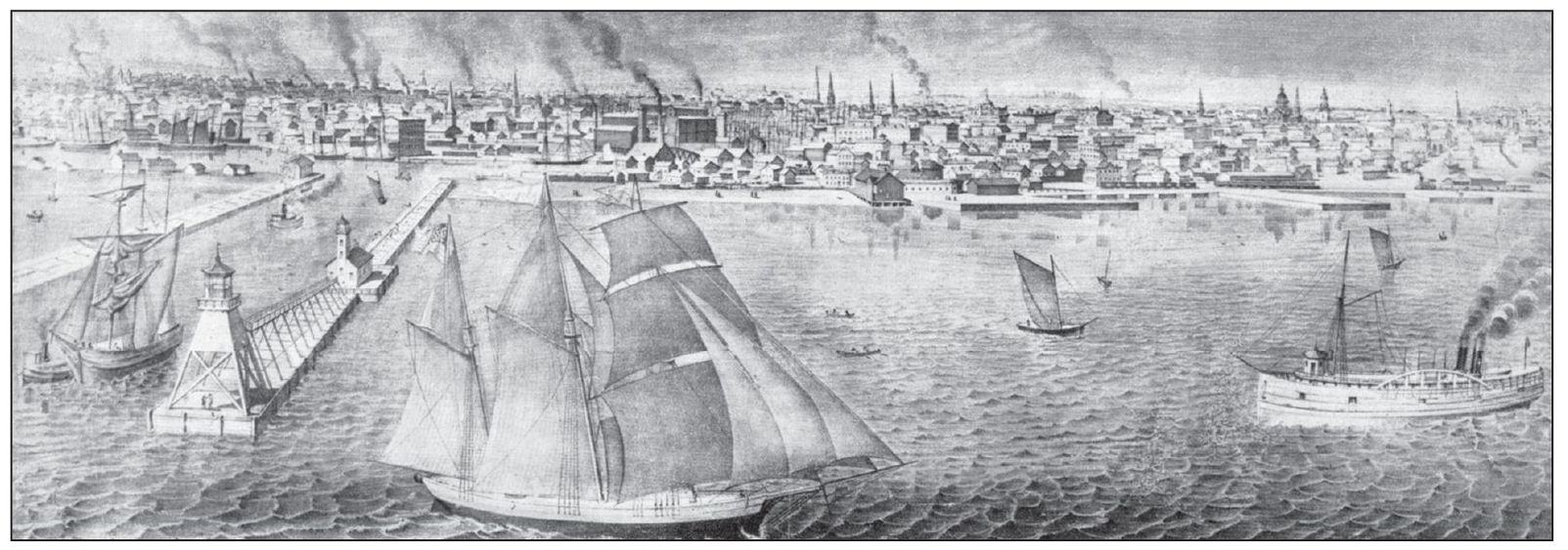
A lithograph shows the Port of Milwaukee around 1870, with piers adjoining the straight cut that lead into the confluence of the Milwaukee, Menomonee, and Kinnickinnic Rivers. Today most of the area landward of the ends of the piers is landfill. (Date of calendar: unidentified; photographer: unidentified.)

This is north of the harbor entrance around 1892 The railroad was already - photo 6

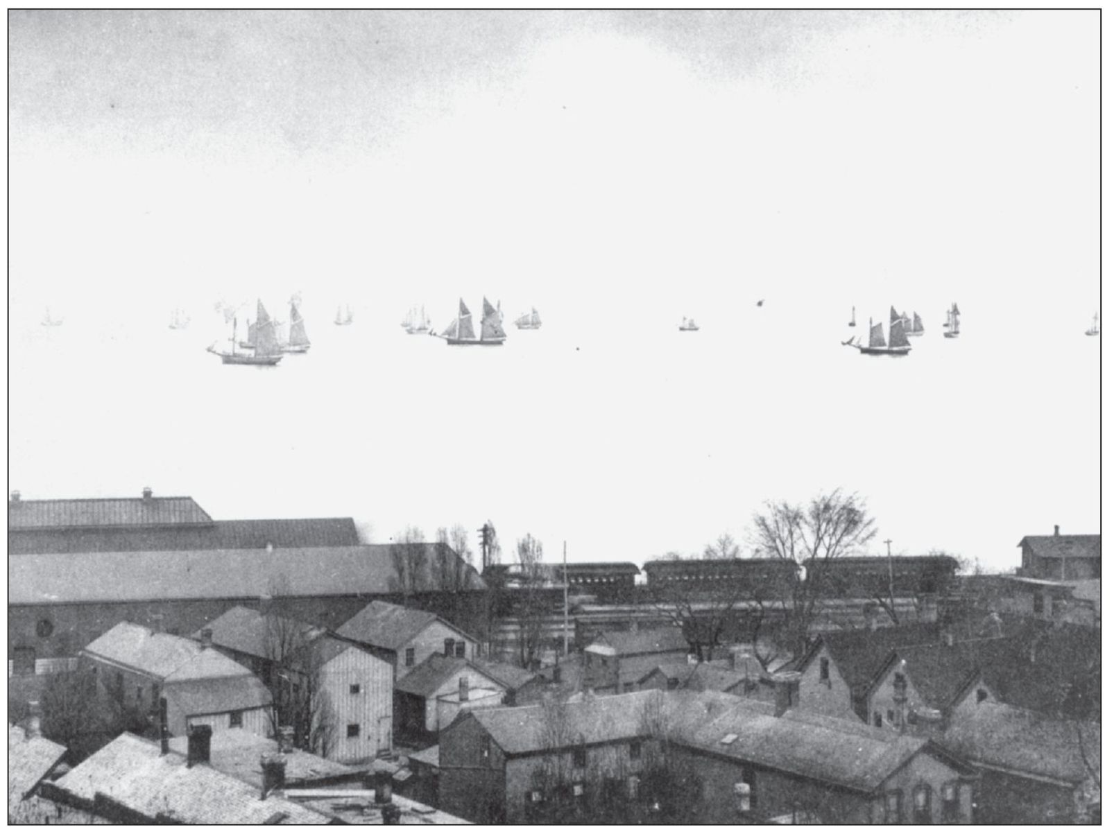
This is north of the harbor entrance around 1892. The railroad was already servicing the lakefront. Note that the outer harbor is filled with schooners, but there are no steamers in sight. (Date of photograph: c. 1892; photographer: unidentified.)

This view looking toward the lake just north of the harbor entrance shows the - photo 7

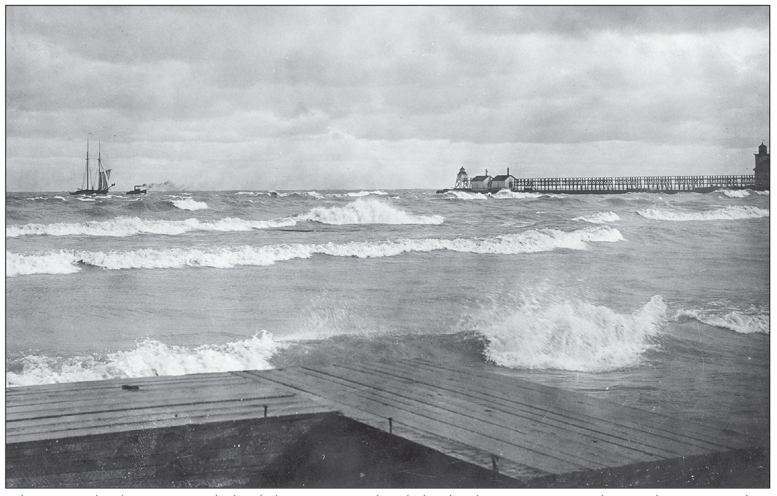
This view looking toward the lake, just north of the harbor entrance, shows the pier with a lighthouse, foghorn, and the Coast Guard station around 1900. A tug is towing in a schooner. (Date of photograph: unidentified; photographer: unidentified.)

Next page
Light

Font size:

Reset

Interval:

Bookmark:

Make

Similar books «Maritime Milwaukee»

Look at similar books to Maritime Milwaukee. We have selected literature similar in name and meaning in the hope of providing readers with more options to find new, interesting, not yet read works.


Reviews about «Maritime Milwaukee»

Discussion, reviews of the book Maritime Milwaukee and just readers' own opinions. Leave your comments, write what you think about the work, its meaning or the main characters. Specify what exactly you liked and what you didn't like, and why you think so.