Allen - GIS tutorial 2: spatial analysis workbook: for ArcGIS 10.3.x
Here you can read online Allen - GIS tutorial 2: spatial analysis workbook: for ArcGIS 10.3.x full text of the book (entire story) in english for free. Download pdf and epub, get meaning, cover and reviews about this ebook. City: Redlands;California, year: 2016, publisher: Esri Press, genre: Computer. Description of the work, (preface) as well as reviews are available. Best literature library LitArk.com created for fans of good reading and offers a wide selection of genres:
Romance novel
Science fiction
Adventure
Detective
Science
History
Home and family
Prose
Art
Politics
Computer
Non-fiction
Religion
Business
Children
Humor
Choose a favorite category and find really read worthwhile books. Enjoy immersion in the world of imagination, feel the emotions of the characters or learn something new for yourself, make an fascinating discovery.

GIS tutorial 2: spatial analysis workbook: for ArcGIS 10.3.x: summary, description and annotation
We offer to read an annotation, description, summary or preface (depends on what the author of the book "GIS tutorial 2: spatial analysis workbook: for ArcGIS 10.3.x" wrote himself). If you haven't found the necessary information about the book — write in the comments, we will try to find it.
Allen: author's other books
Who wrote GIS tutorial 2: spatial analysis workbook: for ArcGIS 10.3.x? Find out the surname, the name of the author of the book and a list of all author's works by series.


GIS tutorial 2: spatial analysis workbook: for ArcGIS 10.3.x — read online for free the complete book (whole text) full work
Below is the text of the book, divided by pages. System saving the place of the last page read, allows you to conveniently read the book "GIS tutorial 2: spatial analysis workbook: for ArcGIS 10.3.x" online for free, without having to search again every time where you left off. Put a bookmark, and you can go to the page where you finished reading at any time.
Font size:
Interval:
Bookmark:
Esri Press, 380 New York Street, Redlands, California 92373-8100
Originally published as GIS Tutorial II: Spatial Analysis Workbook
Copyright 2009 Esri
All rights reserved.
GIS Tutorial 2: Spatial Analysis Workbook
Copyright 2016 Esri
All rights reserved.
20 19 18 17 161 2 3 4 5 6 7 8 9 10
Printed in the United States of America
The information contained in this document is the exclusive property of Esri unless otherwise noted. This work is protected under United States copyright law and the copyright laws of the given countries of origin and applicable international laws, treaties, and/or conventions. No part of this work may be reproduced or transmitted in any form or by any means, electronic or mechanical, including photocopying or recording, or by any information storage or retrieval system, except as expressly permitted in writing by Esri. All requests should be sent to Attention: Contracts and Legal Services Manager, Esri, 380 New York Street, Redlands, California 92373-8100, USA.
The information contained in this document is subject to change without notice.
US Government Restricted/Limited Rights: Any software, documentation, and/or data delivered hereunder is subject to the terms of the License Agreement. The commercial license rights in the License Agreement strictly govern Licensees use, reproduction, or disclosure of the software, data, and documentation. In no event shall the US Government acquire greater than RESTRICTED/LIMITED RIGHTS. At a minimum, use, duplication, or disclosure by the US Government is subject to restrictions as set forth in FAR 52.227-14 Alternates I, II, and III (DEC 2007); FAR 52.227-19(b) (DEC 2007) and/or FAR 12.211/12.212 (Commercial Technical Data/Computer Software); and DFARS 252.227-7015 (DEC 2011) (Technical Data Commercial Items) and/or DFARS 227.7202 (Commercial Computer Software and Commercial Computer Software Documentation), as applicable. Contractor/Manufacturer is Esri, 380 New York Street, Redlands, CA 92373-8100, USA.
@esri.com , 3D Analyst, ACORN, Address Coder, ADF, AML, ArcAtlas, ArcCAD, ArcCatalog, ArcCOGO, ArcData, ArcDoc, ArcEdit, ArcEditor, ArcEurope, ArcExplorer, ArcExpress, ArcGIS, arcgis.com , ArcGlobe, ArcGrid, ArcIMS, ARC/INFO, ArcInfo, ArcInfo Librarian, ArcLessons, ArcLocation, ArcLogistics, ArcMap, ArcNetwork, ArcNews, ArcObjects, ArcOpen, ArcPad, ArcPlot, ArcPress, ArcPy, ArcReader, ArcScan, ArcScene, ArcSchool, ArcScripts, ArcSDE, ArcSdl, ArcSketch, ArcStorm, ArcSurvey, ArcTIN, ArcToolbox, ArcTools, ArcUSA, ArcUser, ArcView, ArcVoyager, ArcWatch, ArcWeb, ArcWorld, ArcXML, Atlas GIS, AtlasWare, Avenue, BAO, Business Analyst, Business Analyst Online, BusinessMAP, CityEngine, CommunityInfo, Database Integrator, DBI Kit, EDN, Esri, esri.com , EsriTeam GIS, EsriThe GIS Company, EsriThe GIS People, EsriThe GIS Software Leader, FormEdit, GeoCollector, Geographic Design System, Geography Matters, Geography Network, geographynetwork.com , Geoloqi, Geotrigger, GIS by Esri, gis.com , GISData Server, GIS Day, gisday.com , GIS for Everyone, JTX, MapIt, Maplex, MapObjects, MapStudio, ModelBuilder, MOLE, MPSAtlas, PLTS, Rent-a-Tech, SDE, SML, SourcebookAmerica, SpatiaLABS, Spatial Database Engine, StreetMap, Tapestry, the ARC/INFO logo, the ArcGIS Explorer logo, the ArcGIS logo, the ArcPad logo, the Esri globe logo, the Esri Press logo, The Geographic Advantage, The Geographic Approach, the GIS Day logo, the MapIt logo, The Worlds Leading Desktop GIS, Water Writes, and Your Personal Geographic Information System are trademarks, service marks, or registered marks of Esri in the United States, the European Community, or certain other jurisdictions. CityEngine is a registered trademark of Esri R&D Center Zurich AG and is distributed under license by Esri. Other companies and products or services mentioned herein may be trademarks, service marks, or registered marks of their respective mark owners.
Ask for Esri Press titles at your local bookstore or order by calling 800-447-9778, or shop online at esri.com/esripress . Outside the United States, contact your local Esri distributor or shop online at eurospanbookstore.com/esri .
Esri Press titles are distributed to the trade by the following:
In North America:
Ingram Publisher Services
Toll-free telephone: 800-648-3104
Toll-free fax: 800-838-1149
E-mail:
In the United Kingdom, Europe, Middle East and Africa, Asia, and Australia:
Eurospan Group
3 Henrietta Street
London WC2E 8LU
United Kingdom
Telephone: 44(0) 1767 604972
Fax: 44(0) 1767 601640
E-mail:
Spatial analysis involves the problem-solving aspect of GIS. From a cursory evaluation, the tools are basicbuffers, overlays, selectionsbut when combined in a particular sequence they can reveal things about the data that cannot be seen in a spreadsheet or chart. With this book, the reader will not create any new data, but will generate new files based on existing data. That is because analysis is not about creating new data but about making existing data say new things. The key is to know the tools well and to design the right sequences to bring the big picture in view. GIS Tutorial 2: Spatial Analysis Workbook, 10.3.x edition, focuses on data presentation and equips readers with the skills to build big picture maps.
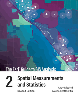
This workbook is a compilation of tutorials and exercises based on the two-volume set The Esri Guide to GIS Analysis by Andy Mitchell. For best results, you should read the corresponding pages in The Esri Guide to GIS Analysis before each tutorial.
, readers learn how to represent data fluctuations over time.
address spatial statistics and introduce a higher level of mathematics for establishing a statistical confidence level for analysis.
Each tutorial contains several elements that build context and engage critical thought to reinforce the skills learned. Review sections appear after each exercise to recap the actions taken. Study questions are provided to encourage further analysis. Your turn tasks appear within certain tutorials to support independent demonstration of skills learned. The workbook also offers Other real-world examples throughout, which provide the reader with real-world scenarios that use the skills covered. Additionally, the Independent projects section outlines six different scenarios for independent projects that build on the skills readers acquire in the tutorials.
This workbook is geared toward a more advanced readership than the introductory GIS Tutorial 1: Basic Workbook and was written for those who want to learn more about analysis tools in ArcGIS and how to use them. It assumes an existing knowledge of ArcMap and ArcCatalog and requires the use of ArcGIS extensions, as well as third-party tools and scripts that are included in the student and instructor data.
For students:GIS Tutorial 2 comes with exercise data and a trial of ArcGIS, which you can access in the Esri Press online resources at esri.com/esripress-resources . The trial comes with ArcGIS 10.3.1.x for Desktop. If you have an earlier version of ArcGIS for Desktop, you will need to uninstall it before loading the trial software.
For instructors: instructors can request instructor resources for this book at esri.com/esripress . This includes an instructor guide with outlines of each tutorial and the answers to the study questions, plus completed data and map documents for each tutorial and exercise.
Next pageFont size:
Interval:
Bookmark:
Similar books «GIS tutorial 2: spatial analysis workbook: for ArcGIS 10.3.x»
Look at similar books to GIS tutorial 2: spatial analysis workbook: for ArcGIS 10.3.x. We have selected literature similar in name and meaning in the hope of providing readers with more options to find new, interesting, not yet read works.
Discussion, reviews of the book GIS tutorial 2: spatial analysis workbook: for ArcGIS 10.3.x and just readers' own opinions. Leave your comments, write what you think about the work, its meaning or the main characters. Specify what exactly you liked and what you didn't like, and why you think so.