• Complain

Pimpler - Building web and mobile ArcGIS Server applications with JavaScript

Here you can read online Pimpler - Building web and mobile ArcGIS Server applications with JavaScript full text of the book (entire story) in english for free. Download pdf and epub, get meaning, cover and reviews about this ebook. year: 2014, publisher: Packt Publishing, genre: Computer. Description of the work, (preface) as well as reviews are available. Best literature library LitArk.com created for fans of good reading and offers a wide selection of genres:

Romance novel Science fiction Adventure Detective Science History Home and family Prose Art Politics Computer Non-fiction Religion Business Children Humor

Choose a favorite category and find really read worthwhile books. Enjoy immersion in the world of imagination, feel the emotions of the characters or learn something new for yourself, make an fascinating discovery.

Pimpler Building web and mobile ArcGIS Server applications with JavaScript
  • Book:
    Building web and mobile ArcGIS Server applications with JavaScript
  • Author:
  • Publisher:
    Packt Publishing
  • Genre:
  • Year:
    2014
  • Rating:
    3 / 5
  • Favourites:
    Add to favourites
  • Your mark:
    • 60
    • 1
    • 2
    • 3
    • 4
    • 5

Building web and mobile ArcGIS Server applications with JavaScript: summary, description and annotation

We offer to read an annotation, description, summary or preface (depends on what the author of the book "Building web and mobile ArcGIS Server applications with JavaScript" wrote himself). If you haven't found the necessary information about the book — write in the comments, we will try to find it.

Master the ArcGIS API for JavaScript, and build exciting, custom web and mobile GIS applications with the ArcGIS ServerAbout This Book
  • Develop ArcGIS Server applications with JavaScript, both for traditional web browsers as well as the mobile platform
  • Acquire in-demand GIS skills sought by many employers
  • Step-by-step instructions, examples, and hands-on practice designed to help you learn the key features and design considerations for building custom ArcGIS Server applications
Who This Book Is For

If you are a web or mobile application developer, who wants to create GIS applications in your respective platform, this book is ideal for you. You will need Java Script programming experience to get the most out of this book. Although designed as an introductory to intermediate level book, it will also be useful for more advanced developers who are new to the topic of developing applications with ArcGIS Server.

What You Will Learn
  • Create maps on a web page and add dynamic and tiled layers
  • Add graphics to maps
  • Use feature layers to render features in the browser
  • Incorporate widgets and toolbars that provide specific functionality to your application
  • Perform spatial and attribute queries
  • Access geoprocessing tasks including models
  • Geocode and reverse geocode addresses
  • Develop mobile GIS applications
  • Conduct network analysis
In Detail

ArcGIS Server is the leading software for developing both web and mobile GIS applications. There are a number of programming languages that you can use to develop applications with ArcGIS Server including JavaScript, Flex, and Silverlight. However, the ArcGIS API for JavaScript is the preferred way of developing your custom applications for ArcGIS Server since it can be used for both web and mobile application development. Its easy to use and doesnt require the use of a browser plugin.

This tutorial-based guide provides you with hands-on experience in developing custom web and mobile ArcGIS Server applications with step-by-step style exercises. Along with introducing you to the HTML/CSS/JavaScript technology stack, you will learn to add intuitive geographic layers of information to your map, interactive query and display of spatial data, add user interface widgets, access geoprocessing tasks, and many more in your own web and mobile GIS applications.

With this practical, hands-on guide, you will be able to develop fully-functional online GIS applications with ArcGIS Server using the ArcGIS API for JavaScript. After creating your own map, you will explore how to add geographic layers from a variety of sources including tiled and dynamic map services, add graphics to the map, and stream geographic features to the browser using a FeatureLayer.

Most applications include the specific functionalities implemented by ArcGIS Server as tasks. Youll learn how to use the various tasks provided by ArcGIS Server including spatial and attribute queries, identification of features, finding features by attribute, and more. Geocoding and geoprocessing tasks are covered in-depth to help you accomplish your task in GIS. Finally, youll learn just how easy it is to integrate ArcGIS.com content into your custom developed applications.

This comprehensive guide quickly advances through probing programmatic techniques for building web and mobile GIS applications which will make application development a lot easier!

Pimpler: author's other books


Who wrote Building web and mobile ArcGIS Server applications with JavaScript? Find out the surname, the name of the author of the book and a list of all author's works by series.

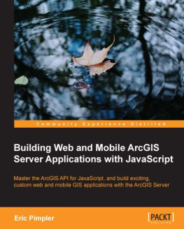
Building web and mobile ArcGIS Server applications with JavaScript — read online for free the complete book (whole text) full work

Below is the text of the book, divided by pages. System saving the place of the last page read, allows you to conveniently read the book "Building web and mobile ArcGIS Server applications with JavaScript" online for free, without having to search again every time where you left off. Put a bookmark, and you can go to the page where you finished reading at any time.

Light

Font size:

Reset

Interval:

Bookmark:

Make
Building Web and Mobile ArcGIS Server Applications with JavaScript

Building Web and Mobile ArcGIS Server Applications with JavaScript

Copyright 2014 Packt Publishing

All rights reserved. No part of this book may be reproduced, stored in a retrieval system, or transmitted in any form or by any means, without the prior written permission of the publisher, except in the case of brief quotations embedded in critical articles or reviews.

Every effort has been made in the preparation of this book to ensure the accuracy of the information presented. However, the information contained in this book is sold without warranty, either express or implied. Neither the author, nor Packt Publishing, and its dealers and distributors will be held liable for any damages caused or alleged to be caused directly or indirectly by this book.

Packt Publishing has endeavored to provide trademark information about all of the companies and products mentioned in this book by the appropriate use of capitals. However, Packt Publishing cannot guarantee the accuracy of this information.

First published: February 2014

Production Reference: 1120214

Published by Packt Publishing Ltd.

Livery Place

35 Livery Street

Birmingham B3 2PB, UK.

ISBN 978-1-84969-796-5

www.packtpub.com

Cover Image by Whitney Pimpler (<>)

Credits

Author

Eric Pimpler

Reviewers

Pouria Amirian

Ken Doman

Joseph Saltenberger

Acquisition Editor

Vinay Argekar

Content Development Editor

Susmita Panda Sabat

Technical Editors

Sharvari H. Baet

Pragnesh Bilimoria

Aparna Chand

Pooja Nair

Nikhil Potdukhe

Copy Editors

Kirti Pai

Stuti Srivastava

Project Coordinator

Joel Goveya

Proofreaders

Simran Bhogal

Ameesha Green

Indexers

Mehreen Deshmukh

Tejal Soni

Graphics

Sheetal Aute

Ronak Dhruv

Disha Haria

Yuvraj Mannari

Abhinash Sahu

Production Coordinator

Melwyn D'sa

Cover Work

Melwyn D'sa

About the Author

Eric Pimpler is the founder and owner of GeoSpatial Training Services (geospatialtraining.com) and has over 20 years of experience in implementing and teaching GIS solutions using Esri, Google Earth/Maps, and open source technology. Currently, he focuses on ArcGIS scripting with Python and the development of custom ArcGIS Server web and mobile applications using JavaScript. He is the author of Programming ArcGIS 10.1 with Python Cookbook .

Eric has a bachelor's degree in Geography from Texas A&M University and a master's degree in Applied Geography with a concentration in GIS from Texas State University.

About the Reviewers

Pouria Amirian is a GIS/Computer Science lecturer, researcher, and developer working with the National University of Ireland, Maynooth. In addition to his collaboration with the University of Ireland, he has several scientific and academic collaborations with world class universities in Germany, France, and the UK. He is the author of the best-selling book on ArcGIS development, Beginning ArcGIS for Desktop Development using .NET , published by Wiley in 2013. He has extensive experience in the design and development of various kinds of small-scale to enterprise-distributed, service-oriented (geospatial) information systems. Dr. Amirian is currently interested in cutting-edge research and development projects on (geospatial) Big Data and NoSQL databases and has recently been a technical editor of several books on the mentioned topics. He can be contacted at <>.

I would like to thank my friend, Dr. Majid Farahani, for his support, understanding, and encouragement during my career. My thanks also goes to the author and the technical review team for making this book a fun project.

Ken Doman has worked with computers for most of his life and still likes to keep himself occupied with them in his free time. He graduated with a bachelor's degree in Biology from Rice University. From there, he moved from one field to another, until he was asked to launch a GIS department for his hometown in Jacksonville, Texas. He started with a shoebox full of notebook paper for an address database. Before long, he published the first online map of his community. He's been hooked on publishing web maps ever since.

Ken currently works as a GIS web developer at Bruce Harris and Associates, a private company that provides GIS services and products for municipalities across the United States. There, he works on an array of technologies, helping county and city governments make their data available on web browsers.

This is the first book Ken has worked on, but he has high hopes that it won't be his last.

I would first like to thank my wife, Luann, for her love and support. Her love for words inspired me to take this responsibility seriously. I'd also like to thank God, without whom nothing is possible. I would also like to thank Bruce Harris and Associates, the City of Plantation, Florida, and the City of Jacksonville, Texas, for giving me the opportunity to learn more about GIS, which helped me grow in my career.

Joseph Saltenberger works as a data analyst at a GIS software company that specializes in spatial decision support systems for fire and EMS departments. He graduated from the Humboldt State University with a B.S. in Natural Resources (GIS and Remote Sensing emphasis), and the San Diego State University with an M.S. in Geography (GIScience emphasis). His academic and professional career has focused on using GIS for data management and analysis, and for developing custom GIS applications.

www.PacktPub.com
Support files, eBooks, discount offers and more

You might want to visit www.PacktPub.com for support files and downloads related to your book.

Did you know that Packt offers eBook versions of every book published, with PDF and ePub files available? You can upgrade to the eBook version at > for more details.

At www.PacktPub.com, you can also read a collection of free technical articles, sign up for a range of free newsletters and receive exclusive discounts and offers on Packt books and eBooks.

httpPacktLibPacktPubcom Do you need instant solutions to your IT - photo 1

http://PacktLib.PacktPub.com

Do you need instant solutions to your IT questions? PacktLib is Packt's online digital book library. Here, you can access, read and search across Packt's entire library of books.

Why Subscribe?
  • Fully searchable across every book published by Packt
  • Copy and paste, print and bookmark content
  • On demand and accessible via web browser
Free Access for Packt account holders

If you have an account with Packt at www.PacktPub.com, you can use this to access PacktLib today and view nine entirely free books. Simply use your login credentials for immediate access.

Preface

ArcGIS Server is the predominant platform used to develop GIS applications for the Web. There are a number of programming languages you can use to develop applications with ArcGIS Server, including JavaScript, Flex, and Silverlight. JavaScript has become the preferred language for developing applications on this platform, since it can be used for both web and mobile applications and doesn't require the installation of a plugin for the application to be used in a browser. Flex and Silverlight both fall short as languages for mobile development and both require the use of a plugin for the application to run in a browser.

Next page
Light

Font size:

Reset

Interval:

Bookmark:

Make

Similar books «Building web and mobile ArcGIS Server applications with JavaScript»

Look at similar books to Building web and mobile ArcGIS Server applications with JavaScript. We have selected literature similar in name and meaning in the hope of providing readers with more options to find new, interesting, not yet read works.


Reviews about «Building web and mobile ArcGIS Server applications with JavaScript»

Discussion, reviews of the book Building web and mobile ArcGIS Server applications with JavaScript and just readers' own opinions. Leave your comments, write what you think about the work, its meaning or the main characters. Specify what exactly you liked and what you didn't like, and why you think so.