Paul Talling - Londons Lost Rivers
Here you can read online Paul Talling - Londons Lost Rivers full text of the book (entire story) in english for free. Download pdf and epub, get meaning, cover and reviews about this ebook. publisher: Random House, genre: Detective and thriller. Description of the work, (preface) as well as reviews are available. Best literature library LitArk.com created for fans of good reading and offers a wide selection of genres:
Romance novel
Science fiction
Adventure
Detective
Science
History
Home and family
Prose
Art
Politics
Computer
Non-fiction
Religion
Business
Children
Humor
Choose a favorite category and find really read worthwhile books. Enjoy immersion in the world of imagination, feel the emotions of the characters or learn something new for yourself, make an fascinating discovery.

- Book:Londons Lost Rivers
- Author:
- Publisher:Random House
- Genre:
- Rating:3 / 5
- Favourites:Add to favourites
- Your mark:
Londons Lost Rivers: summary, description and annotation
We offer to read an annotation, description, summary or preface (depends on what the author of the book "Londons Lost Rivers" wrote himself). If you haven't found the necessary information about the book — write in the comments, we will try to find it.
Paul Talling: author's other books
Who wrote Londons Lost Rivers? Find out the surname, the name of the author of the book and a list of all author's works by series.


Londons Lost Rivers — read online for free the complete book (whole text) full work
Below is the text of the book, divided by pages. System saving the place of the last page read, allows you to conveniently read the book "Londons Lost Rivers" online for free, without having to search again every time where you left off. Put a bookmark, and you can go to the page where you finished reading at any time.
Font size:
Interval:
Bookmark:
PAUL TALLING has been exploring Londons lost and abandoned landmarks for years. His previous book, Derelict London, was a photographic tour of the citys forgotten homes, businesses and cemeteries. Pauls website, www.derelictlondon.com, has received well over a million visitors and won a Yahoo! Finds of the Year award.
Originally a music promoter in North London, he now lives south of the Thames.
 River Effra
 In 2008, my five-year fascination with the run-down, closed-down buildings of London was rewarded with the publication of Derelict London, and I found with enormous relief that I was not alone. The books website, derelictlondon.com, received so many hits and messages that I realised the capitals abandoned buildings were in good hands and began looking around for a new obsession. I found it in Londons lost rivers.
Perhaps the most surprising thing about these hidden waterways is not that they have virtually disappeared into obscurity but that there are so many of them. I still find it mind-boggling to imagine that rivers ever poured down Farringdon Road and through the middle of Hackney, that vast merchant ships could sail straight across the Isle of Dogs and that Rotherhithe was once more water than land.
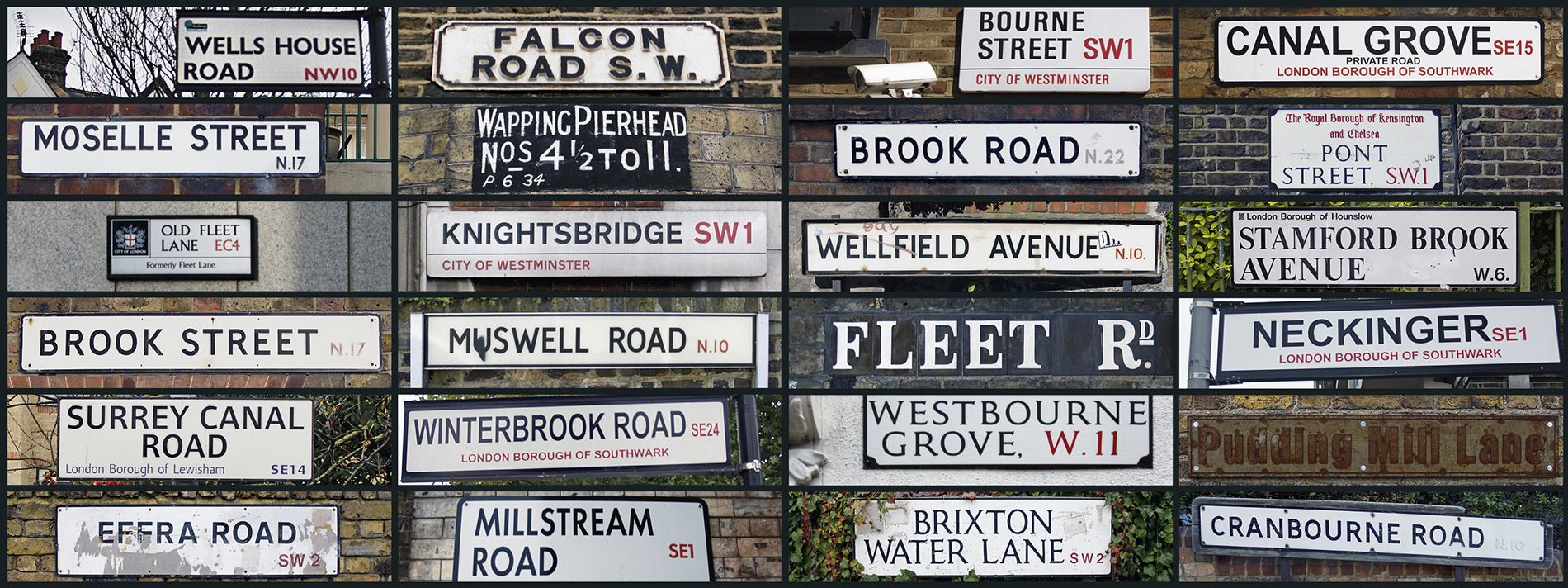
Writing this book has made me see London from an entirely new perspective: the city is riddled with watery relics and clues. Be it the name of an area (Muswell Hill), a tube station (Stamford Brook), a pub (The Falcon in Clapham), a road (Conduit Street) or just the sight of a mysterious lampless lamppost (see ), the evidence is abundant if you know what youre looking for. The lost rivers, canals and docks of London really arent as lost as they seem.
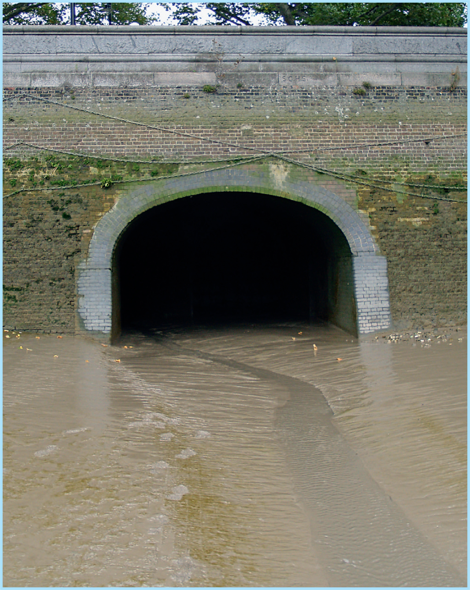
While many abandoned waterways gave way to railways and roads, the majority were culverted (covered over) and turned into sewers in an extraordinary feat of Victorian engineering. Londoners had been using the citys criss-crossing waterways for the disposal of human, household and industrial waste for centuries, but the rapid increase in population during the eighteenth and nineteenth centuries had brought with it an increase in water-related pollution and disease. The final straw was the Great Stink during the hot summer of 1858, when Parliament had to be relocated due to the overwhelming smell of raw sewage.
Joseph Bazalgette was the civil engineer charged with sorting out Londons sewage problem and saving everyone from the threat of cholera. His greatest achievement in designing a system of interconnecting pipes was to divert most of the citys waste away from the Thames. Although these ageing sewers are now undergoing urgent renovation, it is thanks to Bazalgette that London can cope with its still-increasing population, with only excess rainwater and what is euphemistically termed mixed water trickling into the Thames after heavy downpours.
I hope you enjoy walking the courses of these waterways, but I must advise great caution in exploring the Thames foreshore looking for the rivers outfalls: ladders down to the Thames can be very precarious, while waste water and the incoming tide present their own risks. Needless to say, it is extremely dangerous and illegal to enter any sort of sewer.
To send me any feedback or to find out about my occasional guided tours of Londons lost rivers, email me on info@londonslostrivers.com.
PAUL TALLING, 2011
 River Westbourne
 Best known nowadays for its grassy hills and desirable property, Hampstead was once most remarkable for its concentration of headwaters and rivulets, which splintered and converged in such a way as to supply central London with no fewer than three major rivers: the Westbourne, the Tyburn and the Fleet. In recent centuries, all three of these rivers have been covered over to make way for roads, railways and houses.
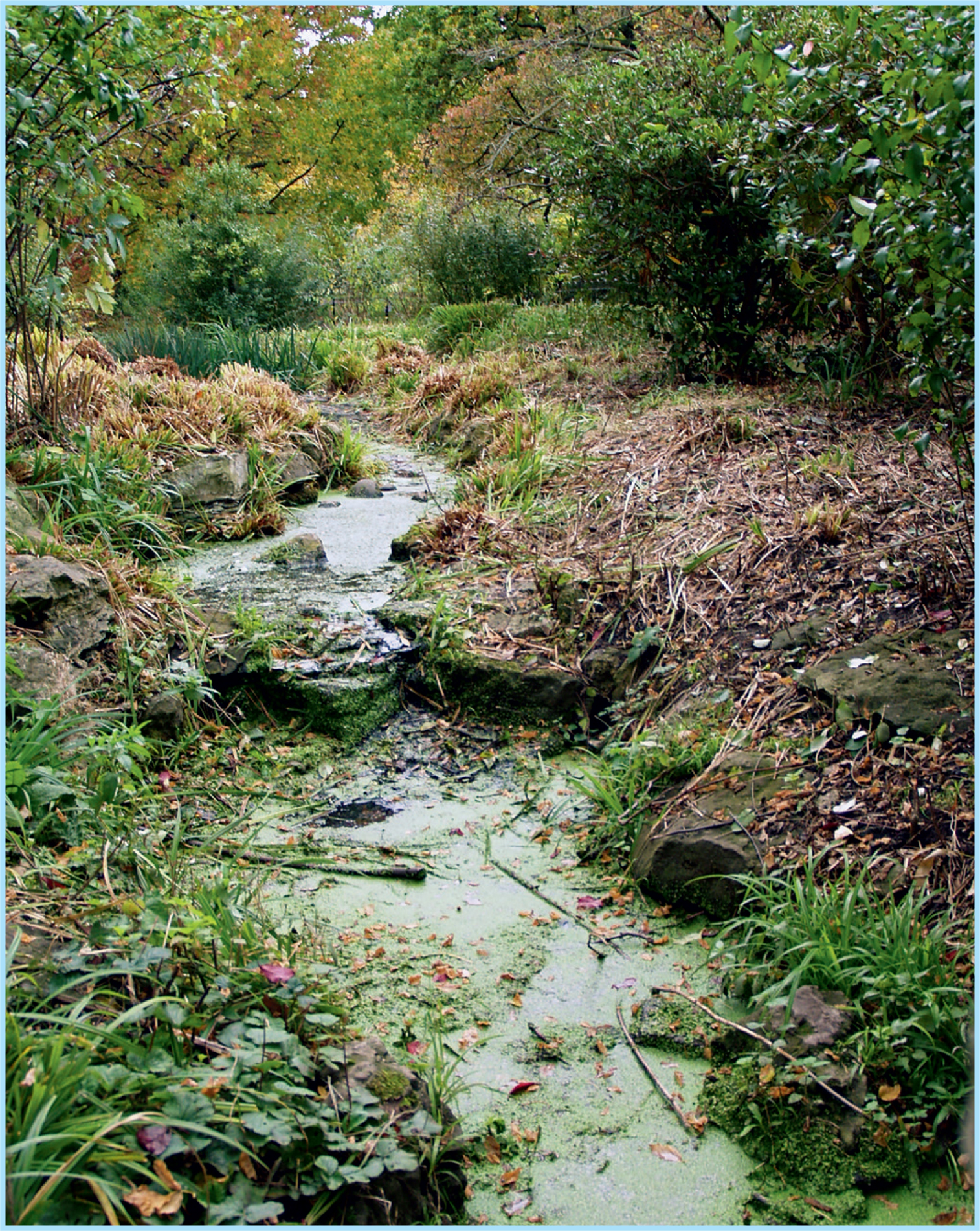
The Westbourne is the westernmost of Hampsteads rivers. Its upper stretch is made up of a number of minor streams that gradually join together, although the main source is generally agreed to have been a pond on Branch Hill. This pond was the subject of a handful of Constable paintings in around 1825, but the water gradually dried up towards the end of that century. On rainy days, tell-tale puddles in the sodden grass still reveal the rivers source.
 Marshy grassland is all that is left of Branch Hill Pond
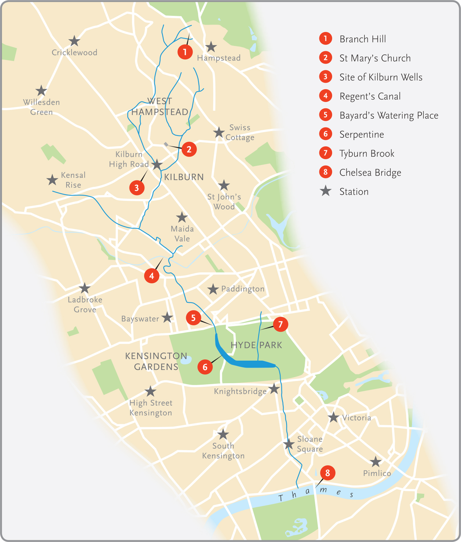
In Kilburn, near the present-day junction of Kilburn Park Road and Shirland Road, the Hampstead streams converged with a smaller tributary from Queens Park.
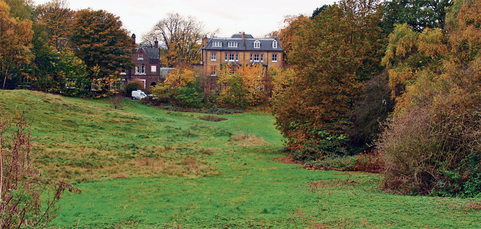
This section of the river was called the Kilburn or Kilbourne, from the Old English cyne-burna (royal stream), and it was a defining feature of the area. The small settlement that eventually grew into the Kilburn of today was established in the first half of the twelfth century, when a priory was built at the junction of the river and Watling Street, the ancient Roman road between Dover and Wales. The priory was supplied with fresh water and even fish by the Westbourne, and it became a popular stop-off for pilgrims on their way out of London. The location of the priory was more or less where Kilburn High Road station now stands and, although it was shut down during the Dissolution of the Monasteries under Henry VIII, its legacy is still visible in nearby road names: Kilburn Priory, Priory Road, Abbey Road and so on.
Springfield Lane and Springfield Walk, also near this junction, hint at another of the Westbournes gifts to Kilburn: a spring whose waters were thought to have healing qualities. In 1714, the water from this spring was discovered to contain properties similar to Epsom salt, and for the next 100 years Kilburn was a fashionable spa. The former location of the Kilburn Wells is marked by a paving stone and a plaque at the corner of Kilburn High Road and Belsize Road, and the nearby Bell Tavern, demolished and rebuilt in 1863, plied a successful trade pumping spring water for the politest companies.
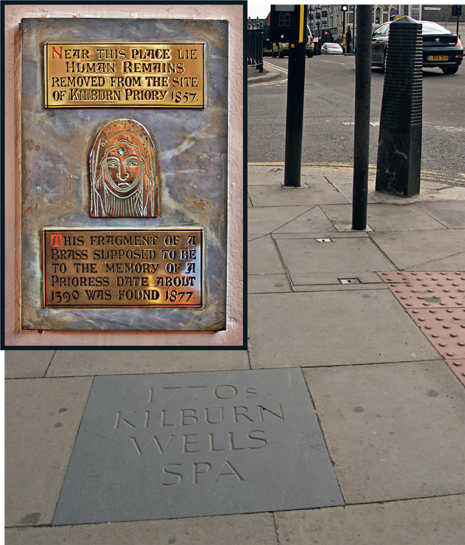 TOP LEFT A brass plaque in St Marys Church, Priory Road; BOTTOM This paving stone is a reminder of Kilburns fashionable past
 The origin of the name Westbourne is unclear, and as late as 1824 the river was still marked on maps as Bayswater Brook. Bayswater is thought to be a shortened version of Bayards Watering Place, a name first recorded in 1380 in reference to a spot where bayards (horses) drank water from the river as it flowed under the Uxbridge Road (now Bayswater Road). The areas of West London that now have Westbourne as part of their names Westbourne Grove, for instance are so named because they lay to the west of this bourne, or river.
Next pageFont size:
Interval:
Bookmark:
Similar books «Londons Lost Rivers»
Look at similar books to Londons Lost Rivers. We have selected literature similar in name and meaning in the hope of providing readers with more options to find new, interesting, not yet read works.
Discussion, reviews of the book Londons Lost Rivers and just readers' own opinions. Leave your comments, write what you think about the work, its meaning or the main characters. Specify what exactly you liked and what you didn't like, and why you think so.