WALKING
LONDONS
WATERWAYS
WALKING
LONDONS
WATERWAYS
GILLY CAMERON-COOPER

This edition published in 2011 by
New Holland Publishers (UK) Ltd
London Cape Town Sydney Auckland
www.newhollandpublishers.com
Garfield House
8688 Edgware Road
London W2 2EA
United Kingdom
80 McKenzie Street
Cape Town 8001
South Africa
Unit 1, 66 Gibbes Street,
Chatswood, NSW 2067
Australia
218 Lake Road
Northcote, Auckland
New Zealand
Copyright 2005, 2011 in text: Gilly Cameron-Cooper
Copyright 2005 in photographs on : Gilly Cameron-Cooper
Copyright 2011 in photographs on pages : Phil Kay
Copyright 2005 in photograph on
Copyright 2011 in photograph on
Copyright 2005, 2011 in photographs: New Holland Publishers (UK) Ltd
Copyright 2005, 2011 in maps: New Holland Publishers (UK) Ltd; Maps based on GTM London
Copyright 2005, 2011 in artwork: New Holland Publishers (UK) Ltd
Copyright 2011 New Holland Publishers (UK) Ltd
2 4 6 8 10 9 7 5 3 1
All rights reserved. No part of this publication may be reproduced, stored in a retrieval system or transmitted, in any form or by any means, electronic, mechanical, photocopying, recording or otherwise, without the prior written permission of the publishers and copyright holders.
eISBN 978 1 60765 270 0
Publisher: Guy Hobbs
Editor: Clare Hubbard
Cartographer: William Smuts
Designer: Lucy Parissi
Indexer: Isobel McLean
Production: Marion Storz
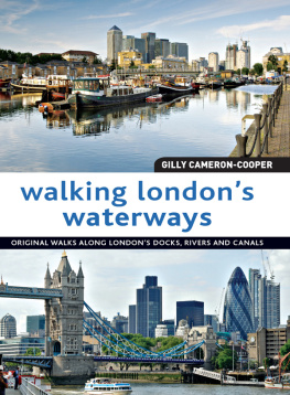
Front cover image (top): View of Canary Wharf buildings and boats moored at Rotherhithes Greenland Dock, Eric Nathan/Britain on View/Photolibrary
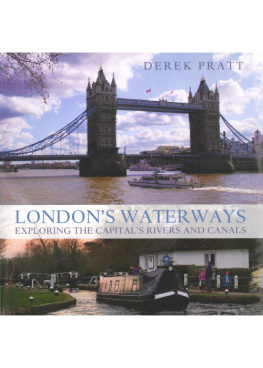
Front cover image (bottom): View of Tower Bridge and the Gherkin, Phil Kay
Spine image: Peter the Great with dwarf statue, Greenwich, Phil Kay
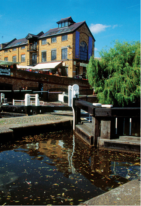
Back cover image: Along Regents Canal, Phil Kay
Reproduction by Pica Colour Separation Overseas (Pte) Ltd, Singapore
Printed and bound by Tien Wah Press (Pte) Ltd, Singapore
CONTENTS
INTRODUCTION
I thought I knew London well; I have cycled from many a suburb to the centre, clawed my way around it by car and written many a city walk. Nevertheless, my ideal of exploring places on foot has generally been among the sculpted mountains, luscious valleys and dazzling shores of the Greek island where I run www.walkingplus.co.uk with my husband. Nothing could be more dramatically different than the industrial and urban landscapes of Londons docklands and waterways. A poor alternative, you might think, but no, Londons waterways offer exciting, rewarding and ever-changing territory, rich in history, discovery and even opportunities for some wildlife watching. You deepen your knowledge and understanding of one of the worlds greatest capital cities, reaching parts you never knew existed and most of these paths are passable for walking at any time of the year. I hope that exploring the docks, rivers and canals will reveal for you, as it did for me, new perspectives, less familiar scenes and an insight into Londons industrial history.
Breathing Space
Looking at London from the perspective of its waterways presents a different world, another level of existence away from the familiar sprawl of streets and arterial roads, shops, houses and offices. Ribbons of almost-rural green wind through unseen industrial and urban wastelands, concealed from view by graceful willows and poplars. Here, sheltered from the roar of traffic and the pace of city life, kingfishers dart, herons stand and wild flowers flourish. You may find yourself strolling beside a green-fringed canal, brown carp loitering just beneath the waters surface and gaily painted narrowboats sliding by, then catch the name of a familiar road on a bridge and marvel at the times you used that road in complete ignorance of the hidden world that lay beneath. In unexpected places, such as Woolwich, Bermondsey or Londons old East End, you will discover a watery cut or basin lined with plane trees and pebbled paths, and occasional gems of modern landscaping that evoke the byways of Amsterdam.
Peeling Back the Past
Londons docks, rivers and canals offer far more than welcome breathing space in a capital city. They are soaked in layers of history. The very life and development of London as a port, commercial centre and cultural capital evolved and revolved around its location on the River Thames, and the citys rises and falls in fortune are reflected in the stories its waterways have to tell.
Sometimes, you may feel that the docks and canals of today, bereft of the jobs for which they were created, are sterile and lifeless compared with, for example, 150 years ago, when they were vital links in the global trade of a thriving industrial nation. However, anyone walking along a waterway of that time would probably have been overwhelmed by the stench and detritus of industrial and urban pollution. Today, thanks to the efforts of organizations such as British Waterways, enlightened local councils and conservation groups, pedestrians not only have unprecedented access to waterside paths, but can see aquatic plants and fish in the relatively clean water and breathe relatively fresh air.
It is their history, however, that makes these waterways particularly interesting to walk along, and the more you learn, the more you are able to look at a building or a scene and peel back the layers of its past. As you stand on the embankment of the River Thames at Blackfriars or Bermondsey you can imagine the broad tidal river that greeted Roman invaders in the 1st century AD: the river was sluggish between its silted shores and flanked by wastes of low-lying marshland dotted with tribal settlements, with the dense woodland of the Great Middlesex Forest beyond. You can mentally substitute the high-rises of new Docklands for Georgian docks packed with a bristling forest of masts, and the suburbs of Brentford and Wembley for the market gardens, which, at the beginning of the 19th century, dominated the countryside within 510 miles (816km) of the city, providing fruit, vegetables, meat and dairy products for the ever-growing population.
Exploring the citys waterways is to reach the heart of Londons history. Stone Age people may have settled on the hillocks we now know as Ludgate (see , Bridging the Thames walk) and Cornhill, protected by the Thames to the south and marshlands to the north and well watered by springs and streams such as the long-lost Walbrook and Fleet rivers. Soon after the Romans had established their control of Britain in the 1st century AD, Londinium, as they were to call the new settlement, became the obvious choice for a commercial and administrative centre. Gravel that had washed down to the mudflats by floods had formed shallows, which could be forded or bridged, and beaches, which provided firm ground for landing. The river became an increasingly busy trading route, carrying supplies to and from the rest of the Roman Empire, and the port of Londinium grew in importance.

