IMAGES
of America
BOSTON
A HISTORIC WALKING TOUR
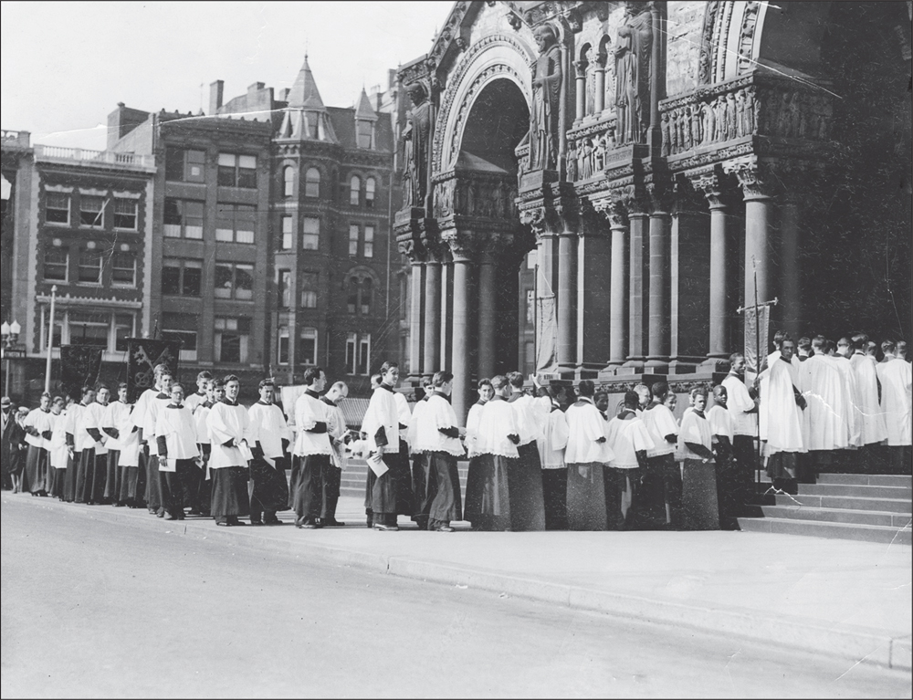
Acolytes process on Easter Sunday in 1933 through Copley Square to the entrance of Trinity Church. The church with its highly detailed columned porch and stringcourses of saints was designed by Henry Hobson Richardson and is among the most important buildings in the United States. (Authors collection.)
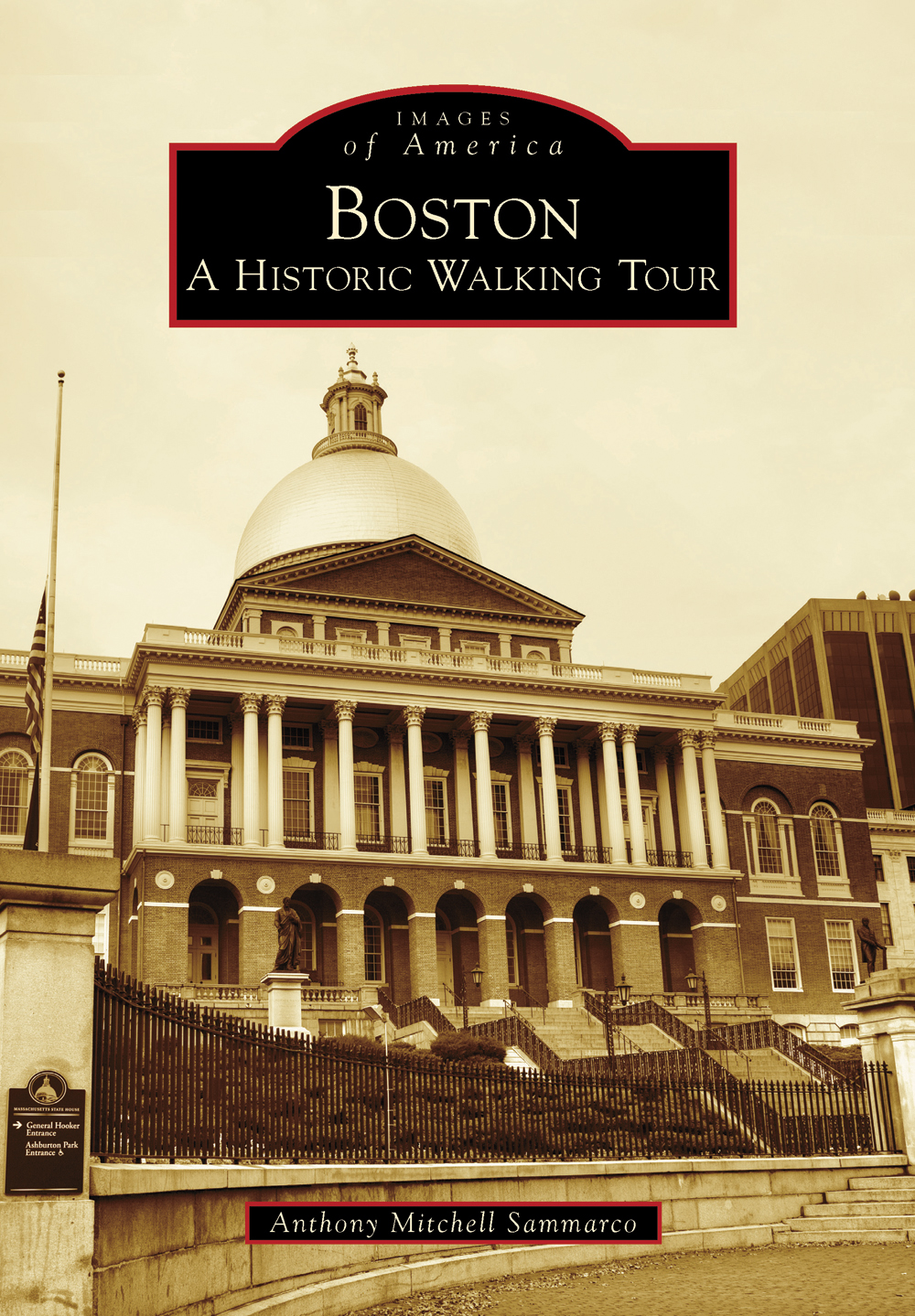
ON THE COVER: The Massachusetts State House was designed by Charles Bulfinch and was completed in 1798. Prominently sited on Beacon Hill facing the Boston Common, its brilliant golden dome and impressive Neoclassical architecture justly attest to its right to be called the Hub of the Universe. (Courtesy of Charlie Rosenberg.)
IMAGES
of America
BOSTON
A HISTORIC WALKING TOUR
Anthony Mitchell Sammarco

Copyright 2013 by Anthony Mitchell Sammarco
ISBN 978-0-7385-9936-6
Ebook ISBN 9781439643983
Published by Arcadia Publishing
Charleston, South Carolina
Library of Congress Control Number: 2012955522
For all general information, please contact Arcadia Publishing:
Telephone 843-853-2070
Fax 843-853-0044
E-mail
For customer service and orders:
Toll-Free 1-888-313-2665
Visit us on the Internet at www.arcadiapublishing.com
For my students at the Urban College of Boston past, present, and future
CONTENTS
ACKNOWLEDGMENTS
I would like to sincerely thank Charlie Rosenberg for his wonderfully evocative contemporary photographs of Boston as well as the following for their assistance in the researching and writing of this book: Lissie Cain, my stalwart editor; Cesidio Joe Cedrone; Colortek of Boston, Jackie Anderson and Girolamo Grassa; Olivia Dybing; eBay; Edward Gordon; Helen Hannon; Hutchinson; Pasqualina; Fran Perkins; Erin Rocha; the Victorian Society, New England Chapter; Wikipedia; Michael Taylor, president of the Urban College of Boston; and the staff of Urban College, assistant to the registrar Jane Dolloff, dean of enrollment and registrar Henry Johnson, academic dean Nancy Daniel, assistant to the president Amanda Norris, office manager Denise Horgan, financial aid director Mia Taylor, tutor Dorothy Chaves, librarian James Morgan, curriculum coordinator Phoenix Feng, case manager Carmen Pineda, director of student support services Josie Hatuey, and early childhood education program chair Ana Cordero.
Unless otherwise noted, all images appear courtesy of Charlie Rosenberg.
INTRODUCTION
Boston, Massachusetts, was settled in 1630 by men and women from England seeking religious freedom, as well as liberty, from the oppressive policies of King Charles I. Known as Puritans, meaning those who sought to purify the English church from within, they had been marginalized by society and sought a New Zion in the new world that they would call New England. They settled in what they referred to as a city upon a hill, which had been called Shawmut by the Massachusetts Indians. Literally translated, Shawmut means a spring of water, so when the settlers chose the peninsula, it had both a source of water as well as three prominent hills that were referred to as Trimount, which were to become known as Mount Vernon and Beacon and Pemberton Hills. Trimount was later to become Tremont in both spelling as well as in pronunciation and has been perpetuated by a major street in the city by that name today.
In September 1630, the new settlement was to be renamed Boston, after the Lincolnshire town in England; it was a midsized town of 800 acres, surrounded by water on three sides and connected to the mainland at Roxbury by a narrow isthmus of land known as The Neck. For almost two centuries, Boston would have its center of town government in the present Old State House, at the head of King (now State) Street, with the North End and the South End flanking it. As the area along the waterfront continued to be developed, as the lucrative mercantile economy of Massachusetts Bay Colony in the 18th century was directly tied to its growth and expansion, the area of Beacon Hill would conversely remain undeveloped until the late 18th century. By the early 19th century, Boston was to see the beginning of tremendous topographical changes culminating with the infilling and creation of new lands, such as that around Quincy Market and the new South End and the Back Bay neighborhoods. Created with new grid plans of streets, these newly created lands were a necessity as Bostons population continued to increase through both births as well as immigration beginning in the 1840s, which continued unabated through the early 20th century.
Boston was incorporated as a city on March 4, 1822, when the town citizens cast their ballots at a special election. The first mayor was John Phillips, a respected attorney and former president of the Massachusetts Senate; he was followed by Josiah Quincy, whose municipal reforms were to include public health, creation of new lands, and the building of Quincy Market as the first supermarket in the city with stalls selling all sorts of fresh foods, produce, meats, and fish. These two men created a sense of municipal duty that most subsequent mayors strove to emulate, but in the decades prior to the Civil War, Boston had the eyes of the nation upon it with great strides and developments in education, prison reform, abolition of slavery agitation, and the creation of workhouses for the poor. Boston was often and justly referred to as the Athens of America, a city of staunchly democratic ideals held in high regard not only locally, but also throughout the nation. The coining of the term the Hub of the Universe by Oliver Wendell Holmes advanced the high and lofty ideals to which Bostonians held themselves to and continue to do so to this day.
As Bostons population continued to increase and new neighborhoods were either created by infilling or by annexing former cities and towns surrounding Boston between the Civil War and World War I, the population shift from downtown Boston dramatically changed the character and composition of the area. No longer were Summer Street and Tremont Street the formerly elegant residential neighborhoods; with the rapid development of four- and five-story commercial buildings replacing former residences, the neighborhoods have dramatically changed in character. The city swiftly evolved in the 19th century and truly did become the thriving, energetic hub of the New England economy, a burgeoning nexus drawing on its new as well as old resourcesits citizens. The city, regardless of however fast it actually changed, would still surprisingly retain remnants of its illustrious history and architecture, which seemed to be almost bookmarked between the newer, taller, and often grander buildings of the late Victorian city.
When I was asked to write a new walking tour of Boston, I immediately thought of my many students at the Urban College of Boston, a two-year college located on Tremont Street opposite the Boston Common. For 16 years, I have taught a course, among others, on the history of Boston, which, through readings, lectures, and walking tours, explains the history and development of the city. Because this is an accelerated evening class held during the summer semester and most of my students have worked during the business day, getting out of classroom and exploring the city has a dual purpose. It first allows the student to see what they have been reading about in the assigned texts and handouts, but it also acts to stimulate their minds, as there is nothing better than an evening walk in the summer. These students, who take the course as a humanities elective, are often surprised and pleased by the walks that take them along the city streets that are so familiar to them but now take on a new meaning as they learn of the rich overlay of the citys history and architecture. I hope that you too will enjoy these walks to the Old North End and the South End, most of which are along one street such as Washington, Beacon, Summer, Cambridge, Tremont, and Boylston Streets or the fascinating Ladder Streets of the city. Whatever order you take the walks, enjoy the rich overlay of architecture, history, and development of this truly special place that we call Boston.
Next page

