We are deeply indebted to current and former residents of Sharpsburg and their families who shared time, suggestions, stories, and photographs. Of this group, we particularly thank Frank Hammond; Rosita Ray; Bonnard J. Morgan Sr.; William Poffenberger; Robert Brooks, M.D.; and Annabelle and the late Robert Earl Roulette.
This book would have been impossible to complete without help from the following: Sharpsburg Historical Society (SHS), Brad Toole; Washington County Historical Society (WCHS), James D. Neville; National Park Service, Antietam National Battlefield (NPS/ANB), Ted Alexander; National Park Service, Chesapeake and Ohio Canal National Historical Park (NPS/C&O Canal NHP), Sam Tamburro and Karen M. Gray, Ph.D.; Washington County Free Library, Western Maryland Room (WCFL/WMR), John Frye and Elizabeth Howe; Maryland Cracker Barrel , Suanne and Frank Woodring; Sharpsburg Town Council, Jeffrey Saylor; Sharpsburg Public Library, Betty Holtz; Sharpsburg Elementary School, Vickie Winston; Sharpsburg Volunteer Fire Company, Shawn McCoy; St. Pauls Episcopal Church, Rev. Mark Michael; Christ Reformed United Church of Christ, Rev. Delancy Catlett; and Holy Trinity Memorial Evangelical Lutheran Church, Judy Walkly.
We have, in many cases relied on previously published material. We apologize for any inaccuracies and mistakes we might have included. We welcome your correspondence; write to us at Antietamhouse111@aol.com.
BIBLIOGRAPHY
Antietam National Battlefield Historic Resource Study: Sharpsburg and the Battle of Antietam . Washington, D.C.: National Park Service, 2008.
Archives of Maryland . Maryland Hall of Records. www.msa.md.gov .
Barron, Lee and Barbara. The History of Sharpsburg, Maryland . n. p., 1972.
Ernst, Kathleen A. Too Afraid to Cry . Mechanicsburg, PA: Stackpole Books, 2007.
Hahn, Thomas F. The C&O Canal Boatmen, 18921924 . Shepherdstown, WV: American Canal and Transportation Center, 1980.
. Towpath Guide to the C&O Canal . Shepherdstown, WV: American Canal and Transportation Center, 1983.
Musser, Clifford S. Two Hundred Years History of Shepherdstown . Shepherdstown, WV: The Independent, 1931.
Paula S. Reed and Associates, Inc. Sharpsburg Historic District. Hagerstown, MD: National Register Nomination, 2008.
Reilly, Oliver T. Battlefield of Antietam . n. p., 1906.
Schildt, John W. Drums Along the Antietam . Parsons, WV: McClain Printing Company, 2004.
The Churches of Sharpsburg Walking Tour . Sharpsburg, MD: Sharpsburg Historical Society, 2005.
The Stone Houses of Sharpsburg Walking Tour . Sharpsburg, MD: Sharpsburg Historical Society, 2005.
Unrau, Harlan D. Historic Resource Study: Chesapeake and Ohio Canal . Prepared by Karen M. Gray, Ph.D. Washington, D.C.: National Park Service, 2007.
Find more books like this at
www.imagesofamerica.com
Search for your hometown history, your old
stomping grounds, and even your favorite sports team.
One
THE TOWN
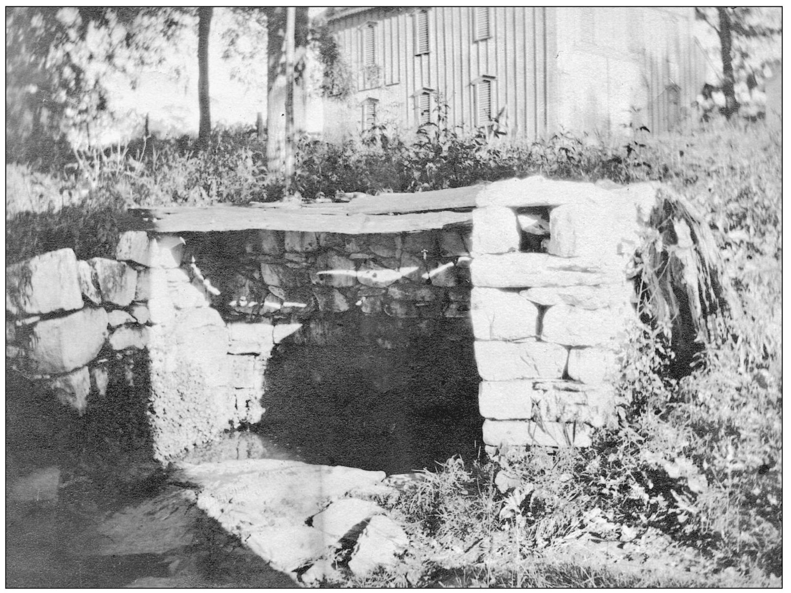
This is the Great Spring or Big Spring, which helped Joseph Chapline Sr. determine the placement of the town of Sharpsburg. Before 1763, a nearby settlement of four houses was called Great Spring. Before then, the Shawnee, Delaware, and Catawba Indians followed trails to this unfailing source of fresh water. At some point, protective stone walls and a plank roof were set around the towns main water source. (Courtesy Frank Hammond.)
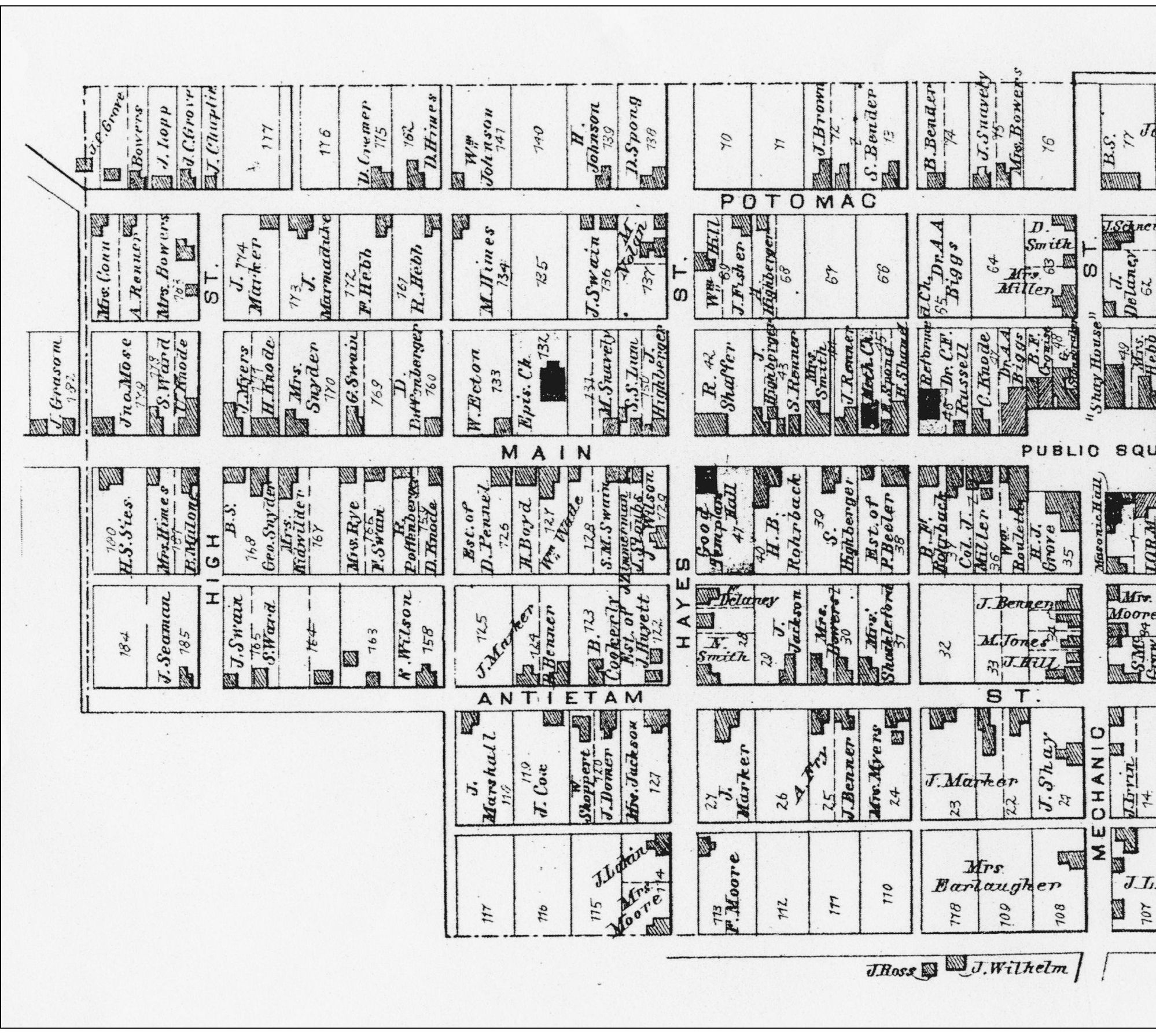
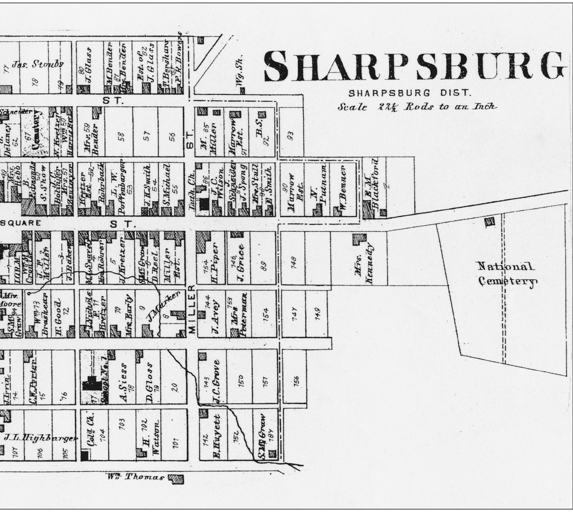
Reflecting few changes from founder Joseph Chaplines 1763 town design, this 1877 map shows Sharpsburgs eight streets and alleys. It also shows who owned the towns lots in 1877. Potomac Street is now Chapline Street, and High Street is Potomac Street. Hays Street is Hall Street. Miller Street is Church Street, and the unnamed last east-west street on the south side of town is now named High Street. Only Main, Mechanic, and Antietam Streets have retained their original street names. Joseph Chapline Sr. died in 1769 and, according to his will, seven of his children each received one town lot. James received Lot 76; Jeremiah, Lot 84; Deborah, Lot 43; Ruhannah, Lot 41; Sarah, Lot 130; Jean, Lot 16; and Theodosha, Lot 15. Joseph Chapline Jr. inherited the rest of the town. (Courtesy WCFL/WMR.)
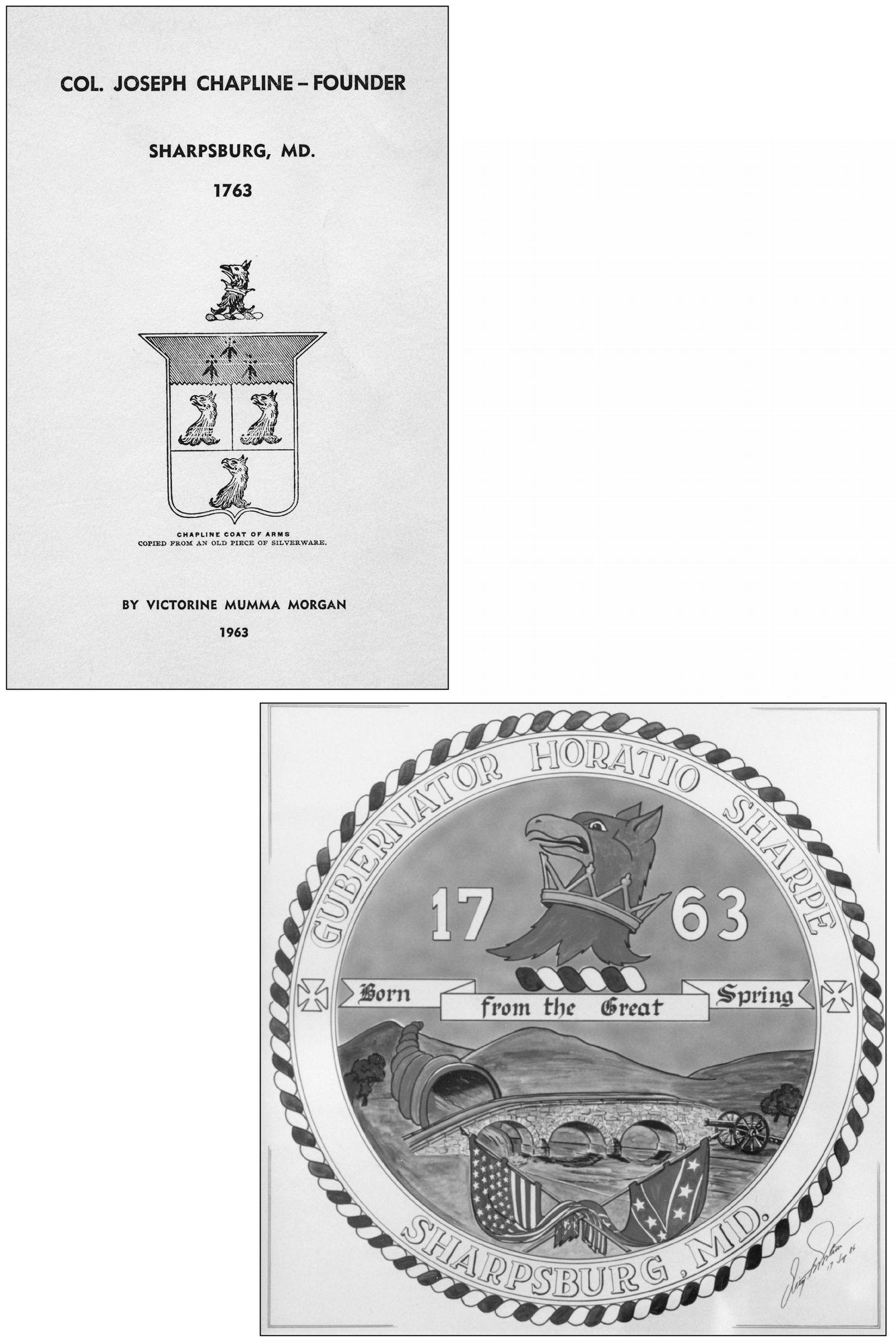
The framed original of Sharpsburgs official seal, designed by Dieter Protsch in 1986, hangs in town hall. The founding date surrounds a griffins head. Griffins are on the coats of arms of Horatio Sharpe and Joseph Chapline. The banner on the seal refers to the towns great spring, symbolized by the horn of plenty pouring water, which flows into the Antietam Creek. The towns association with the Civil War is represented by the cannon, the Union and Confederate flags, and Burnside Bridge. The Latin word for governor identifies Horatio Sharpe, friend of Chapline, and the crosses signify the towns Christian heritage. The coat of arms shown here with four griffin heads, copied from an old piece of silverware, is on the cover of a biography of Chapline, founder of Sharpsburg. (At left, courtesy Bonnard J. Morgan Sr.; below, courtesy Jeffrey Saylor.)
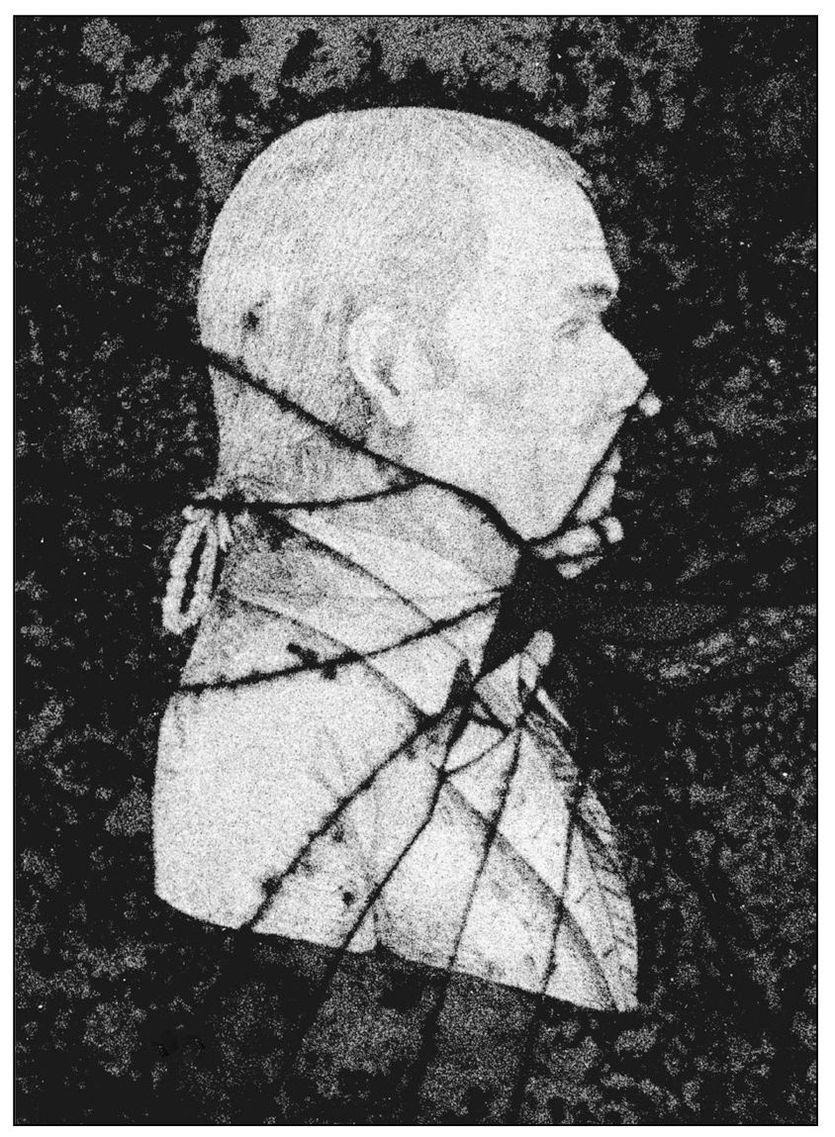
In his will dated January 27, 1768, Joseph Chapline Sr. gave to his son Joseph all that Tract of Land called Joes Lott that lies on the west side of Bigg Anteatum together with the town of Sharpsburgh. According to Lee and Barbara Barrons History of Sharpsburg , that was 2,100 acres. This portrait of Joseph Chapline Jr., preserved behind cracked glass, shows a successful, fashionable gentleman of the last half of the 18th century. (Courtesy Bonnard J. Morgan Sr.)
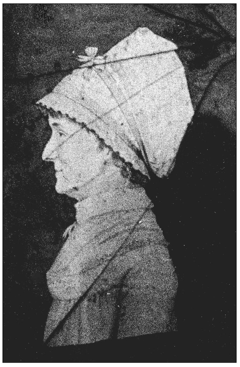
In 1770, Mary Ann Christian Abigail Ferguson from Frederick Town married Joseph Chapline Jr., who was practicing law in that city. The couple lived in their country estate called Mount Pleasant, northwest of Sharpsburg. The history of St. Pauls Episcopal Church tells of a minister being invited by Captain Chapline and his lady to be their guest at their Mount Pleasant home. Chapline Jr. was appointed captain in the Revolutionary War. (Courtesy Bonnard J. Morgan Sr.)

