IMAGES
of America
MURRAY
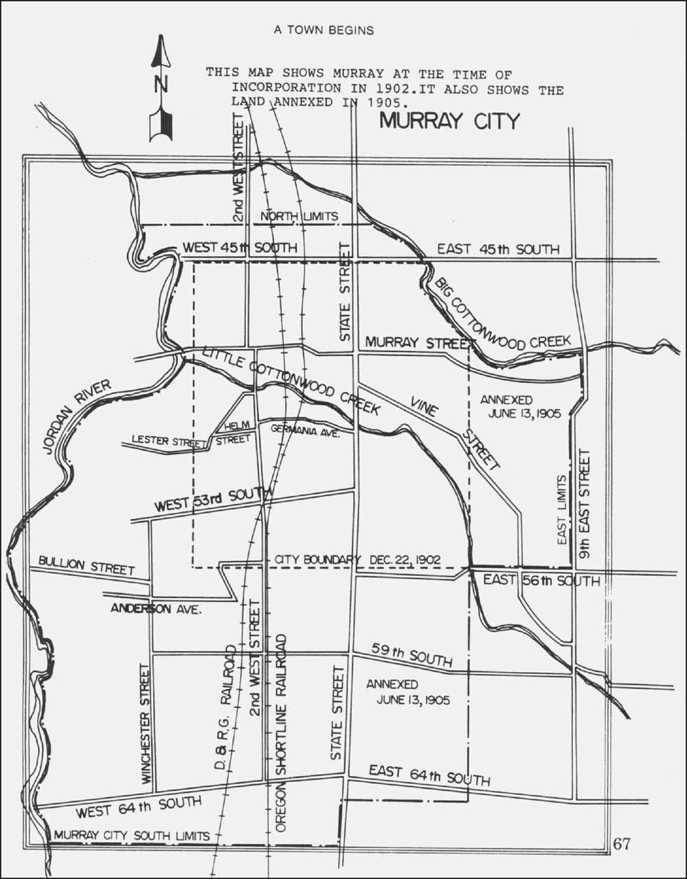
This map is included in The History of Murray, published for the nations bicentennial in 1976. It illustrates the boundaries at the time of incorporation in 1903 and the first annexation in 1905. (Courtesy of the Murray City Corporation.)
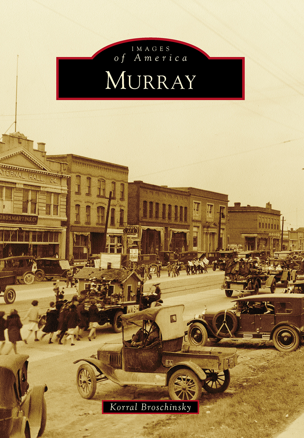
ON THE COVER: Murray citizens love a parade. This photograph from the early 1920s shows the commercial district along State Street. Today, only the buildings at the far right are still standing. (Courtesy of the Murray City Museum.)
IMAGES
of America
MURRAY
Korral Broschinsky

Copyright 2015 by Korral Broschinsky
ISBN 978-1-4671-3322-7
Ebook ISBN 9781439653104
Published by Arcadia Publishing
Charleston, South Carolina
Library of Congress Control Number: 2014952483
For all general information, please contact Arcadia Publishing:
Telephone 843-853-2070
Fax 843-853-0044
E-mail
For customer service and orders:
Toll-Free 1-888-313-2665
Visit us on the Internet at www.arcadiapublishing.com
To Mike, Krystopher, Kamryn, Kourtlyn, Zach, and Riley, for giving me love when I most needed it
CONTENTS
ACKNOWLEDGMENTS
The majority of photographs in this book can be found in the photograph collection of the Murray City Museum (MCM), therefore first and foremost my thanks go to the hundreds of Murray residents who donated their precious family photographs to Murray City over the years. Mary Ann Kirk, the citys cultural-arts director, has been the driving force behind cataloging the collection and making it available to the public. She has also made available a collection of historical photographs from various agencies within Murray City. These and many more photographs can be found on the website of the Murray City Library. I owe a debt of gratitude to Bunny Ankney, the curator of the museum, for her valuable aid in accessing the collection. A thank-you goes to Murray City for the use of these photographs.
Other photographs were obtained from the following archives and are used with permission: the Utah State Historical Society (USHS), the Church History Library of the Church of Jesus Christ of Latter-day Saints (CHL), the International Daughters of Utah Pioneers (IDUP), and the Salt Lake County Archives (SLCA). Thanks go to the staff of these institutions for their expertise in maintaining these irreplaceable resources.
I wish to thank the many historians of Murray City, past and present, who have helped me re-create the people and places of Murray in my mind. These historians include Ethel Bradford, Judson Callaway, Reed Clegg, Vere McHenry, R. Ray Rasmussen, Su Richards, David Schirer, the contributors to the 1976 History of Murray, the participants in Murrays oral history project, and the anonymous journalists of the Murray Eagle.
I am grateful to my editors at Arcadia Publishing for their patience and support. Lastly, I wish to thank my family for always making Murray feel like home.
INTRODUCTION
Every story of Murray City begins with its place near the center of the Salt Lake Valley. Following the footpaths of the Native Americans who traversed the valley before them, a group of hardy Mormon pioneers camped near a creek eight miles south of the newly established Salt Lake City in the spring of 1848. Named for the cottonwood trees that lined its banks, the Little Cottonwood Creek cut a diagonal path from an eastern mountain canyon to the Jordan River and on to the Great Salt Lake. The settlers dug ditches, planted crops, and built log cabins on a one-square-mile tract of land. Within a few years, more tracts were surveyed, following the path of the Big Cottonwood Creek to the north, and the community of scattered farmsteads was organized into the South Cottonwood Ward.
The religious and social center of South Cottonwood was an adobe meetinghouse near the rest stop for wagons that hauled granite blocks from a quarry at the mouth of Little Cottonwood Canyon and was about halfway between the quarry and the temple site in Salt Lake City. This granite trail established the path of present-day Vine Street to the Territorial Road (later State Street), the main arterial connecting Salt Lake City to other Mormon settlements along the Wasatch Mountains. By the time the Utah Southern Railway reached South Cottonwood in 1870, there was a cluster of businesses near the intersection of Vine Street and Territorial Road. The arrival of the railroad and the discovery of valuable minerals in the mountain canyons changed the landscape dramatically. With Big and Little Cottonwood Creeks only a mile apart near the rail corridor, the presence of abundant water and branch rail lines to the mines spurred the construction of eight smelters by 1880. As the new boomtown emerged, community identification became important, and the local postmaster submitted for consideration the name Murray, after Utahs territorial governor Eli H. Murray. One early resident referred to the town as a dirty little place with only two stores and a number of saloons.
Murray developed three distinct populations: the farmers living on the outlying agricultural lands, the merchants living near the business district, and the smelter workers, living in boardinghouses and shanty towns. The smelters drew hundreds of immigrants, mostly single men from Southern and Central Europe and Scandinavia. The influx of workers steadily increased, particularly after the American Smelting and Refining Company (ASARCO) built a massive lead smelter at State Street just south of the Little Cottonwood Creek. For a time in the late 19th and early 20th centuries, Murray was the most ethnically diverse community in Salt Lake County. ASARCOs two colossal smokestacks, visible from every part of the valley, would dominate Murrays skyline through the 20th century.
A campaign for incorporation began after a confrontation between a group of cowboys, fresh from sheep shearing, and smelter workers on payday resulted in robbery, riots, and the burning of a brewery and dance hall. For several years, the residents were divided into opposing camps, with one side hoping incorporation would help manage growth and rising social unrest and the other side fearful of burdensome taxation and lack of control. The vote for incorporation took place on November 18, 1902, with 294 votes in favor and 235 votes against. Murray became a third-class city when the official declaration was published on January 3, 1903.
From the beginning, Murray was fiercely independent. Resisting pressure from Salt Lake County to be included in a consolidated high school district, the city council annexed additional farmland to increase the population, allowing the city to form its own school district. Murray was designated a second-class city in July 1905. The new boundaries extended to approximately 4500 South on the north, 6400 South on the south, 900 East on the east, and the Jordan River on the west. Within a few years of incorporation, the city had its own school district, power plant, waterworks, and police and fire departments. A city hall was built on State Street in 1907. The burgeoning city built new schools, constructed a library, established a city park, and acquired the South Cottonwood Ward cemetery.
During the Great Depression, city officials took advantage of public funds to expand its electrical system, improve the city park, and build a new elementary school. Murray was a place where kids could go down to the tracks by the river and talk to the hoboes. On the outskirts were the enormous farms, with dairies along the east boundary and grains and sugar beets near the Jordan River to the west. Many of the immigrants married and settled in Murray to raise their families. The ethnic diversity spread from the industrial corridor as naturalized citizens purchased land for truck farms or started businesses. The storefronts along the State Street corridor began advertising their central location as the Hub of Salt Lake County. The county agreed when it chose a site adjacent to Murray City Park for the location of the county fairgrounds.
Next page


