On 6 June 1944 British, American, Canadian and French troops landed in Normandy by air and sea. This was one of the key moments of the Second World War, a long-anticipated invasion which would, ultimately, lead to the defeat of Nazi Germany. By the days end a lodgement had been effected and Operation OVERLORD was being hailed as a success. In reality the assault had produced mixed results and at certain points along the French coastline the position was still far from certain. The key Allied objectives had also not been captured during the first day of the fighting and this failure would have long-term consequences. Of the priority targets, the city of Caen was a vital logistical hub with its road and rail networks plus it would also act as a critical axis for launching the anticipated follow-on attacks against the German defenders. As a result an entire brigade of British troops was tasked with attempting its capture but their advance culminated a few miles short. This new book examines this significant element of the wider D-Day operation and provides a narrative account of the operations conducted by 3 British Infantry Division. It examines in some detail the planning, preparation and the landings that were made on the beaches of Sword sector. To do this it considers the previously published material and also draws upon archival sources many of which have been previously overlooked to identify key factors behind the failure to capture the city. Its publication coincides with the 70th anniversary of the Allied liberation of France.

Since the autumn of 2002 Dr Andrew Stewart has been a member of the Defence Studies Department, Kings College London, the academic component of the United Kingdoms Joint Services Command and Staff College (JSCSC). Currently he is the Land Historian supporting the Higher Command and Staff Course and giving lectures and leading seminars on conflict-related historical and contemporary issues. As a senior military historian within the department he also regularly leads European battlefield tours and studies. He has published a number of books and articles on the Second World War and is currently working on volumes relating to the threat of a German invasion of England and the military campaign fought in East Africa. Married to Joanne, he lives in Oxford and enjoys watching cricket and beer tasting in his spare time.
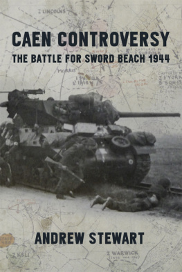
Caen Controversy
The Battle for Sword Beach 1944
Andrew Stewart
Helion & Company
Helion & Company Limited
26 Willow Road
Solihull
West Midlands
B91 1UE
England
Tel. 0121 705 3393
Fax 0121 711 4075
Email:
Website: www.helion.co.uk
Twitter:
Visit our blog http://blog.helion.co.uk
Published by Helion & Company 2014. Reprinted in paperback 2016
Designed and typeset by Mach 3 Solutions Limited, Bussage, Gloucestershire
Cover designed by Euan Carter, Leicester ( www.euancarter.com )
Text Andrew Stewart 2014
Index prepared by Onderosa Indexing, email
Photographs see Bibliography
The maps were produced by the Geographical Section, General Staff (GSGS) operating under the Director of Military Operations and form part of the 1944 series specially produced for the D-Day landings. They were Crown Copyright but are now in the public domain and, where applicable, have been adapted by George Anderson for Helion.
Cover: Front Leading companies of 1 South Lancs move inland supported by tanks of 13/18 Hussars. Rear cover The view from HILLMAN today looking down towards the Sword beaches.
ISBN 978-1-911096-17-7
eISBN 978-1-912174-32-4
Mobi ISBN 978-1-912174-32-4
British Library Cataloguing-in-Publication Data.
A catalogue record for this book is available from the British Library.
All rights reserved. No part of this publication may be reproduced, stored in a retrieval system, or transmitted, in any form, or by any means, electronic, mechanical, photocopying, recording or otherwise, without the express written consent of Helion & Company Limited.
For details of other military history titles published by Helion & Company
Limited contact the above address, or visit our website: http://www.helion.co.uk
List of Photographs
For sources see
Lieutenant-General Frederick Morgan COSSAC at his desk
General Eisenhower surrounded by his senior OVERLORD commanders
The Land Forces commander for D-Day, General Sir Bernard Montgomery
Admiral Sir Bertram Ramsay who oversaw the creation of the huge NEPTUNE fleet
General Sir Miles Dempsey, GOC Second British Army
Major-General Tom Rennie, commanding 3 Br Inf Div
Rommel inspects the Atlantic Wall
With the tide out the height of the defences can be clearly seen
The beaches of the Orne estuary show their defences
Rennies command vessel HMS Largs
Heinrich Hoffmann, who commanded the E-Boat attack on the invasion fleet
Major-General Richard Windy Gale in his airborne smock
Two of the Operation DEADSTICK gliders with the Caen Canal bridge in front of them
A Horsa glider showing the scars of its landing
HMS Ramillies , the most powerful battleship in Bombardment Force D
Brigadier Prior Palmer gives instructions to his staff captain
The AVRE Churchill tank with the 290 mm Petard spigot mortar and round
A pre-invasion demonstration of the DD Sherman tank showing the collapsible canvas screen
Part of the COD strongpoint as seen from the beach
Men from the Beach Group near COD
The assault on Queen White
A landing craft on the approach to Queen Red with AVREs and DDs on the beach
Leading companies of 1 South Lancs move inland supported by tanks of 13/18 Hussars
An AVRE with Petard mortar positioned near a beach exit and facing in the direction of Hermanville
Lovats commandos on board the LCIs approaching Queen Red
About 0845, men from 8 Inf Bde landing on Queen Red
The famous picture of Bill Millin coming ashore also shows the congestion of DD tanks on the beach
An AVRE of 79 Armd Div near Lane 2 on Queen Red
A carrier from 2 KSLI on the road to Hermanville
Commandos moving in file on the road from Colleville
A mixture of sappers and armour on the road to Colleville
No.4 Commando heads for Ouistreham with the support of armour from 27 Armd Bde
The village of St. Aubin dArquenay being cleared by commandos and tanks of 13/18 Hussars
The three brigadiers from 3 Br Inf Div back together on the beach at La Breche in 1954; (L-R) Copper Cass, Jim Cunningham, K.P. Smith
List of Maps
Maps in colour section.
The maps were produced by the Geographical Section, General Staff (GSGS) operating under the Director of Military Operations and form part of the 1944 series specially produced for the D-Day landings. They were Crown Copyright but are now in the public domain and, where applicable, have been adapted by George Anderson for Helion.
One of the series of maps issued on 5 June 1944 to the troops in 3 Br Inf Div showing the area of operations
An annotated map showing the final D-Day positions for each of the battalions from 3 Br Inf Div
The British assault area for Sword sector centred around La Breche and the strong-point COD ()
Next page
