Campaign 118
The Yom Kippur War 1973 (1)
The Golan Heights
Simon Dunstan Illustrated by Howard Gerrard
Series editor Lee Johnson Consultant editor David G Chandler
CONTENTS
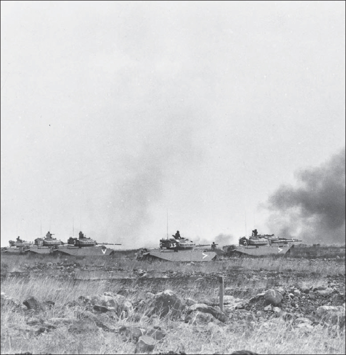
A classic image of armoured warfare illustrates the principle of employing tanks en masse as a formation ofShotUpgraded Centurions advances on Syrian positions. It also shows the normal posture of Israeli tank commanders in battle and how exposed they were to enemy fire, be it exploding artillery shells or Syrian snipers who were deployed on the battlefield with their Dragunov rifles with the specific task of killing Israeli tank commanders.
BACKGROUND TO WAR
O n the afternoon of 10 June 1967, a ceasefire imposed by the United Nations brought an end to the Arab-Israeli Six Day War. The ceasefire found the Israel Defense Forces (IDF) triumphant on the Suez Canal, on the Jordan River, and on the Golan Heights, some 26km (16 miles) east of the old frontier with Syria. The entire Sinai, the Gaza Strip, the West Bank including East Jerusalem, and the troublesome Golan Heights were now in Israeli hands. In less than a week the IDF conquered an area three and a half times that of Israel itself, as well as over 1,000,000 Palestinians living in the West Bank and Gaza Strip. In six days the geopolitical balance in the Middle East was radically altered. Three sovereign Arab states, Egypt, Jordan and Syria, were utterly humiliated. Early in August 1967, Arab leaders met in Khartoum where they rejected any form of negotiation with Israel and resolved to reclaim the lost lands through force of arms. (See Campaign 126 The Yom Kippur War 1973 (2) The Sinai for the political background to the conflict.)
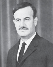
President Hafaz al Assad of Syria. Born in 1924 of the Alawite clan, Assad joined the ruling Baath Party in 1958 and rose to become the commander of the Syrian Air Force. He was subsequently the Minister of Defence during the Six Day War. He seized supreme power in October 1970 and began to rebuild the Syrian Armed Forces for the coming battle with Israel that erupted in October 1973.
With the death of Gamal Abdel Nasser in September 1970, his successor, President Anwar Sadat, carefully reconstructed the Egyptian armed forces over the following years. At the same time he persuaded President Hafaz al Assad of Syria to adopt his strategy of a military campaign with achievable aims. The aim would be to win a substantial lodgement across the Suez Canal in the Sinai Desert and the recapture of the Golan Heights prior to a United Nations ceasefire that would break the diplomatic logjam and focus the worlds attention on the Middle East once more. Both countries conducted a brilliant deception plan, codenamed Operation Spark, to lull the Israelis into a false sense of security prior to their joint offensive on two fronts.
OPPOSING PLANS
T errain is significant in any military operation but on the Golan it was fundamental both to the attackers and defenders and to a large extent determined the dispositions and plans of both sides. Rising above the Jordan Valley from the Sea of Galilee is an escarpment some 1,000m high known as the Golan Heights. Covering an area of about 900 square kilometres, it rises steadily from south to north; its peaks looking down on the Upper Jordan Valley to the west and the Yarmouk Valley to the south. The latter forms the boundary with Jordan, which to the east gives way to extensive lava fields. In the distant past, this rugged terrain was shaped by volcanic activity. Lava, belching from craters, covered the high plateau with a coating of basalt. The largest volcanic cones such as Tel Faris, rise to over 1,000m above sea level. Dominating the northern end of the Golan is the peak of Mount Hermon, called Jebel Sheikh by the Arabs. This strategic high ground with its vital observation post was known as The Eyes of Israel as it dominated the surrounding terrain with excellent views of much of the northern Golan and deep into Syria.
In contrast to the Sinai in the south, the Golan is not good tank country. The going is better in the southern grasslands than in the north where large areas are rendered impassable to vehicles by basalt boulders and rock outcrops, while the Golans many defiles represent perfect ambush country. The volcanic cones scattered across the heights also provide excellent observation posts and fields of fire. Many of them were integrated into the Israeli defence system on the Golan as natural firing ramps. Two of the dominant volcanic cones in particular, the 1,200m Mount Hermonit north of Kuneitra and the 1,250m Tel Faris near the Rafid junction, were to play key roles in the October War.
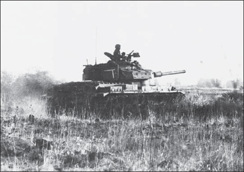
A solitary CenturionShottakes up position behind a wall of basalt rocks. Tank crews use any fold in the ground to minimise exposure to enemy observation or fire. This was particularly significant in the southern area of the Golan Heights with its open rolling terrain. At the outset of the battle, this was defended by just 33Shottanks of the 53rd Mechanised Infantry Battalion commanded by Lieutenant Colonel Oded Erez against a force of some 900 Syrian tanks. This units ordeal in the October War is one of the most harrowing and courageous in the annals of modern warfare.
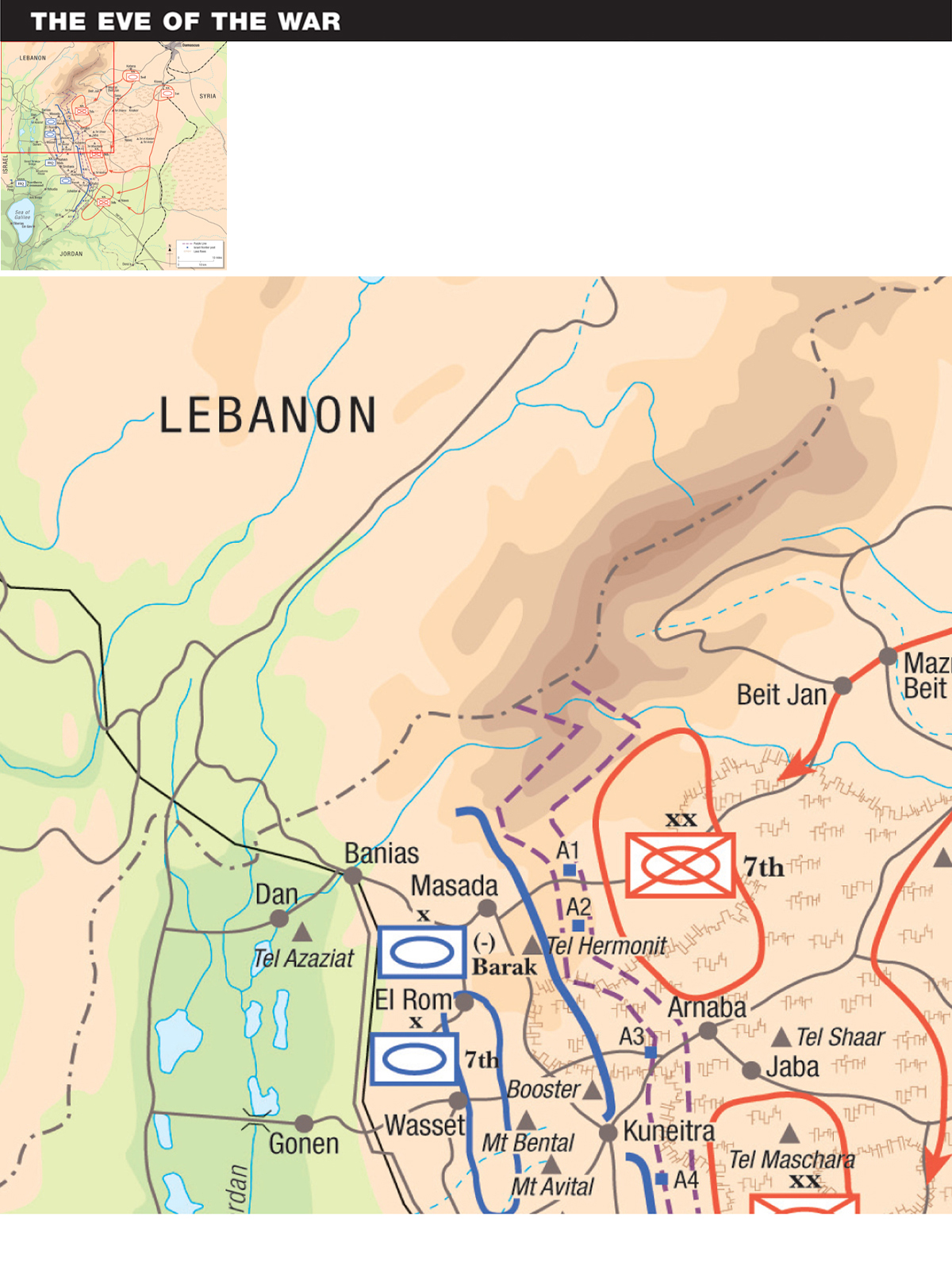
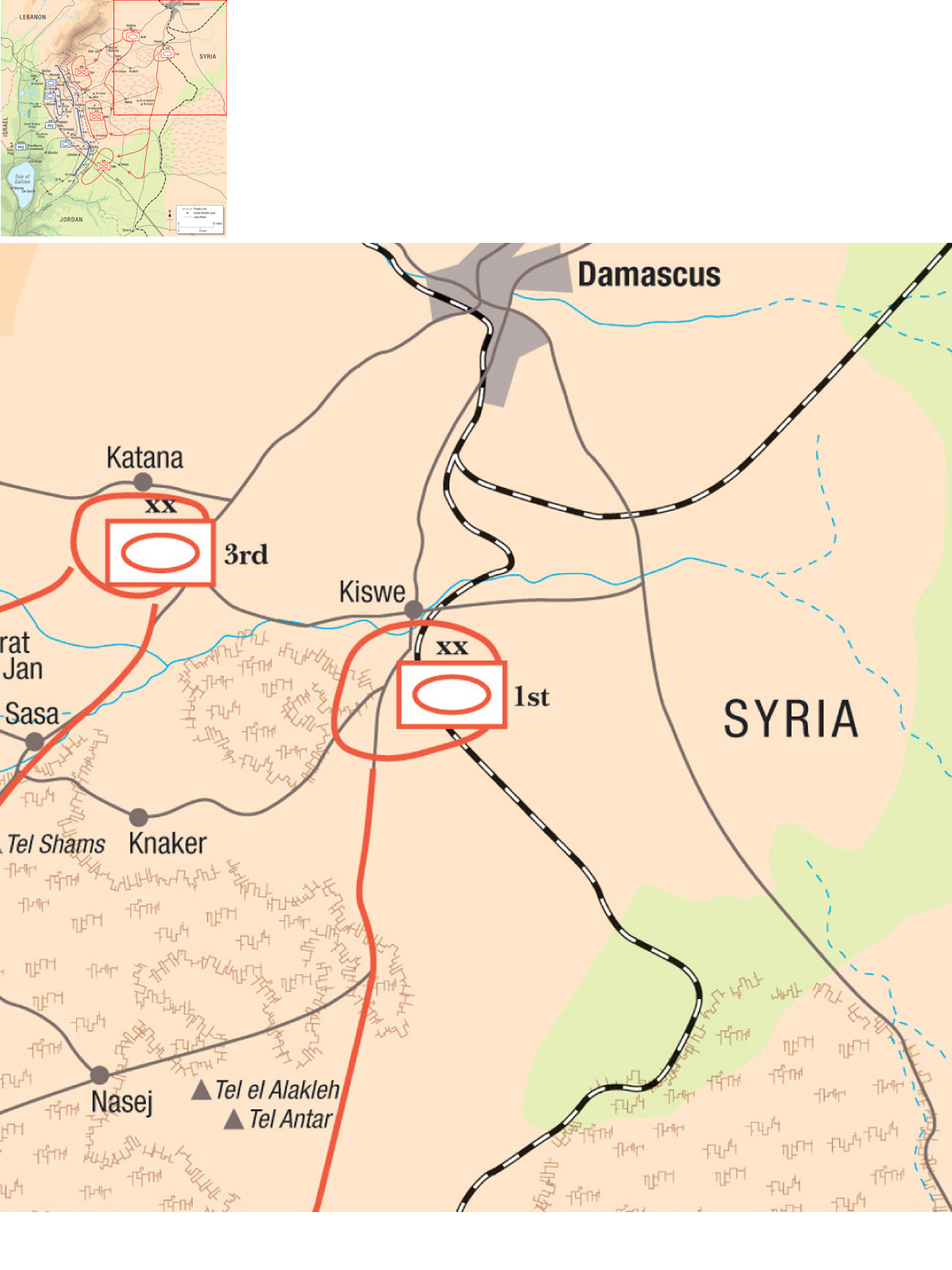
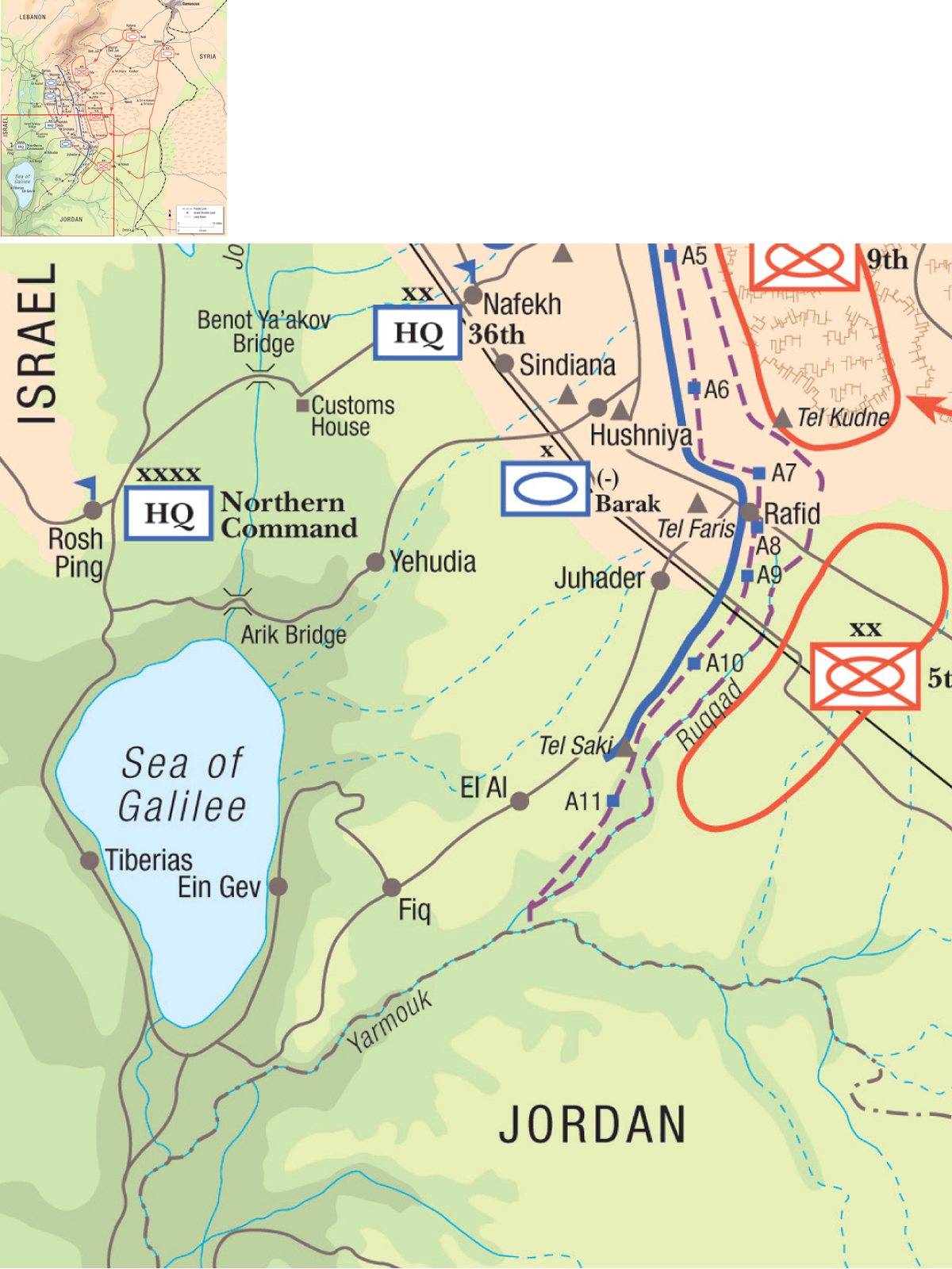
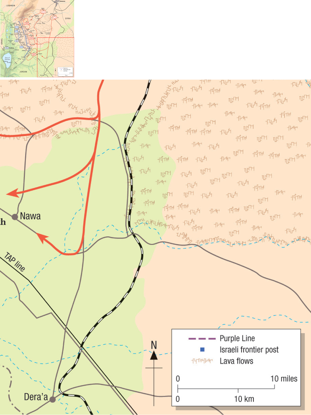
The eastern boundary of the Golan, facing the Damascus Plain, ran in an irregular line along the edge of the United Nations Purple Line a demilitarised zone established after the Six Day War and so called because of its colouring on the maps of the UN observers stationed there. Along the ceasefire line there was a narrow strip of neutral territory, less than 500m wide, patrolled by personnel from the 16 UN observer posts built within the zone.
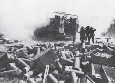
An M50 155mm SP howitzer fires in support of an Israeli attack on the Golan. One of the major lessons of the October War to all armies was the prodigious scale of ammunition expenditure during the heavy fighting. Artillery and mortars were quickly integrated into the fire plans of Israeli offensive operations to counter the menace of RPG and Sagger anti-tank teams who found plenty of cover among the rocks of the Golan Heights to ambush Israeli tanks.

