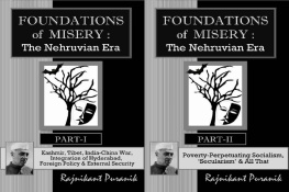
Foundation of Misery :
The Nehruvian Era
PART-I
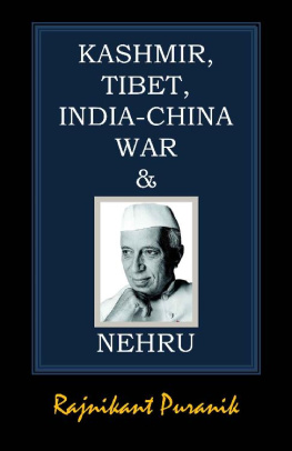
Kashmir, Tibet, India-China War, Integration of Hyderabad,
Foreign Policy & External Security
by
Rajnikant Puranik
Categories: Non-fiction, History
Copyright 2020 Rajnikant Puranik
Available at Amazon and Pothi.com
Please check
www.rkpbooks.com
for all the books by the author,
for their details, and from where to procure them
All rights reserved. No part of this publication may be reproduced, distributed or transmitted in any form or by any means, whether electronic/digital or print or mechanical/physical, or stored in an information storage or retrieval system, without the prior written permission of the copyright owner, that is, the author, except as permitted by law. However, extracts up to a total of 1,000 words may be quoted without seeking any permission, but with due acknowledgement of the source. For permission, please write to rkpuranik@gmail.com .
Preface
Those who do not learn from history are doomed to repeat it.
George Santayana
It has been said that the road to hell is often paved with best intentions, and despite the probable best intentions, The Nehruvian Era, 194764 unfortunately laid the firm foundations of Indias misery. The same are detailed in this two-part book. This part deals with the major foreign policy and external security issues.
Chapter-1 gives an overview of the history of J&K, and details chronologically how Nehru, by arrogantly ignoring wise councils and making one blunder after another, single-handedly created the Kashmir problem that bedevils India till today.
Chapter-2 details how creation of Pakistan-II was frustrated by Sardar Patel by a firm policy on the integration of the Hyderabad Princely State, despite Nehrus muddle-headedness.
Chapter-3 is a sad story on how India under Nehru pusillanimously and irresponsibly created a permanent severe external security threat for India by allowing our peaceful neighbour Tibet to be erased as a nation, without even registering a protest in the international fora.
Chapter-4 is the shocking story of how India drifted into an unnecessary war with China in 1962 by failing to settle the borders peacefully, despite an overlong time of a decade and a half to settle it, willingness of China to do so, and the multiple opportunities that presented themselves; and how with irresponsibly no preparation, Nehru&Co shamed India before the world in that war.
Chapter-5 summarises the many foreign policy and external security failures of the Nehruvian era.
Rajnikant Puranik
To the fond memory of my late parents
Shrimati Shakuntala and Shri Laxminarayan Puranik
Thanks to
Devbala, Manasi, and Manini
A Note on Citations & Bibliography
Citations are given as super-scripts in the text, such as {Azad/128}.
Citation Syntax & Examples
{Source-Abbreviation/Page-Number}
e.g. {Azad/128} = Azad, Page 128
{Source-Abbreviation/Volume-Number/Page-Number}
e.g. {CWMG/V-58/221} = CWMG, Volume-58, Page 221
{Source-Abbreviation} for URLs (articles on the web), and for digital books (including Kindle-Books), that are searchable, where location or page-number may not be given.
e.g. {VPM2} , {URL15}
{Source-Abbreviation/Location-Number} for Kindle Books
e.g. {VPM2} , {VPM2/L-2901}
Example from Bibliography Table at the end of this Book
Azad | B | Maulana Abul Kalam Azad India Wins Freedom . Orient Longman. New Delhi. 2004 |
CWMG | D, W | Collected Works of Mahatma Gandhi. Vol. 1 to 98. http://gandhiserve.org/e/cwmg/cwmg.htm |
URL15 | U | Article Nehru vs Patel: Ideological Rift, Hardly a Trivial One. Rakesh Sinha, Sunday Express. 10-Nov-2013. www.pressreader.com/india/sunday-express8291/20131110/282033324959792 |
VPM2 | K, D | V.P. Menon The Transfer of Power in India . Orient Longman. Chennai. (1957) 1997. books.google.co.in/books?id=FY5gI7SGU20C |
The second column above gives the nature of the source : B=paper Book, D=Digital Book/eBook other than Kindle, K=Kindle eBook, U=URL of Document/Article on Web, W=Website, Y=YouTube.
Table of Contents
Detailed Table of Contents
{ 1 }
Nehrus Kashmir Botch-up
J&Ks Geography
Geographically, J&K was the biggest of the princely States with a population of about 40 lacs. Its location was strategic. Its northern boundaries touch Afghanistan, USSR and China, with Pakistan to its west, and India to the south. Control-wise, J&K comprises three parts, otherwise seven parts.
(A) Area under the control of India:
(1) Jammu in the south, which is largely Hindu.
(2) Ladakh in the east, which is Buddhist.
(3)Kashmir Valley: An oval-shaped valley in the middlebetween PoK to the north and west, Jammu to the south, and Ladakh to the eastoften referred to as just Kashmir, which is predominantly Muslim.
(B) Area under the control of China:
(4) Aksai Chin in the north-east, under the control of China.
(5) Shaksgam Valley in the north, illegally ceded by Pakistan to China.
(C) Area under the control of Pakistan:
(6) Gilgit-Baltistan in the north.
(7) Poonch, Mirpur and Muzaffarabad divisions in the north-west referred to as PoK or Pakistan-occupied-Kashmir.
The length of the Kashmir valley, including the inner slopes of its surrounding hills, is about 120 miles from north-west to south-east, the greatest width being 75 miles, and the total area about 6000 square miles. The basin is about 84 miles long and 20 to 24 miles wide. Its mean height is 6000 feet above the sea level.
To the north of the valley are the main ranges of Himalayas. To the east is Ladakh separated by the Himalayas. Pir Panjal range encloses the valley from the west and the south, separating it from the Great Plains of northern India.
Srinagar, its capital, is located in the heart of the Kashmir valley at an altitude of 1,730 metres, that is, 5674 feet above sea level, and is spread on both sides of the river Jhelum. Its two lakesDal and Naginenhance its picturesque setting. The Indus, Jhelum, Tawi, Ravi and Chenab are the five major rivers that flow through the state.
67% of the population of J&K under the Indian control is Muslim. However, Kashmir valley is about 97% Muslim.
Area of Ladakh, Jammu and Kashmir Valley divisions are respectively 59000, 26000 and 16000 sq km out of the total of 1,01,000 sq km, forming respectively 58%, 26% and 16% of the total area of J&K within Indias control.
However, the total area of J&K is 2,22,000 sq km. Therefore, 1,21,000 sq km amounting to 54% of the total, that is, more than half, is illegally occupied by Pakistan and China: 78,000 sq km amounting to 35% of the total area of J&K by Pakistan; 38,000 sq km amounting to 17% of the total by China; and 5,000 sq km, that is, 2% of the total that was illegally handed over by Pakistan to China.
Outline of Kashmirs History
How Kashmir Got its Name
Kashmir got its name from Kashyap , the sage who founded it. Kashyap-mir aka Kashyapmir aka Kashmir means the land of Kashyap Rishi . Kashmir was then a home of rishis and scholars. The land of Kashmir nourished Shaivism, Vaishnavism and Buddhism, and spread them for the benefit of mankind.
Legend has it that Shiva, at the instance of Kashyap, struck the earth with his trident, and a river flowed from the spot. The river was named Vitasta , now called Jhelum . As per a popular belief, many generations of Pandavas ruled over Kashmir, and that the temple atop the hill of Shankaracharya in Srinagar dates from the Pandava era .

