• Complain

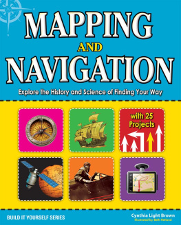
Cynthia Light Brown - Mapping and Navigation: Explore the History and Science of Finding Your Way with 20 Projects

Here you can read online Cynthia Light Brown - Mapping and Navigation: Explore the History and Science of Finding Your Way with 20 Projects full text of the book (entire story) in english for free. Download pdf and epub, get meaning, cover and reviews about this ebook. year: 2013, publisher: Nomad Press, genre: History. Description of the work, (preface) as well as reviews are available. Best literature library LitArk.com created for fans of good reading and offers a wide selection of genres:

Romance novel Science fiction Adventure Detective Science History Home and family Prose Art Politics Computer Non-fiction Religion Business Children Humor

Choose a favorite category and find really read worthwhile books. Enjoy immersion in the world of imagination, feel the emotions of the characters or learn something new for yourself, make an fascinating discovery.

Cynthia Light Brown Mapping and Navigation: Explore the History and Science of Finding Your Way with 20 Projects
  • Book:
    Mapping and Navigation: Explore the History and Science of Finding Your Way with 20 Projects
  • Author:
  • Publisher:
    Nomad Press
  • Genre:
  • Year:
    2013
  • Rating:
    3 / 5
  • Favourites:
    Add to favourites
  • Your mark:
    • 60
    • 1
    • 2
    • 3
    • 4
    • 5

Mapping and Navigation: Explore the History and Science of Finding Your Way with 20 Projects: summary, description and annotation

We offer to read an annotation, description, summary or preface (depends on what the author of the book "Mapping and Navigation: Explore the History and Science of Finding Your Way with 20 Projects" wrote himself). If you haven't found the necessary information about the book — write in the comments, we will try to find it.

How did we get from 20-foot-long maps to GPS devices small enough to fit in the palm of our hands? How does GPS work and what can it tell us? How do ancient mapmaking techniques used by the Romans and Greeks influence the satellite technologies we use today? The history of mapmaking is full of remarkable characters who charted the unknown with an ever-changing set of tools. In Mapping and Navigation: The History and Science of Finding Your Way, kids ages 912 will learn the history and science behind the evolution of mapmaking, and how much is still out there for discovery.
Readers will explore ideas through hands-on experiments while learning new terminology and interesting facts. Projects include using triangulation to measure distances, creating contour lines on a mini-mountain to understand elevation changes on a map, and inventing a sundial and compass to understand the basics of navigation. Whether mapping the solar system or mapping their own backyard,...

Cynthia Light Brown: author's other books


Who wrote Mapping and Navigation: Explore the History and Science of Finding Your Way with 20 Projects? Find out the surname, the name of the author of the book and a list of all author's works by series.

Mapping and Navigation: Explore the History and Science of Finding Your Way with 20 Projects — read online for free the complete book (whole text) full work

Below is the text of the book, divided by pages. System saving the place of the last page read, allows you to conveniently read the book "Mapping and Navigation: Explore the History and Science of Finding Your Way with 20 Projects" online for free, without having to search again every time where you left off. Put a bookmark, and you can go to the page where you finished reading at any time.

Light

Font size:

Reset

Interval:

Bookmark:

Make

~ Latest titles in the Build It Yourself Series ~

Check out more titles at wwwnomadpressnet Nomad Press A division of Nomad - photo 1

Check out more titles at www.nomadpress.net

Nomad Press

A division of Nomad Communications

10 9 8 7 6 5 4 3 2 1

Copyright 2013 by Nomad Press. All rights reserved.

No part of this book may be reproduced in any form without permission in writing from the publisher, except by a reviewer who may quote brief passages in a review or for limited educational use.

The trademark Nomad Press and the Nomad Press logo are trademarks of Nomad Communications, Inc.

ISBN: 978-1-61930-198-6

Illustrations by Beth Hetland

Educational Consultant, Marla Conn

Questions regarding the ordering of this book should be addressed to Nomad Press

2456 Christian St.

White River Junction, VT 05001

www.nomadpress.net

Nomad Press is committed to preserving ancient forests and natural resources - photo 2

Nomad Press is committed to preserving ancient forests and natural resources. We elected to print Mapping and Navigation: Explore the History and Science of Finding Your Way on Thor PCW containing 30% post consumer waste.

Nomad Press made this paper choice because our printer, Sheridan Books, is a member of Green Press Initiative, a nonprofit program dedicated to supporting authors, publishers, and suppliers in their efforts to reduce their use of fiber obtained from endangered forests.

For more information, visit www.greenpressinitiative.org.

CONTENTS

Introduction
Finding Your Way

Chapter 1
Ancient Maps

Chapter 2
Explorers Cross the Seas

Chapter 3
Mapping New Lands and New Skies

Chapter 4
Mapping from Satellites: GPS and Landsat

Chapter 5
What Is GIS?

Chapter 6
Oceans: The Least Known Surface on Earth

Chapter 7
Space: Navigating the Final Frontier

Picture 3

Picture 4

Index

Picture 5 TIMELINE Picture 6

BCE

1400s BCE: the Chinese start using a grid system to lay out their cities.

500s BCE: a Babylonian map called the Imago Mundi is created showing the world as seven islands surrounding Babylon and the Euphrates River. This is in what is modern-day Iraq.

300s BCE: the Qin dynasty in China makes the first grid maps.

200s BCE: Eratosthenes, the first person to use the word geography, calculates the earths circumference to be about 24,390 miles (36,250 kilometers). He draws a map of the known world using lines of latitude and longitude.

200s BCE: Pei Xiu uses a grid system to show Chinese cities.

100300s CE

120 CE: maps made by Marinus of Tyre are the first in the Roman Empire to show China.

150 CE: Claudius Ptolemy, a Roman citizen living in Egypt, publishes Geographia, which contains a huge list of the names of cities and their locations on a grid system. He also develops detailed maps using latitude and longitude.

300s CE: the Peutinger Map shows the road networks, bodies of water, and settlements in the Roman Empire, as well as distances between cities.

14001500s

1487: Bartholomew Dias (Portugal) discovers the southern tip of Africa.

1492: Christopher Columbus (Italy) discovers the New World.

1497: John Cabot (Italy) discovers Newfoundland, Canada.

14971499: Vasco da Gama (Portugal) discovers a water route between Portugal and India.

1502: Amerigo Vespucci (Italy) explores the New World.

1507: the Waldseemuller Map is the first map to use America as the name for the New World, named after explorer Amerigo Vespucci.

1513: Juan Ponce de Leon (Spain) discovers Florida on his search for the Fountain of Youth.

1513: Vasco Nunez de Balboa (Spain) crosses the Isthmus of Panama and is the first European to see the Pacific Ocean from its eastern shore.

15191522: Ferdinand Magellan (Portugal) sails around the world.

1540: Francisco Vasquez de Coronado (Spain) is the first European to explore the American Southwest in Arizona and New Mexico.

1569: Gerardus Mercator makes his famous map of the world called the Mercator projection.

16001700s

1608: The first telescopes are invented by Hans Lippershey, Zacharias Janssen, and Jacob Metius.

1609: Galileo Galilei is the first person to use a telescope to observe the heavens.

1620: Dutch architect Cornelius Drebel constructs the first submarine. He tests it in the Thames River in England.

1643: Evangelista Torricelli develops the first working barometer.

1668: Isaac Newton invents the first reflecting telescope.

1757: John Bird makes the first sextant.

1773: John Harrison is awarded the prize for inventing the marine chronometer, which tells accurate time at sea and allows for determination of longitude.

1783: the Montgolfier brothers of France launch unmanned flights in a hot air balloon. The first free flight with human passengers soon follows.

1800s

1803: Lewis and Clark set off from Pittsburgh, Pennsylvania, on the Corps of Discovery Expedition to explore and map the western United States.

1804: Sir George Cayley of Great Britain flies the first model glider.

1807: President Thomas Jefferson authorizes the Survey of the Coast, which is the first attempt to map the ocean in an organized system.

1855: U.S. Navy Lieutenant Matthew Maury publishes a map that is the first to show underwater mountains in the mid-Atlantic Ocean.

1856: Jean-Marie Le Bris of France makes the first flight that goes higher than his point of departure by having a horse pull him on a beach.

1869: John Wesley Powell leads an expedition down the Colorado River to map the Grand Canyon.

1872: The HMS Challenger circumnavigates the globe on a four-year voyage that discovers 4,417 new marine creatures.

1891: Otto Lilienthal of Germany is the first to successfully pilot gliders in flight.

1896: Samuel P. Langley of the United States flies a steam-powered model plane.

1900s

1903: Orville and Wilbur Wright of the United States make the first engine-powered, heavier-than-air flight near Kitty Hawk, North Carolina. The flight goes about 120 feet and lasts 12 seconds.

1906: Lewis Nixon invents the first sonar device to detect icebergs.

1921: the first flight to carry airmail crosses the United States.

Next page
Light

Font size:

Reset

Interval:

Bookmark:

Make

Similar books «Mapping and Navigation: Explore the History and Science of Finding Your Way with 20 Projects»

Look at similar books to Mapping and Navigation: Explore the History and Science of Finding Your Way with 20 Projects. We have selected literature similar in name and meaning in the hope of providing readers with more options to find new, interesting, not yet read works.


Reviews about «Mapping and Navigation: Explore the History and Science of Finding Your Way with 20 Projects»

Discussion, reviews of the book Mapping and Navigation: Explore the History and Science of Finding Your Way with 20 Projects and just readers' own opinions. Leave your comments, write what you think about the work, its meaning or the main characters. Specify what exactly you liked and what you didn't like, and why you think so.