THE
GEOLOGY
OF
BRITAIN
AN INTRODUCTION
PETER TOGHILL
Airlife
DEDICATION
Susan for company in wild and often wet places, when another photograph just needs to be taken.
Marianne and Elizabeth for support and encouragement.
First published in 2000 by Swan Hill Press
This e-book edition first published in 2011by The Crowood Press Ltd, Ramsbury, Marlborough, Wiltshire, SN8 2HR
www.crowood.com
Dr Peter Toghill 2000
All rights reserved. This e-book is copyright material and must not be copied, reproduced, transferred, distributed, leased, licensed or publicly performed or used in any way except as specifically permitted in writing by the publishers, as allowed under the terms and conditions under which it was purchased or as strictly permitted by applicable copyright law. Any unauthorised distribution or use of this text may be a direct infringement of the authors and publishers rights, and those responsible may be liable in law accordingly.
The information in this book is true and complete to the best of our knowledge. All recommendation are made without any guarantee on the part of the Publisher, who also disclaims any liability incurred in connection with the use of this data or specific details.
ISBN 978 1 84797 361 0
ACKNOWLEDGEMENTS
I must sincerely thank Gill and Andrew Jenkinson of Scenesetters, Bucknell, Shropshire, who have produced all the computer generated colour diagrams. Gill Jenkinson in particular has worked with skill and patience when deciphering my original drawings, and has put up with many changes of opinion. The original manuscript was all hand-written, and I owe heartfelt thanks to my secretary Brenda Campbell who has word-processed the manuscript and is one of the few people who can read my handwriting. She has also shown great patience and coped with numerous versions of various sections.
Thirty (nearly half) of the photographs were generously made available, as indicated, by Ken Gardner of Landform Slides, Lowestoft. Without his support the book would not have been so attractive.
Dr Andy Chambers, School of Earth Sciences, The University of Birmingham, kindly provided the photograph of layered gabbro on Skye (). A number of publishers have allowed me to re-draw diagrams from their publications as indicated in the text, and I am most grateful for this. Duplicate sets of photographs made available by Landform Slides can be purchased from Mr K. Gardner, Landform Slides, 38 Borrow Road, Lowestoft, Suffolk N32 3PN.
FOREWORD
T he geology of Britain is immensely varied, with rocks and structures representing over 2000 million years of earth history. Geologists working in Britain were amongst the first to recognise the importance of fossils in working out the relative ages of rocks. The fossils discovered in Britain during the nineteenth century paved the way for the setting up of a geological time scale now recognised worldwide. The varied scenery of Britain is wholly dependent on the underlying geology and geological structure.
This book sets out to describe the geological history of Britain through the various recognised periods of geological time, starting with the oldest rocks in the north-west of Scotland and finishing with the young, unconsolidated sediments of south-east England, and those left behind by the recent Ice Age.
There is a public interest nowadays in geology, particularly earthquakes and volcanoes, as explained by the modern concept of plate tectonics. This book uses plate tectonics to explain the geological development of Britain and its remarkable movement across the Earths surface in the last 500 million years. It is written for the lay person and includes an introduction to general principles of geology, but will also appeal to students at all levels.
The reader will find a geological map of Britain a very useful complement to the book. The most suitable is the British Geological Surveys Ten Mile Map, Scale 1: 625 000, Solid Edition. This comes in two halves (north and south), and each can be purchased through stockists of Ordnance Survey maps, or direct from the British Geological Survey ().
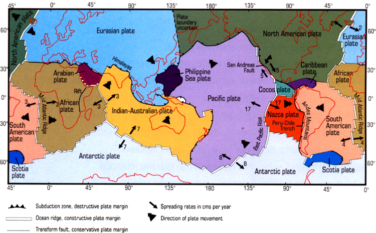
FIG. 1. Plates and plate boundaries of the present day world. After Plummer and McGeary, Physical Geology, Brown, W. C., Times Mirror Education Group 1996, 7th edition, p. 418, fig. 19.1. (Reproduced with permission of The McGraw-Hill Companies.)
INTRODUCTION
V isitors to Britain are always struck by the great variety of scenery in what is a relatively small geographical area. This ever-changing scenery and landscape pattern is a reflection of an underlying complex geological sequence and structure developed through hundreds of millions of years of Earth history.
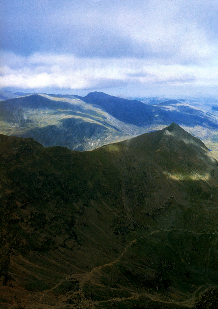
One of the reasons why the geological sequence is so varied is that the British area has often in the past (though happily not today!) been close to plate boundaries. These boundaries are the active geological areas of the world where constant earthquake and volcanic activity occurs, and where compression of the Earths crust can build up large mountain chains. The presence in Britain of ancient fault lines such as the Great Glen Fault and old volcanic areas like Snowdonia, together with the evidence of deeply eroded fold mountains in Scotland dating back over 400 million years, all point to our having been at plate boundaries in the past.
The various rock types of Britain have been formed in a number of ways. During the hundreds of millions of years which have shaped the landscape, constant erosion of land masses produced sediments which were laid down to form new sedimentary rocks, such as sandstone and shale, of which many parts of Britain are made. Episodes of igneous activity have produced the volcanic lavas and ashes, and granites, which we find in many of Britains highland areas, and these episodes have occurred at various times in the geological past. Many of the older rocks of Britain have been altered by the effects of heat and pressure caused by deep burial in the Earths crust, and movements at plate boundaries. These altered rocks, which geologists call metamorphic, include slates and schists. Other rock types such as reef limestones, desert sandstone and coal-bearing sediments show evidence of the British area having been in very different latitudes from those of today. This suggests large movements of continental areas over the surface of the globe, which are explained by the modern concept of plate tectonics.
Plate tectonics
This concept explains how continents have moved over the Earths surface throughout geological time, and are still moving today. The early ideas of continental drift, as put forward by Alfred Wegener, although basically correct, could not produce a sensible explanation or mechanism for continental movements. It was not until the discovery in the 1960s of ocean floor growth caused by volcanic activity, now called sea-floor spreading, that a mechanism for the movement of continents, as well as for the birth and destruction of oceans, was discovered.
Geologists now accept that the Earths outer shell, down to around 100 km, is made up of a number of distinct areas called plates (mid-ocean ridges, where volcanic activity produces a constant conveyor belt of new oceanic crust on either side of the ridge to produce a new ocean floor. These new ocean floor factories move continents apart to a certain extent on either side of the ocean, as is happening around the Atlantic today.
Next page
