Published in 2009 by The Rosen Publishing Group, Inc.
29 East 21st Street, New York, NY 10010
Copyright 2009 by The Rosen Publishing Group, Inc.
All rights reserved. No part of this book may be reproduced in any form without permission in writing from the publisher, except by a reviewer.
Book Design: Michael J. Flynn
Photo Credits: Cover, p. 24 (battle scene) MPI/Stringer/Hulton Archive/Getty Images; pp. 311 (grass background), 1327 (grass background), 2932 (grass background) Tony Campbell/ Shutterstock; p. 5 (battle scene) Stock Montage/Hulton Archive/Getty Images; p. 6 (Plimouth Plantation) Marily Angel Wynn/Nativestock Pictures/Corbis; p. 8 (engraving) The Mariners Museum/Corbis; p. 9 (three chiefs on horses) Christies Images/Corbis; p. 11 (Native American camp) Corbis; pp. 12 (mining town), 20 (Custer and Indian scouts) Bettmann/Corbis; p. 14 (Sitting Bull) Hulton Archive/Getty Images; p. 16 (Crazy Horse) http://upload.wikimedia.org/wikipedia/en/b/b1/ Crazy_Horse_1877.jpg; p. 17 (Crazy Horse monument) magmarcz/Shutterstock; p. 18 (George Custer) Mathew Brady/Hulton Archive/Getty Images; p. 21 (map) http://upload.wikimedia.org/wikipedia/ commons/b/b1/Custermovements.jpg; pp. 23 (battle reenactment), 27 (battle reenactment) Brian A. Vikander/Corbis; p. 28 (Sitting Bull and Buffalo Bill) D. F. Barry/Hulton Archive/Getty Images; p. 30 (grave marker of General Custer) Connie Ricca/Corbis; p. 30 (sculpture) http://upload.wikimedia.org/ wikipedia/commons/b/bc/Little-bighorn-memorial-sculpture-2.jpg.
ISBN: 978-1-4358-0197-4
6-pack ISBN: 978-1-4358-0198-1
Manufactured in the United States of America

Contents
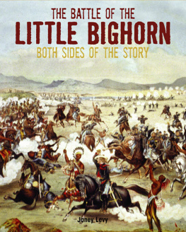
Have you ever heard of the Battle of the Little Bighorn? It was a famous battle that took place along the Little Bighorn River in present-day Montana on June 25, 1876. On one side were U.S. soldiers led by Lieutenant Colonel George Armstrong Custer. On the other side were Lakota Sioux (SOO), Cheyenne, and Arapaho warriors led by legendary Lakota holy man Sitting Bull and great Lakota chief Crazy Horse.
The Battle of the Little Bighorn was the most famous battle of the Great Sioux War of 18761877. You might have heard other names for the battle and the war. The battle is sometimes called Custers Last Stand. Native Americans have their own name for it: they call it the Battle of the Greasy Grass. The war is sometimes called the Black Hills War.
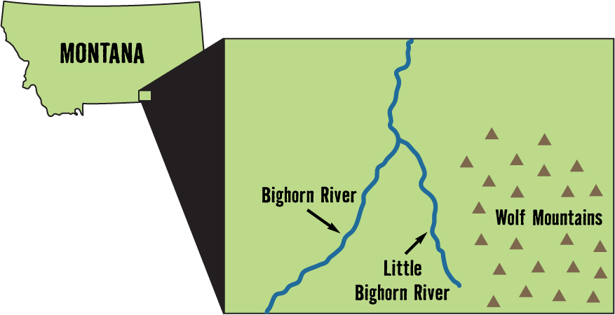
This image shows an enlarged detail map of the area where the Battle of the Little Bighorn was fought.
Just as the battle was part of a war, the war itself was part of a long series of wars called the Indian Wars. Although the Battle of the Little Bighorn ended with a great victory for the Native Americans, they lost the Indian Wars in the end.
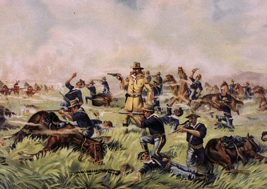
This painting shows an artists interpretation of the battle rather than a faithful record of what happened. The artist wanted to present the soldiers as heroes, so he focused on them and didnt include many Native Americans. Which man do you think is Custer? How did you pick him out?
The Indian Wars began in the early 1600s, soon after the first European colonists settled in North America. While many Native American tribes were friendly at first, others were hostile because they feared the strangers would take their land. As the number of colonists grew, they occupied more Indian land and fighting increased.
Whose Land Is It?
Colonists and Native Americans signed many land treaties. However, different understandings of the treaties led to conflict. Colonists believed the treaties made the land theirs. Native Americans believed they had simply given colonists the right to use the land. They thought they would be able to hunt on the land as they always had.
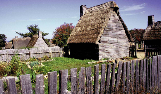
In 1627, Plimouth Plantation, in what is now Massachusetts, was built by colonists in the middle of Native American land. This is a picture of the re-created village.
The colonists practice of cutting down forests to create farmland also led to fighting. Even though Native Americans raised crops, they also hunted and gathered wild foods in the forests. The destruction of the forests threatened their food supply and their way of life.
As Long as the Rivers Shall Run
In the early 1800s, the U.S. government marked a huge area of land west of the Mississippi River as Indian Country. Treaties promised Native Americans the land would be theirs as long as the rivers shall run and the grass shall grow. However, the treaties werent honored, and settlers were soon moving onto the land.
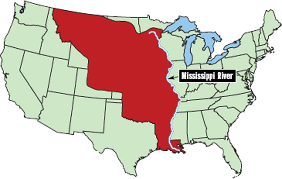
The red area on this map shows Indian Country, land promised to Native Americans, as it was around 1810.
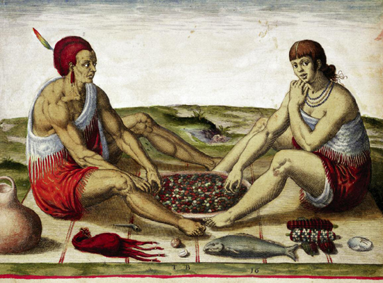
This engraving, based on a 1585 watercolor by John White, shows Native Americans eating a traditional meal of corn, berries, and seafood.
Conflict Spreads
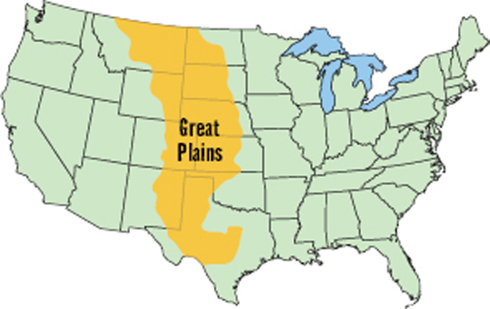
In 1783, the colonies won the American Revolution and became the United States of America. The new country continued to gain Indian land through treaties, but it also set aside reservationsplaces where Native Americans could live and maintain their traditions. Many American settlers ignored the treaties and moved onto Native American land, creating more conflict. By the early 1800s, fighting spread to the Great Plains, where Plains Indianssuch as the Cheyenne, Arapaho, and Lakotabattled to protect their land.
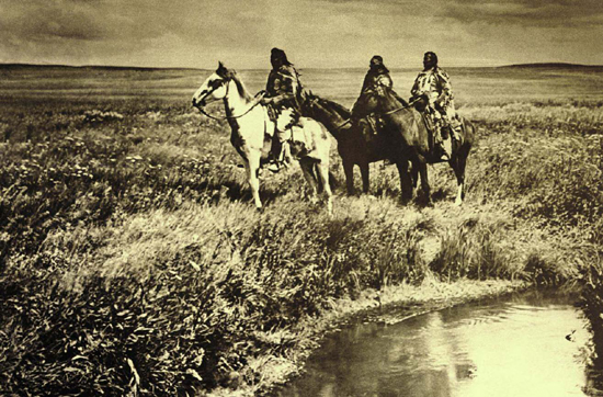
This is a picture of three chiefs of the Blackfeet tribe that also lived on the Great Plains.
The Cheyenne, Arapaho, and Lakota were three large tribes of Plains Indians. They practiced a nomadic lifestyle, following the buffalo herds on which they depended for meat, leather, and bones for tools. They also gathered wild fruits and vegetables. They lived in tepees (sometimes spelled tipis), which they could easily pack up and move.
The Cheyenne and Arapaho
The Cheyenne originally lived in permanent villages around the Great Lakes, raising crops and fishing in the lakes. In the late 1700s, they moved onto the Great Plains and became nomadic buffalo hunters. In 1851, the U.S. government created a reservation for them in present-day Colorado. However, white settlers soon invaded their land.
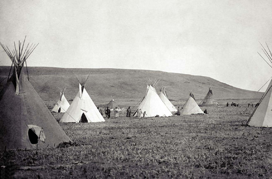
This photograph shows a Native American camp on the Great Plains.
The Arapaho were allies of the Cheyenne. Its believed that they also had once lived in permanent villages in eastern woodlands. In keeping with the traditions of other Plains tribes, they became nomadic when they were moved. The territory they occupied included present-day South Dakota, Nebraska, Colorado, Wyoming, and Kansas.
Next page
