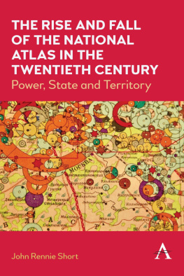
The Rise and Fall of the National Atlas in the Twentieth Century
The Rise and Fall of the National Atlas in the Twentieth Century
Power, State and Territory
John Rennie Short

Contents
I first started the research for this book an embarrassingly long time ago. I started working on the idea of the book 20 years ago. Yes, that long ago. I pursued the matter more intensively, when in 2009 I was awarded a Helen and John S. Best Fellowship to work on national atlases at the American Geographical Society (AGS) Library at the University of Wisconsin Milwaukee. During my time there, the then curator Chris Baruth made me feel most welcome. It was a pleasure to spend a summer month in the AGS Library. It was a good start. But more research was needed. When I returned to my home in Maryland, I started to visit the Library of Congress (LOC) map collection more often than my previous occasional visits. The LOC is not only one of the bibliographic wonders of the world; it is an unparalleled cartographic treasure trove. The Geography and Map Division holds the most comprehensive collection of atlases anywhere in the world, more than 53,000 atlases. It is a rich treasure house for cartographic research. My occasional visits were all too rare as the teaching and other research activities took up my energies. Anyway, I loved the archival research so much that I was in no hurry to finish.
We moved to Washington, DC, in 2013. There were many reasons for the move and the final choice was based on many factors, but not the least was the location. Our new home was only a brisk 15-minute walk from the LOC. I could and did visit more often. Yet the cartographic riches of the LOC meant that there was always one more atlas to consult, one more edition to check. My privileged position allowed me to keep researching. The research, as I came to realize, was becoming less a means to an end and more of a pleasurable experience in its own right.
The staff at the Geography and Map Reading Room was enormously helpful. I am very grateful to the support and encouragement shown by previous chiefs of the division, John R. Hebert and Ralph Ehrenberg. The staff not only met my bibliographic requests but also made suggestions and provided advice. Edward Redmond was always suggesting another edition of a volume when a specific call number proved elusive. Anthony Mullen shared his knowledge of Spanish language atlases and guided me on the path of looking at the nineteenth-century national atlases of Mexico, Peru and Venezuela as little-known forerunners of the European national atlases of the twentieth century. Ryan Moore freely shared his encyclopedic knowledge of an early Polish atlas. One afternoon, as I pored over the Eugeniusz Romer 1916 atlas of Poland, he very graciously guided me through the text in front of us for over an hour, sharing his deep knowledge of the text.
At the invitation of Tom Sander, I gave a talk at to the Washington Map Society in February 2016 on my research. A version of the talk was printed later that year in the Societys journal, The Portolan. The presentation and published essay were opportunities to gather my research notes and structure a narrative in lecture and print form.
The COVID-19 pandemic halted my visits to the LOC. Stuck at home during the pandemic I was more fortunate than most as it meant that while my archival research was stymied, I could devote more time writing up my research.
In turning the research into this text more debts were incurred. Megan Greiving at Anthem Press was an early supporter of the project and answered my many queries about illustrations with remarkable calm. I am very fortunate to have received tremendous support from my institution, the University of Maryland Baltimore County (UMBC). It came in a variety of forms. My research assistant, Abbey Farmer, carefully read through the manuscript more than once and helped with the index. To meet the costs of publication I received generous support from a variety of funds. I received a UMBC Center for Social Science Scholarship Small Research Grant. I also received financial support from two other UMBC sources, the Dresher Centers Scholarly Completion Fund and the College of Arts, Humanities and Social Science Deans Research Fund. The director of the School of Public Policy, Professor Nancy Miller, was a steadfast supporter of my research and scholarship, over many years. Thank you, Nancy, for everything.
I have also been fortunate with anonymous reviewers. The publisher sent out both the proposal and a completed text to reviewers who made many good suggestions. The two reviewers of the full manuscript deserve a special thanks for a careful and sympathetic reading that improved the text.
I have drawn upon the visual material of a wide variety of atlases to provide the illustrations in this book. It has proved enormously difficult to obtain copyright permissions to reproduce the images that I photographed during my archival research at the AGS Map Library and LOC. The national atlas is a complex text with multiple authors, and a diverse set of institutions are involved in its production and reproductionsome of them only for the duration of the project. Even for the more recent atlases it proved impossible to identify let alone contact the original copyright holders. So, this is an acknowledgment of my reliance on the work of others to produce the images used in this book. I will be delighted in subsequent editions to provide acknowledgment of all copyright holders who come forward.
I think it was Paul Valery, who noted that books are never finished, they are merely abandoned. For many the leave-taking is a source of relief, even joy. Not in my case. The book you have before you was reluctantly finished. Rather than relief, I have a sense of loss. I can only hope that my loss is your gain.
Cover, Atlas fver Finland ( Atlas of Finland ), 1899 |
Diagram, Atlas fver Finland ( Atlas of Finland ), 1899. The text, in both Finnish and Swedish, refers to the export of timber products from sawmills to different countries |
Cheshire, Atlas of England and Wales , 1579 |
Queen Elizabeth I (The Ditchley portrait) by Marcus Gheeraerts the Younger oil on canvas, c. 1592 |
Territorial map, Atlas Fsico y Poltico de La Repblica de Venezuela , 1840 |
Topographical diagram, Atlas Geografico Del Peru , 1865 |
Rich imagery, Atlas Pintaresco e Historico de Los estados unidos Mexicanos , 1885 |
Territorial claims, Atlas de Venezuela , 1979 |
Map of goats, Atlas of Pakistan , 1997 |
Map of industrial population, Atlas of Finland , 1925 |
Map, Atlas Polski , 1916 |
Map of financial relationship of capitalist countries, the export of capital, Bolshoi sovietski atlas mira ( Great Soviet World Atlas ) 1937 |
Collectivization of farming, Bolshoi sovietski atlas mira ( Great Soviet World Atlas ) 1937 |
Traffic flows in Bucharest, Atlas Republica Socialista Romania , 1974 |
Map of ethnic composition, National Atlas of the Democratic Republic of Afghanistan , 1985 |
Transportation network, National Atlas of Ethiopia , 1988 |
Indicators of socioeconomic development in the revolutionary period, Nuevo Atlas Nacional de Cuba , 1989 |
Next page
