• Complain

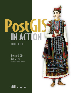
Regina O. Obe - PostGIS in Action, 2nd Edition

Here you can read online Regina O. Obe - PostGIS in Action, 2nd Edition full text of the book (entire story) in english for free. Download pdf and epub, get meaning, cover and reviews about this ebook. year: 2015, publisher: Manning Publications, genre: Home and family. Description of the work, (preface) as well as reviews are available. Best literature library LitArk.com created for fans of good reading and offers a wide selection of genres:

Romance novel Science fiction Adventure Detective Science History Home and family Prose Art Politics Computer Non-fiction Religion Business Children Humor

Choose a favorite category and find really read worthwhile books. Enjoy immersion in the world of imagination, feel the emotions of the characters or learn something new for yourself, make an fascinating discovery.

Regina O. Obe PostGIS in Action, 2nd Edition

PostGIS in Action, 2nd Edition: summary, description and annotation

We offer to read an annotation, description, summary or preface (depends on what the author of the book "PostGIS in Action, 2nd Edition" wrote himself). If you haven't found the necessary information about the book — write in the comments, we will try to find it.

Summary

PostGIS in Action, Second Edition teaches readers of all levels to write spatial queries that solve real-world problems. It first gives you a background in vector-, raster-, and topology-based GIS and then quickly moves into analyzing, viewing, and mapping data. This second edition covers PostGIS 2.0 and 2.1 series, PostgreSQL 9.1, 9.2, and 9.3 features, and shows you how to integrate with other GIS tools.

Purchase of the print book includes a free eBook in PDF, Kindle, and ePub formats from Manning Publications.

About the Book

Processing data tied to location and topology requires specialized know-how. PostGIS is a free spatial database extender for PostgreSQL, every bit as good as proprietary software. With it, you can easily create location-aware queries in just a few lines of SQL code and build the back end for a mapping, raster analysis, or routing application with minimal effort.

PostGIS in Action, Second Edition teaches you to solve real-world geodata problems. It first gives you a background in vector-, raster-, and topology-based GIS and then quickly moves into analyzing, viewing, and mapping data. Youll learn how to optimize queries for maximum speed, simplify geometries for greater efficiency, and create custom functions for your own applications. Youll also learn how to apply your existing GIS knowledge to PostGIS and integrate with other GIS tools.

Familiarity with relational database and GIS concepts is helpful but not required.

Whats Inside

  • An introduction to spatial databases
  • Geometry, geography, raster, and topology spatial types, functions, and queries
  • Applying PostGIS to real-world problems
  • Extending PostGIS to web and desktop applications
  • Updated for PostGIS 2.x and PostgreSQL 9.x

About the Authors

Regina Obe and Leo Hsu are database consultants and authors. Regina is a member of the PostGIS core development team and the Project Steering Committee.

Table of Contents

    PART 1 INTRODUCTION TO POSTGIS
  1. What is a spatial database?
  2. Spatial data types
  3. Spatial reference system considerations
  4. Working with real data
  5. Using PostGIS on the desktop
  6. Geometry and geography functions
  7. Raster functions
  8. PostGIS TIGER geocoder
  9. Geometry relationships
  10. PART 2 PUTTING POSTGIS TO WORK
  11. Proximity analysis
  12. Geometry and geography processing
  13. Raster processing
  14. Building and using topologies
  15. Organizing spatial data
  16. Query performance tuning
  17. PART 3 USING POSTGIS WITH OTHER TOOLS
  18. Extending PostGIS with pgRouting and procedural languages
  19. Using PostGIS in web applications

Regina O. Obe: author's other books


Who wrote PostGIS in Action, 2nd Edition? Find out the surname, the name of the author of the book and a list of all author's works by series.

PostGIS in Action, 2nd Edition — read online for free the complete book (whole text) full work

Below is the text of the book, divided by pages. System saving the place of the last page read, allows you to conveniently read the book "PostGIS in Action, 2nd Edition" online for free, without having to search again every time where you left off. Put a bookmark, and you can go to the page where you finished reading at any time.

Light

Font size:

Reset

Interval:

Bookmark:

Make
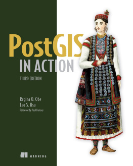
PostGIS in Action, Second Edition
Regina O. Obe and Leo S. Hsu

PostGIS in Action 2nd Edition - image 1

Copyright

For online information and ordering of this and other Manning books, please visit www.manning.com. The publisher offers discounts on this book when ordered in quantity. For more information, please contact

Special Sales Department Manning Publications Co. 20 Baldwin Road PO Box 761 Shelter Island, NY 11964 Email: orders@manning.com

2015 by Manning Publications Co. All rights reserved.

No part of this publication may be reproduced, stored in a retrieval system, or transmitted, in any form or by means electronic, mechanical, photocopying, or otherwise, without prior written permission of the publisher.

Many of the designations used by manufacturers and sellers to distinguish their products are claimed as trademarks. Where those designations appear in the book, and Manning Publications was aware of a trademark claim, the designations have been printed in initial caps or all caps.

Picture 2 Recognizing the importance of preserving what has been written, it is Mannings policy to have the books we publish printed on acid-free paper, and we exert our best efforts to that end. Recognizing also our responsibility to conserve the resources of our planet, Manning books are printed on paper that is at least 15 percent recycled and processed without the use of elemental chlorine.

Picture 3Manning Publications Co.20 Baldwin RoadPO Box 761Shelter Island, NY 11964Development editor: Jeff BleielTechnical development editor: Deepak VohraCopyeditors: Benjamin Berg, Andy CarrollProofreader: Katie TennantTechnical proofreader: David PombalTypesetter: Dottie MarsicoCover designer: Marija Tudor

ISBN 9781617291395

Printed in the United States of America

1 2 3 4 5 6 7 8 9 10 EBM 20 19 18 17 16 15

Dedication

To Dr. Ernest Olagbade Obe (19352012), professor, chief, daddy

Brief Table of Contents
Table of Contents
Praise for the First Edition of PostGIS in Action

All PostGIS users, from novices to experts, will benefit from this book. Dont use PostGIS without it!

Brent Wood, NIWA

An elegant introduction to a difficult domain.

Mark Leslie, LISAsoft Pty Ltd.

Its next to impossible to explain geospatial SQL succinctly, but this book pulls it off!

Andy Saurin, Saurin Solutions

A great guide for the beginner and a great reference for the advanced user.

Bruce Rindahl, Ventura County Watershed Protection District

Required reading for anyone wanting to get the most out of PostGIS.

James Fee, WeoGeo.com

The must-have guide if you aim to do any serious professional PostGIS development.

Paolo Corti, European Forest Fire Information System (EFFIS)

If you dont understand the benefits of PostGIS, this book will give you the Aha! moment you have been waiting for. It is the most comprehensive book of its kind.

Jeff Addison, Southgate Software Ltd.

This is the PostGIS reference Ive always wished for.

Bill Dollins, Zekiah Technologies, Inc.

Foreword

As children, we were probably all told at one time or another that we are what we eat, as a reminder that our diet is integral to our health and quality of life. In the modern world, with location-aware smartphones in our pockets, GPS units in our vehicles, and the internet addresses of our computers geocoded, it has also become true that who we are is where we areevery individual is now a mobile sensor, generating a ceaseless flow of location-encoded data as they move about the planet.

To manage and tame that flow of data, and the parallel flow of data opened up by economical satellite imaging and crowdsourced mapping, we need a tool equal to the taska tool that can persistently store the data, efficiently access it, and powerfully analyze it. We need a spatial database, like PostGIS.

Prior to the advent of spatial databases, computer analysis of location and mapping data was done with geographic information systems (GIS) running on desktop workstations. When it was first released in 2001, the project name was just a simple play on wordsnaturally, a spatial extension of the PostgreSQL database would be named PostGIS.

But the name has come to have further significance as the project has matured. Each year, new functions have been added for data analysis, and each year users have pressed those functions further and further, doing the kinds of work that in earlier years would have required a specialized GIS workstation. PostGIS is actually creating a world that is post-GISwe dont need GIS software to do GIS work anymore. A spatial database suffices.

In March of 2002, not even one year after the first release of PostGIS, I asked on the user mailing list for examples of how people were using PostGIS. In her first post to the list, Regina Obe answered this way:

We use it here [city of Boston] for proximity analysis. Part of our department is in charge of distributing foreclosed property to developers, etc., to build houses, businesses, etc. We use PostGIS to list properties by proximity ... so that if a developer wants to develop on a piece of land that is, say, X in size, they will be able to get a better sense of whether it can be done.

Even at that early date in the project, Regina Obe was already testing the capabilities of PostGIS and creating clever analyses.

Since the first edition of PostGIS in Action in 2011, PostGIS has itself remained very much in action, adding new features for raster analysis, 3D, and more. And the world has kept on moving, too.

Only a decade ago, when PostGIS was brand new, the idea that almost every person would have a GPS unit (a phone) in their pocket was pretty crazy, and now its commonplace. The features of PostGIS for managing location are now being used widely by developers who only a few years ago had never heard of spatial data.

Within the next few years, satellite and aerial imagery will move into the mass market, as drone systems and new low-cost satellite systems become affordable. The raster-management capabilities of PostGIS are now there for the next generation of developers to work with.

Enjoy this book and enjoy the insights it provides in putting location data to work. Regina and Leo have distilled a huge body of information into a concise guide that is truly one of a kind.

P AUL R AMSEY

C HAIR , P OST GIS P ROJECT S TEERING C OMMITTEE

Preface

PostGIS (pronounced post-jis) is a spatial database extender for the PostgreSQL open source relational database management system. Its the most powerful open source spatial database engine. It adds to PostgreSQL several spatial data types and over 300 functions for working with these spatial types. It does for PostgreSQL what Oracle Spatial and Oracle Locator do for Oracle, what IBM DB2 Spatial Extender and IBM Informix Spatial DataBlade do for DB2 and Informix, and what the geometry and geography types packaged in Microsoft SQL Server 2008+ do for SQL Server. PostGIS supports many of the OGC/ISO SQL/MMcompliant spatial functions youll find in these other OGC-compliant databases, as well as numerous additional ones that are unique to PostGIS.

Readers coming from other ANSI/ISOcompliant spatial databases, or other relational databases such as those weve mentioned, will feel right at home with PostgreSQL and PostGIS. PostgreSQL is the most ANSI/ISO SQLcompliant database management system around. In a similar vein, PostGIS supports many of the industry-standard OGC/ISO SQL/MM spatial database functions, types, and operations.

Next page
Light

Font size:

Reset

Interval:

Bookmark:

Make

Similar books «PostGIS in Action, 2nd Edition»

Look at similar books to PostGIS in Action, 2nd Edition. We have selected literature similar in name and meaning in the hope of providing readers with more options to find new, interesting, not yet read works.


Reviews about «PostGIS in Action, 2nd Edition»

Discussion, reviews of the book PostGIS in Action, 2nd Edition and just readers' own opinions. Leave your comments, write what you think about the work, its meaning or the main characters. Specify what exactly you liked and what you didn't like, and why you think so.