About the Author
Janette Norton was born in England but lived near Geneva with her husband Alan for over 40 years, raising four children and working in the marketing and educational fields. Her love of walking and exploring the mountains dated from the time she was a guide in Switzerland in her twenties, and the proximity of both the Alps and the Jura enabled her to continue her passion. After writing her first book on the Haute Savoie, she moved further afield to explore other areas of France, such as Provence, the Cevennes and the Dordogne. Sadly Janette died from cancer in January 2013, and her books are now revised by Alan Norton and Pamela Harris.
Alan Norton studied Physics at Edinburgh and Oxford universities before moving to Geneva to work at CERN on Particle Physics research. Since retirement, he has continued to participate in CERN experiments as a professor at the Italian University of Ferrara. As leisure activities, he has completed many mountain running events at the rear of the field, and helped Janette with walking and map preparation for her guides.
Pamela Harris graduated from Reading University and then moved to Switzerland, where she taught English and Classical studies at international schools in the Geneva area. A long-time member of both the Alpine Club and the Swiss Alpine Club, she has walked and climbed extensively in the mountains of Europe and the Himalayas. For several years she walked with Janette and assisted with previous editions of her guides.
Other Cicerone guides by the author
Walking in the Haute Savoie: South
Walking in Provence: East
Walking in Provence: West
Walking in the Cevennes
Walking in the Dordogne
WALKING IN THE HAUTE SAVOIE: NORTH
30 DAY WALKS SALEVE, VALLEE VERTE, ABONDANCE, BELLEVAUX, MORZINE
by Janette Norton
Revised by Alan Norton and Pamela Harris
JUNIPER HOUSE, MURLEY MOSS,
OXENHOLME ROAD, KENDAL, CUMBRIA LA9 7RL
www.cicerone.co.uk
Janette Norton 2017
Third edition 2017
ISBN: 978 1 85284 810 1
First edition 1996, second edition 2005
Printed by KHL Printing, Singapore
A catalogue record for this book is available from the British Library.
All photographs are by the author unless otherwise stated.
 Route mapping by Lovell Johns www.lovelljohns.com. Additional mapping by Alan Norton.
Contains OpenStreetMap.org data OpenStreetMap contributors, CC-BY-SA. NASA relief data courtesy of ESRI
 The routes of the GR, PR and GRP paths in this guide have been reproduced with the permission of the Fdration Franaise de la Randonne Pdestre holder of the exclusive rights of the routes. The names GR, PR and GRP are registered trademarks. FFRP 2017 for all GR, PR and GRP paths appearing in this work:
Acknowledgements
It is a daunting task to revise a guidebook when the original author is no longer present to share her skills and experience. Fortunately Janette left us perfect records, as well as wonderful memories, making it a pleasure to pick up her legacy. Even so, we would not have managed without several friends who enthusiastically re-visited some of the trails, providing text updates, GPS traces and brilliant new photographs.
We are especially indebted to Sharon Bryand, Richard Saynor and William Westermeyer, who took charge of the more challenging routes. Thanks also to those who accompanied them or us on various occasions: Patrick Bryand, Kevin Bryand, Carol Saynor, Rosie Westermeyer, Philip Jenkins, Mark Warren, Mike Goodyer, Rebecca Norton, Katherine Heery and Diane Mueller.
It is a pleasure to work with Cicerone, a very special company: cosily small, efficient and demanding when needed, but above all human and understanding when it matters most.
Finally, we are extremely grateful for the information provided by the various tourist offices in the Haute Savoie.
Updates to this Guide
While every effort is made by our authors to ensure the accuracy of guidebooks as they go to print, changes can occur during the lifetime of an edition. Any updates that we know of for this guide will be on the Cicerone website (www.cicerone.co.uk/810/updates), so please check before planning your trip. We also advise that you check information about such things as transport, accommodation and shops locally. Even rights of way can be altered over time. We are always grateful for information about any discrepancies between a guidebook and the facts on the ground, sent by email to updates@cicerone.co.uk or by post to Cicerone, Juniper House, Murley Moss, Oxenholme Road, Kendal LA9 7RL, United Kingdom.
Register your book : To sign up to receive free updates, special offers and GPX files where available, register your book at www.cicerone.co.uk.
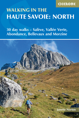
Front cover: Cornettes de Bise in early autumn (Walk 21): photo Richard Saynor
CONTENTS

Lac de Montriond from the Col de Chsery (Walk 28)
PREFACE TO THE THIRD EDITION
Since moving to the Geneva area about 50 years ago, the mountains of the Haute Savoie have been part of our lives. In good weather the Mle and the Salve are always visible across the lake, with the peaks of the Chablais behind and the glistening snows of Mont Blanc towering over all. It is a view we will never tire of, and the walks in this guide lead visitors into the spectacular beauty of what has become our home.
As revisers, we have had great pleasure in preparing this new edition and in re-discovering the delights of the walks we did in our younger days. In the past two years all the walks have been re-done by ourselves and helpers, relying on a few younger and faster friends in the case of the more challenging ones.
Although the walking takes longer as the years pass, route finding has become easier, for new signposts and information boards have sprung up almost everywhere. As a result all the route descriptions needed updating, and an increase in building has necessitated the re-routing of some walks or finding a more suitable parking place at the start. Two walks have been suppressed and even lovelier new ones added in their place.
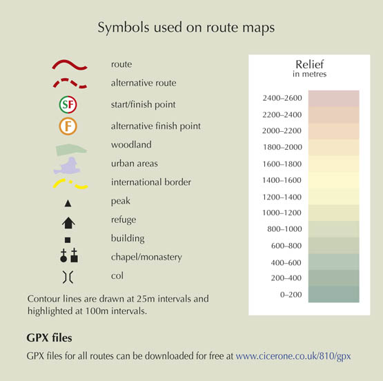
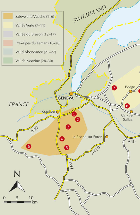
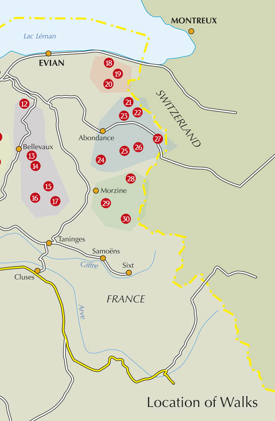
The general introduction has been revised and the walks re-structured into six sections, each with its own introduction. Each walk is accompanied by a new sketch map which overlays a recorded GPS track and key features on a colourful Cicerone base map, and by a profile plot which shows the steepness of the uphill and downhill sections. In addition, the many new photos will illustrate to readers the variety and beauty of this region which we have grown to love so much.








 Route mapping by Lovell Johns www.lovelljohns.com. Additional mapping by Alan Norton.
 The routes of the GR, PR and GRP paths in this guide have been reproduced with the permission of the Fdration Franaise de la Randonne Pdestre holder of the exclusive rights of the routes. The names GR, PR and GRP are registered trademarks. FFRP 2017 for all GR, PR and GRP paths appearing in this work:


