About the Author
Graham Uney is based near Bala in the Snowdonia National Park in Wales. Apart from writing guidebooks for Cicerone Press, he also works as a freelance journalist for a number of outdoor and wildlife magazines. This is Grahams sixth guidebook for Cicerone Press, and his 16th book to date.
Graham also runs a small outdoor activity business, Wild Walks Wales, offering holidaymakers in Snowdonia guided hill and mountain walking, wildlife walks, rock climbing and abseiling, orienteering, and wild country camping expeditions, and skills courses for walkers and mountaineers, including National Navigation Award Scheme courses, and Hill and Mountain Skills Scheme courses. He is a qualified Mountain Leader (summer and winter), and is now working towards a Mountain Instructor Award.
In his spare time Graham enjoys dog walking, rock climbing, playing the mandolin and acoustic guitar, and drinking real ale and malt whisky.
Other Cicerone guides by the author
Backpackers Britain: Northern Scotland
Backpackers Britain: Central and Southern Scotland
Walking on the Orkney and Shetland Isles
WALKING IN CORNWALL
by Graham Uney
2 POLICE SQUARE, MILNTHORPE, CUMBRIA LA7 7PY
www.cicerone.co.uk
Graham Uney 2015
First edition 2015
ISBN: 978 1 85284 684 8
Printed by KHL Printing, Singapore
A catalogue record for this book is available from the British Library.
All photographs are by the author unless otherwise stated.
 This product includes mapping data licensed from Ordnance Survey with the permission of the Controller of Her Majestys Stationery Office. Crown copyright 2015. All rights reserved. Licence number PU100012932.
Acknowledgements
Thanks to my wife Olivia for all her support during the checking of routes and writing of this book. Thanks also to Sue Viccars for her editing skills, and for supplying the photograph of Lamorna Cove at the beginning of the Lands End chapter.
Updates to this Guide
While every effort is made by our authors to ensure the accuracy of guidebooks as they go to print, changes can occur during the lifetime of an edition. Any updates that we know of for this guide will be on the Cicerone website (www.cicerone.co.uk/684/updates), so please check before planning your trip. We also advise that you check information about such things as transport, accommodation and shops locally. Even rights of way can be altered over time. We are always grateful for information about any discrepancies between a guidebook and the facts on the ground, sent by email to info@cicerone.co.uk or by post to Cicerone, 2 Police Square, Milnthorpe LA7 7PY, United Kingdom.
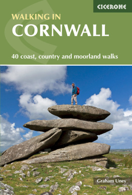
Front cover: Exploring the granite outcrops on Showery Tor (Walk 6) (photo: Olivia Abbott)
CONTENTS
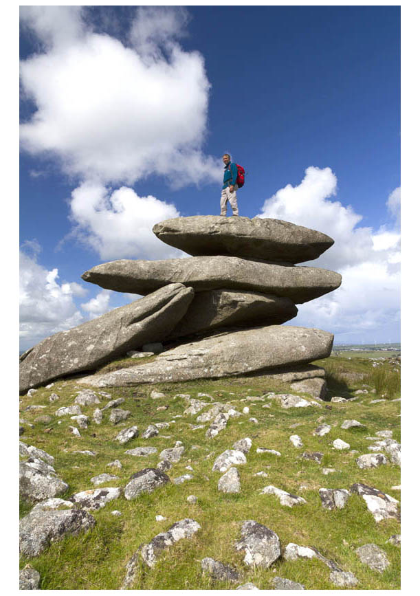
Bodmin Moor (Walks 17) is a real paradise for walkers who love to explore wild country
INTRODUCTION
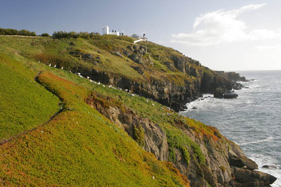
Looking back to the lighthouse from Lizard Point (Walk 39)
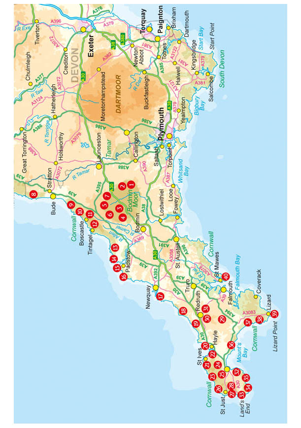
The county of Cornwall is home to both the British mainlands most southwesterly point at Landss End, and most southerly at Lizard Point. The county stretches into the Atlantic Ocean for almost 130km from its boundary with Devon, which largely follows the River Tamar, rising not far from the north coast then flowing south to reach the sea at Plymouth. Cornwall is thus almost an island, surrounded by the Celtic Sea to the north and west, the English Channel to the south, and the Tamar to the east. The Cornish display a fierce sense of independence; the name Kernow (Cornwall in the Cornish language) is seen regularly, town and village signs appear in English and Cornish, and the black-and-white county flag is very much in evidence. Many will only know Cornwall as a holiday destination, but this is a land steeped in history and tradition with a fascinating industrial heritage.
Walking is the best way to see the county. Many places in Cornwall are only accessible on foot, and the routes described here will take you to the very best places for spectacular scenery, wildlife, prehistory, industrial archaeology, and just for relaxing and getting away from the hustle and bustle of life further east.
Being largely surrounded by water apart from the land border with Devon many of the walks are coastal. There are routes to stunning headlands, to some of the most important industrial sites of a long-ago age, and to some of the top places to see wildlife. Cornwalls coast is remarkably varied: the north and west coasts tend to be more rugged than the south, which is home to the sheltered wooded valleys and broad estuaries of rivers such as the Fowey, Fal and Helford.
But this guide is not all about the coast. Cornwall is also blessed in that at its heart lies one of the most exciting and scenic upland areas in England: Bodmin Moor. Here you will find wild, remote-feeling hills, many of them topped by weirdly shaped granite tors, as well as ancient settlements, burial cairns, and hill forts.
The walking in Cornwall can be surprisingly strenuous, considering that the highest hill in the whole county Brown Willy is only 420m above sea level. Many of the routes on Bodmin Moor lead over wild, boggy, pathless terrain; while as anyone whos ever spent time walking around much of the UK coastline will tell you any route along a cliff top is likely to involve a fair amount of up and down.
The 40 walks described in this book provide options suitable for all tastes and levels of ability. There are lots of short walks for Sunday strolls, and a fair few longer routes for those who want to head out for more than just a couple of hours. There is also the opportunity for the serious walker to combine some routes for a more challenging day out (Walks 5 and 7, and 9 and 10). Note that Walks 17, on Bodmin Moor, are only suitable for those competent in the use of map and compass.
Geology
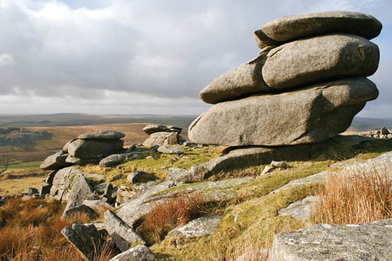
Superb granite tors are a major feature of Bodmin Moor
When most people think about which rocks make up Cornwall they immediately picture the huge granite tors that characterise many of the hilltops on Bodmin Moor. This granite sheet forms the backbone of the whole county and is by far the most important, and most obvious, rock type in Cornwall. It was formed when continental plates collided during the Late Paleozoic era 300 million years ago as part of the Cornubian batholith (the great mass of granite that intrudes throughout the southwest peninsula).
Much of the rest of the county is made up of slates from the Devonian period, but there are also outcroppings of sandstones and shales in the northeast from the Carboniferous age. The obvious exception is the peculiar rock of the Lizard peninsula. This is serpentine a rare section of the oceanic crust which has been thrust to the surface. The only other place in the UK where serpentine is found is as far from the Lizard as it is possible to get the island of Unst, on the northern tip of the Shetland Islands!



 This product includes mapping data licensed from Ordnance Survey with the permission of the Controller of Her Majestys Stationery Office. Crown copyright 2015. All rights reserved. Licence number PU100012932.


