About the Author
Paddy Dillon is a prolific walker and guidebook writer with over 70 guidebooks to his name, and contributions to 30 other titles. He has written extensively for many different outdoor publications and has appeared on radio and television.
Paddy uses a tablet computer to write his route descriptions while walking. His descriptions are therefore precise, having been written at the very point at which the reader uses them.
Paddy is an indefatigable long-distance walker who has walked all of Britains National Trails and several major European trails. He lives on the fringes of the Lake District and has walked, and written about walking, in every county throughout the British Isles. He has led guided walks and walked throughout Europe, as well as in Nepal, Tibet, Korea, Africa and the Rocky Mountains of Canada and the US. Paddy is a member of the Outdoor Writers and Photographers Guild.
Other Cicerone guides by the author
GR20: Corsica
Irish Coastal Walks
The Cleveland Way and the Yorkshire Wolds Way
The GR5 Trail
The Great Glen Way
The Irish Coast to Coast Walk
The Mountains of Ireland
The National Trails
The North York Moors
The Pennine Way
The Reivers Way
The Teesdale Way (Martin Collins; updated by Paddy Dillon)
The South West Coast Path
The Wales Coast Path
Trekking in Greenland
Trekking in the Alps (contributing author)
Walking and Trekking in Iceland
Trekking through Mallorca
Walking on Arran
Walking in County Durham
Walking in Madeira
Walking in Mallorca (June Parker; updated by Paddy Dillon)
Walking in Sardinia
Walking in the Isles of Scilly
Walking in the North Pennines
Walking on Guernsey
Walking on Jersey
Walking on La Gomera and El Hierro
Walking on La Palma
Walking on Tenerife
Walking the Galloway Hills
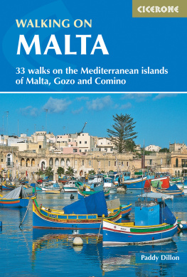
WALKING ON MALTA
by Paddy Dillon
2 POLICE SQUARE, MILNTHORPE, CUMBRIA LA7 7PY
www.cicerone.co.uk
Paddy Dillon 2016
Third edition 2016
ISBN-13: 978 1 85284 822 4
First edition 2007
ISBN-10: 1 85284 422 1
ISBN-13: 978 1 85284 422 6
Second edition 2012
ISBN-13: 978 1 85284 719 7
Printed in China on behalf of Latitude Press Ltd
A catalogue record for this book is available from the British Library.
All photographs are by the author unless otherwise stated.
The maps in this guide are based on the 1:25,000 Maltese Government maps, and have been reproduced with the permission of the Ministry for Resources and Infrastructure, Malta.
Updates to this Guide
While every effort is made by our authors to ensure the accuracy of guidebooks as they go to print, changes can occur during the lifetime of an edition. Any updates that we know of for this guide will be on the Cicerone website (www.cicerone.co.uk/822/updates), so please check before planning your trip. We also advise that you check information about such things as transport, accommodation and shops locally. Even rights of way can be altered over time. We are always grateful for information about any discrepancies between a guidebook and the facts on the ground, sent by email to info@cicerone.co.uk or by post to Cicerone, 2 Police Square, Milnthorpe LA7 7PY, United Kingdom.
Emergency Assistance
Malta has adopted the standard European emergency number of . Use this to call for the police, ambulance or fire service. There are also two other numbers for specific rescue requests, handled by the Armed Forces of Malta: to call for a rescue patrol boat , tel 2123 8797, and to call for a rescue helicopter , tel 2124 4371. Whatever the nature of the emergency, be ready to give full details of the incident and stay in contact to await further instructions. Mobile phone coverage is generally excellent around Malta and Gozo, but signals can be blocked near cliffs or in deep valleys. Check with your network provider about roaming and charges.
There are both public and private hospitals and health centres, as well as abundant pharmacies. Malta has a reciprocal health agreement with the United Kingdom, which is useful to know if hospitalisation is required. However, its wise to take out appropriate insurance and to carry a European Health Insurance Card, as not all treatments or medication may be provided free of charge.
Front cover: Marsaxlokk harbour and traditional fishing boats (Walk 3)
CONTENTS
INTRODUCTION
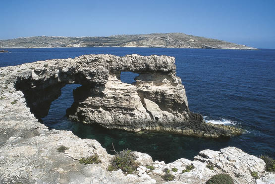
The shattered headland of Gemieri with Gozo seen far beyond (Walk 33)
The Maltese islands of Malta, Gozo and Comino bask in sunshine at the heart of the Mediterranean, between Europe and Africa, the Christian and Muslim world, on busy shipping lanes running north, south, east and west. Sicily is Maltas nearest neighbour, followed by Tunisia and Libya. History has ensured that the islands have been colonised time and time again in the name of trade, warfare, politics and religion, leaving them with a colourful and complex history and heritage, and defended by all kinds of fortifications. It is reputedly the most bombed country in the world. The islanders take a fierce pride in the independence won just over 50 years ago in 1964, and summertime seems to be an endless round of festivals and fireworks. The Maltese islands are a popular tourist destination. They offer plenty of historic walks, stunningly beautiful and dramatic architecture, and a surprising amount of excellent scenery away from the urban sprawl, especially around their cliff coastlines.
Location and population
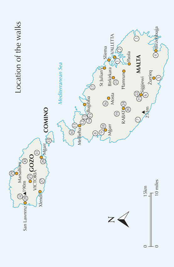
The islands of Malta, Gozo and Comino lie between 1412' to 1425'E and 3548' to 3605'N, approximately 95km (60 miles) south of Sicily and 290km (180 miles) from Tunisia and Libya. The combined area of the islands is only around 315km (122 square miles) about the same size as the Isle of Wight but the population is around 400,000, compared with around 30,000 for the Isle of Wight. In fact, Malta is one of the most densely populated micro-states in the world, and there are over a million visiting tourists per year, mostly from sun-starved northern Europe!

Looking along the rough and rocky coast from near Gar Lapsi (Walk 5)
Geology and landscape
In simple terms, the Maltese islands are part of the floor of the Mediterranean that crumpled upwards as the continental plates carrying Africa and Europe slowly crushed together. The forces unleashed are evident further north around the hot-spot Sicilian and Italian volcanoes of Etna and Vesuvius, as well as in the occasional earthquakes that shake the area. These forces have buckled and broken the Maltese bedrock so that it is severed by a number of fault lines. However, the basic geology is fairly simple, and the rocks seen on the island date only from the past 30 million years.

