About the Author
Paddy Dillon is a prolific walker and guidebook writer, with over 40 books to his name and contributions to 25 other books. He has written extensively for several outdoor magazines and other publications and has appeared on radio and television.
Paddy has fond memories of camping and walking on the Cleveland Way as a teenager, meeting his first long-distance walker on the trail. He later walked the route, extending his explorations to the Yorkshire Wolds Way, covering both trails twice, walking some stretches many more times, adding the Tabular Hills Walk later. Paddy uses a palmtop computer to write his route descriptions while walking. His descriptions are therefore precise, having been written at the very point at which the reader uses them.
Paddy is an indefatigable long-distance walker who has walked all of Britains National Trails and several major European trails. He lives on the fringes of the English Lake District and has walked, and written about walking, in every county throughout the British Isles. He has led guided walking holidays and has walked throughout Europe, as well as in Nepal, Tibet, and the Rocky Mountains of Canada and the US. Paddy is a member of the Outdoor Writers and Photographers Guild.
Other Cicerone guides by the author
Channel Island Walks
GR20 Corsica
Irish Coastal Walks
The GR5 Trail
The Great Glen Way
The Irish Coast to Coast Walk
The Mountains of Ireland
The National Trails
The North York Moors
The Reivers Way
The South West Coast Path
Trekking through Mallorca
Walking in the Canary Islands East & West
Walking in County Durham
Walking in Madeira
Walking in Malta
Walking in the Isles of Scilly
Walking in the North Pennines
Walking on the Isle of Arran
Walking the Galloway Hills
The Pennine Way
THE CLEVELAND WAY AND
YORKSHIRE WOLDS WAY
with the Tabular Hills Walk
by Paddy Dillon
2 POLICE SQUARE, MILNTHORPE, CUMBRIA LA7 7PY
www.cicerone.co.uk
Paddy Dillon 2005, 2010
First published 2005
ISBN-10: 1 85284 447 7
ISBN-13: 978 1 85284 447 9
Reprinted 2010 (with updates)
All photographs are by the author unless otherwise stated.
A catalogue record for this book is available from the British Library.
Printed by KHL Printing, Singapore
 This product includes mapping data licensed from Ordnance Survey with the permission of the Controller of Her Majestys Stationery Office. Crown copyright 2003. All rights reserved. Licence number PU100012932
Advice to Readers
Readers are advised that, while every effort is made by our authors to ensure the accuracy of guidebooks as they go to print, changes can occur during the lifetime of an edition. Please check Updates on this books page on the Cicerone website ( www.cicerone.co.uk ) before planning your trip. We would also advise that you check information about such things as transport, accommodation and shops locally. Even rights of way can be altered over time. We are always grateful for information about any discrepancies between a guidebook and the facts on the ground, sent by email to info@cicerone.co.uk or by post to Cicerone, 2 Police Square, Milnthorpe LA7 7PY, United Kingdom.
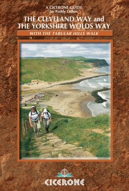
Front cover: Walkers following the Cleveland Way along the cliff coastline


The abrupt rocky western edge of the Cleveland Hills overlooks the lowland plains (Cleveland Way, Day 3)
INTRODUCTION
As a young teenager I pitched my tent for a week near Whitby, safely within sight of the chalet my parents had rented. One evening a man dropped his heavy pack to the ground beside my tent, and I watched in fascination as he sorted out his gear for the night. By the time I woke in the morning he was long gone. He was one of the first Cleveland Way walkers, and I dont know who he was or where he might be now, but I do remember wanting to follow him and see where that long trail went. My parents took me along the cliff path as far as Robin Hoods Bay, but the rest of the route remained a mystery to me for many years.
Eventually I got my chance to walk the Cleveland Way, and I have covered parts of the route many times since. I later walked the Wolds Way (recently renamed the Yorkshire Wolds Way), and the Tabular Hills Walk came last of all. I have now had the opportunity to walk all three routes afresh while researching this guidebook.
Each of the three routes is described in the guide, and walkers can complete them separately or link all three trails end-to-end in a long-distance walk of over 400km (250 miles). The whole distance could be completed comfortably within three weeks, even allowing for outward travel and return home. Together the three trails open up a wonderfully rich and varied landscape of cultivated countryside, intricate networks of dales, wild heather moorlands and dramatic cliff coastline, peppered with dozens of interesting little towns and villages.
The Yorkshire Wolds Way is usually walked from south to north, and extends over 130km (80 miles) from Hessle, near Hull on the Humber Estuary, to Filey. It traverses the Yorkshire Wolds, passing the villages of Welton, Brantingham, South Cave, North Newbald, Goodmanham, Londesborough and Nunburnholme. The central parts of the Wolds are sparsely settled, but the route includes Millington, Huggate, Fridaythorpe, Thixendale, Wharram-le-Street and Wintringham. The northern stretch of the route stays high on the Wolds, but passes Sherburn, Ganton and Muston on the way to Filey. For the sake of a days march, walkers can continue along the coast to Scarborough and Scalby Mills to join the Tabular Hills Walk.

The jagged outcrops of the Wain Stones rise in contrast to the gently rolling moors (Cleveland Way, Day 3)
The Tabular Hills Walk takes in the gentle, forested or cultivated southern parts of the North York Moors National Park between Scalby Mills, near Scarborough, and Helmsley, far inland. The route measures 80km (50 miles) and wanders through sparsely settled countryside between Scalby and Levisham, then includes the villages of Newton-on-Rawcliffe, Cropton, Appleton-le-Moors, Hutton-le-Hole, Gillamoor, Fadmoor and Carlton. When the Link reaches the bustling market town of Helmsley, walkers can pick up the Cleveland Way and continue along this route back to Filey.
The Cleveland Way essentially wraps itself round the North York Moors National Park, covering 177km (110 miles). It traverses the high, western moors and hills at first, where villages are few and far between, passing Rievaulx, Cold Kirby, Sutton Bank, Osmotherley, Carlton Bank, Clay Bank, Kildale, Slapewath and Skelton to reach the coast at Saltburn. From that point the route follows the coast and passes a variety of seaside towns and villages. These include Skinningrove, Staithes, Runswick Bay, Kettleness and Sandsend. The busy resort of Whitby is followed by Robin Hoods Bay, Ravenscar and the big, brash resort of Scarborough. All that remains is a days walk from Scarborough to Filey to bring the Cleveland Way to a close.




 This product includes mapping data licensed from Ordnance Survey with the permission of the Controller of Her Majestys Stationery Office. Crown copyright 2003. All rights reserved. Licence number PU100012932

