Cleveland Way
Alan Staniforth
How to use this guide
This guide to the 109 mile (175km) Cleveland Way National Trail is in three parts:
The introduction, with a background to the walk and the region and advice for those walking the route.
A detailed description of the route, divided into ten sections, each with its appropriate maps. The total length for each section includes the distance walked through towns and villages. This part of the guide also includes information on places and topics of interest en route. These are numbered consecutively both on the maps and within the text.
The last part of the guide includes useful information covering local transport, accommodation and equipment.
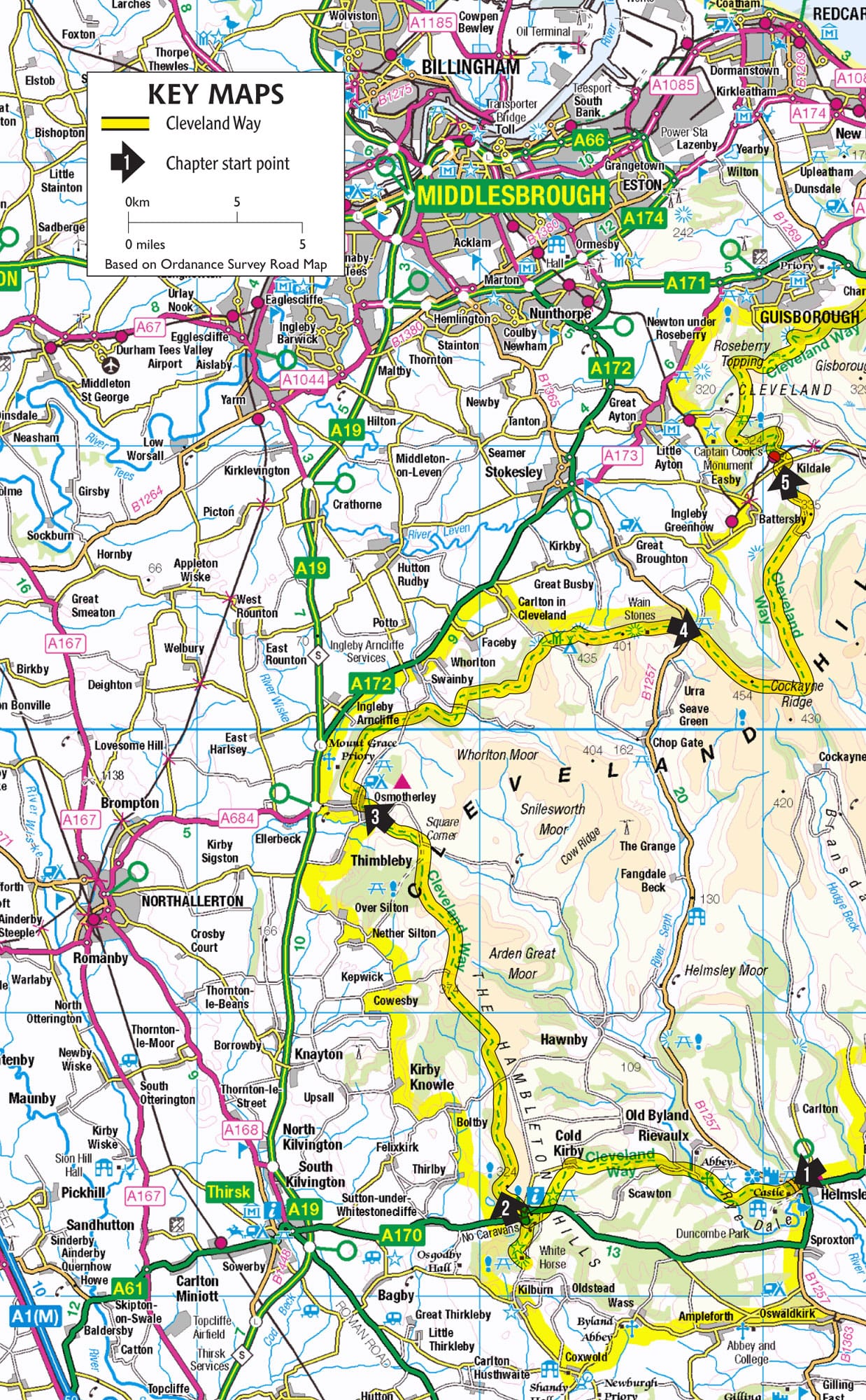
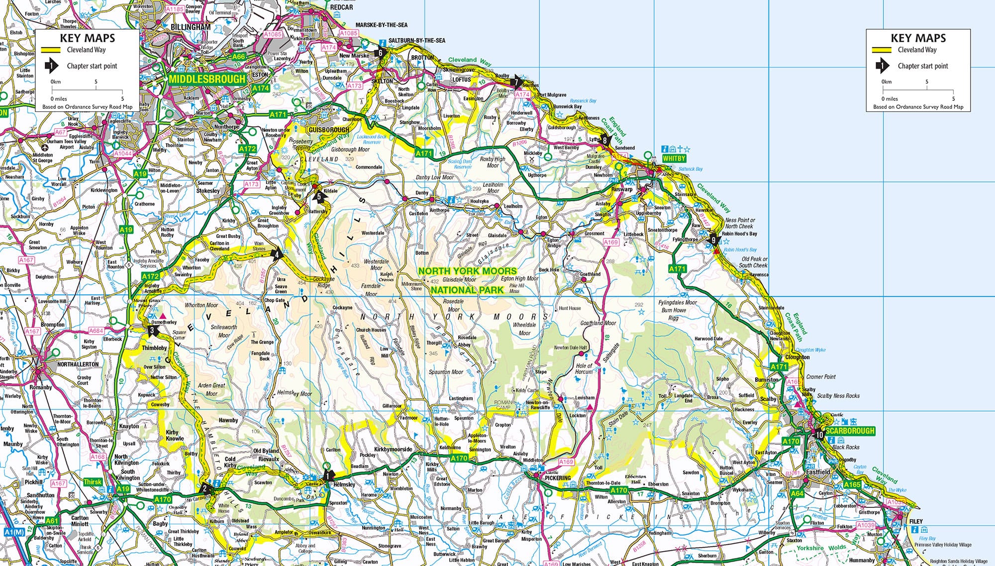
The maps have been prepared for this Trail Guide by the Ordnance Survey using the 1:25 000 Explorer or Outdoor Leisure map as a base. The line of the Cleveland Way is shown in yellow, with the status of the Trail footpath or bridleway, for example shown in green underneath. Walkers are reminded that virtually all the land over which the Way passes is privately owned; please do not stray from the path. The route is clearly signposted Cleveland Way and these signs are frequently supplemented with the distinctive acorn symbol used for all National Trails. Bold letters on the maps and in the text indicate important points to look out for while walking. Should any part of the Cleveland Way need to be diverted for maintenance work or for other reasons, the alternative route will be clearly marked on the ground.
Distance checklist
This list will assist you in calculating the distances between places where you may be planning to stay overnight, or in checking your progress along the way.
approx. distance from previous location |
miles | km |
Helmsley | | |
Rievaulx Bridge | 2.8 | 4.5 |
Cold Kirby | 2.9 | 4.7 |
White Horse | 3.1 | 5.0 |
Sutton Bank | 1.4 | 2.3 |
Sneck Yate | 2.4 | 5.5 |
Black Hambleton | 5.2 | 8.4 |
Osmotherley | 2.8 | 4.5 |
Scarth Nick | 2.9 | 4.7 |
Carlton Bank | 4.3 | 6.9 |
Clay Bank | 3.9 | 6.3 |
Bloworth Crossing | 3.2 | 5.1 |
Kildale | 6.0 | 9.7 |
Roseberry Topping | 4.3 | 6.9 |
Slapewath | 6.0 | 9.7 |
Skelton | 2.5 | 4.0 |
Saltburn | 1.9 | 3.1 |
Skinningrove | 2.9 | 6.3 |
Staithes | 4.9 | 7.9 |
Runswick | 3.4 | 5.5 |
Sandsend | 5.1 | 8.2 |
Whitby | 3.1 | 5.0 |
Robin Hoods Bay | 7.0 | 11.3 |
Ravenscar | 3.4 | 5.5 |
Scarborough (Corner) (North Bay) | 10.2 | 16.4 |
Scarborough (Spa) | 2.3 | 3.7 |
Cayton Bay | 2.9 | 4.7 |
Filey Brigg | 4.4 | 7.1 |
Preface
The beauty of walking the Cleveland Way lies in the great variety of landscapes through which you pass youll discover just why much of the Way lies within a National Park and a Heritage Coast. Attractive farmland, woods and heather moorland dominate the first half of the walk while dramatic cliffs, secluded coves and sandy beaches are your companions from Saltburn to Filey. Scattered throughout this ever changing vista you will find charming villages and historic edifices such as Helmsley Castle and Whitby Abbey, as well as the often more subtle remains left by ancient man. The effect of mans hand on the countryside will also be visible in bygone workings for once valuable minerals. The weather, whatever you encounter, will add another dimension to your experience while the North Sea will never appear the same from one day to the next.
The Cleveland Way is funded and promoted by Natural England and is liberally waymarked by signposts and the distinctive acorn symbol, a sign of quality used exclusively on the National Trails of England and Wales.
However you choose to walk the Way, this guide will keep you on the right track and provide useful, interesting and, hopefully, entertaining information to enhance your walk. Enjoy!
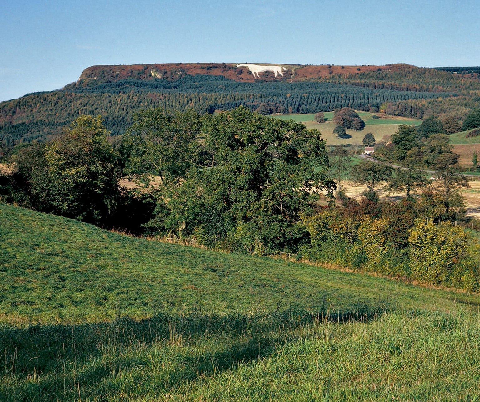
The Victorian White Horse at Kilburn, which is best viewed from a distance.
PART ONE
Introduction
The former fishing village of Staithes has great character and close links with the explorer Captain Cook.
Introduction
The landscapes of the 109 mile (175km) Cleveland Way range from high heather clad moorland to sheer coastal cliffs, from rolling farmland to steep inland escarpments, from sandy beaches to attractive woodland. Spread throughout these landscapes are ancient burial mounds, stone crosses, old routeways and relics of ancient industries. You will also see attractive villages and small towns with the occasional historic castle and abbey. In short, the Cleveland Way offers a variety of scenery rarely seen on any of the other National Trails throughout the country. Beginning in the old market town of Helmsley, the Way traces a horseshoe route around three sides of the North York Moors National Park, designated in 1952 for its magnificent scenery and wildlife. Following the path along the high western escarpment there are superb distant views over the Vale of Mowbray to the far hills of the Yorkshire Dales National Park. Further north the views extend across the valley of the River Tees to County Durham and beyond. For nearly half its length you follow the dramatic coastline from Saltburn to Filey, much of which forms the North Yorkshire and Cleveland Heritage Coast. Defined in 1974, this is one of a number of coastlines around England which are given special protection and where particular efforts are made for people to enjoy the area. The Way follows the undulating path clinging close to the cliff top and occasionally descending to the shore. The Cleveland Way has much to offer; take your time and savour its delights.


