Contents
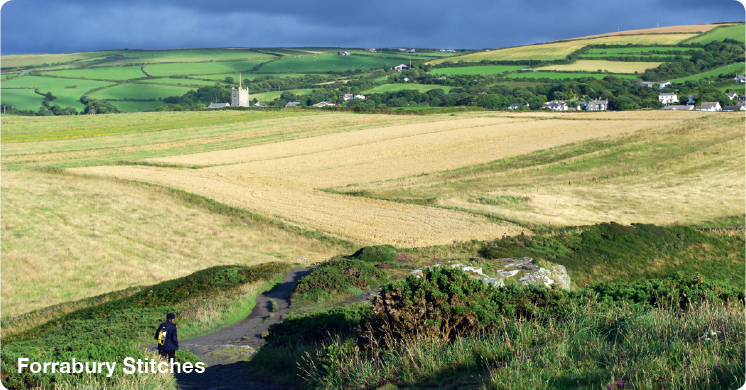
Crackington Haven
4 miles (6.5km) |
|
|
|
|
|
|
|
|
|
|
|
|
|
|
|
|
|
|
|
Walking in Cornwall
Cornwall is one of Britains principal holiday destinations. The county occupies the most southwesterly part of England, a peninsula bounded to the north and west by the Atlantic Ocean and warmed by the waters of the Gulf Stream to an extent that mild winters allow exotic plants to flourish in sheltered places. The sea is never more than 20 miles away and the coast is the main attraction of the county for most visitors. Inland, both the rugged landscape of moorland and the gentler scenery of woodland, valleys and farmland as well as the remains of over 5000 years of history are all worthy of exploration. There could be no better way to experience these landscapes than to follow one or more of the routes in this guide. The walks have been carefully chosen to introduce a cross section of countryside, with a selection of places of interest along the way.
Many of the walks include coastal sections and are well signposted for the South West Coast Path. In its entirety this National Trail runs for 630 miles (1014km) around the peninsula from Minehead in Somerset to Poole Harbour in Dorset. To enable the walker to experience selected sections of this path a few of the walks in this guide are planned using public transport to avoid a return journey on foot. In these cases the suggestion is to park your car at the destination and take the bus to the start point of your walk. Always check bus timetables carefully before setting out. Timetables are available locally and online.
Bus: www.westerngreyhound.com covers the Porthcothan to Mawgan Porth walk, the Penzance and St Michaels Mount walk and the Polperro to Looe walk.
www.cornwallpublictransport.info and www.hopleyscoaches.com covers the Hopleys Coaches service between St Agnes and Porthtowan.
Train: as part of the St Ives walk www.firstgreatwestern.co.uk has the timetable for the St Ives Bay Line.
Ferry: it is essential to check ahead for the seasonally operated Tamar Passenger Ferry for the Cotehele and Calstock route. The timetable is available at www.calstock-ferry.com
A tide timetable gives details of high and low water at various points so you can plan your walks, beach visits and ferry trips accordingly. A visit to Kynance Cove, for example, will be best at low tide when the rock formations are visible, and if you want to walk the causeway to St Michaels Mount then it is essential to visit at low tide. Buy a timetable locally in newsagents or garages, or check out times on the Internet.
Walking is a pastime which can fulfil the needs of everyone. You can adapt it to suit your own preferences and it is one of the healthiest of activities. This guide is for those who just want to walk a few miles. It really doesnt take long to find yourself in some lovely countryside. All the walks are five miles or less so should easily be completed in under three hours. Walking can be anything from an individual pastime to a family stroll, or maybe a group of friends enjoying the fresh air and open spaces of our countryside. There is no need for walking to be competitive and, to get the most from a walk, it shouldnt be regarded simply as a means of covering a given distance in the shortest possible time.
What is Cornwall ?
Cornwall is now classified as a county, but it was once a Celtic nation, like Brittany or Wales. This old Celtic Kingdom was where King Arthur and his knights were thought to have roamed, but history and legend have become so entwined that even historians cannot agree. What is certain is that Cornwall has been known for over a thousand years as a place of almost magical attraction.
Cornwall has retained a distinct cultural identity, a legacy from an historic isolation from the rest of the country. The county flag of St Piran, with its white cross on a black background, can be seen flying proudly in many places. The Cornish language was spoken until the 1700s and is still reflected in place names and surnames starting with Tre-, Polor Pen-, testifying to an ancient origin. Cornish is now a recognised minority language, which since the early 20th century has benefited from a conscious effort for revival.
Parts of Cornwall are often windswept and treeless, presenting an image of a land of austere grandeur. The wildest place is Bodmin Moor, with its rocky summit tors and boulder-strewn flanks. Cattle, sheep and ponies graze the coarse grasses, bracken and heather. Brown Willy is the countys highest point at 1377ft (420m). Along the coast of north Cornwall the sea has shaped dramatic coastal cliffs and steep-sided valleys. Here the land is gradually eroding under the relentless attack of the Atlantic Ocean. But despite this there are peaceful sheltered coves that are perfect for the holidaymaker, and the scenic beauty is without comparison. In contrast the southern coast provides gentler slopes, green fields and quiet bays of fine sand. The fishing villages are a photographers delight and everywhere the changeable maritime climate brings the clear light much loved by artists.
Geology
The dramatic and beautiful landscapes of Cornwall are largely a product of the geology beneath. The Lizard peninsula reveals the oldest rocks in the county, with a rare section of serpentine, formed deep in the Earths crust before being thrust up some 350 million years ago. However, as with the rest of the southwest peninsula, the greater part of the rock structure in Cornwall is of sedimentary origin, formed from beds of mudstone, sandstone and limestone laid down over 300 million years ago on the sea bed or on the beds of lakes. In some places river valleys cut deeply into these sedimentary rocks. In other places immense geological pressures have bent the strata into strange shapes, such as seen in the cliffs along the coast at Crackington Haven.
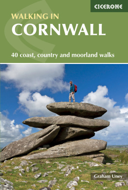
Rising out of this sedimentary plateau is the granite backbone of Cornwall. Granite is an igneous rock - one that has been thrust up in a molten state into the generally older sedimentary beds, cooling and hardening slowly, sometimes close to the surface. Forces such as the weather and sea have subsequently eroded it, leaving huge exposed bosses, or domes, of which Lands End and Bodmin Moor are examples. The granite of Bodmin Moor was formed 287 million years ago and weathering along lines of weakness in the rock has created the distinctive cheesewring formations often seen on the summits of tors such as Rough Tor. Neolithic Man also made his chamber tombs and entrance graves from the hard granite he found around him and this is one reason why there are more Neolithic remains in the Lands End peninsula than in the whole of the rest of the south-west.
As well as creating the familiar bold and rugged scenery, the formation of granite rocks also made possible the Cornish mining industry. Cooling molten granite had the effect, through immense pressures and heat, of radically changing the sedimentary rock with which it came into contact, forming liquids and gases that eventually solidified as mineral ores. The coastal strip near Lands End, as well as other areas such as St Agnes, are situated on these areas of contact - known as metamorphic aureoles - and this is where the ores of copper, tin and other metals such as silver and gold were found and exploited.

