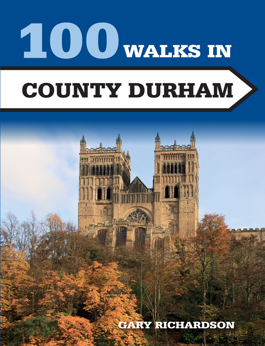
Gary Richardson - 100 Walks in County Durham
Here you can read online Gary Richardson - 100 Walks in County Durham full text of the book (entire story) in english for free. Download pdf and epub, get meaning, cover and reviews about this ebook. year: 2017, publisher: Crowood Press, genre: Home and family. Description of the work, (preface) as well as reviews are available. Best literature library LitArk.com created for fans of good reading and offers a wide selection of genres:
Romance novel
Science fiction
Adventure
Detective
Science
History
Home and family
Prose
Art
Politics
Computer
Non-fiction
Religion
Business
Children
Humor
Choose a favorite category and find really read worthwhile books. Enjoy immersion in the world of imagination, feel the emotions of the characters or learn something new for yourself, make an fascinating discovery.
- Book:100 Walks in County Durham
- Author:
- Publisher:Crowood Press
- Genre:
- Year:2017
- Rating:5 / 5
- Favourites:Add to favourites
- Your mark:
100 Walks in County Durham: summary, description and annotation
We offer to read an annotation, description, summary or preface (depends on what the author of the book "100 Walks in County Durham" wrote himself). If you haven't found the necessary information about the book — write in the comments, we will try to find it.
Gary Richardson: author's other books
Who wrote 100 Walks in County Durham? Find out the surname, the name of the author of the book and a list of all author's works by series.

100 Walks in County Durham — read online for free the complete book (whole text) full work
Below is the text of the book, divided by pages. System saving the place of the last page read, allows you to conveniently read the book "100 Walks in County Durham" online for free, without having to search again every time where you left off. Put a bookmark, and you can go to the page where you finished reading at any time.
Font size:
Interval:
Bookmark:
100 WALKS IN COUNTY DURHAM

THE CROWOOD PRESS
First published in 2017 by
The Crowood Press Ltd
Ramsbury, Marlborough
Wiltshire SN8 2HR
www.crowood.com
The Crowood Press 2017
This e-book first published in 2017
All rights reserved. This e-book is copyright material and must not be copied, reproduced, transferred, distributed, leased, licensed or publicly performed or used in any way except as specifically permitted in writing by the publishers, as allowed under the terms and conditions under which it was purchased or as strictly permitted by applicable copyright law. Any unauthorised distribution or use of thistext may be a direct infringement of the authors and publishers rights, and those responsible may be liable in law accordingly.
British Library Cataloguing-in-Publication Data
A catalogue record for this book is available from the British Library.
ISBN 978 1 78500 307 3
Front cover: Shutterstock
Mapping in this book is sourced from the following products: OS Explorer 304, 305, 307, 308, OL31
Crown copyright 2016 Ordnance Survey. Licence number 100038003
Every effort has been made to ensure the accuracy of this book. However, changes can occur during the lifetime of an edition. The Publishers cannot be held responsible for any errors or omissions or for the consequences of any reliance on the information given in this book, but should be very grateful if walkers could let us know of any inaccuracies by writing to us at the address above or via the website.
As with any outdoor activity, accidents and injury can occur. We strongly advise readers to check the local weather forecast before setting out and to take an OS map. The Publishers accept no responsibility for any injuries which may occur in relation to following the walk descriptions contained within this book.
Contents
How to Use this Book
The walks in the book are ordered regionally, and then by distance within each region, starting with the shortest and ending with the longest. An information panel for each walk shows the distance, start point (see below), a summary of level of difficulty (easy/moderate/difficult/strenuous), OS map(s) required, and suggested pubs/cafs at the start/end of walk or on the way. An introductory sentence at the beginning of each walk briefly describes the route and terrain.
Readers should be aware that starting point postcodes have been supplied for satnav purposes and are not indicative of exact locations. Some start points are so remote that there is no postcode.
M APS
There are 92 maps covering the 100 walks. Some of the walks are extensions of existing routes and the information panel for these walks will tell you the distance of the short and long versions of the walk, depending on whether you wish to combine two walks or tackle each singly.
The routes marked on the maps are punctuated by a series of numbered waypoints. These relate to the same numbers shown in the walk description.
Start Points
The start of each walk is given as a postcode and also a six-figure grid reference number prefixed by two letters (which indicates the relevant square on the National Grid). More information on grid references is found on Ordnance Survey maps.
Parking
Many of the car parks suggested are public, but for some walks you will have to park on the roadside or in a lay-by. Please be considerate when leaving your car and do not block access roads or gates. Also, if parking in a pub car park for the duration of the walk, please try to avoid busy times.
C OUNTRYSIDE C ODE
- Consider the local community and other people enjoying the outdoors
- Leave gates and property as you find them and follow paths
- Leave no trace of your visit and take litter home
- Keep dogs under effective control
- Plan ahead and be prepared
- Follow advice and local signs
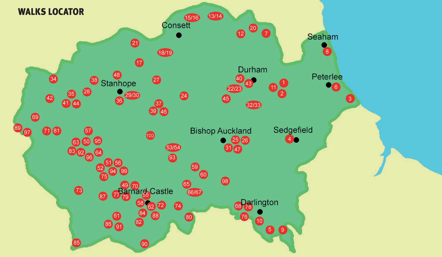
Walks Locator
WALK
Pittington Hill |
S TART St Laurences Church, High Pittington, DH6 1AB, GR NZ328435
D ISTANCE 2 miles/4.4km with 340ft/103m of ascent
S UMMARY An easy walk mainly along field paths, with one short steep climb
M APS OS Explorer 308 Durham & Sunderland; OS Landranger 88 Newcastle upon Tyne
P ARKING Small parking area adjacent to the church gates
W HERE TO EAT AND DRINK Hallgarth Manor Hotel, High Pittington, T0191-372-1188 www.hallgarthmanorhotel.com
A short walk around the environs of Pittington Hill, with great panoramic views from the top.
From the church go right along a footpath alongside the churchyard wall, follow this downhill, cross a footbridge and continue across the fields to Littletown Farm. Enter the farmyard via a gate and go left, passing in front of some houses, and then along the track to reach Coalford La. Cross this and turn right for a short distance to reach a track leading into Pittington Woods (1).
Turn left here and follow the path until you reach a track on the left; go down this to cross a bridge. Continue in the same direction uphill through the conifer plantation to reach another minor road. Go directly across and take the path which climbs steeply through the woods, passing an old quarry on the left to reach the edge of the wood (2).
There is no defined path across Pittington Hill from here, so go slightly left across some rough grass until you reach the edge of the field, then turn right and follow the field edge; where this stops, continue ahead in the same direction. There are great views from the highest point: on a clear day Durham Cathedral and the Penshaw Monument are visible. Continue downhill in the same direction, aiming for a metal gate at the bottom of the field. Dont go through this; turn left and double back slightly to reach a stile through the hedge. Follow the path through the woods to another stile, cross this and continue in the same direction. Shortly after exiting the woods you will come to a fork in the path (3).
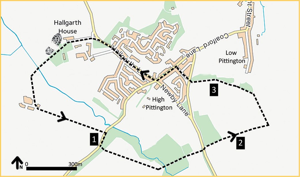
Take the right-hand fork and head downhill to reach a metal kissing gate, which gives access onto a minor road. Turn right and then go left down a road between houses to reach Coalford La again. Turn left and walk through the village to the crossroads, here turning right onto Hallgrath La. Follow this past the school, opposite the Hallgarth Manor Hotel. Where the road bends right, keep left and go down the lane towards St Laurences Church to reach the car park.
Points of interest
 Sheltered by a grove of elm and sycamore, the village of High Pittington was once the country retreat of the Prior of the Abbey of Durham.
St Laurences Church contains a Norman font, which was once sold for half a crown and used as a feeding trough at Belmont Farm; it was rediscovered in 1885 after 76 years.
WALK
Cassop Vale |
S TART Cassop Community Centre, Cassop, DH6 4RP, GR NZ344383
D ISTANCE 3 miles/5.2km with 400ft/120m of ascent
S UMMARY An easy walk mainly along field paths, with some climbing
M APS OS Explorer 308 Durham & Sunderland; OS Landranger 88 Newcastle upon Tyne
P ARKING Roadside parking outside the community centre
Next pageFont size:
Interval:
Bookmark:
Similar books «100 Walks in County Durham»
Look at similar books to 100 Walks in County Durham. We have selected literature similar in name and meaning in the hope of providing readers with more options to find new, interesting, not yet read works.
Discussion, reviews of the book 100 Walks in County Durham and just readers' own opinions. Leave your comments, write what you think about the work, its meaning or the main characters. Specify what exactly you liked and what you didn't like, and why you think so.