One
SUTTERS FORT THE BEGINNING OF IT ALL BY DYLAN MCDONALD
When John Sutter stepped off the schooner Isabella in 1839 and onto the bank of the American River, foremost on his mind was finding the ideal spot to begin building his colony. Key to his venture was selecting the right location in an area dominated by two rivers and numerous wetlands. The prevalence of water not only demanded high ground, so did the settlements remoteness from other western outpostsliterally an island in a sea of a native populous. While Sutters Fort was built in a defensive position, its back to the river with two bastions and numerous cannons, the location was also chosen to provide its owner with a central location to oversee his land. Making use of the transportation corridors and being close to the confluence of the American and Sacramento Rivers, Sutter was soon controlling the areas commercial and agricultural trade.
From this spot, Sutter oversaw his would-be empire despite the political struggles that enveloped California in the 1840s. Dependent upon native labor, eager to see his lands settled, and plagued by growing debt, Sutter saw his investment and dreams overrun by the masses struck by gold fever. By the end of 1849, just 10 years after its enthusiastic founding, the fort was sold, and Sutter retired to Hock Farm. Yet it is this spot, today known as Twenty-eighth and L Streets, which gave rise to the great city of Sacramento and, arguably, the great state of California.
Sutters Fort is one of Sacramentos most-visited tourist destinations and a source of pride for Midtown residents. However it might never have become such if not for the foresight of determined preservationists. As the fort lost its importance during the heyday of the gold rush, it fell victim to scavengers and the elements. Soon all that remained of the structure was the central building. Saved through the efforts of the Native Sons of the Golden West and the state legislature in the 1890s, today it is part of the states park system. Offering visitors the sights, sounds, and smells of 1840s California via living history programs, exhibits, and demonstrations, the fort truly is the beginning of any visit to Sacramento.
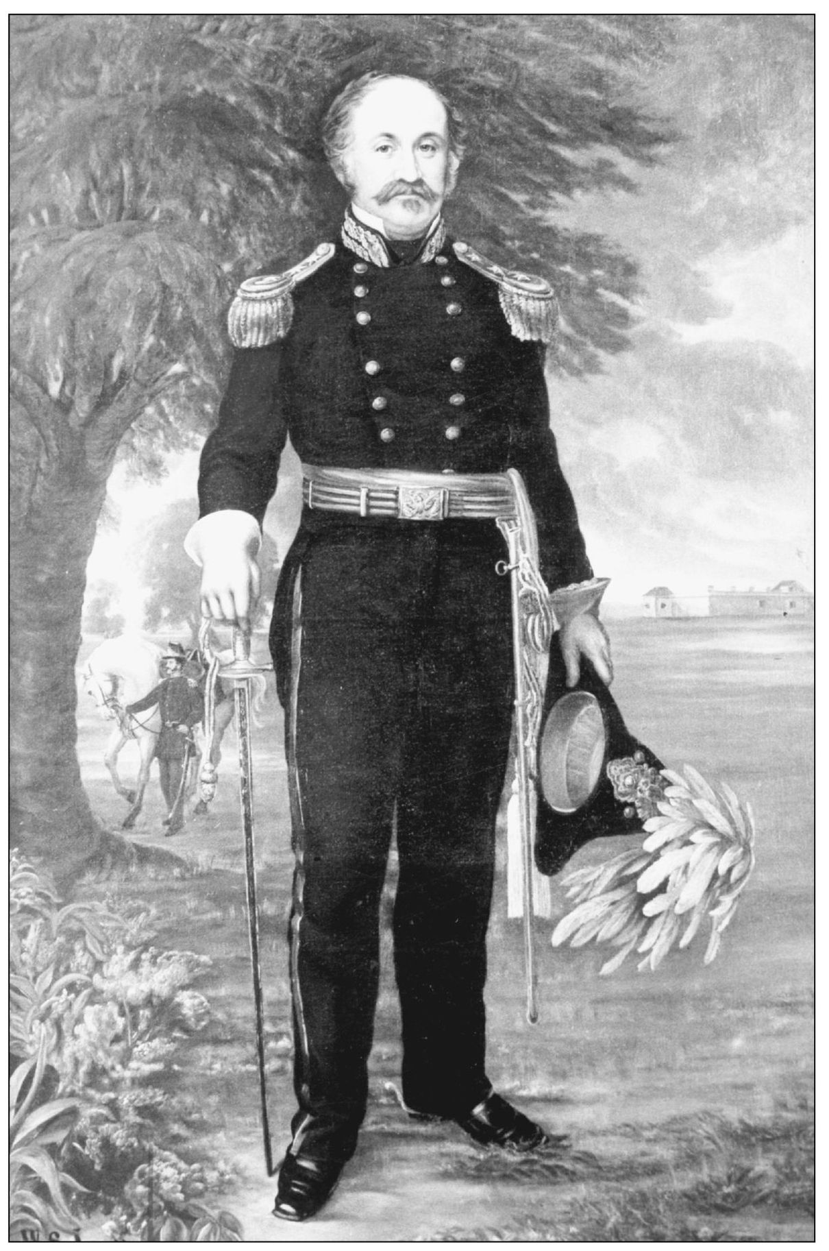
Undoubtedly one of Californias most recognizable figures, John Sutter left an enduring mark on the states history, government, geography, tourism, and ethnic relations. Born Johann Augustus Suter in February 1803 to Swiss parents living in Kandern, Baden (Germany), Sutter attended military school and then apprenticed at a bookbindery in Basle. Married at age 23 to Annette Dbeld, the young Sutter tried his hand unsuccessfully in various commercial ventures. With the strain of creditors and the responsibility to provide for a wife and four children, he looked toward the New World to improve his prospects. Leaving his family in the care of a brother, the eager traveler made his way to New York City in 1834. Over the course of the next few years, Sutter made his way west, stopping in St. Louis; Santa Fe; Fort Vancouver; Honolulu; Sitka, Alaska; Monterey; and finally to Yerba Buena (San Francisco), where the epic chapter began. This 1855 romantic painting, Portrait of General John A. Sutter by William Smith Jewett, was commissioned by the state and shows an aged Sutter regaled in his California militia uniform. (Courtesy Eleanor McClatchy Collection.)
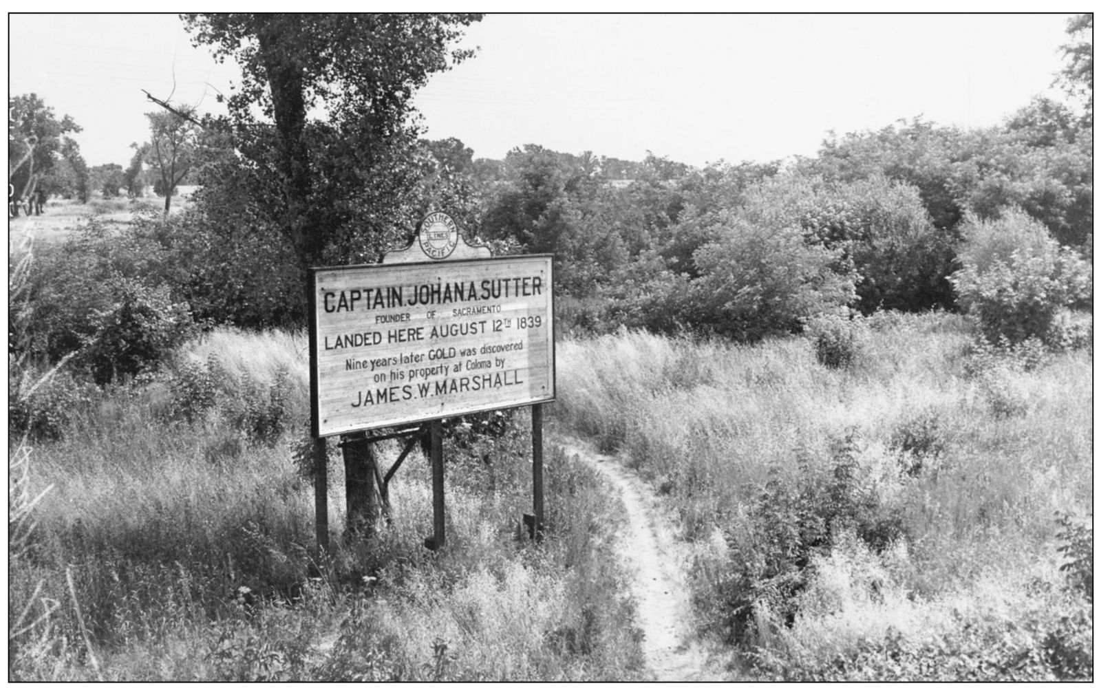
Having arrived in Mexican California, Sutter obtained permission from local governing officials to establish a colony in the interior. He soon chartered the schooner Isabella and two other boats, each loaded with provisions, tools, seeds, and guns, to journey up the Sacramento River. Leaving in early August 1839, the small fleet turned east at the mouth of the American River and landed near todays Twenty-eighth and C Streets on August 12. (Courtesy Eleanor McClatchy Collection.)
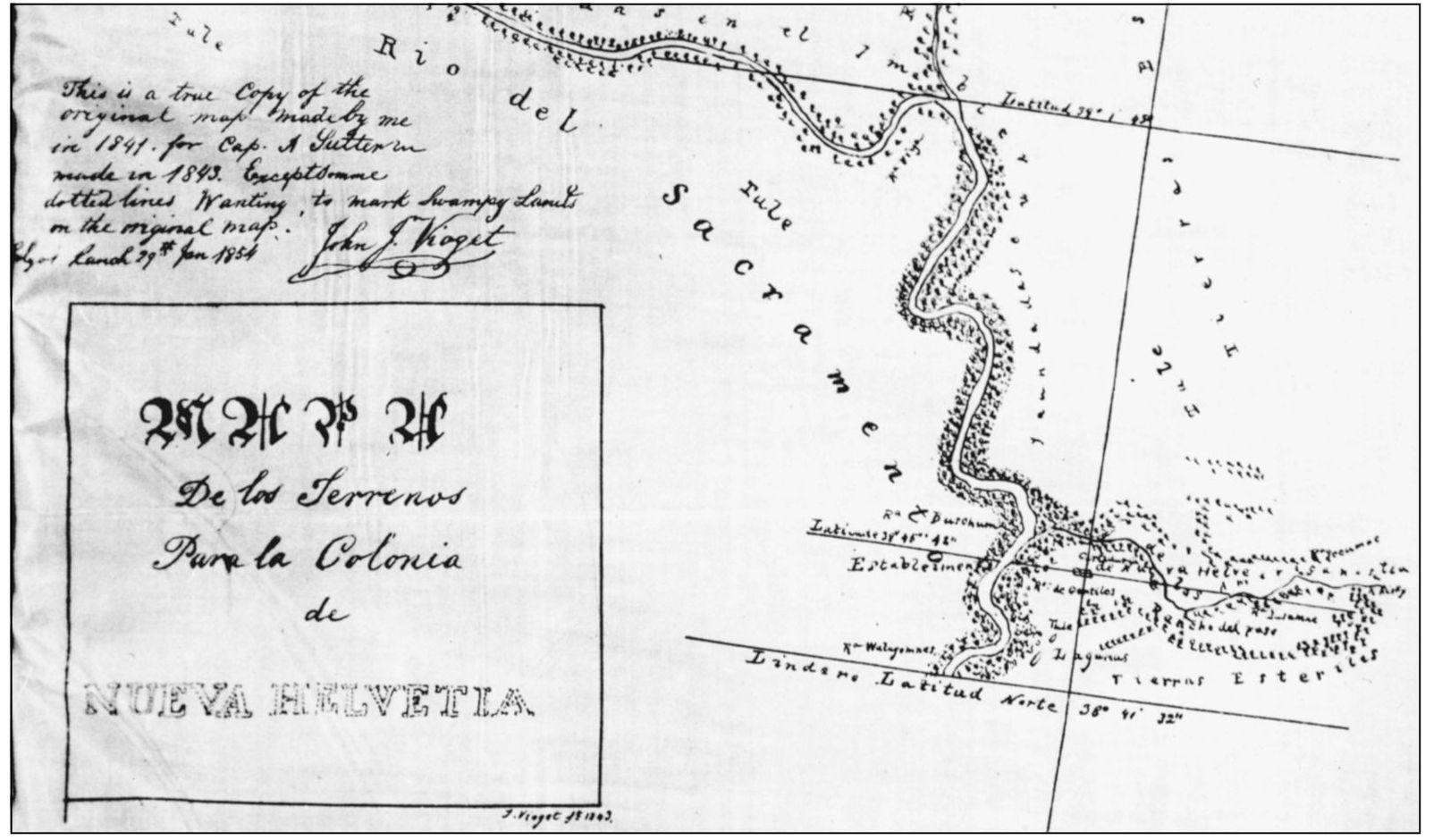
Sutter chose to build his colony about a mile from the landing site, on higher ground. With 14 other settlers, and soon with native help, Sutter began building his settlement, Nueva Helvetia (New Switzerland). He became a Mexican citizen in 1840 to secure title to the land, which was granted on June 18, 1841. This map by Jean Jacques Vioget shows a portion of the 11 leagues granted by Gov. Juan B. Alverado. (Courtesy Eleanor McClatchy Collection.)
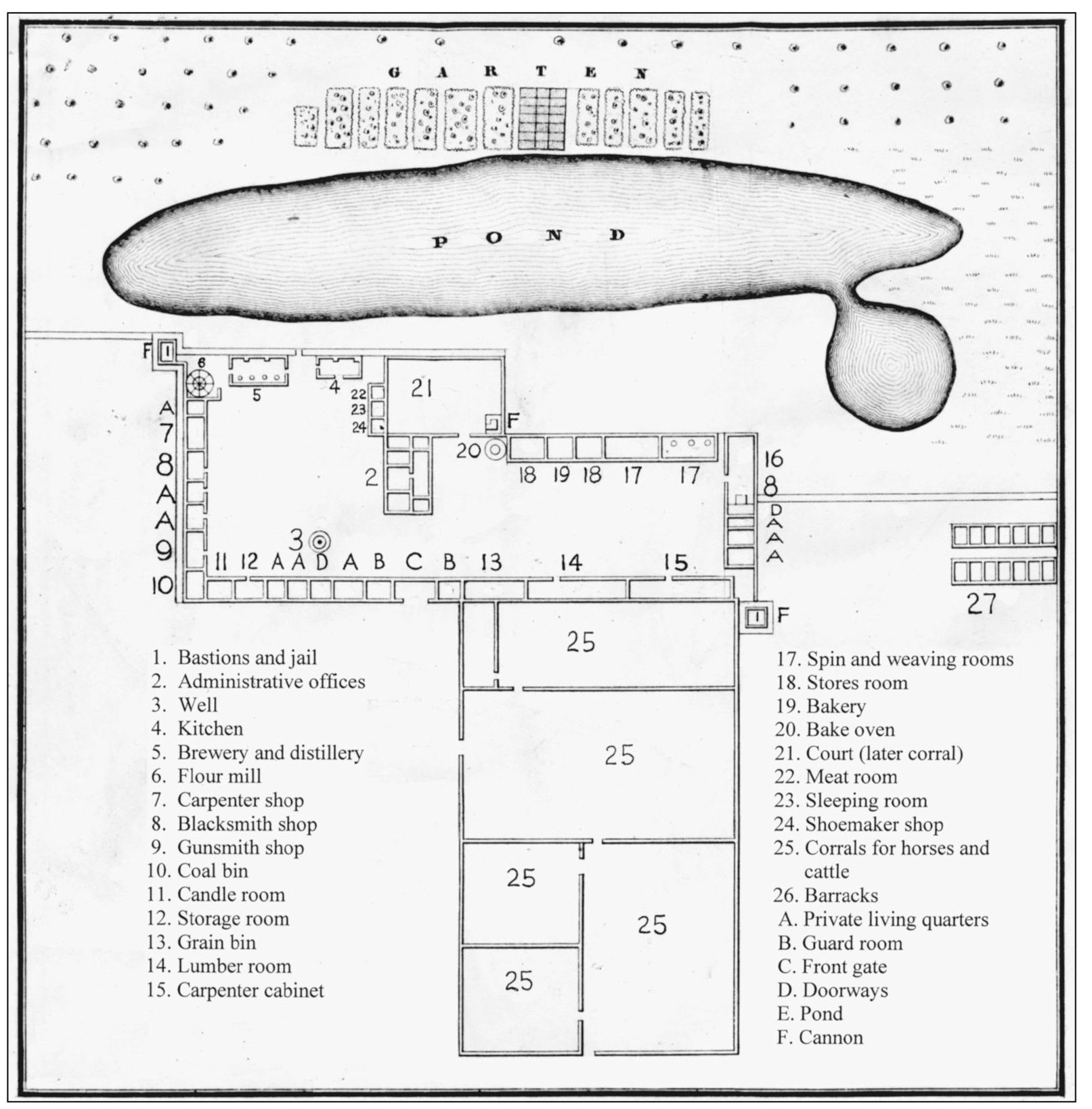
The Heinrich Kunzel map, first published in Germany in 1848 to promote German immigration to California, shows the footprint of Sutters Fort. Finished in 1844, the enclosure had two-and-a-half-foot thick adobe walls that were between 15 and 18 feet high. The fort had two bastions armed with cannons Sutter purchased in Hawaii and from Fort Ross. The maps key indicates what the rooms were thought to have been used for originally, although over the course of time their uses changed. The fort could accommodate around 300 persons during the day, although less than 50 actually called it home. When making a visit to the fort today, the only remaining structure from the original fort is the central building, indicated on the map by the No. 2. From this building, Sutter oversaw his nearly 48,000 acres, with its large native population and a growing number of settlers, in addition to his thousands of cattle, crops, tannery, fort, and later, a famous mill. This map was revised for publication in the Sacramento Bee , and it was translated from its original German to English. (Courtesy Sacramento Bee Collection.)

