Bill Yenne is the author of more than three dozen books on historical topics, as well as many large-format pictorial books for American and international publishers, including the acclaimed San Francisco Then & Now. He is a member of the San Francisco Aeronautical Society, the American Aviation Historical Society, and the American Society of Journalists and Authors. He is a graduate of the Stanford University Professional Publishing Course.
Mr. Yenne and his wife, Carol, have owned a home in Noe Valley for three decades and they raised both of their children, Azia and Annalisa, in Noe Valley. Carol owns Small Frys Childrens Store on Twenty-fourth Street and is an active member of the Noe Valley Merchants Association.
INTRODUCTION
In the heart of San Francisco, there is a quiet residential neighborhood that has earned a reputation for being a village within the city. A traditional working-class neighborhood, it gradually evolved into a highly desirable residential area for people who sought to have the amenities of a smaller village without having to leave the confines of the city. By the beginning of the 21st century, it was seen as being one of the two or three most desirable residential areas within the city.
Located in the geographical center of the City and County of San Francisco, the district is in the valley formed by Glen Park to the south, Diamond Heights to the southwest, Twin Peaks to the west, and by the line of hills that include Alvarado Heights and Dolores Heights to the north. The generally accepted boundaries of Noe Valley are Grand View Avenue on the west, Twenty-first Street on the north, Dolores Street on the east, and Thirtieth Street on the south.
At the northeast corner of Noe Valley is the section bounded by Twentieth, Twenty-second, Dolores, and Mission Streets that was designated in 1985 by the San Francisco Landmarks Preservation Advisory Board as the Liberty Hill Historic District.
The other adjacent neighborhoods include Twin Peaks to the west, Eureka Valley to the north, Glen Park to the south, and the Mission District to the east. Indeed, Noe Valley was long considered a sub-section of the Mission District. Both shared the old Mission telephone exchange, evidence of which is seen in the numerous 64-prefix telephone numbers that still exist throughout both the Mission District and Noe Valley.
The heart of Noe Valley is the shopping district that extends along Twenty-fourth Street from Douglass Street to Church Street, mainly in the blocks between Castro and Church Streets. An additional, smaller shopping district is located on Church Street between Twenty-seventh Street and Thirtieth Street.
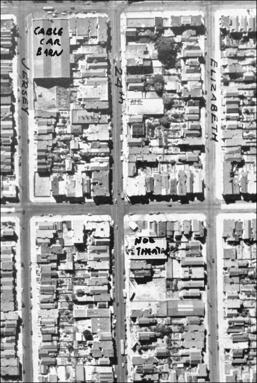
This photo centers on the corner of Twenty-fourth Street and Noe Street, showing Noe Valley as it appeared in 1937. For the most part, these buildings are still as they appear in this photograph. On the lower right corner of the intersection is what was then Charles Schroyers gas station. A large vacant lot exists on the site where Bell Market would be built in 1968. In the interim, various businesses would occupy this site. At the bottom, we can see the Number 11 street car making its way west on Twenty-fourth Street, while at the top, the Castro Street Cable Car is just opposite the Cable Car Barn headed south to the turntable one block away. (U.S. Army photo, courtesy of the Noe Valley Archives.)
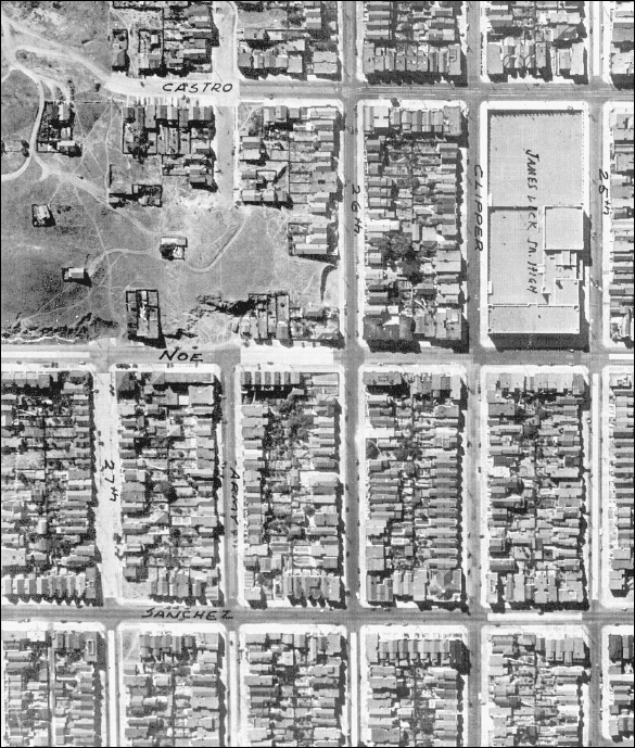
This 1937 aerial view by the U.S. Army Air Corps shows the point where Castro Street ended and became a dirt road, before the extension was paved and named Newburg Street. The cable car turntable at Twenty-sixth and Castro Streets is also visible. (U.S. Army photo, courtesy of the Noe Valley Archives.)
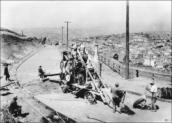
Noe Valleys Alvarado Heights can be seen in the distance of this 1916 view looking northeast from the slopes of Twin Peaks. Crews are paving what was then Corbett Road, and now Corbett Avenue. Just below Corbett is Market Street, and just beyond that, the western edge of Noe Valley. (Courtesy authors collection.)
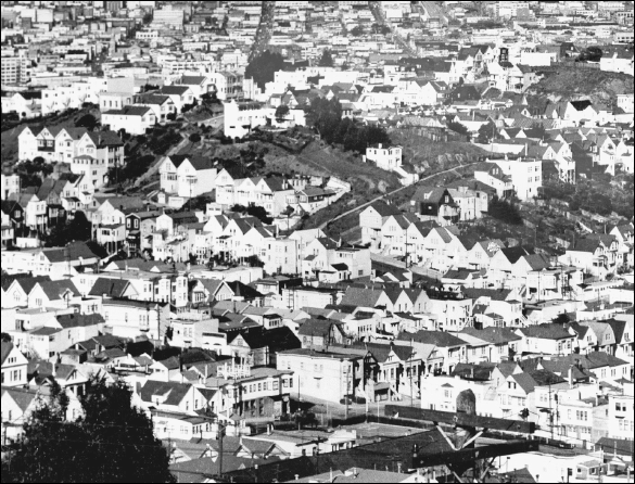
This view of Alvarado Heights was taken c. 1940 looking east from the same angle as the previous photograph. The tennis courts at the corner of Douglass and Elizabeth Streets can be seen at the bottom center. The paved trail on the north side of Alvarado Street above Diamond Street can be seen arcing across the hillside. This hillside would remain mostly vacant for another two decades. (Courtesy authors collection.)
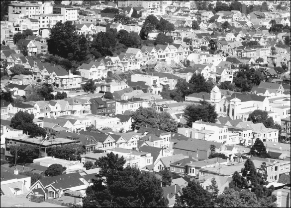
Alvarado Heights can be seen upper left in this recent photograph of western Noe Valley. The line of Queen Anne Victorian high houses along Twenty-third Street east of Diamond Street runs across the top center of this view. St. Philips Church is on the right. (Photo by Bill Yenne.)

