ACKNOWLEDGMENTS
The community that this book honors was named for the author of Two Years Before the Mast . When I worked with Dana Points civic leaders to found a local historical society, I hardly realized that it would come to pass two years before the city, which would incorporate in 1989.
I saw the need to delineate the origins and development of the transitioning communities in order to instill pride in their historic roots. Most of the residents then were new to the area and unaware of the colorful heritage of this segment of Southern California coast, which was also endowed with an especially dramatic geological backdrop.
Fine individuals have stepped forward through the years since to serve as officers, directors, docents, specialists, and speakers. Through their collective efforts, the society has grown in strength, purpose, and accomplishments to become a leading voice in current, as well as historical, affairs. Im proud of the ensemble.
When it comes to the authors task of recording the text, word for word, comma for comma, of a bookand this is my 12thit becomes a solo adventure. All the information, the implications, the outline, and the editorial and space requirements must come together in the authors mind with the challenge of producing the best possible end product, page by page, chapter by chapter, from them all. The readers are the ultimate judges.
Along the road to that end, there are individuals and resources that are greatly appreciated and must be mentioned. In the Images of America series, the photography comes first. My own collection of images compiled during 44 years in Dana Point provided most of those in this book, including very many I captured with my own inquisitive cameras.
For further photographic resources, I recommend the collections of the Dana Point Historical Society, the Orange County Archives, and the photographic library of First American Corporation, which has also preserved negatives of the entire countys past. Film negatives are themselves becoming historic relics in this digital age. One image in this book comes from an even rarer glass negative (see page 40).
I am especially grateful for the photographers of earlier eras, many unidentifiable now. Their fine work is essential to us. They were artists of the camera, as is Cliff Wassmann of Dana Point in our own era.
To confirm various morsels of information, I turned to several individual specialists. They all have my sincere appreciation for lending their meaningful thoughts. Then there was ever faithful, long-time Dana Point Historical Society officer Judy Henderson. She pondered and proofed my text as I figured and fingered out each chapter digitally.
Special thanks go to my husband, Jack Pierson Smith, who sidetracked me sometimes but has always supported my editorial endeavors. Im appreciative, too, of being able to work with a personable editor like Arcadias Jerry Roberts, who balanced Dana Point well with the many other books he juggled simultaneously. The proof is in the publishing!
Find more books like this at
www.imagesofamerica.com
Search for your hometown history, your old
stomping grounds, and even your favorite sports team.
One
THE NATURAL SETTING
San Juan [now Dana Point] is the only romantic spot in California. The country here for several miles is high table-land, running boldly to the shore, and breaking off in a steep hill, at the foot of which the waters of the Pacific are constantly dashing. For several miles the water washes the very base of the hill, or breaks upon ledges and fragments of rocks which run out into the sea.
Richard Henry Dana Two Years Before the Mast
GREAT ROCK WALL. Most of the more than 7-mile coast of todays City of Dana Point is set upon high marine terraces that were once segments of the ocean floor, uplifted eons ago by cataclysmic earth eruptions. The terraces south of the headlands within Dana Point Harbor continue up to todays Doheny State Beach. The citys modern residential neighborhoods offer varying vistas of the seacoast, the Capistrano Valley, and the Santa Ana Mountains.
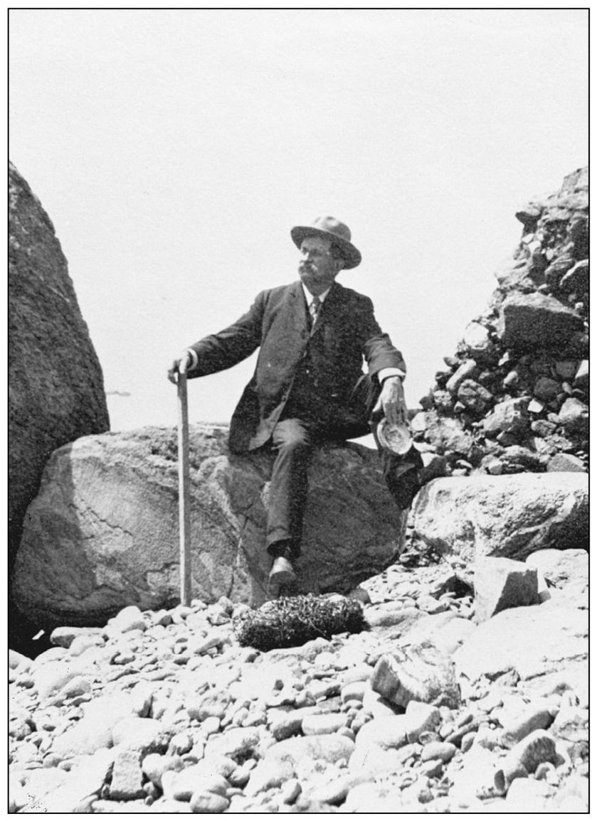
ROCKY REACHES. This early 20th-century visitor, while passing though, chose to be photographed within a rocky coastal setting. He holds the shell of an abalone, a species quite abundant and sought after along the south Orange County coast in those days. Because the bluffs were then uniformly planted with lima beans from Irvine to Oceanside, the only access to an ocean view would have been achieved by walking between the rigid rows of plants.
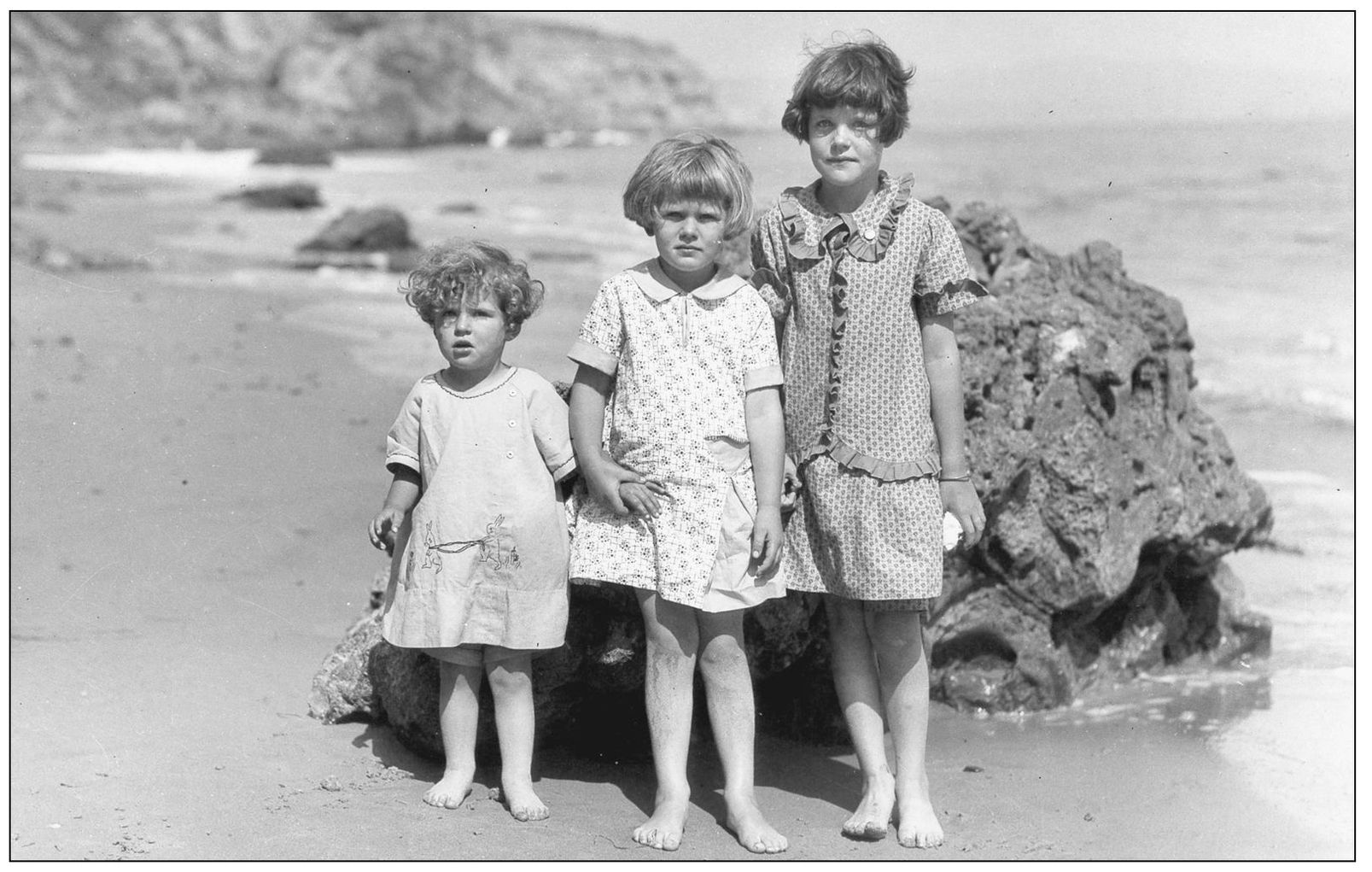
ANCIENT ROCK AND YOUNG ADMIRERS, 1920s. The rocks that circle the coves of Dana Point are a special focus for geologists. This huge boulder fell from the oldest formation of all, the Dana Point headlands. It is formed of angular rocks cemented within a hard matrix. They include rare schist rock formed about 150 million years ago. A walk along the base of the headlands reveals this blue schist embedded within a rosy-colored foundation.
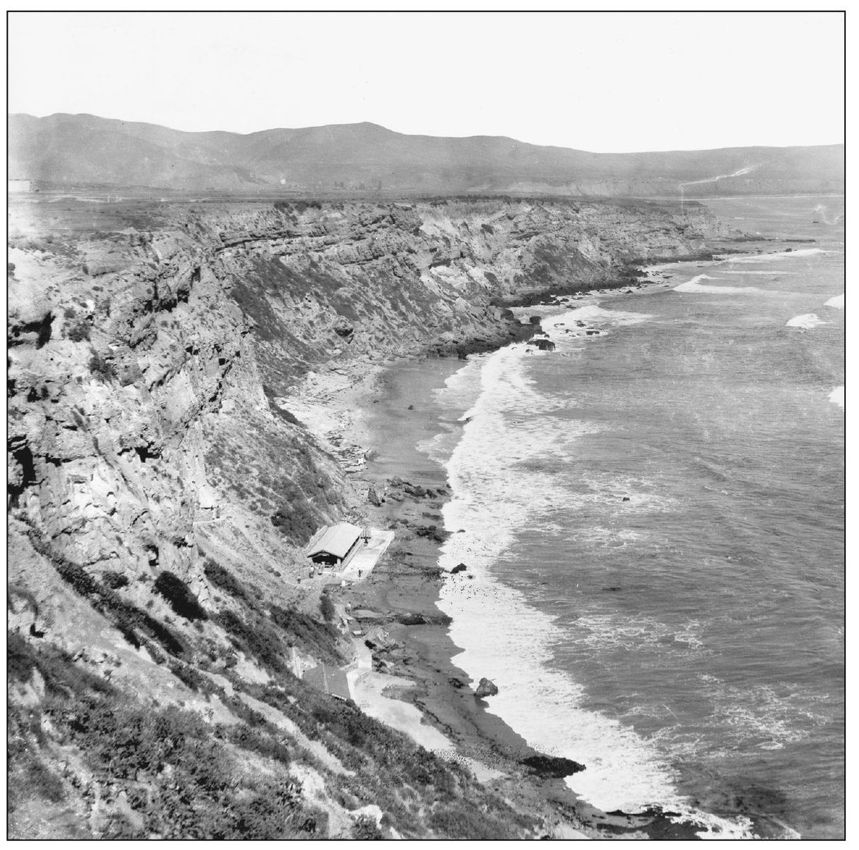
SCENIC INN, 1924. Though there was no natural access to the narrow, rocky beach at the foot of the Dana Cove cliffs, and despite its isolation at high tide, the first planned development on the bluff-tops had this secluded Scenic Inn built of native beach rock. The shelter was an enticement for hardy lot shoppers, who were served promotional picnics that featured local lobster. A winding foot trail cut along the bluff-side gave access to this glorious scene.
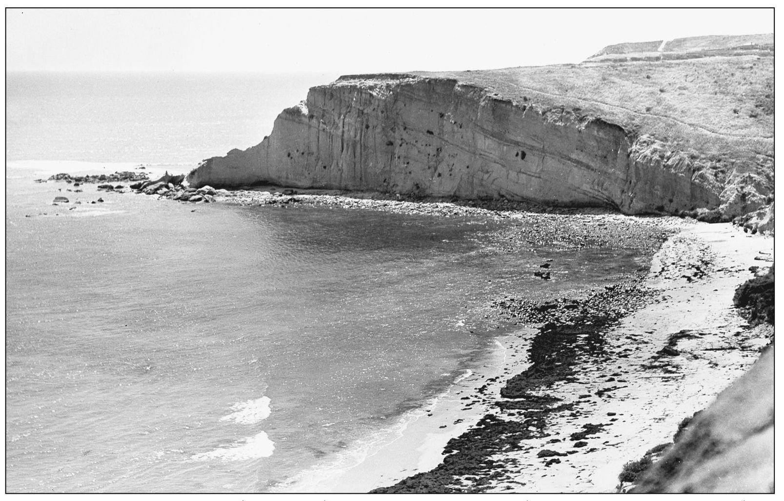
PICTURESQUE EROSION. The fine-grained beige siltstone cliffs have eroded over the ages from the forces of wind and weather, magnifying their beauty to the beholder. Pockets in their pleasingly eroded sides become natural flowerpots for rare native succulents. The swallows that brought romance to nearby Mission San Juan Capistrano once built their nests in the orifices of Dana Points oceanfront cliffs, hence their name cliff swallows. (Photograph by the author.)
SAN JUAN POINT, 1920s. This secondary point once projected into Capistrano Bay south of the Dana Point promontory that marks the north end of Capistrano Bay. That was the natural anchorage for ships bringing supplies for Mission San Juan Capistrano, which lies three miles inland. It was the only shelter for ships between San Diego and San Pedro during 1800s hide-trading days. Capistrano Bay ends at San Mateo Point in south San Clemente.

