IMAGES
of America
BIENVILLE PARISH

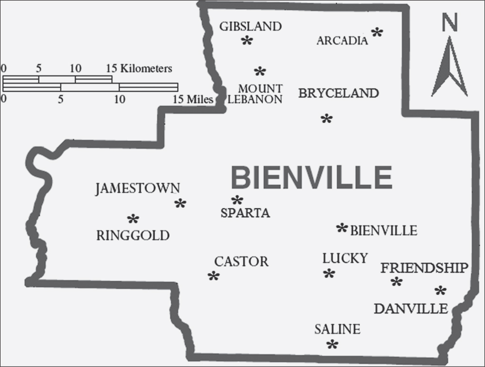
Bienville Parish, in northwest Louisiana, covers about 822 square miles. This map of the parish will be a useful reference throughout the book. focuses on the southern portion of the parish. (Courtesy of the author.)
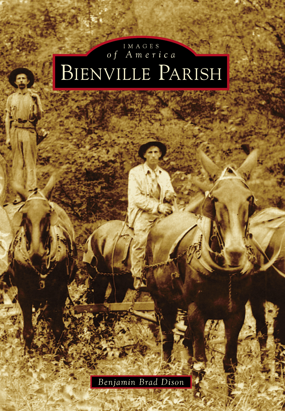
ON THE COVER: Bienville Parish can link its initial growth and prosperity to the timber industry. At the turn of the 20th century, the parish experienced an economic boom. Logging crews, such as the one in the photograph, moved into the area with their families to harvest the virgin pine forests and transport the trees to one of many local sawmills. The timber industry continues to be an important part of the local economy. (Courtesy of Mary Hamner.)
IMAGES
of America
BIENVILLE PARISH
Benjamin Brad Dison

Copyright 2014 by Benjamin Brad Dison
ISBN 978-1-4671-1191-1
Ebook ISBN 9781439645307
Published by Arcadia Publishing
Charleston, South Carolina
Library of Congress Control Number: 2013954630
For all general information, please contact Arcadia Publishing:
Telephone 843-853-2070
Fax 843-853-0044
E-mail
For customer service and orders:
Toll-Free 1-888-313-2665
Visit us on the Internet at www.arcadiapublishing.com
I dedicate this book to my brother Jereme Dison.
Without his help, this book would not have been possible.
CONTENTS
ACKNOWLEDGMENTS
I would like to express my sincere gratitude to the following for allowing me to reproduce their photographs in this history of Bienville Parish: Bert Davis, Bruce Evans, Cheryl Babers, Donna Sutton, Keith Vincent, Lavon Sullivan, Mary Crochet, Mary Hamner, Muriel Sullivan, Nanette Choate, Pat Mathews, Wanda Culpepper, Galen White of the Louisiana & North West Railroad, the wonderful volunteers at the Stage Coach Trail Museum, Saline High School librarian Rebekah Barnett, the Bienville Democrat, and the agents of the Federal Bureau of Investigation. I would also like to thank my aunt Lavon Sullivan for helping me contact contributors; my brother Jereme for the countless hours he spent helping me edit photographs; and Victoria Sheppard for helping me scan all of the photographs in this book.
INTRODUCTION
On March 14, 1848, the Louisiana State Legislature divided Claiborne Parish in half and named the lower portion Bienville Parish, in honor of French Canadian explorer Jean-Baptiste Le Moyne, Sieur de Bienville. He had served as the governor of French Louisiana for four separate terms, a total of 30 years, and is credited as the founder of New Orleans. Although the parish bears his name, Bienville explored the Gulf of Mexico coastline and the mouth of the Mississippi River, and never traversed what is now Bienville Parish.
In the 1830s, Reuben Drake left his home in South Carolina and scouted for land in Louisiana to which to move his family. They established the first permanent settlement in what became Bienville Parish and named it Mount Lebanon. As they were devout Baptists, the early pioneers quickly built a church and school, which became the focus of the community. By 1853, the school had grown into Mount Lebanon University. At first, the university was a mens college, but it soon converted to a coed college. During the Civil War, classes were suspended as the Confederacy commandeered the college and used the campus as a hospital for sick and wounded soldiers. After the war, Mount Lebanon University resumed its classes. In 1906, following years of financial troubles, the school was consolidated into Louisiana College in Pineville, Louisiana.
Over time, small communities developed throughout the region, but Bienville Parish was sparsely populated during the 19th century. Until the last decade of the century, the small town of Sparta was the cultural and political center of the parish. Sparta had no immediate access to a navigable waterway, and all goods and supplies were transported overland by horse-drawn wagons. Visitors to the region wrote to their families about the vast acreage of virgin pine timber. Entrepreneurs quickly realized the potential profits that pine lumber could bring, but they lacked the infrastructure to move the harvested lumber to market.
In the late 1880s, workers completed the Vicksburg, Shreveport & Texas Railroad, an east-west railway that passed through the northern portion of Bienville Parish and bypassed Sparta. The community of Arcadia was originally located about a mile south of the railroad, and its citizens moved the town to its present location to be along the rail line. Towns along the railroad, such as Arcadia and Gibsland, became boomtowns, and communities that were bypassed, such as Sparta and Sailes, began to decline. Citizens of Arcadia, Bienville, and Gibsland rallied for a more suitable parish seat and held an election to decide the matter. Shortly after the election results were in, several wagons pulled up beside the courthouse in Sparta, and the wagon drivers haphazardly loaded the parish records destined for Arcadia. Controversy still surrounds the midnight raid, as many citizens of Bienville continue to argue that the parish seat was stolen.
In the latter part of the 19th century, the population in Bienville Parish grew rapidly due to the booming timber industry. Railroad companies built more miles of track throughout the parish to reach the remote pine trees. Teams of woodcutters built temporary wooden-railed railroads, called trams, to transport the fresh-cut timber to the main railroad line. Once loggers exhausted the timber supply along the tram, they moved to another location. Mill companies built sawmills along the route of the railroad to process the rough timber into finished lumber. The timber industry required a large number of workers, and multitudes of people arrived with their families seeking new opportunities. Many sawmills in the parish paid their employees with tokens or company notes that could only be spent at the sawmills company stores, called commissaries.
Towns grew around the sawmills. As the infrastructure grew, other support businesses came in and provided opportunities besides those immediately involved with the timber industry. Each town had different enterprises that supported the workers in the region, providing a number of goods and services, including general stores, millineries, hotels, restaurants, and cotton gins. These businesses also played an important role in the developing communities. They served as gathering places for people to form community bonds and aided in the creation of settlements that would outlast the timber industry.
Farmers in the region were putting the newly cleared land to good use. They planted a variety of crops, including corn, beans, and tomatoes, but perhaps the most well-known was watermelons. The sandy soil around villages like Saline provided the ideal conditions for a bumper crop. Workers at the packing mill in Saline loaded crops onto train cars destined for distant locations. Saline became synonymous with watermelons, and Saline Watermelons were shipped worldwide.
Churches and schools were the foundations of the early communities. Most towns had a single one-room building that functioned as a school during the week and as a church on weekends. For many farmers in the parish, churches provided the only source of activity away from their farms. In the 1920s, motorized buses transported students over longer distances in a shorter period of time, and the several small schools consolidated into newly built multiroom schools. Although churches and schools no longer used the same building, they continued to bind many residents to the region.
Next page


