IMAGES
of America
ST. MATTHEWS
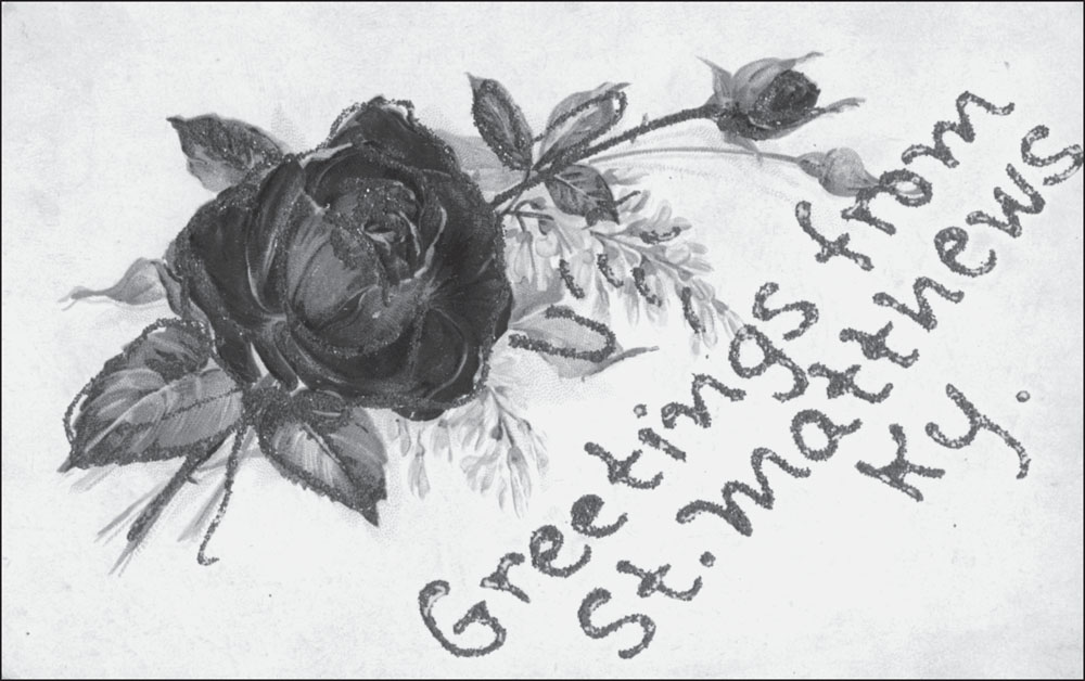
GREETINGS FROM ST. MATTHEWS. This postcard is typical of greetings from cards that were popular between 1905 and 1920. Some were printed, while others, like this one, utilized a generic design and left space for the sender to write in the name of the city or town. (Authors collection.)
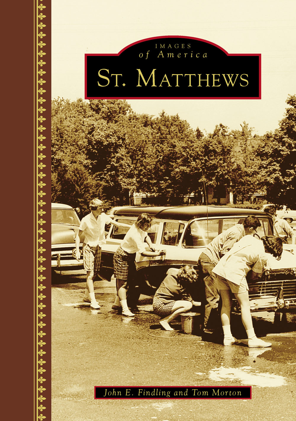
ON THE COVER: BEARGRASS CHRISTIAN CHURCH YOUTH CAR WASH. Every youth group in St. Matthews has sponsored (and continues to sponsor) a car wash like this one at Beargrass Christian Church. In 1959, the youth program at Beargrass was in high gear with a revised Sunday school program, boys basketball teams, an expanded Scouting program, and the completion of a youth lounge. (Courtesy of Beargrass Christian Church.)
IMAGES
of America
ST. MATTHEWS
John E. Findling and Tom Morton

Copyright 2015 by John E. Findling and Tom Morton
ISBN 978-1-4671-1494-3
Ebook ISBN 9781439654248
Published by Arcadia Publishing
Charleston, South Carolina
Library of Congress Control Number: 2015941348
For all general information, please contact Arcadia Publishing:
Telephone 843-853-2070
Fax 843-853-0044
E-mail
For customer service and orders:
Toll-Free 1-888-313-2665
Visit us on the Internet at www.arcadiapublishing.com
Tom dedicates this book to KELSTKMNLCCJ: they know who they are; John dedicates this book to the memory of Joe Cole and Larry Maurer.
CONTENTS
ACKNOWLEDGMENTS
This book could not have been completed without the very generous help from many individuals and organizations. David Morgan of the Beargrass-St. Matthews Historical Society permitted us to use images from its archives, and Ann Rockwell and Dustin Strong of the St. Matthews Eline Memorial Library gave us a place to work and meet with local people who had photographs and stories to share. Most of the churches in St. Matthews likewise shared their photographs with us, as did the Sam Swope Auto Group and the St. Matthews Chamber of Commerce. Mary Margaret Bell of the Jefferson County Public School archives led us to information about the public elementary and high schools in the community, and Barbara Mullen, archivist at Trinity High School, graciously permitted us to scan images. Jamie Dumstorf at Waggener High School opened the schools archives for us. Other individuals in St. Matthews who took the time to find and lend us photographs from their families past include Sidney W. Eline Jr., David Kraft, Bernie Bowling, and Al Ring, whose website (see ) contains a world of information about St. Matthews. Others who helped us with photographs or in various other ways include Judy Steinhauer and Mary Sue Ryan of the Girl Scout Council of Kentuckiana, Ellen Kaelin Venhoff, Carol Tobe, Tom Zehnder, Tom Owen, Bob Moore, Ken Draut, Mike and Rich Ochsner, Julie Garrison of Baptist East Hospital, Shirley Harmon of Norton Hospitals, Shiela Wallace of the Jewish Community Center, Marsha Burton of the Inn at Woodlawn, and Marty Perry of the Kentucky Heritage Council.
In the photograph credit lines, we have used the following abbreviations where appropriate: Archdiocese of Louisville (AOL), Beargrass Christian Church (BGCC), Beargrass-St. Matthews Historical Society (BGSTMHS), Bethel-St. Paul Church (BSP), Harvey Browne Presbyterian Church (HBPC), Jefferson County Historic Preservation and Archives (JCHPA), Kentucky Heritage Council (KHC), Our Lady of Lourdes Catholic Church (OLOL), St. Johns Lutheran Church (SJL), St. Matthews Baptist Church (STMBC), St. Matthews Chamber of Commerce (STMCC), St. Matthews Episcopal Church (STMEC), Trinity High School archives (THS), University of Louisville (U of L), and Waggener High School archives (WHS).
INTRODUCTION
The question Where is St. Matthews? is not an easy one to answer in any kind of precise way. When it was first incorporated in the 1950s, St. Matthews was a very compact town, located on several square blocks around what is called the Point, the intersection of Frankfort Avenue, Shelbyville Road, Lexington Road, and Breckenridge Lane that had been the commercial center of the community since the early 19th century. Since the 1950s, St. Matthews has expanded in all directions, but there are smaller communities that have remained independent although surrounded by the larger town. In addition, the annexation struggle between St. Matthews and Louisville in the 1950s resulted in part of the commercial district, mainly along Lexington Road, becoming legally part of Louisville. For the purposes of this book, however, we are going to follow the commonly accepted understanding of where St. Matthews is. That is to say, St. Matthews is bounded on the north by Brownsboro Road, on the west by Cannons Lane to Frankfort Avenue, around the east side of the Masonic Home property, and north to Brownsboro on a line along Staebler Avenue, where it turns north at the Masonic Home property. We consider the southern boundary to be Dutchmans Lane from Cannons Lane to the intersection where it meets Breckenridge Lane, very near the Watterson Expressway, and the eastern boundary to be the Watterson, except for a small residential area east of the Watterson between Shelbyville Road and Westport Road. It is best to think of St. Matthews as former mayor Art Draut once described it: the town of St. Matthews is not the same as the community of St. Matthews.
John Floyd (17501783) was named a deputy surveyor in 1774 in what was then Fincastle County, Virginia. He was sent west to survey much of the land that became St. Matthews, and in late 1774, he moved his family to this land, which became known as Floyds Station. In 1781, he was made commander of the Jefferson County militia, fought Native Americans in 1782, and died the following year in an Indian ambush while on a trip to Bullitt County. He is buried in St. Matthews, not far from Breckenridge Lane.
Floyds Station was built in late 1774 in the middle of Floyds property. It was a walled structure meant to offer some protection against Indian raids. The station remained on the property at least until Floyds widow, Jane Floyd Breckinridge, died in 1812. After the Native American threat subsided near the end of the 19th century, more settlers came to Floyds Station. Stagecoach routes were developed along roads to Lexington, Frankfort, and Shelbyville, which remain today as names of some of the most important streets in St. Matthews. The stagecoach continued to be the principal mode of transportation until the Louisville and Frankfort Railroad was completed in 1849. Virtually all of the land was used for agriculture, but a small business district grew up around a store and tavern owned by Daniel Gilman. For this reason, the area became known as Gilmans Point. In 1851, however, residents chose St. Matthews as the official name of the community since they thought it more appropriate to name the town after its one church, St. Matthews Episcopal Church, rather than its one tavern. Later, in the 1850s, a wave of settlers, mostly farmers, arrived in St. Matthews from the small Swiss town of Einsiedeln; they bore surnames such as Kaelin, Zehnder, Ochsner, Schoenbeckler, and Ehrler. Many of the descendants of these families still call St. Matthews home.
St. Matthews remained a farming community throughout the 19th century, developing a reputation for potato cultivation, along with recreational cockfighting. Many of these families prospered and built fine large homes, a few of which still survive. But as the city of Louisville, just to the west, continued to grow, the push for more housing began encroaching on the farmland of St. Matthews. The first residential subdivision was laid out in the area of Cannons Lane and Grandview Avenue in 1899. In 1901, the interurban streetcar line connected St. Matthews with downtown Louisville, allowing easier commuting, and in 1906, the Bank of St. Matthews opened. Still, farming, especially potatoes, continued to flourish, and St. Matthews billed itself the potato capital of the world. Potato growing in St. Matthews was impressive; in 1913, for example, the area exported 13 million pounds of potatoes.
Next page

