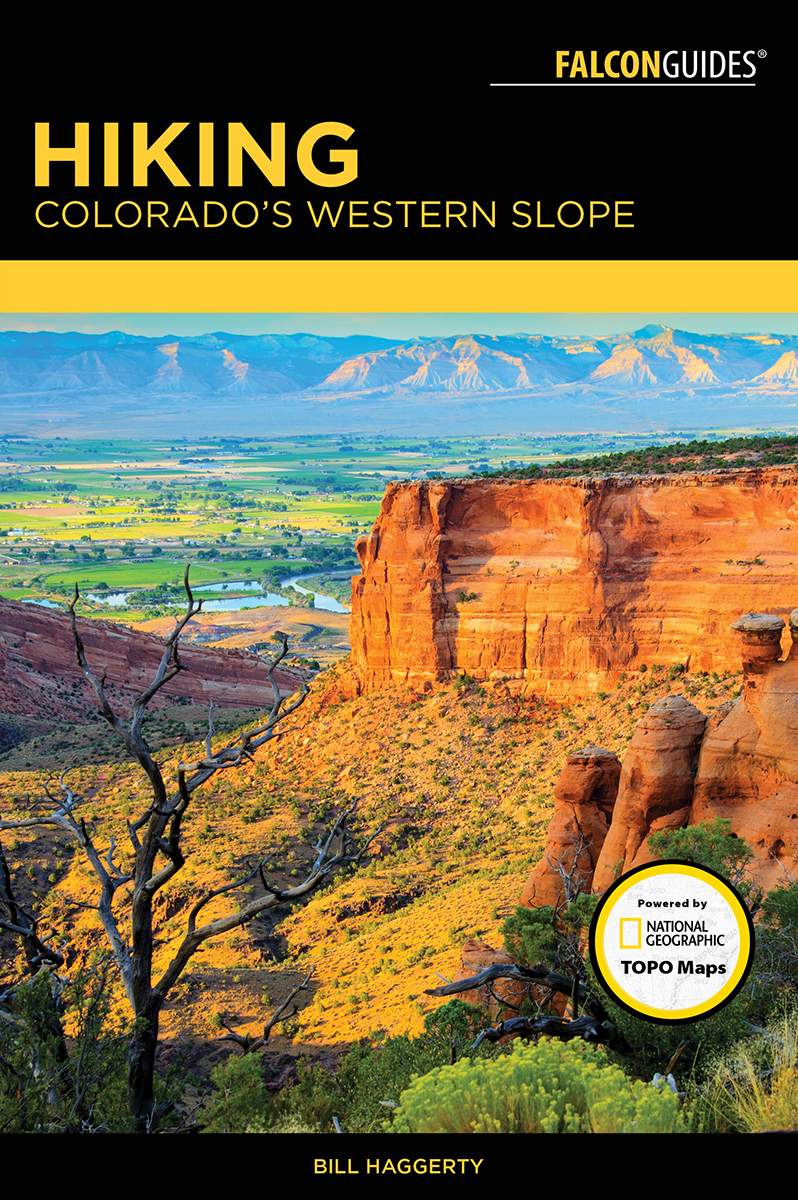
Haggerty - Hiking Colorados Western Slope
Here you can read online Haggerty - Hiking Colorados Western Slope full text of the book (entire story) in english for free. Download pdf and epub, get meaning, cover and reviews about this ebook. City: Colorado;Western Slope;Western Slope (Colo, year: 2017, publisher: Falcon Guides, genre: Home and family. Description of the work, (preface) as well as reviews are available. Best literature library LitArk.com created for fans of good reading and offers a wide selection of genres:
Romance novel
Science fiction
Adventure
Detective
Science
History
Home and family
Prose
Art
Politics
Computer
Non-fiction
Religion
Business
Children
Humor
Choose a favorite category and find really read worthwhile books. Enjoy immersion in the world of imagination, feel the emotions of the characters or learn something new for yourself, make an fascinating discovery.
- Book:Hiking Colorados Western Slope
- Author:
- Publisher:Falcon Guides
- Genre:
- Year:2017
- City:Colorado;Western Slope;Western Slope (Colo
- Rating:5 / 5
- Favourites:Add to favourites
- Your mark:
Hiking Colorados Western Slope: summary, description and annotation
We offer to read an annotation, description, summary or preface (depends on what the author of the book "Hiking Colorados Western Slope" wrote himself). If you haven't found the necessary information about the book — write in the comments, we will try to find it.
Haggerty: author's other books
Who wrote Hiking Colorados Western Slope? Find out the surname, the name of the author of the book and a list of all author's works by series.


Hiking Colorados Western Slope — read online for free the complete book (whole text) full work
Below is the text of the book, divided by pages. System saving the place of the last page read, allows you to conveniently read the book "Hiking Colorados Western Slope" online for free, without having to search again every time where you left off. Put a bookmark, and you can go to the page where you finished reading at any time.
Font size:
Interval:
Bookmark:

Hiking
Colorados
Western Slope
Bill Haggerty
![]()
In Memory of Steve Campbell
![]()
An imprint of Globe Pequot
Falcon and FalconGuides are registered trademarks and Make Adventure Your Story is a trademark of Rowman & Littlefield.
Distributed by NATIONAL BOOK NETWORK
Copyright 2017 by Rowman & Littlefield
All rights reserved. No part of this book may be reproduced in any form or by any electronic or mechanical means, including information storage and retrieval systems, without written permission from the publisher, except by a reviewer who may quote passages in a review.
Photos by Bill Haggerty unless otherwise noted
TOPO! Maps copyright 2017 National Geographic Partners, LLC. All Rights Reserved.
Maps Rowman & Littlefield
British Library Cataloguing in Publication Information available
Library of Congress Cataloging-in-Publication Data available
ISBN 978-1-4930-2436-0 (paperback)
ISBN 978-1-4930-2437-7 (e-book)
Printed in the United States of America
 The paper used in this publication meets the minimum requirements of American National Standard for Information SciencesPermanence of Paper for Printed Library Materials, ANSI/NISO Z39.48-1992.
The author and Rowman & Littlefield assume no liability for accidents happening to, or injuries sustained by, readers who engage in the activities described in this book.
THE HIKES
Meet Your Guide
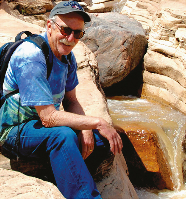
Photo by Jim Watson
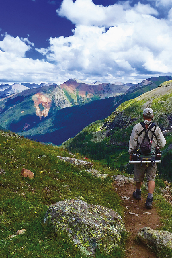
I love hiking in Western Colorado for the cool mountain air and bright desert heat, for the diminutive roar of a rushing high-mountain brook, and the vibrant colors of desert wildflowers in the spring the way the light changes across the canyons, the alpenglow on the peaks at sunset, the smell of fresh pine after a rainstorm, pupils dilated, skin tingling, all the senses alive and contributing to the feeling of wonder that Mother Nature has provided.
Hiking in these environments soothes my soul, makes me aware and alive, and keeps me in the moment. When I return home, I can breathe easier, think more clearly, and deal with the issues of life with a smile and not a frown.
Hiking makes me happy. It keeps me grounded and allows me to be grateful every day for where I live and what I do and who I love.
Tis a privilege to live in Colorado, my dear mother always said. Mom was always right.
As you check out this book, youll notice that a lot of classic hikes on the Western Slope are not included. There are no hikes into the Maroon Bells, one of the most scenic and rugged places in the entire Rocky Mountains. Thats because its so crowded, you have to take a shuttle bus to get there. Hanging Lakes in Glenwood Canyon is drop-dead gorgeous, but the parking lot in the canyon is closed by 9 a.m. all summer because its already full.
Another reason some classic hikes are not included is because there must be 200 of them. You can only put so much in one book!
The hikes that are included here, for the most part, remain off the beaten path and theyre spread all across the Western Slope, so you can discover your own favorite part on the bright side of the Continental Divide.
Happy Trails!
Hag
(Editors Note: Mr. Haggerty has been writing about outdoor issues in western Colorado for nearly four decades, first as a newspaper reporter/photographer, then as an Information Specialist for the Colorado Division of Wildlife, and more recently as an outdoor columnist. This is his second book for Falcon. His first, a Falcon Guide entitled Best Easy Day Hikes Grand Junction/Fruita, was published in 2015 as part of Falcons popular Where To Hike Series.)
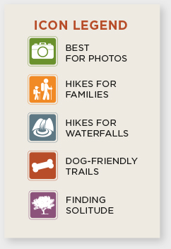
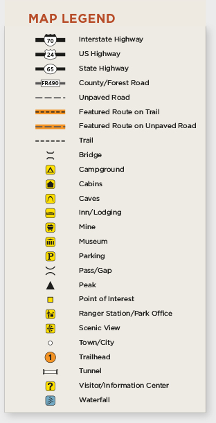
Map & Icon Legends
Each hike features The Rundown. This summary describes where the trail begins, how long it is, and how long it will take to hike. Youll also find information about degree of difficulty, elevation, canine compatibility, nearest towns, maps, and other pertinent information. This section is designed to give you a feel for the hike.
Difficulty ratings, for example, give a general sense of how strenuous a hike is. The ratings correspond to elevation gain, tempered by the grade, length, and hiking surface.
Easy: can be completed with little difficulty by hikers of all abilities.
Moderate: may be challenging due to elevation gain or other factors.
Strenuous: may tax even experienced hikers.
Very strenuous: will be difficult even for experienced hikers.
Trail type refers to the degree of development of the trail. Accessible trails are packed and graded and suitable for most hikers. Unfortunately, there are only few wheelchair-accessible trails described in this book.
Elevation gain shows the high and low points on the trail, usually at the trailhead and trail-end. However, you may gain or lose a lot more in elevation depending upon terrain.
Some routes may be marked with rock cairns, wooden posts, or fiberglass stakes and follow intermittent sections of tread laid down by hikers feet, but they are rough and may be difficult to follow in places. Cross-country or bushwacking refers to travel following a line of geography like a stream or ridgeline without any marking or tread to follow.
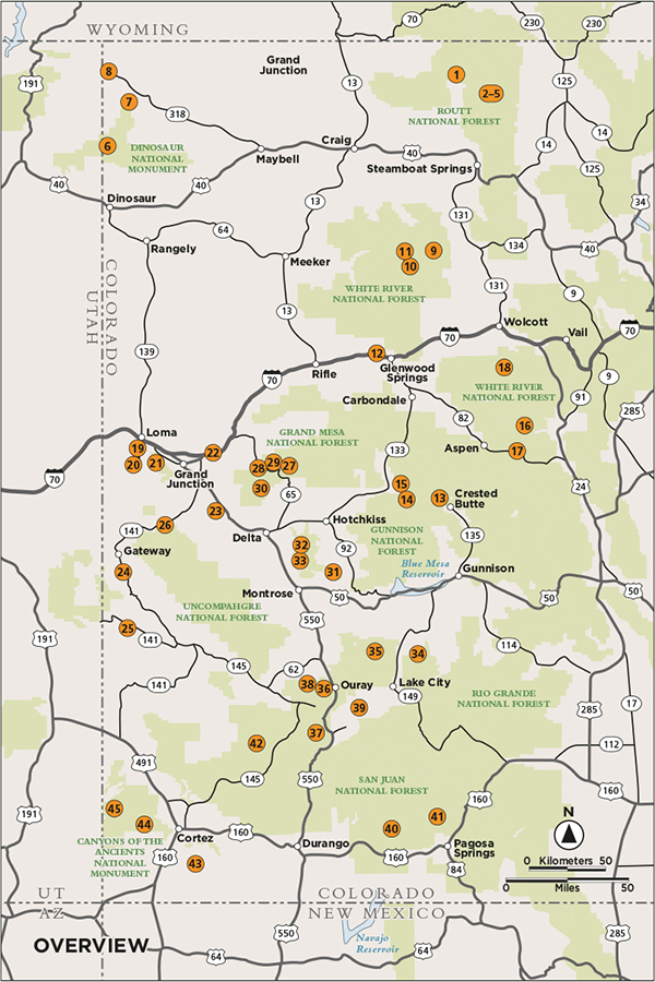
Topographic maps are an essential companion to the activities in this guide. Falcon has partnered with National Geographic to provide the best mapping resources. Each activity is accompanied by a detailed map and the name of the National Geographic TOPO! map (USGS), which can be downloaded for free from natgeomaps.com.
If the activity takes place on a National Geographic Trails Illustrated map it will be noted. Continually setting the standard for accuracy, each Trails Illustrated topographic map is crafted in conjunction with local land managers and undergoes rigorous review and enhancement before being printed on waterproof, tear-resistant material. Trails Illustrated maps and information about their digital versions, that can be used on mobile GPS applications, can be found at natgeomaps.com.
TRAIL FINDER CHART
 |  |
|---|
Font size:
Interval:
Bookmark:
Similar books «Hiking Colorados Western Slope»
Look at similar books to Hiking Colorados Western Slope. We have selected literature similar in name and meaning in the hope of providing readers with more options to find new, interesting, not yet read works.
Discussion, reviews of the book Hiking Colorados Western Slope and just readers' own opinions. Leave your comments, write what you think about the work, its meaning or the main characters. Specify what exactly you liked and what you didn't like, and why you think so.