Contents
Contents

75 GREAT HIKES SEATTLE
MELISSA OZBEK
How to Use This Book
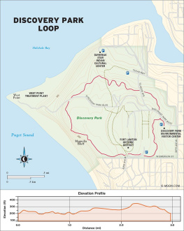
ABOUT THE MAPS
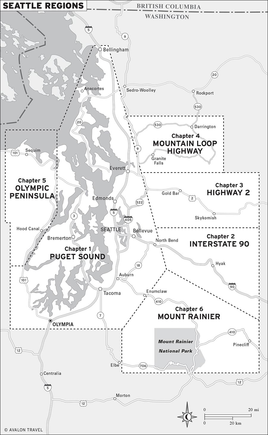
This book is divided into chapters based on regions that are within close reach of the city; an overview map of these regions precedes the table of contents. Each chapter begins with a region map that shows the locations and numbers of the trails listed in that chapter.
Each trail profile is also accompanied by a detailed trail map that shows the hike route.
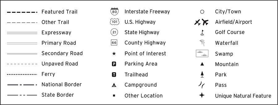
Map Symbols
ABOUT THE TRAIL PROFILES
Each profile includes a narrative description of the trails setting and terrain. This description also typically includes mile-by-mile hiking directions, as well as information about the trails highlights and unique attributes.
The mileage and elevation for each hike was measured with a Garmin GPSMAP 64st. The elevation gain for each hike is cumulative; all the bumps and hills that youll ascend throughout the hike are counted in the overall elevation gain.
In addition to the featured trail, each listing includes options on how to shorten or lengthen the hike, where to hike nearby, or how to extend the hike into a day trip or get away for the weekend.
Detailed driving directions are provided from the city center or from the intersection of major highways to the trailhead. Two GPS coordinates are included for each trailhead: The first can be entered online, while the second can be entered into your GPS. When public transportation is available, instructions are noted after the directions.
ABOUT THE ICONS
The icons in this book are designed to provide at-a-glance information on special features for each trail.
 | The trail offers an opportunity for wildlife watching. |
 | The trail features wildflower displays in spring. |
 | The trail travels to a waterfall. |
 | The trail visits a historic site. |
 | Dogs are allowed. |
 | The trail is appropriate for children. |
 | The trail is wheelchair accessible. |
 | The trailhead can be accessed via public transportation. |
ABOUT THE DIFFICULTY RATING
Each profile includes a difficulty rating. Definitions for ratings follow. Remember that the difficulty level for any trail can change due to weather or trail conditions, so always phone ahead to check the current state of any trail.
Easy: Easy hikes are 5 miles or less and with an elevation gain of 500 feet. They are generally suitable for beginner hikers, those recovering from an injury, and families with young children.
Easy/Moderate: Easy/Moderate hikes are 28 miles long and with an elevation gain of up to 1,200 feet. They are generally suitable for reasonably fit hikers and families with active children age 6 or older.
Moderate: Moderate hikes are 39 miles long and with an elevation gain of up to 2,500 feet. They are suitable for fit hikers.
Moderate/Strenuous: Moderate/Strenuous hikes are 311 miles long and with an elevation gain of up to 3,500 feet. They are suitable for fit and experienced hikers seeking a workout.
Strenuous: Strenuous hikes are 612 miles long with an elevation gain of up to 5,300 feet. They are suitable for very fit, advanced hikers.
The best-kept secret about living in the Seattle area is its natural surroundings. Cocooned among the Pacific Ocean, Puget Sound, the Olympics, and the Cascades, Seattles dynamic topography ranges from beaches and river valleys to rainforests and snowcapped mountains. This is a playground for hikers of all shapes and sizes: kids, naturalists, fitness fanatics, weekend warriors, and everyday people looking to experience the natural wonders of Washington state. Easy trails to surging waterfalls and spooky ghost towns, moderate hikes to undulating waves of wildflowers and mountain-rimmed alpine lakes, and hard-core climbs to spired peaks with 360-degree views barely scratch the surface of hiking options.
Few cities can boast a hiking community as experienced, engaged, and interwoven as Seattle can. A wide range of hiking groups, friendly outdoor organizations, conservation societies, and passionate, experienced locals enhance our community by sharing their knowledge of the local landscape. Seattle residents gain further inspiration from a vibrant community of outdoor writers, filmmakers, photographers, and bloggers. Sometimes its so much information that its hard to know where to start. Thats where this book comes in.
At your fingertips is a library of classic hikes and hidden gems for a range of abilities, including those traveling with a wheelchair, families with children, and experienced hiking enthusiasts. Organized by geographic area, these hikes help pinpoint where to go and highlight trail features such as wildflowers, waterfalls, or berry picking. Included within are notable hikes nearby and options to turn your hike into a day trip or a weekend getaway. Everything you need to know about your next hike has been thoroughly researched, taking the guesswork out of your planning so that you can relax and enjoy your time on the trail.
After logging hundreds of miles throughout the state, hiking has become more than just a walk in the woods for me. It is a quiet space to gather my thoughts, an outlet for the frustrations of everyday life, and a shared sense of wonder with friends. Sometimes a valuable experiencewhere we learn about ourselves, grow our self-confidence, and feel personal fulfillmentcan happen right in our own backyard. Your adventure is waiting for you. Go out and get it.

