A CIP record for this book is available from the British Library.
All rights reserved. No part of this book may be reproduced or transmitted in any form or by any means, electronic or mechanical including photocopying, recording or by any information storage and retrieval system, without permission from the publisher in writing.
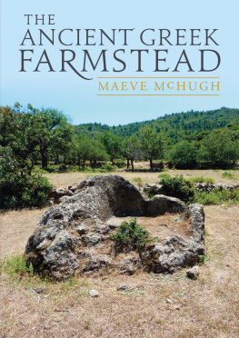
Front cover image: Large rock cut patitiri , Methana (photograph by the author).
Back cover: A terraced valley, Methana (photography by the author).
| Fig. 1.1 | Ground plan of the Vari house, Attica |
| Fig. 1.2 | Ground plan of the Dema house, Attica |
| Fig. 3.1 | Elevation map of the Akte peninsula with first, second, and third order sites |
| Fig. 3.2 | Elevation map of the Methana peninsula, with first, second, and third order sites |
| Fig. 3.3 | Elevation map of Atene, Attica, with second and third order sites, and Sounion towers |
| Fig. 3.4 | Elevation map of the Eurotas valley, Laconia, with first, second, and third order sites |
| Fig. 3.5 | Slope map of the Akte peninsula |
| Fig. 3.6 | Slope map of the Methana peninsula |
| Fig. 3.7 | Slope map of the Eurotas valley, Laconia |
| Fig. 3.8 | CORINE land use data for the Akte peninsula |
| Fig. 3.9 | View of the terraced landscape of Methana, from the acropolis of Oga |
| Fig. 3.10 | CORINE land use data for the Methana peninsula |
| Fig. 3.11 | CORINE land use data for the Eurotas valley, Laconia |
| Fig. 3.12 | Princess Tower complex with threshing floor |
| Fig. 3.13 | Methana Tower 2/Methana Installation 1, on the acropolis of Oga Methana peninsula |
| Fig. 3.14 | Akte Tower 5, Akte peninsula |
| Fig. 3.15 | Methana Tower 6, Methana Peninsula |
| Fig. 3.16 | Turmgehfte Atene Tower 5, Atene survey, Attica |
| Fig. 3.17 | Ground plan of the house near Vari |
| Fig. 3.18 | Isometric reconstruction of the house near Vari |
| Fig. 3.19 | Ground plan of site C-38, Paximadhi peninsula |
| Fig. 3.20 | Ground plan of site Akte SRS 19, Akte peninsula |
| Fig. 3.21 | Ground plan of site Akte SRS 54, Akte peninsula |
| Fig. 3.22 | Continuum of simple rural sites |
| Fig. 3.23 | Abandoned threshing floor in the Eurotas valley, Laconia |
| Fig. 3.24 | Reconstruction of a Classical trapetum |
| Fig. 3.25 | Reconstruction of a Classical-Hellenistic lever press |
| Fig. 3.26 | Venn diagram illustrating the number of installation sites with each ceramic class |
| Fig. 4.1 | Shaded relief map of the Eurotas valley with ancient roads, and least-cost paths |
| Fig. 4.2 | Distance in minutes from Halieis with least-cost paths to first and second order sites |
| Fig. 4.3 | Distance in minutes from Hermione with least-cost paths to first and second order sites |
| Fig. 4.4 | Distance in minutes from second order sites in the Akte peninsula |
| Fig. 4.5 | Distance in minutes from Methana with least-cost paths to first order sites |
| Fig. 4.6 | Distance in minutes from Oga with least-cost paths to first order sites |
| Fig. 4.7 | Distance in minutes form second order sites in the Methana peninsula |
| Fig. 4.8 | Distance in minutes from Halieis, with least-cost paths and first, second, and third order sites |
| Fig. 4.9 | Distance in minutes from Hermione, with least-cost paths and first, second, and third order sites |
| Fig. 4.10 | Distance in minutes from second order sites, with least-cost paths |
| Fig. 4.11 | Distance in minutes from Methana, with least-cost paths and first, second, and third order sites |
| Fig. 4.12 | Distance in minutes from Oga, with least-cost paths and first, second, and third order sites |
| Fig. 4.13 | Distance in minutes from installations in the Akte peninsula |
| Fig. 4.14 | Distance in minutes from installations in the Methana peninsula and least-cost paths via installations |
| Fig. 4.15 | Extent of visible land from first and second order sites in the Akte peninsula |
| Fig. 4.16 | Extent of visible land from simple rural sites in the Akte peninsula |
| Fig. 4.17 | Extent of visible land from installations in the Akte peninsula |
| Fig. 4.18 | Extent of visible land from towers in the Akte peninsula |
| Fig. 4.19 | Extent of visible land from first and second order sites in the Methana peninsula |
| Fig. 4.20 | Extent of visible land from simple rural sites in the Methana peninsula |
| Fig. 4.21 | Extent of visible land from installations in the Methana peninsula |
| Fig. 4.22 | Extent of visible land from towers in the Methana peninsula |
| Fig. 5.1 | Flow of resources from a household/farmstead unit |
| Fig. 5.2 | Ancient roads in Attica |
| Fig. App. 1.1 | Location of the Akte, Atene, Methana, and Eurotas valley survey areas |
| Fig. App. 1.2 | Farmsteads in the Atene survey, and Sounion towers Attica |
| Fig. App. 1.3 | Farmsteads in the Eurotas valley survey, Laconia |
| Fig. App. 1.4 | Farmsteads in the northern area of the Akte peninsula survey |
| Fig. App. 1.5 | Farmsteads in the southern area of the Akte peninsula survey |
| Fig. App. 1.6 | Farmsteads in the Methana peninsula survey |


